| Home | City Bus | Maps | Villages | Cities | Rail | Tourist Places | School | College | Pin Codes | Corona Cases Count |
| Distance Calculator Bus Services IFSC Codes Trace Mobile Number Weather Search Place Trace IP Available Cash ATM/Banks Locate Polling Booth Report an Error contact People |
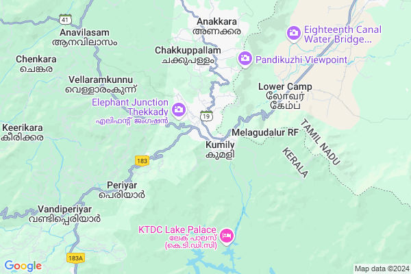
Kumaly Map
EDIT Map
Add Your House
 ..
..
Current Corona Virus Infected Patients Count in Idukki District
| City Name | District Name | Total Covid cases |
|---|---|---|
| Idukki District | Idukki | 14 |
| Elappara | Idukki | 2 |
| Munnar | Idukki | 1 |
| Nedumkandam | Idukki | 1 |
| Maniyarankudy | Idukki | 1 |
| Thodupuzha | Idukki | 1 |
Locality Name :
Kumaly
( കുമളി )
Block Name : Azhutha
District : Idukki
State : Kerala
Division : Central Kerala
Language : Malayalam and English
Current Time 11:35 AM
Date: Tuesday , Apr 29,2025 (IST)
Time zone: IST (UTC+5:30)
Elevation / Altitude: 27 meters. Above Seal level
Telephone Code / Std Code: 04869
Assembly constituency : Peerumade assembly constituency
Assembly MLA : Vazhoor Soman
Lok Sabha constituency : Idukki parliamentary constituency
Parliament MP : Adv. DEAN KURIAKOSE
Serpanch Name :
Alternate Village Name : Kumily
Commodities Prices : Vandiperiyar Market / Mandi
Kumaly Live Weather
Temperature: 29.9 °C
overcast clouds
Humidity: 54%
Wind : 1.18 mt/sec towards NE
StationName : "Gudalur"
observed on Now
Temperature: 29.9 °C
overcast clouds
Humidity: 54%
Wind : 1.18 mt/sec towards NE
StationName : "Gudalur"
observed on Now
Kumaly Weather Forecast for Next 5 days
30-04-2025
19.8°C to 28.5°C
light rain
19.8°C to 28.5°C
light rain
01-05-2025
19.4°C to 28.9°C
light rain, overcast clouds, broken clouds
19.4°C to 28.9°C
light rain, overcast clouds, broken clouds
02-05-2025
18.7°C to 27.8°C
overcast clouds, light rain, moderate rain
18.7°C to 27.8°C
overcast clouds, light rain, moderate rain
03-05-2025
19.3°C to 27.7°C
overcast clouds, light rain, broken clouds
19.3°C to 27.7°C
overcast clouds, light rain, broken clouds
04-05-2025
19.2°C to 27.4°C
broken clouds, scattered clouds, light rain, moderate rain, overcast clouds
19.2°C to 27.4°C
broken clouds, scattered clouds, light rain, moderate rain, overcast clouds
National Highways Reachable To Kumaly
Nationa High Way :NH544
Nationa High Way :NH66
Nationa High Way :NH544
Nationa High Way :NH66
Rivers Near Kumaly
Achenkovil
Chikkahole :ಚಿಕ್ಕಹೊಳೆ
Achenkovil
Chikkahole :ಚಿಕ್ಕಹೊಳೆ
About Kumaly
Correct below Info and add more info about KumalyKumaly is a Village in Azhutha Block in Idukki District of Kerala State, India. It belongs to Central Kerala Division . It is located 39 KM towards South from District head quarters Painavu. 20 KM from Azhutha. 148 KM from State capital Thiruvananthapuram
Vandiperiyar ( 10 KM ) , Vandenmedu ( 15 KM ) are the nearby Villages to Kumaly. Kumaly is surrounded by Kambam Block towards East , Azhutha Block towards west , Nedumkandom Block towards North , Uttamapalaiyam Block towards North .
Uthamapalayam , Erattupetta , Sivagiri , Rajapalayam are the near by Cities to Kumaly.
Kumily 2011 Census Details
Kumaly Local Language is Malayalam. Kumily Village Total population is 30276 and number of houses are 7404. Female Population is 49.9%. Village literacy rate is 81.1% and the Female Literacy rate is 39.2%.
Population
| Census Parameter | Census Data |
| Total Population | 30276 |
| Total No of Houses | 7404 |
| Female Population % | 49.9 % ( 15114) |
| Total Literacy rate % | 81.1 % ( 24564) |
| Female Literacy rate | 39.2 % ( 11880) |
| Scheduled Tribes Population % | 5.4 % ( 1637) |
| Scheduled Caste Population % | 17.3 % ( 5238) |
| Working Population % | 42.0 % |
| Child(0 -6) Population by 2011 | 3128 |
| Girl Child(0 -6) Population % by 2011 | 48.6 % ( 1520) |
Kumily Census More Deatils.
Politics in Kumaly
Indian National Congress , KEC , INC are the major political parties in this area.Polling Stations /Booths near Kumaly
1)Govt. H.s.s Kumily (north)2)Forest Range Office Kumily
3)Govt. Vocational Higher Secondary School And Tti Kumily East Building)
4)Govt. Up School Pruvanrthanam (west Portion)
5)Govt. Higher Secondary School Amaravathy East Building(east Portion)
HOW TO REACH Kumaly
By Rail
There is no railway station near to Kumaly in less than 10 km.Pincodes near Kumaly
685512 ( Anakkara (Idukki) ) , 685533 ( Vandiperiyar ) , 685535 ( Murukady )Colleges near Kumaly
College Of Applied Science
Address :
Sanjo College Of Management And Advanced Studies
Address : Sanjo College (scmas)
rajakkad P.o., Mullakkanam
Asramam Training College
Address : Asramam Training College, Vazhavara,idukki Dt
Mahatma Gandhi College Of Engineering,idukki,kerala
Address : 256534website-www.ucet.ac.in
Mar Baselios Christian College Of Engineering And Technology
Address : Peermadeidukki District, Keralapin - 685 531
Schools near Kumaly
Sm Hs Vellaramkunnu
Address : anavilasam , peermadu , idukki , Kerala . PIN- 685535 , Post - Murukady
St English Medium High School Attapallam
Address : kumali , peermadu , idukki , Kerala . PIN- 685509 , Post - Kumily
Mariagiri English Medium High School Peermadu
Address : peermadu , peermadu , idukki , Kerala . PIN- 685531 , Post - Peermade
Phs Elappara
Address : elappara , peermadu , idukki , Kerala . PIN- 685501 , Post - Elappara
Govt Health Centers near Kumaly
1) PHC CHITTAR , Chittar Community health centre , Chittar Maniyar road , police stationSub Villages in Kumaly
Petrol Bunks in Kumaly,Azhutha
T.K. KURUVILLA(THACHARA) & CO.
VANDIPERIYAR; IDUKKI; IDUKKI; Kerala 685533; India
9.7 KM distance Detail
Bharath Petroleum
Dindigul - Theni - Kottarakkara Hwy; Vandiperiyar; Kerala 685533; India
9.8 KM distance Detail
more ..
Colleges in Kumaly,Azhutha
St. John's College of Nursing
Kattappana South; Idukki; Kerala 685515; India
18.5 KM distance Detail
St John's Nursing College Kattappana
St johns; Kattappana; Kerala 685515; India
18.5 KM distance Detail
Christ College
Thodupuzha - Puliyanmala Rd; Kattappana; Kerala 685515; India
18.6 KM distance Detail
more ..
Schools in Kumaly,Azhutha
St.Joseph's English Medium School
Santhigiri; Pathumury; Kerala 685509; India
5.0 KM distance Detail
St. Mary's HSS Vellaramkunnu
Murukkady; Kumily Alady Road; Periyar; Kerala 685535; India
7.4 KM distance Detail
Electronic Shops in Kumaly,Azhutha
Cyber Hub
Dubai Mall; Near Leemas Wedding Centre; Vandiperiyar; Kerala 685533; India
9.9 KM distance Detail
Galaxy Mobile Shop
Dindigul - Theni - Kottarakkara Hwy; Vandiperiyar; Kerala 685533; India
10.0 KM distance Detail
Police Stations near Kumaly,Azhutha
Vandiperiyar Police Station
NH-183; Kollam -Theni Hwy; Vandiperiyar; Kerala 685533; India
10.8 KM distance Detail
Governement Offices near Kumaly,Azhutha
Kalyana Mandapam
Kottayam-Kumily Rd; Peermade; Pambanar; Kerala 685532; India
17.8 KM distance Detail
About Kumaly &
History
How to reach Kumaly
Tourist Places Near By Kumaly
Schools in Kumaly
Colleges in Kumaly
Temperature & weather of Kumaly
places in Kumaly
Kumaly photos
More Information
How to reach Kumaly
Tourist Places Near By Kumaly
Schools in Kumaly
Colleges in Kumaly
Temperature & weather of Kumaly
places in Kumaly
Kumaly photos
More Information
Village Talk
Post News or Events about this Village
Near Cities
Uthamapalayam 31 KM near
Erattupetta 45 KM near
Sivagiri 48 KM near
Rajapalayam 53 KM near
Uthamapalayam 31 KM near
Erattupetta 45 KM near
Sivagiri 48 KM near
Rajapalayam 53 KM near
Near By Taluks
Kattappana 17 KM near
Kambam 18 KM near
Azhutha 19 KM near
Nedumkandom 28 KM near
Kattappana 17 KM near
Kambam 18 KM near
Azhutha 19 KM near
Nedumkandom 28 KM near
Near By Air Ports
Kochi Airport 116 KM near
Madurai Airport 117 KM near
Trivandrum International Airport 144 KM near
Tuticorin Airport 154 KM near
Kochi Airport 116 KM near
Madurai Airport 117 KM near
Trivandrum International Airport 144 KM near
Tuticorin Airport 154 KM near
Near By Tourist Places
Thekkady/Periyar 8 KM near
Sabarimala 25 KM near
Vagamon 32 KM near
Idukki 37 KM near
Painaw 39 KM near
Thekkady/Periyar 8 KM near
Sabarimala 25 KM near
Vagamon 32 KM near
Idukki 37 KM near
Painaw 39 KM near
Near By Districts
Idukki 37 KM near
Pathanamthitta 61 KM near
Theni 63 KM near
Kottayam 79 KM near
Idukki 37 KM near
Pathanamthitta 61 KM near
Theni 63 KM near
Kottayam 79 KM near
Near By RailWay Station
Rajapalayam Rail Way Station 53 KM near
Sankarankovil Rail Way Station 70 KM near
Rajapalayam Rail Way Station 53 KM near
Sankarankovil Rail Way Station 70 KM near