| Home | City Bus | Maps | Villages | Cities | Rail | Tourist Places | School | College | Pin Codes | Corona Cases Count |
| Distance Calculator Bus Services IFSC Codes Trace Mobile Number Weather Search Place Trace IP Available Cash ATM/Banks Locate Polling Booth Report an Error contact People |
Chandipur
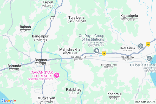
Chandipur Map
EDIT Map
Add Your House
 ..
..
Current Corona Virus Infected Patients Count in Howrah District
| City Name | District Name | Total Covid cases |
|---|---|---|
| Howrah District | Howrah | 1 |
Locality Name :
Chandipur
( চন্ডিপুর )
Block Name : Uluberia-i
District : Howrah
State : West Bengal
Division : Presidency
Language : Bengali and English
Current Time 06:50 AM
Date: Saturday , Apr 26,2025 (IST)
Time zone: IST (UTC+5:30)
Elevation / Altitude: 10 meters. Above Seal level
Telephone Code / Std Code: 03214
Assembly constituency : Uluberia Dakshin assembly constituency
Assembly MLA : Pulak Roy
Lok Sabha constituency : Uluberia parliamentary constituency
Parliament MP : SAJDA AHMED
Serpanch Name :
Pin Code : 711411
Post Office Name : Begri
Commodities Prices : Uluberia Market / Mandi
Chandipur Live Weather
Temperature: 26.4 °C
clear sky
Humidity: 89%
Wind : 4.8 mt/sec towards S
StationName : "Ä\u0080mta"
observed on 2 Hours Back
Temperature: 26.4 °C
clear sky
Humidity: 89%
Wind : 4.8 mt/sec towards S
StationName : "Ä\u0080mta"
observed on 2 Hours Back
Chandipur Weather Forecast for Next 5 days
27-04-2025
26.3°C to 41.1°C
clear sky
26.3°C to 41.1°C
clear sky
28-04-2025
26.8°C to 40.2°C
clear sky, broken clouds, overcast clouds
26.8°C to 40.2°C
clear sky, broken clouds, overcast clouds
29-04-2025
24.4°C to 34.9°C
light rain, overcast clouds, moderate rain, broken clouds
24.4°C to 34.9°C
light rain, overcast clouds, moderate rain, broken clouds
30-04-2025
22.3°C to 37.1°C
broken clouds, light rain, few clouds, moderate rain, overcast clouds
22.3°C to 37.1°C
broken clouds, light rain, few clouds, moderate rain, overcast clouds
Edit below overview about Chandipur
Edit below overview about Chandipur
OverView of Chandipur
Chandipur Gram Panchayat to Mayanapur Road condition very bad but political member not be care .TMC Member ControllerEdit below overview about Chandipur
National Highways Reachable To Chandipur
Nationa High Way :NH12
Nationa High Way :NH12
Rivers Near Chandipur
Hooghly :হুগলী :Hugli :Hooghly :Hugli :胡格利河
:কাঁসাই নদী :Cossye River Kangsabati :কংসাবতী নদী
Hooghly :হুগলী :Hugli :Hooghly :Hugli :胡格利河
:কাঁসাই নদী :Cossye River Kangsabati :কংসাবতী নদী
About Chandipur
Chandipur is a Village in Uluberia-i Block in Howrah District of West Bengal State, India. It belongs to Presidency Division . It is located 37 KM towards west from District head quarters Howrah. 9 KM from Uluberia-I. 43 KM from State capital Kolkata
Chandipur Pin code is 711411 and postal head office is Begri .
Tulsiberia ( 5 KM ) , Khalore ( 6 KM ) , Bangalpur ( 6 KM ) , Khardah ( 6 KM ) , Antila ( 7 KM ) are the nearby Villages to Chandipur. Chandipur is surrounded by Uluberia-Ii Block towards East , Bagnan-I Block towards west , Uluberia-I Block towards East , Amta-I Block towards North .
Uluberia , Panchla , Tamluk , Howrah are the near by Cities to Chandipur.
This Place is in the border of the Howrah District and 24 Paraganas South District. 24 Paraganas South District Budge Budge-ii is East towards this place .
Demographics of Chandipur
Bengali is the Local Language here.Politics in Chandipur
CPM , AITC , AIFB , All India Trinamool Congress are the major political parties in this area.Polling Stations /Booths near Chandipur
1)Srikrishnapur Chittaranjan High School Room-22)Kolia Amir Ali Pry School
3)Kulgachia Adarsha Sangha Pathagar
4)Kulgachia Pry. School Room-1
5)Janbar Pry. School Room-2
HOW TO REACH Chandipur
By Rail
Kulgachia Rail Way Station , Bir Shibpur Rail Way Station are the very nearby railway stations to Chandipur.Schools near Chandipur
Mulnibasi Vidyalaya
Address : tapna/x , uluberia-i , haora , West Bengal . PIN- 711315 , Post - Uluberia
Khaskhamar High Madrasah
Address : uluberia municipality/28 , uluberia municipality , haora , West Bengal . PIN- 711310 , Post - Fortgloster
Nimdighi High Madrasah
Address : uluberia municipality/9 , uluberia municipality , haora , West Bengal . PIN- 711316 , Post - Uluberia R.S
Nona High School
Address : uluberia municipality/6 , uluberia municipality , haora , West Bengal . PIN- 711315 , Post - Uluberia
Govt Health Centers near Chandipur
1) Mugkalyan BPHC SC , , Sahora , Mugkalyan-Benapur G.P2) Uluberia Sub Divisional Hospital , ULUBERIA STATION ROAD , ULUBERIA BAZARPARA , OPP. ULUBERIA I, BLOCK DEVELOPMENT OFFICE
3) Bhekutal SC , , , Matri Milan Sangha Club
Hospitals in Chandipur,Uluberia-i
Das Homeo Hall
Kulgachia Tulsiberia Rd; Chandipur; Kulgachia; Howrah; West Bengal 711306; India
1.0 KM distance Detail
more ..
Petrol Bunks in Chandipur,Uluberia-i
Indian Oil Petrol Pump
Chandipur; Kulgachia; Harinarayan Chak; West Bengal 711316; India
3.6 KM distance Detail
more ..
Colleges in Chandipur,Uluberia-i
International Institute of Management Sciences
NH-6 ; Bombay Road ; Uluberia Palara; (Opp. Bisk Firm);Mahisrekha; Howrah; West Bengal 711303; India
1.3 KM distance Detail
Vivekananda Ramakrishna Mission B.Ed College
Pirpur; Kulgachia; Howrah; West Bengal 711303; India
1.4 KM distance Detail
International Institute of Management Sciences
Chandipur; Kulgachia; Palara; West Bengal 711306; India
1.5 KM distance Detail
Ramakrishna Vedanta Mission Teachers’ Academy
VILL P.O. PIRPUR; P.S. ULUBERIA; DIST- 711303 PHONE- 9434119041 Mail Us rvmta.chandipur@gmail.com; Chandipur; Kulgachia; Howrah; West Bengal 711306; India
2.5 KM distance Detail
more ..
Schools in Chandipur,Uluberia-i
Ideal Public School
Police Station Uluberia; Howrah District; Mohishrekha Kulgachia; West Bengal 711303; India
0.8 KM distance Detail
Ankur KG School
Orisha Trunk Rd; Kulgachia; Howrah; West Bengal 711306; India
1.0 KM distance Detail
Eng.com Coaching Centre
kulgachia Ramkrishna Fancy Market; Howrah; 711306; India
1.1 KM distance Detail
Wecan Spoken English Academy
Kashyappur; Kulgachia; Howrah; West Bengal 711306; India
1.2 KM distance Detail
Electronic Shops in Chandipur,Uluberia-i
sabeya telecom 8240951178
Chandipur; Kulgachia; Bamunhati; West Bengal 711306; India
0.6 KM distance Detail
Super Markets in Chandipur,Uluberia-i
Kulgachia Super Market
Orisha Trunk Rd; Maithipara; Kulgachia; Howrah; West Bengal 711306; India
1.1 KM distance Detail
Police Stations near Chandipur,Uluberia-i
Uluberia Ladies Police Station
Kalibari; Uluberia; Howrah; West Bengal 711315; India
11.4 KM distance Detail
About Chandipur &
History
How to reach Chandipur
Tourist Places Near By Chandipur
Schools in Chandipur
Colleges in Chandipur
Temperature & weather of Chandipur
places in Chandipur
Chandipur photos
More Information
How to reach Chandipur
Tourist Places Near By Chandipur
Schools in Chandipur
Colleges in Chandipur
Temperature & weather of Chandipur
places in Chandipur
Chandipur photos
More Information
Village Talk
Post News or Events about this Village
Near Cities
Uluberia 10 KM near
Panchla 15 KM near
Tamluk 23 KM near
Howrah 32 KM near
Uluberia 10 KM near
Panchla 15 KM near
Tamluk 23 KM near
Howrah 32 KM near
Near By Taluks
Bagnan-Ii 6 KM near
Uluberia-Ii 7 KM near
Bagnan-I 8 KM near
Uluberia-I 9 KM near
Bagnan-Ii 6 KM near
Uluberia-Ii 7 KM near
Bagnan-I 8 KM near
Uluberia-I 9 KM near
Near By Air Ports
Netaji Subhas Chandra Bose Airport 52 KM near
Ranchi Airport 326 KM near
Bhubaneswar Airport 377 KM near
Singerbhil Airport 408 KM near
Netaji Subhas Chandra Bose Airport 52 KM near
Ranchi Airport 326 KM near
Bhubaneswar Airport 377 KM near
Singerbhil Airport 408 KM near
Near By Tourist Places
Howrah 31 KM near
Raichak 35 KM near
Alipore 36 KM near
Shankarpur 38 KM near
Kolkata 41 KM near
Howrah 31 KM near
Raichak 35 KM near
Alipore 36 KM near
Shankarpur 38 KM near
Kolkata 41 KM near
Near By Districts
Medinipur East 26 KM near
Howrah 35 KM near
Kolkata 37 KM near
24 Paraganas South 38 KM near
Medinipur East 26 KM near
Howrah 35 KM near
Kolkata 37 KM near
24 Paraganas South 38 KM near
Near By RailWay Station
Kulgachia Rail Way Station 0.9 KM near
Bir Shibpur Rail Way Station 4.2 KM near
Bagnan Rail Way Station 6.4 KM near
Uluberia Rail Way Station 8 KM near
Mecheda Rail Way Station 20 KM near
Kulgachia Rail Way Station 0.9 KM near
Bir Shibpur Rail Way Station 4.2 KM near
Bagnan Rail Way Station 6.4 KM near
Uluberia Rail Way Station 8 KM near
Mecheda Rail Way Station 20 KM near