| Home | City Bus | Maps | Villages | Cities | Rail | Tourist Places | School | College | Pin Codes | Corona Cases Count |
| Distance Calculator Bus Services IFSC Codes Trace Mobile Number Weather Search Place Trace IP Available Cash ATM/Banks Locate Polling Booth Report an Error contact People |
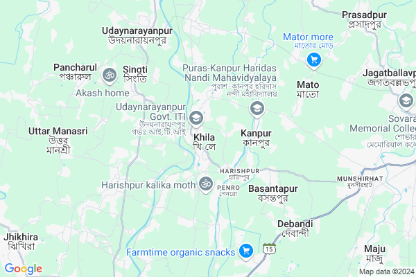
Khila
Khila Map
EDIT Map
Add Your House
 ..
..
Current Corona Virus Infected Patients Count in Howrah District
| City Name | District Name | Total Covid cases |
|---|---|---|
| Howrah District | Howrah | 1 |
Locality Name :
Khila
( খিলা )
Block Name : Udaynarayanpur
District : Howrah
State : West Bengal
Division : Presidency
Language : Bengali and English
Current Time 07:48 PM
Date: Sunday , Apr 27,2025 (IST)
Time zone: IST (UTC+5:30)
Elevation / Altitude: 7 meters. Above Seal level
Telephone Code / Std Code: 03212
Assembly constituency : Udaynarayanpur assembly constituency
Assembly MLA : Samir Kumar Panja
Lok Sabha constituency : Uluberia parliamentary constituency
Parliament MP : SAJDA AHMED
Serpanch Name :
Pin Code : 711410
Post Office Name : Munshirhat
Commodities Prices : Champadanga Market / Mandi
Khila Live Weather
Temperature: 25.9 °C
overcast clouds
Humidity: 53%
Wind : 5.34 mt/sec towards E
StationName : "Ä\u0080mta"
observed on 2 Mins Back
Temperature: 25.9 °C
overcast clouds
Humidity: 53%
Wind : 5.34 mt/sec towards E
StationName : "Ä\u0080mta"
observed on 2 Mins Back
Khila Weather Forecast for Next 5 days
28-04-2025
25.9°C to 26.7°C
broken clouds, overcast clouds
25.9°C to 26.7°C
broken clouds, overcast clouds
29-04-2025
22.7°C to 33.7°C
overcast clouds, heavy intensity rain, moderate rain, light rain, broken clouds
22.7°C to 33.7°C
overcast clouds, heavy intensity rain, moderate rain, light rain, broken clouds
30-04-2025
22.9°C to 35.4°C
broken clouds, clear sky, scattered clouds, light rain, moderate rain, overcast clouds
22.9°C to 35.4°C
broken clouds, clear sky, scattered clouds, light rain, moderate rain, overcast clouds
01-05-2025
20.4°C to 34.6°C
scattered clouds, few clouds, broken clouds, very heavy rain, moderate rain, overcast clouds
20.4°C to 34.6°C
scattered clouds, few clouds, broken clouds, very heavy rain, moderate rain, overcast clouds
02-05-2025
22.5°C to 33.4°C
broken clouds, light rain, scattered clouds
22.5°C to 33.4°C
broken clouds, light rain, scattered clouds
Edit below overview about Khila
Edit below overview about Khila
OverView of Khila
There another two high school, named khila gopimohan siksha sadan and khila girls high school. And there is a cinema hall 'aparupa' also situated.
Edit below overview about Khila
National Highways Reachable To Khila
Nationa High Way :NH12
Nationa High Way :NH34
Nationa High Way :NH12
Nationa High Way :NH34
About Khila
Khila is a Village in Udaynarayanpur Block in Howrah District of West Bengal State, India. It belongs to Presidency Division . It is located 37 KM towards west from District head quarters Howrah. 4 KM from Harali Udaynarayanpur. 44 KM from State capital Kolkata
Khila Pin code is 711410 and postal head office is Munshirhat .
Kanupat Mansuka ( 4 KM ) , Basantapur ( 5 KM ) , Debipur ( 5 KM ) , Singti ( 6 KM ) , Khosalpur ( 6 KM ) are the nearby Villages to Khila. Khila is surrounded by Jangipara Block towards North , Amta-I Block towards South , Jagatballavpur Block towards East , Khanakul-Ii Block towards west .
Panchla , Tarakeswar , Uluberia , Howrah are the near by Cities to Khila.
This Place is in the border of the Howrah District and Hooghly District. Hooghly District Jangipara is North towards this place .
Khila 2011 Census Details
Khila Local Language is Bengali. Khila Village Total population is 3540 and number of houses are 812. Female Population is 48.5%. Village literacy rate is 80.3% and the Female Literacy rate is 37.5%.
Population
| Census Parameter | Census Data |
| Total Population | 3540 |
| Total No of Houses | 812 |
| Female Population % | 48.5 % ( 1717) |
| Total Literacy rate % | 80.3 % ( 2844) |
| Female Literacy rate | 37.5 % ( 1328) |
| Scheduled Tribes Population % | 0.0 % ( 1) |
| Scheduled Caste Population % | 14.0 % ( 496) |
| Working Population % | 40.2 % |
| Child(0 -6) Population by 2011 | 306 |
| Girl Child(0 -6) Population % by 2011 | 43.5 % ( 133) |
Khila Census More Deatils.
Politics in Khila
CPM , CPI(M) , AITC , All India Trinamool Congress are the major political parties in this area.Polling Stations /Booths near Khila
1)Khempur Pry. School2)Khila Gopimohan Sikhasadan R-2
3)Khila Gopimohan Sikshasadan
4)Birajlakshmi Balika Vidyalaya Shibpur
5)Naranarayanchak Pry.school
HOW TO REACH Khila
By Rail
Mahendralal Nagar Rail Way Station , Munsirhat P.h. Rail Way Station are the very nearby railway stations to Khila.Schools in Khila
Khila Special Kedar Primary School
Address : Vill+P.O-Khila,P.S-Udaynarayan Pur,Dist.-Howrah,Pin-711410
Govt Health Centers near Khila
1) Dilakash SC , Dilakash Sub-Centre , Dilakash , Oppt. Side of Dilakash Gram Panchayat Office2) Satgarah SC , Satgarah Sub-Centre , Dilakash , Near Satgarah Post Office
3) Debipur BPHC , , Bag Para , Bus Stand
Hospitals in Khila,Udaynarayanpur
Penro Hospotal And Hospital Ground
Penro; Par Radhanagar; West Bengal 711410; India
2.4 KM distance Detail
more ..
Petrol Bunks in Khila,Udaynarayanpur
Khila Service Station
PS Udaynarayanpur; Howrah; Khila; West Bengal 711410; India
0.6 KM distance Detail
Singti Rajapur Petrol Pump
Udaynarayanpur - Munshirhat Rd; West Bengal 711226; India
4.8 KM distance Detail
HP Petrol Pump - Annapurna Filling Station
Jangalpara Belgram; Udaynarayanpur; West Bengal 711226; India
6.7 KM distance Detail
more ..
Colleges in Khila,Udaynarayanpur
Puras-Kanpur Haridas Nandi Mahavidyalaya
Kanpur Puras; West Bengal 711410; India
3.2 KM distance Detail
Education College
Basantapur Rd; Dist: Murshidabad; Basantapur; West Bengal 711410; India
5.1 KM distance Detail
more ..
Schools in Khila,Udaynarayanpur
Khila Gopimohan Siksha Sadan
Udaynarayanpur Rd; Khila; West Bengal 711410; India
0.9 KM distance Detail
Super Markets in Khila,Udaynarayanpur
Mete Decorators
Khila Girls High School; Bhabanipur; West Bengal 711410; India
0.8 KM distance Detail
Mannat Super Market মান্নাত সুপার মার্কেট
Basantapur; West Bengal 711410; India
4.4 KM distance Detail
Police Stations near Khila,Udaynarayanpur
Udaynarayanpur Police Station
Harali-Udaynarayanpur Road; Near BDO Office; Udaynarayanpur; West Bengal 711226; India
7.6 KM distance Detail
About Khila &
History
How to reach Khila
Tourist Places Near By Khila
Schools in Khila
Colleges in Khila
Temperature & weather of Khila
places in Khila
Khila photos
More Information
How to reach Khila
Tourist Places Near By Khila
Schools in Khila
Colleges in Khila
Temperature & weather of Khila
places in Khila
Khila photos
More Information
Village Talk
Post News or Events about this Village
Near Cities
Panchla 22 KM near
Tarakeswar 26 KM near
Uluberia 27 KM near
Howrah 31 KM near
Panchla 22 KM near
Tarakeswar 26 KM near
Uluberia 27 KM near
Howrah 31 KM near
Near By Taluks
Udaynarayanpur 4 KM near
Jangipara 8 KM near
Amta-I 9 KM near
Jagatballavpur 11 KM near
Udaynarayanpur 4 KM near
Jangipara 8 KM near
Amta-I 9 KM near
Jagatballavpur 11 KM near
Near By Air Ports
Netaji Subhas Chandra Bose Airport 49 KM near
Ranchi Airport 318 KM near
Bhubaneswar Airport 393 KM near
Singerbhil Airport 400 KM near
Netaji Subhas Chandra Bose Airport 49 KM near
Ranchi Airport 318 KM near
Bhubaneswar Airport 393 KM near
Singerbhil Airport 400 KM near
Near By Tourist Places
Shankarpur 25 KM near
Howrah 30 KM near
Alipore 40 KM near
Kolkata 42 KM near
Jairambati 53 KM near
Shankarpur 25 KM near
Howrah 30 KM near
Alipore 40 KM near
Kolkata 42 KM near
Jairambati 53 KM near
Near By Districts
Howrah 36 KM near
Kolkata 42 KM near
24 Paraganas South 46 KM near
Medinipur East 48 KM near
Howrah 36 KM near
Kolkata 42 KM near
24 Paraganas South 46 KM near
Medinipur East 48 KM near
Near By RailWay Station
Uluberia Rail Way Station 26 KM near
Santragachi Junction Rail Way Station 33 KM near
Uluberia Rail Way Station 26 KM near
Santragachi Junction Rail Way Station 33 KM near