| Home | City Bus | Maps | Villages | Cities | Rail | Tourist Places | School | College | Pin Codes | Corona Cases Count |
| Distance Calculator Bus Services IFSC Codes Trace Mobile Number Weather Search Place Trace IP Available Cash ATM/Banks Locate Polling Booth Report an Error contact People |
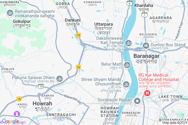
Bali
Bali Map
EDIT Map
Add Your House
 ..
..
Current Corona Virus Infected Patients Count in Howrah District
| City Name | District Name | Total Covid cases |
|---|---|---|
| Howrah District | Howrah | 1 |
Locality Name :
Bali
( বালি )
Block Name : Bally-jagacha
District : Howrah
State : West Bengal
Division : Presidency
Language : Bengali and English
Current Time 11:11 AM
Date: Sunday , Apr 27,2025 (IST)
Time zone: IST (UTC+5:30)
Assembly constituency : Domjur assembly constituency
Assembly MLA : Kalyan Ghosh
Lok Sabha constituency : Serampore parliamentary constituency
Parliament MP : KALYAN BANERJEE
Serpanch Name :
Pin Code : 711227
Post Office Name : Ghoshpara (Howrah)
Commodities Prices : Kalipur Market / Mandi
Bali Live Weather
Temperature: 31.0 °C
haze
Humidity: 66%
Wind : 2.57 mt/sec towards E
StationName : "Howrah"
observed on 50 Mins Back
Temperature: 31.0 °C
haze
Humidity: 66%
Wind : 2.57 mt/sec towards E
StationName : "Howrah"
observed on 50 Mins Back
Bali Weather Forecast for Next 5 days
28-04-2025
28.5°C to 41.6°C
few clouds, scattered clouds, broken clouds, light rain, overcast clouds
28.5°C to 41.6°C
few clouds, scattered clouds, broken clouds, light rain, overcast clouds
29-04-2025
26.1°C to 33.1°C
light rain, overcast clouds, broken clouds, moderate rain
26.1°C to 33.1°C
light rain, overcast clouds, broken clouds, moderate rain
30-04-2025
23.2°C to 37.2°C
overcast clouds, broken clouds, few clouds, light rain, scattered clouds
23.2°C to 37.2°C
overcast clouds, broken clouds, few clouds, light rain, scattered clouds
01-05-2025
23.0°C to 32.8°C
broken clouds, light rain, moderate rain
23.0°C to 32.8°C
broken clouds, light rain, moderate rain
02-05-2025
24.5°C to 36.4°C
broken clouds, clear sky, few clouds, light rain, overcast clouds
24.5°C to 36.4°C
broken clouds, clear sky, few clouds, light rain, overcast clouds
Edit below overview about Bali
Edit below overview about Bali
OverView of Bali
Bali is a Village in Bally-jagacha Block in Howrah District of West Bengal State, India. It belongs to Presidency Division . It is located 8 KM towards North from District head quarters Howrah. 11506 KM from Bally-Jagacha. 10 KM from State capital KolkataEdit below overview about Bali
National Highways Reachable To Bali
Nationa High Way :NH12
Nationa High Way :NH12
Rivers Near Bali
Hooghly :হুগলী :Hugli :Hooghly :Hugli :胡格利河
Hooghly :হুগলী :Hugli :Hooghly :Hugli :胡格利河
About Bali
Bali is a Village in Bally-jagacha Block in Howrah District of West Bengal State, India. It belongs to Presidency Division . It is located 7 KM towards North from District head quarters Howrah. 10 KM from State capital Kolkata
Bali Pin code is 711227 and postal head office is Ghoshpara (Howrah).
Bali is surrounded by Howrah Block towards South , Konnagar Block towards North , Chanditala-Ii Block towards North , Domjur Block towards west .
Bally , Monoharpur , Baranagar , Kamarhati are the near by Cities to Bali.
Demographics of Bali
Bengali is the Local Language here.Politics in Bali
CPM , CPI(M) , AITC , All India Trinamool Congress are the major political parties in this area.Polling Stations /Booths near Bali
1)Anandanagar High . School2)Abhoynagar G.s.f.p. School
3)Anandanagar High . School
4)Anandanagar High . School
5)Anandanagar High . School
HOW TO REACH Bali
By Rail
Rajchandrapur Rail Way Station , Belanagar Rail Way Station are the very nearby railway stations to Bali.Schools near Bali
St. Denis School
Address : bally/17 , bally municipality , haora , West Bengal . PIN- 711202 , Post - Belur Math
M.c.kejriwal Vidyapeeth
Address : bally/20 , bally municipality , haora , West Bengal . PIN- 711204 , Post - Shibtala Liluah
Urdu H.s.
Address : bally/26 , bally municipality , haora , West Bengal . PIN- 711202 , Post - Belur Math
Sun Rise English Medium School
Address : bally/16 , bally municipality , haora , West Bengal . PIN- 711202 , Post - Belur Math
Govt Health Centers near Bali
1) Uttarpara State General Hospital , 9 , Raja Pearry Mohan Road , Near Uttarpara Railway Station2) Satya Bala Devi ID Hospital , 199, , G. T. Road, Ghusuri , SATYABALA TELEPHONE EXCHANGE
3) Krishnapur SC , Krishnapur Sub Centre , KRISHNAPUR, GARALGACHA , KRISHNAPUR SPORTING CLUB
Hospitals in Bali,Bally-jagacha
Dr Subhadip Mukherjee Chamber
Sapuipara Main Road; Ghosh Para; Howrah; West Bengal 711206; India
0.3 KM distance Detail
Dr Suchandana Dasgupta Chamber
Sapuipara Main Road; Ghosh Para; Howrah; West Bengal 711206; India
0.3 KM distance Detail
Belur ESI Hospital
P.O.- Sapuipara; P.S.- Nischinda; Howrah; West Bengal 711227; India
1.0 KM distance Detail
Dr. Basudeb Das
Basukati Charak Mandir; Bally; Ghosh Para; Howrah; West Bengal 711227; India
1.0 KM distance Detail
more ..
Petrol Bunks in Bali,Bally-jagacha
CRTC Refill Indian Oil Petrol Pump
National Highway 6; Joypur Bil; Howrah; West Bengal 711227; India
2.0 KM distance Detail
Chamrail Service Station
National Highway 6; Near Hindhusthan Liver Godown; Chamrail; West Bengal 711114; India
2.0 KM distance Detail
more ..
Colleges in Bali,Bally-jagacha
Surendralal Das Teachers' Training College
Anandanagar Nischinda (Bally); Howrah; West Bengal; India
0.6 KM distance Detail
Kuntala Das College Of Education
Ghosh Para; Anandanagar; West Bengal 711227; India
0.7 KM distance Detail
more ..
Schools in Bali,Bally-jagacha
EuroKids
D.C.Neogi Road (Pashchim);; Bally (C.T);; Bally; Howrah; West Bengal 711227; India
0.1 KM distance Detail
Orchid Public School
Sapuipara; Ghosh Para; Howrah; West Bengal 711227; India
1.0 KM distance Detail
Saradananda School
398; Ananda Nagar Jhawtala Rd; Sapuipara; Ghosh Para; Howrah; West Bengal 711227; India
1.2 KM distance Detail
Maheswar Vidyapith
Ananda Nagar Jhawtala Rd; Bhatta Nagar; Liluah; Howrah; West Bengal 711203; India
1.2 KM distance Detail
Electronic Shops in Bali,Bally-jagacha
Manohar Maharaj Electrician
; Sapuipara; Ghosh Para; Howrah; West Bengal 711227; India
0.3 KM distance Detail
dristi communication
Sapuipara; Ghosh Para; Howrah; West Bengal 711227; India
0.6 KM distance Detail
Super Markets in Bali,Bally-jagacha
Chandmari Market
222; Ghoshpara; Ghosh Para; Howrah; West Bengal 711227; India
1.4 KM distance Detail
Bhattanagar Consumers Cooperative Stores Ltd
139; Netaji Subhas Rd; Ashram Para; Bhatta Nagar; Liluah; Howrah; West Bengal 711203; India
2.0 KM distance Detail
Local Parks in Bali,Bally-jagacha
New Jhilpar Childern Park
Howrah; Durgapur; Bally; Howrah; West Bengal 711205; India
2.4 KM distance Detail
Nanibala Park
Mohanlal Bahalwala Rd; Belur; Bally; Howrah; West Bengal 711201; India
2.7 KM distance Detail
Police Stations near Bali,Bally-jagacha
Nischinda Police Station
Sabeb Bagan; Bally; Howrah; West Bengal 711205; India
2.2 KM distance Detail
Howrah City Police Post
Rajchandrapur; Bally; Howrah; West Bengal 711205; India
3.1 KM distance Detail
Railway Protection Force; Liluah Workshop Post
Shibnath Banerjee Rd; Liluah; Howrah; West Bengal 711204; India
3.4 KM distance Detail
Governement Offices near Bali,Bally-jagacha
Nischinda Gram Panchayat
Nischinda Purbapara; Madhyapara; Ghosh Para; Bally; Howrah; West Bengal 711227; India
1.7 KM distance Detail
Health Center
Bally Sarkhelbagan; Madhyapara; Ghosh Para; Howrah; West Bengal 711227; India
1.9 KM distance Detail
Knight Security
C.R Das Sarani; Ghoshpara (South); Bally; Howrah; West Bengal 711227; India
2.0 KM distance Detail
About Bali &
History
How to reach Bali
Tourist Places Near By Bali
Schools in Bali
Colleges in Bali
Temperature & weather of Bali
places in Bali
Bali photos
More Information
How to reach Bali
Tourist Places Near By Bali
Schools in Bali
Colleges in Bali
Temperature & weather of Bali
places in Bali
Bali photos
More Information
Village Talk
Post News or Events about this Village
Near Cities
Bally 3 KM near
Monoharpur 5 KM near
Baranagar 5 KM near
Kamarhati 6 KM near
Bally 3 KM near
Monoharpur 5 KM near
Baranagar 5 KM near
Kamarhati 6 KM near
Near By Taluks
Bally-Jagacha 0 KM near
Howrah 6 KM near
Konnagar 8 KM near
Chanditala-Ii 9 KM near
Bally-Jagacha 0 KM near
Howrah 6 KM near
Konnagar 8 KM near
Chanditala-Ii 9 KM near
Near By Air Ports
Netaji Subhas Chandra Bose Airport 13 KM near
Ranchi Airport 353 KM near
Singerbhil Airport 369 KM near
Bhubaneswar Airport 415 KM near
Netaji Subhas Chandra Bose Airport 13 KM near
Ranchi Airport 353 KM near
Singerbhil Airport 369 KM near
Bhubaneswar Airport 415 KM near
Near By Tourist Places
Howrah 8 KM near
Kolkata 9 KM near
Alipore 13 KM near
Raichak 58 KM near
Shankarpur 61 KM near
Howrah 8 KM near
Kolkata 9 KM near
Alipore 13 KM near
Raichak 58 KM near
Shankarpur 61 KM near
Near By Districts
Howrah 7 KM near
Kolkata 14 KM near
24 Paraganas South 20 KM near
24 Paraganas North 21 KM near
Howrah 7 KM near
Kolkata 14 KM near
24 Paraganas South 20 KM near
24 Paraganas North 21 KM near
Near By RailWay Station
Rajchandrapur Rail Way Station 1.7 KM near
Belur Rail Way Station 2.4 KM near
Belanagar Rail Way Station 2.8 KM near
Dakshineswar Rail Way Station 5 KM near
Howrah Junction Rail Way Station 7 KM near
Rajchandrapur Rail Way Station 1.7 KM near
Belur Rail Way Station 2.4 KM near
Belanagar Rail Way Station 2.8 KM near
Dakshineswar Rail Way Station 5 KM near
Howrah Junction Rail Way Station 7 KM near