| Home | City Bus | Maps | Villages | Cities | Rail | Tourist Places | School | College | Pin Codes | Corona Cases Count |
| Distance Calculator Bus Services IFSC Codes Trace Mobile Number Weather Search Place Trace IP Available Cash ATM/Banks Locate Polling Booth Report an Error contact People |
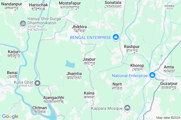
Jaypur
Jaypur Map
EDIT Map
Add Your House
 ..
..
Current Corona Virus Infected Patients Count in Howrah District
| City Name | District Name | Total Covid cases |
|---|---|---|
| Howrah District | Howrah | 1 |
Locality Name :
Jaypur
( জয়পুর )
Block Name : Amta-ii
District : Howrah
State : West Bengal
Division : Presidency
Language : Bengali and English
Current Time 12:29 PM
Date: Sunday , Apr 27,2025 (IST)
Time zone: IST (UTC+5:30)
Elevation / Altitude: 6 meters. Above Seal level
Telephone Code / Std Code: 03214
Assembly constituency : Amta assembly constituency
Assembly MLA : Sukanta Kumar Paul
Lok Sabha constituency : Uluberia parliamentary constituency
Parliament MP : SAJDA AHMED
Serpanch Name :
Pin Code : 711401
Post Office Name : Amta
Commodities Prices : Kolaghat Market / Mandi
Jaypur Live Weather
Temperature: 41.2 °C
overcast clouds
Humidity: 14%
Wind : 3.52 mt/sec towards W
StationName : "Ä\u0080mta"
observed on 1 Hours Back
Temperature: 41.2 °C
overcast clouds
Humidity: 14%
Wind : 3.52 mt/sec towards W
StationName : "Ä\u0080mta"
observed on 1 Hours Back
Jaypur Weather Forecast for Next 5 days
28-04-2025
27.7°C to 41.0°C
overcast clouds, broken clouds, scattered clouds
27.7°C to 41.0°C
overcast clouds, broken clouds, scattered clouds
29-04-2025
24.7°C to 33.6°C
overcast clouds, light rain, broken clouds, moderate rain
24.7°C to 33.6°C
overcast clouds, light rain, broken clouds, moderate rain
30-04-2025
21.2°C to 34.8°C
overcast clouds, broken clouds, moderate rain, heavy intensity rain, light rain
21.2°C to 34.8°C
overcast clouds, broken clouds, moderate rain, heavy intensity rain, light rain
01-05-2025
22.1°C to 32.8°C
broken clouds, light rain, moderate rain, overcast clouds
22.1°C to 32.8°C
broken clouds, light rain, moderate rain, overcast clouds
02-05-2025
23.1°C to 35.0°C
broken clouds, few clouds, clear sky, light rain, moderate rain, overcast clouds
23.1°C to 35.0°C
broken clouds, few clouds, clear sky, light rain, moderate rain, overcast clouds
Edit below overview about Jaypur
Edit below overview about Jaypur
OverView of Jaypur
Masjid:1)gemokhalipara Jame masjid 2)mallick para Jame masjid 3)mollapara Jame masjid 4)utter Muslim para Jame masjid 5)mirpara Jame masjid.Edit below overview about Jaypur
National Highways Reachable To Jaypur
Nationa High Way :NH12
Nationa High Way :NH12
Rivers Near Jaypur
Damodar
Damodar
About Jaypur
Jaypur is a Village in Amta-ii Block in Howrah District of West Bengal State, India. It belongs to Presidency Division . It is located 45 KM towards west from District head quarters Howrah. 0 KM from Amta-Ii. 52 KM from State capital Kolkata
Jaypur Pin code is 711401 and postal head office is Amta .
Amragori ( 2 KM ) , Thalia ( 4 KM ) , Kalna ( 4 KM ) , Jhikira ( 4 KM ) , Raspur ( 6 KM ) are the nearby Villages to Jaypur. Jaypur is surrounded by Amta-I Block towards East , Khanakul-Ii Block towards North , Bagnan-I Block towards South , Udaynarayanpur Block towards North .
Panchla , Uluberia , Tamluk , Tarakeswar are the near by Cities to Jaypur.
This Place is in the border of the Howrah District and Hooghly District. Hooghly District Khanakul-ii is North towards this place . Also it is in the Border of other district Medinipur West .
Jaypur 2011 Census Details
Jaypur Local Language is Bengali. Jaypur Village Total population is 9023 and number of houses are 1982. Female Population is 49.3%. Village literacy rate is 77.1% and the Female Literacy rate is 36.2%.
Population
| Census Parameter | Census Data |
| Total Population | 9023 |
| Total No of Houses | 1982 |
| Female Population % | 49.3 % ( 4445) |
| Total Literacy rate % | 77.1 % ( 6960) |
| Female Literacy rate | 36.2 % ( 3265) |
| Scheduled Tribes Population % | 0.5 % ( 48) |
| Scheduled Caste Population % | 14.9 % ( 1346) |
| Working Population % | 37.1 % |
| Child(0 -6) Population by 2011 | 842 |
| Girl Child(0 -6) Population % by 2011 | 47.6 % ( 401) |
Jaypur Census More Deatils.
Politics in Jaypur
CPM , CPI(M) , AITC , All India Trinamool Congress , INC are the major political parties in this area.Polling Stations /Booths near Jaypur
1)Purba Khalna Pry School2)Joypur Bakultala Pry.school(room No. -2)
3)Joypur Surangamayee Balika Vidyalaya ( Room No. 2 )
4)Jhikira High School (room No.1)
5)Joypur Bakultala Pry.school(room No. -1)
HOW TO REACH Jaypur
By Rail
Amta Rail Way Station is the very nearby railway stations to Jaypur.Schools in Jaypur
Joypur Phakirdas Institution (h. S.)
Address : P.Offic. J F Das,District Howrah
Govt Health Centers near Jaypur
1) Hayatpur SC , Hayatpur GP Hq SC , Hayatpur , Hayatpur G.P2) Palaspai SC , Palaspai SC , Palaspai GP Hq SC , Palaspai Bro Mandir Primary School
3) Narendrapur SC , Narendrapur SC , Narendrapur , Narendrapur Primary School
Hospitals in Jaypur,Amta-ii
B B. DHAR Amragari Hospital Bablu Mallick
Amragari; West Bengal 711401; India
2.2 KM distance Detail
more ..
Colleges in Jaypur,Amta-ii
Palaspai Raja Rammohan College of Education
P.O. - Chak Hayatpur;P.S. - Khanakul; Dist - Hoogly; Arambagh; West Bengal 712416; India
5.6 KM distance Detail
Ramkrishna Mandal Institute of Education(B.Ed. College)
Amta; Howrah; Rashpur; West Bengal 711401; India
5.6 KM distance Detail
more ..
Electronic Shops in Jaypur,Amta-ii
Anusua Mobiles & WIFI
Amta - Udaynarayanpur Rd; Thaliya; West Bengal 711401; India
4.5 KM distance Detail
Governement Offices near Jaypur,Amta-ii
Amta-II Block Development Office
Joypur Fakirdas; Howrah; West Bengal 711401; India
2.2 KM distance Detail
About Jaypur &
History
How to reach Jaypur
Tourist Places Near By Jaypur
Schools in Jaypur
Colleges in Jaypur
Temperature & weather of Jaypur
places in Jaypur
Jaypur photos
More Information
How to reach Jaypur
Tourist Places Near By Jaypur
Schools in Jaypur
Colleges in Jaypur
Temperature & weather of Jaypur
places in Jaypur
Jaypur photos
More Information
Village Talk
Post News or Events about this Village
Near Cities
Panchla 24 KM near
Uluberia 25 KM near
Tamluk 35 KM near
Tarakeswar 38 KM near
Panchla 24 KM near
Uluberia 25 KM near
Tamluk 35 KM near
Tarakeswar 38 KM near
Near By Taluks
Amta-Ii 1 KM near
Amta-I 7 KM near
Khanakul-Ii 8 KM near
Bagnan-I 12 KM near
Amta-Ii 1 KM near
Amta-I 7 KM near
Khanakul-Ii 8 KM near
Bagnan-I 12 KM near
Near By Air Ports
Netaji Subhas Chandra Bose Airport 58 KM near
Ranchi Airport 312 KM near
Bhubaneswar Airport 380 KM near
Singerbhil Airport 412 KM near
Netaji Subhas Chandra Bose Airport 58 KM near
Ranchi Airport 312 KM near
Bhubaneswar Airport 380 KM near
Singerbhil Airport 412 KM near
Near By Tourist Places
Shankarpur 21 KM near
Howrah 38 KM near
Alipore 46 KM near
Kolkata 50 KM near
Raichak 52 KM near
Shankarpur 21 KM near
Howrah 38 KM near
Alipore 46 KM near
Kolkata 50 KM near
Raichak 52 KM near
Near By Districts
Medinipur East 37 KM near
Howrah 43 KM near
Kolkata 48 KM near
24 Paraganas South 51 KM near
Medinipur East 37 KM near
Howrah 43 KM near
Kolkata 48 KM near
24 Paraganas South 51 KM near
Near By RailWay Station
Mecheda Rail Way Station 23 KM near
Uluberia Rail Way Station 23 KM near
Mecheda Rail Way Station 23 KM near
Uluberia Rail Way Station 23 KM near