| Home | City Bus | Maps | Villages | Cities | Rail | Tourist Places | School | College | Pin Codes | Corona Cases Count |
| Distance Calculator Bus Services IFSC Codes Trace Mobile Number Weather Search Place Trace IP Available Cash ATM/Banks Locate Polling Booth Report an Error contact People |
Balichak
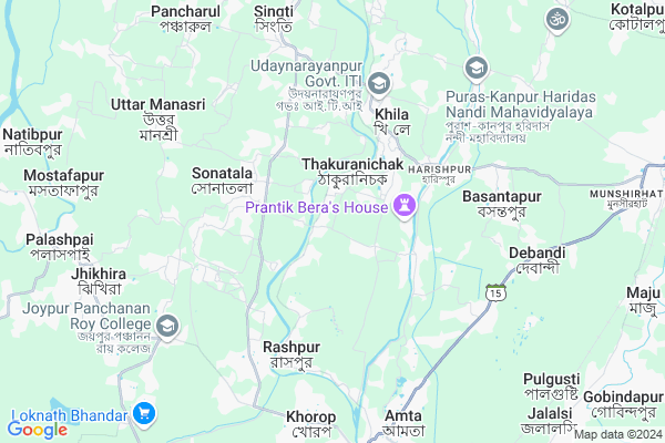
Balichak Map
EDIT Map
Add Your House
 ..
..
Current Corona Virus Infected Patients Count in Howrah District
| City Name | District Name | Total Covid cases |
|---|---|---|
| Howrah District | Howrah | 1 |
Locality Name :
Balichak
( বালিচক )
Block Name : Amta-i
District : Howrah
State : West Bengal
Division : Presidency
Language : Bengali and English
Current Time 11:58 AM
Date: Monday , Apr 28,2025 (IST)
Time zone: IST (UTC+5:30)
Elevation / Altitude: 6 meters. Above Seal level
Telephone Code / Std Code: 03214
Assembly constituency : Udaynarayanpur assembly constituency
Assembly MLA : Samir Kumar Panja
Lok Sabha constituency : Uluberia parliamentary constituency
Parliament MP : SAJDA AHMED
Serpanch Name :
Pin Code : 711104
Post Office Name : Sarat Chatterjee Rd.
Commodities Prices : Uluberia Market / Mandi
National Highways Reachable To Balichak
Nationa High Way :NH12
Nationa High Way :NH12
Rivers Near Balichak
Damodar
Damodar
About Balichak
Correct below Info and add more info about BalichakBalichak is a Village in Amta-i Block in Howrah District of West Bengal State, India. It belongs to Presidency Division . It is located 39 KM towards west from District head quarters Howrah. 7 KM from Amta. 46 KM from State capital Kolkata
Balichak Pin code is 711104 and postal head office is Sarat Chatterjee Rd. .
Debipur ( 3 KM ) , Khila ( 3 KM ) , Khosalpur ( 4 KM ) , Garbhabanipur-sonatala ( 4 KM ) , Raspur ( 5 KM ) are the nearby Villages to Balichak. Balichak is surrounded by Amta-I Block towards South , Amta-Ii Block towards South , Khanakul-Ii Block towards west , Jangipara Block towards North .
Panchla , Uluberia , Tarakeswar , Howrah are the near by Cities to Balichak.
Balichak 2011 Census Details
Balichak Local Language is Bengali. Balichak Village Total population is 3304 and number of houses are 788. Female Population is 48.8%. Village literacy rate is 73.0% and the Female Literacy rate is 33.8%.
Population
| Census Parameter | Census Data |
| Total Population | 3304 |
| Total No of Houses | 788 |
| Female Population % | 48.8 % ( 1612) |
| Total Literacy rate % | 73.0 % ( 2412) |
| Female Literacy rate | 33.8 % ( 1118) |
| Scheduled Tribes Population % | 0.0 % ( 0) |
| Scheduled Caste Population % | 25.5 % ( 843) |
| Working Population % | 37.0 % |
| Child(0 -6) Population by 2011 | 298 |
| Girl Child(0 -6) Population % by 2011 | 47.7 % ( 142) |
Balichak Census More Deatils.
Politics in Balichak
CPM , CPI(M) , AITC , All India Trinamool Congress are the major political parties in this area.Polling Stations /Booths near Balichak
1)Purpat Pry.school2)Nayachak 2nd Pry.school
3)Sonagachhi Kailash Pry.school
4)Dhurkhali Pry. School
5)Dehibhurshut Uttar(board) Primary School Room - 2
HOW TO REACH Balichak
By Rail
Amta Rail Way Station , Jalalsi P.h. Rail Way Station are the very nearby railway stations to Balichak.Schools near Balichak
Purba Gazipur G.k.b.r.high Sch
Address : udong-ii/iv , amta-i , haora , West Bengal . PIN- 711401 , Post - Amta
Udang Girls High School
Address : udang-i/i , amta-i , haora , West Bengal . PIN- 711401 , Post - Amta
Baramahara Jatindra Vidyapith
Address : khosalpur/x , amta-i , haora , West Bengal . PIN- 711401 , Post - Amta
Siberhana High School
Address : khardah/v , amta-i , haora , West Bengal . PIN- 711316 , Post - Uluberia R.S
Govt Health Centers near Balichak
1) Debipur BPHC , , Bag Para , Bus Stand2) Mostafapur SC , Mostafapur SC , ,
3) Mostafapur SC , Mostafapur SC , Mostafapur , Mostafapur Gandhi High School
Hospitals in Balichak,Amta-i
Sonatala Milan Sangha Hospital
Udaynarayanpur-Amta Rd; Garh Bhawanipur; West Bengal 711412; India
2.8 KM distance Detail
more ..
Petrol Bunks in Balichak,Amta-i
Ganaraj Filling Station
Udaynarayan pur; Amta - Udaynarayanpur Rd; West Bengal; India
3.5 KM distance Detail
Khila Service Station
PS Udaynarayanpur; Howrah; Khila; West Bengal 711410; India
4.0 KM distance Detail
Singti Rajapur Petrol Pump
Udaynarayanpur - Munshirhat Rd; West Bengal 711226; India
6.7 KM distance Detail
more ..
Colleges in Balichak,Amta-i
Ramkrishna Mandal Institute of Education(B.Ed. College)
Amta; Howrah; Rashpur; West Bengal 711401; India
5.6 KM distance Detail
more ..
Super Markets in Balichak,Amta-i
Mete Decorators
Khila Girls High School; Bhabanipur; West Bengal 711410; India
4.9 KM distance Detail
About Balichak &
History
How to reach Balichak
Tourist Places Near By Balichak
Schools in Balichak
Colleges in Balichak
Temperature & weather of Balichak
places in Balichak
Balichak photos
More Information
How to reach Balichak
Tourist Places Near By Balichak
Schools in Balichak
Colleges in Balichak
Temperature & weather of Balichak
places in Balichak
Balichak photos
More Information
Village Talk
Post News or Events about this Village
Near Cities
Panchla 21 KM near
Uluberia 25 KM near
Tarakeswar 30 KM near
Howrah 32 KM near
Panchla 21 KM near
Uluberia 25 KM near
Tarakeswar 30 KM near
Howrah 32 KM near
Near By Taluks
Udaynarayanpur 5 KM near
Amta-I 6 KM near
Amta-Ii 10 KM near
Khanakul-Ii 11 KM near
Udaynarayanpur 5 KM near
Amta-I 6 KM near
Amta-Ii 10 KM near
Khanakul-Ii 11 KM near
Near By Air Ports
Netaji Subhas Chandra Bose Airport 51 KM near
Ranchi Airport 317 KM near
Bhubaneswar Airport 389 KM near
Singerbhil Airport 403 KM near
Netaji Subhas Chandra Bose Airport 51 KM near
Ranchi Airport 317 KM near
Bhubaneswar Airport 389 KM near
Singerbhil Airport 403 KM near
Near By Tourist Places
Shankarpur 24 KM near
Howrah 31 KM near
Alipore 41 KM near
Kolkata 44 KM near
Jairambati 54 KM near
Shankarpur 24 KM near
Howrah 31 KM near
Alipore 41 KM near
Kolkata 44 KM near
Jairambati 54 KM near
Near By Districts
Howrah 37 KM near
Kolkata 43 KM near
Medinipur East 44 KM near
24 Paraganas South 46 KM near
Howrah 37 KM near
Kolkata 43 KM near
Medinipur East 44 KM near
24 Paraganas South 46 KM near
Near By RailWay Station
Amta Rail Way Station 9.2 KM near
Uluberia Rail Way Station 24 KM near
Mecheda Rail Way Station 31 KM near
Amta Rail Way Station 9.2 KM near
Uluberia Rail Way Station 24 KM near
Mecheda Rail Way Station 31 KM near