| Home | City Bus | Maps | Villages | Cities | Rail | Tourist Places | School | College | Pin Codes | Corona Cases Count |
| Distance Calculator Bus Services IFSC Codes Trace Mobile Number Weather Search Place Trace IP Available Cash ATM/Banks Locate Polling Booth Report an Error contact People |
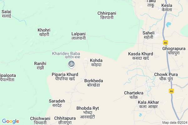
Kohda
Kohda Map
EDIT Map
Add Your House
 ..
..
Current Corona Virus Infected Patients Count in Hoshangabad District
| City Name | District Name | Total Covid cases |
|---|---|---|
| Hoshangabad District | Hoshangabad | 29 |
Locality Name :
Kohda
( कोहड़ा )
Tehsil Name : Kesla
District : Hoshangabad
State : Madhya Pradesh
Division : Narmadapuram
Language : Hindi
Current Time 09:13 AM
Date: Wednesday , Apr 30,2025 (IST)
Time zone: IST (UTC+5:30)
Elevation / Altitude: 390 meters. Above Seal level
Telephone Code / Std Code: 07572
Assembly constituency : Seoni-Malwa assembly constituency
Assembly MLA : Premshankar Kunjilal Verma
Lok Sabha constituency : Hoshangabad parliamentary constituency
Parliament MP : UDAY PRATAP SINGH
Serpanch Name :
Commodities Prices : Itarsi Market / Mandi
Kohda Live Weather
Temperature: 36.2 °C
clear sky
Humidity: 18%
Wind : 6.25 mt/sec towards NW
StationName : "ShÄ\u0081hpur"
observed on Now
Temperature: 36.2 °C
clear sky
Humidity: 18%
Wind : 6.25 mt/sec towards NW
StationName : "ShÄ\u0081hpur"
observed on Now
Kohda Weather Forecast for Next 5 days
01-05-2025
31.1°C to 42.3°C
clear sky, broken clouds, overcast clouds
31.1°C to 42.3°C
clear sky, broken clouds, overcast clouds
02-05-2025
28.7°C to 42.2°C
broken clouds, scattered clouds, clear sky
28.7°C to 42.2°C
broken clouds, scattered clouds, clear sky
03-05-2025
28.8°C to 43.4°C
scattered clouds, few clouds, clear sky, broken clouds
28.8°C to 43.4°C
scattered clouds, few clouds, clear sky, broken clouds
04-05-2025
29.6°C to 42.6°C
broken clouds, scattered clouds, few clouds, clear sky
29.6°C to 42.6°C
broken clouds, scattered clouds, few clouds, clear sky
05-05-2025
29.0°C to 37.8°C
broken clouds, overcast clouds, light rain, scattered clouds, few clouds, clear sky
29.0°C to 37.8°C
broken clouds, overcast clouds, light rain, scattered clouds, few clouds, clear sky
Rivers Near Kohda
Denwa
Kharha Nadi
Denwa
Kharha Nadi
About Kohda
Correct below Info and add more info about KohdaKohda is a Village in Kesla Tehsil in Hoshangabad District of Madhya Pradesh State, India. It belongs to Narmadapuram Division . It is located 43 KM towards South from District head quarters Hoshangabad. 13 KM from Kesla. 117 KM from State capital Bhopal
Chartekra ( 6 KM ) , Saheli ( 7 KM ) , Sadhpura ( 8 KM ) , Kala Akhar ( 8 KM ) , Chhitapura ( 8 KM ) are the nearby Villages to Kohda. Kohda is surrounded by Itarsi Tehsil towards North , Shahpur Tehsil towards South , Hoshangabad Tehsil towards North , Seoni Malwa Tehsil towards west .
Itarsi , Seoni-Malwa , Sarni , Sohagpur are the near by Cities to Kohda.
Kohda 2011 Census Details
Kohda Local Language is Hindi. Kohda Village Total population is 742 and number of houses are 144. Female Population is 47.0%. Village literacy rate is 53.8% and the Female Literacy rate is 21.6%.
Population
| Census Parameter | Census Data |
| Total Population | 742 |
| Total No of Houses | 144 |
| Female Population % | 47.0 % ( 349) |
| Total Literacy rate % | 53.8 % ( 399) |
| Female Literacy rate | 21.6 % ( 160) |
| Scheduled Tribes Population % | 65.9 % ( 489) |
| Scheduled Caste Population % | 5.5 % ( 41) |
| Working Population % | 50.9 % |
| Child(0 -6) Population by 2011 | 113 |
| Girl Child(0 -6) Population % by 2011 | 49.6 % ( 56) |
Kohda Census More Deatils.
Politics in Kohda
Bharatiya Janata Party , BJP , INC are the major political parties in this area.Polling Stations /Booths near Kohda
1)Pharidapur2)Nandaravada
3)Bharalay
4)Thua
5)Beeltalai
HOW TO REACH Kohda
By Rail
Kala Akhar Rail Way Station , Saheli Rail Way Station are the very nearby railway stations to Kohda.Pincodes near Kohda
461111 ( Surajganj Itarsi ) , 461115 ( NYC Itarsi ) , 461114 ( Cpe Itarsi )Colleges near Kohda
Satpuda (p) Iti Itarsi (m.p.)
Address : Near Fci Gowdon Dehri Jamani Road Itarsi (m.p.) 461111
Jayanti Computer Institute
Address : Sohagpur Road Old Bus Stand Semri Harchand
Govt.kusum Mhavidyalya Seoni Malwa
Address :
Scope College Of Engineering
Address : Scope Campus, Nh-12, Hoshangabad Road Bharonpur, N
Schools in Kohda
Gms Kohda
Address : kohda , kesla , hoshangabad , Madhya Pradesh . PIN- 461111 , Post - Surajganj Itarsi
Govt Health Centers near Kohda
1) SHC Pipariya Khurd , , SHC PIPARIYAKHURD ,2) SHC Bhatna , , SHC BHATNA , BHATNA
3) SHC Saheli , , SAHELI , YADAV MOHALLA
Hospitals in Kohda,Kesla
Kamle Clinic
Kesla; Hoshangabad; NH-69; Hosangabad; Hosangabad; Madhya Pradesh 461111; India
11.9 KM distance Detail
Ordnance Factory Hospital
Ordnance Factory Itarsi Quarters; Dob; Madhya Pradesh 461111; India
23.3 KM distance Detail
more ..
Petrol Bunks in Kohda,Kesla
Indian Oil Petrol Pump
Nh-69 Post; Saheli Tehsil; Itrasi district; Hoshangabad; Madhya Pradesh 461111; India
6.5 KM distance Detail
RDS PETROLEUM Indian Oil
NH-69; Nagpur Road; Sukhtawa-Kesla; Itarsi; Itarsi; Madhya Pradesh 461111; India
9.8 KM distance Detail
Narmada Filling Station BPCL
NH46; Sukhtava; Chowk Pura; Madhya Pradesh 461111; India
10.5 KM distance Detail
KANHA KISAN SEWA KENDRA
ITARSI DHARAMKUNDI ROAD; Jamani; Madhya Pradesh 461115; India
16.6 KM distance Detail
more ..
Colleges in Kohda,Kesla
Lal Bhadur Shashtri Professional Studies; Harda
LBS Campus;Handia Road; Madhya Pradesh 461111; India
6.5 KM distance Detail
Prasanna Institute of computer education
BEHIND R D SANTULAL PETROL PUMP PATHROTA ITARSI; Itarsi; Madhya Pradesh 461111; India
20.3 KM distance Detail
more ..
Schools in Kohda,Kesla
Government Primary School; Aabadipura
; Kala Akhar; Madhya Pradesh 461111; India
9.2 KM distance Detail
Government Middle School
Sukhtava; Hoshangabad; NH-69; Betul; Betul; Madhya Pradesh 460443; India
9.9 KM distance Detail
Super Markets in Kohda,Kesla
Ankit Pan bhandar
NH46; MPSEB CAMPAS; Kubda Khedi; Madhya Pradesh 461111; India
21.0 KM distance Detail
Local Parks in Kohda,Kesla
Propel Park
Ordnance Factory Itarsi Quarters; Dob; Madhya Pradesh 461111; India
22.8 KM distance Detail
Humsafar Garden
New Yard Rd; Railway Colony; Itarsi; Madhya Pradesh 461115; India
22.9 KM distance Detail
Police Stations near Kohda,Kesla
Police Station Kesla
Kesla; Hoshangabad; NH-69; Hosangabad; Hosangabad; Madhya Pradesh 461111; India
12.2 KM distance Detail
POLICE STATION PATHROTA
State Highway 22; Prakash Nagar Colony; Kubda Khedi; Madhya Pradesh 461111; India
20.6 KM distance Detail
Governement Offices near Kohda,Kesla
offuce of the Assistant Director; Satpura TR
Hiran Chapda; Madhya Pradesh 461111; India
9.5 KM distance Detail
Lok Seva Kendra
Kesla; Hoshangabad; NH-69; Hosangabad; Hosangabad; Madhya Pradesh 461111; India
11.0 KM distance Detail
Janpad Panchayat
Kesla; Hoshangabad; NH-69; Hosangabad; Hosangabad; Madhya Pradesh 461111; India
11.0 KM distance Detail
About Kohda &
History
How to reach Kohda
Tourist Places Near By Kohda
Schools in Kohda
Colleges in Kohda
Temperature & weather of Kohda
places in Kohda
Kohda photos
More Information
How to reach Kohda
Tourist Places Near By Kohda
Schools in Kohda
Colleges in Kohda
Temperature & weather of Kohda
places in Kohda
Kohda photos
More Information
Village Talk
Post News or Events about this Village
Near Cities
Itarsi 24 KM near
Seoni-Malwa 33 KM near
Sarni 59 KM near
Sohagpur 61 KM near
Itarsi 24 KM near
Seoni-Malwa 33 KM near
Sarni 59 KM near
Sohagpur 61 KM near
Near By Taluks
Kesla 13 KM near
Itarsi 23 KM near
Shahpur 29 KM near
Hoshangabad 30 KM near
Kesla 13 KM near
Itarsi 23 KM near
Shahpur 29 KM near
Hoshangabad 30 KM near
Near By Air Ports
Bhopal Airport 117 KM near
Sonegaon Airport 223 KM near
Indore Airport 227 KM near
Jabalpur Airport 250 KM near
Bhopal Airport 117 KM near
Sonegaon Airport 223 KM near
Indore Airport 227 KM near
Jabalpur Airport 250 KM near
Near By Tourist Places
Itarsi 24 KM near
Bhimbetka 67 KM near
Pachmarhi 77 KM near
Bhopal 111 KM near
Raisen 113 KM near
Itarsi 24 KM near
Bhimbetka 67 KM near
Pachmarhi 77 KM near
Bhopal 111 KM near
Raisen 113 KM near
Near By Districts
Hoshangabad 41 KM near
Betul 65 KM near
Harda 77 KM near
Bhopal 110 KM near
Hoshangabad 41 KM near
Betul 65 KM near
Harda 77 KM near
Bhopal 110 KM near
Near By RailWay Station
Kala Akhar Rail Way Station 7.8 KM near
Itarsi Junction Rail Way Station 23 KM near
Banapura Rail Way Station 32 KM near
Kala Akhar Rail Way Station 7.8 KM near
Itarsi Junction Rail Way Station 23 KM near
Banapura Rail Way Station 32 KM near