| Home | City Bus | Maps | Villages | Cities | Rail | Tourist Places | School | College | Pin Codes | Corona Cases Count |
| Distance Calculator Bus Services IFSC Codes Trace Mobile Number Weather Search Place Trace IP Available Cash ATM/Banks Locate Polling Booth Report an Error contact People |
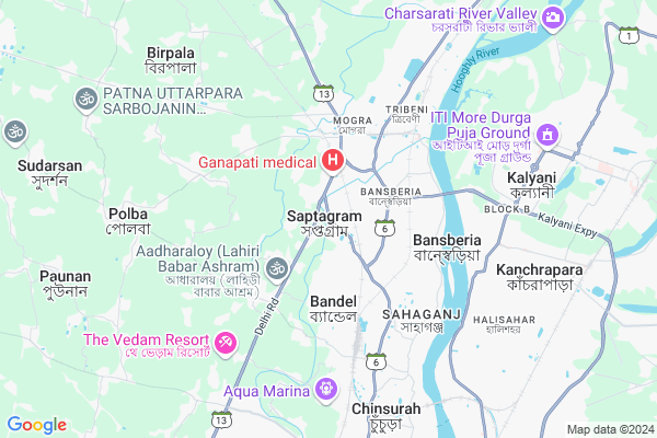
State Highway 13, Bandel
State Highway 13, Bandel Map
EDIT Map
Add Your House
 ..
..
Current Corona Virus Infected Patients Count in Hooghly District
| City Name | District Name | Total Covid cases |
|---|---|---|
| Hooghly District | Hooghly | 1 |
Village Name :
State Highway 13, Bandel
( স্টেট হাইওয়ে ১৩ বান্ডেল )
Block Name : Chinsurah-magrah
District : Hooghly
State : West Bengal
Division : Burdwan
Language : Bengali
Current Time 01:15 PM
Date: Friday , Mar 14,2025 (IST)
Time zone: IST (UTC+5:30)
Elevation / Altitude: 16 meters. Above Seal level
Telephone Code / Std Code: 03213
Ward : Ward
Assembly constituency : Chunchura assembly constituency
Assembly MLA : Asit Mazumder (Tapan)
Lok Sabha constituency : Hooghly parliamentary constituency
Parliament MP : LOCKET CHATTERJEE
Pin Code : 712123
Post Office Name : Bandel Junction
Commodities Prices : Kalyani Market / Mandi
State Highway 13, Bandel Live Weather
Temperature: 39.1 °C
clear sky
Humidity: 14%
Wind : 3.76 mt/sec towards W
StationName : "BÄ\u0081nsbÄ\u0081ria"
observed on 23 Mins Back
Temperature: 39.1 °C
clear sky
Humidity: 14%
Wind : 3.76 mt/sec towards W
StationName : "BÄ\u0081nsbÄ\u0081ria"
observed on 23 Mins Back
State Highway 13, Bandel Weather Forecast for Next 5 days
15-03-2025
23.3°C to 39.7°C
clear sky
23.3°C to 39.7°C
clear sky
16-03-2025
22.8°C to 40.5°C
clear sky
22.8°C to 40.5°C
clear sky
17-03-2025
22.4°C to 41.2°C
clear sky, broken clouds, scattered clouds
22.4°C to 41.2°C
clear sky, broken clouds, scattered clouds
18-03-2025
23.3°C to 41.0°C
clear sky, scattered clouds, broken clouds, few clouds
23.3°C to 41.0°C
clear sky, scattered clouds, broken clouds, few clouds
19-03-2025
23.9°C to 42.4°C
few clouds, clear sky
23.9°C to 42.4°C
few clouds, clear sky
National Highways Reachable To State Highway 13, Bandel
Nationa High Way :NH19
Nationa High Way :NH19
Rivers Near State Highway 13, Bandel
Ichamati :ইছামতী নদী :Ichamati River
Bhagirathi :Hooghly River
Ichamati :ইছামতী নদী :Ichamati River
Bhagirathi :Hooghly River
About State Highway 13, Bandel
Correct below Info and add more info about State Highway 13, BandelState Highway 13, Bandel is a Locality in Chinsurah-magrah City in West Bengal State, India. It is belongs to Burdwan Division .
State Highway 13, Bandel Pin code is 712123 and postal head office is Bandel Junction .
Chinsura , Hugli-Chuchura , Naihati , Chandannagar are the nearby Cities to Chinsurah-magrah.
Demographics of State Highway 13, Bandel
Bengali is the Local Language here.Politics in State Highway 13, Bandel
CPM , Bharatiya Janata Party , AITC , AIFB are the major political parties in this area.Polling Stations /Booths near State Highway 13, Bandel
1)Hoooghly Collegiate School Room No-12)Rabindranagra Upa-swastha Kendra
3)Milan Park Primary Vidyalaya Room No.- 2
4)Bahir Ranaghacha Primary School
5)Korola Jr. Basic School
HOW TO REACH State Highway 13, Bandel
By Rail
Adi Saptagram Rail Way Station , Magra Rail Way Station are the very nearby railway station to State Highway 13, Bandel.Govt Health Centers near State Highway 13, Bandel
1) Sonatikri , , Polba - Mogra Road , High School2) Manaspur SC , Manaspur SubCentre , Bandel Station Road , Bandel GP Office
3) Sultangacha , , Chinsurah - Tarakeswar 23 no. Road , High School
Hospitals in State Highway 13, Bandel,Chinsurah-magrah
Patrapara Adisapta Gram
712148; West Shek Para; Mogra; Saptagram; West Bengal 712502; India
0.2 KM distance Detail
Dr. Achintya Kumar Das' Homoeopathic Clinic
Adisaptagram Stn. Road; Adisaptagram; West Bengal 712121; India
1.2 KM distance Detail
Doctor Center
Adisaptagram Station Roed; 712121; Namajghar; West Bengal; India
1.5 KM distance Detail
Chhoto Khejuria Uttarpara Club
Adisaptagram; Chhota Khejuria; West Bengal 712502; India
1.8 KM distance Detail
more ..
Petrol Bunks in State Highway 13, Bandel,Chinsurah-magrah
Kundu Service Station
HP Dealer G T Road PO DT; Mogra; Kolkata; West Bengal 712148; India
1.1 KM distance Detail
IndianOil
Simurali - Brahma Para Rd; West Shek Para; Mogra; Alikhoja; West Bengal 712502; India
1.4 KM distance Detail
HP Petrol Pump
Grand Trunk Rd; Adisaptagram; Bandel; West Bengal 712502; India
2.0 KM distance Detail
more ..
Colleges in State Highway 13, Bandel,Chinsurah-magrah
Academy of Technology
Grand Trunk Road; Adisaptagram; Hooghly; West Bengal 712121; India
1.1 KM distance Detail
AOT Electrical Engineering Department
Adisaptagram; Krishnapur Chandanpur; West Bengal 712502; India
1.2 KM distance Detail
more ..
Schools in State Highway 13, Bandel,Chinsurah-magrah
Academy Of Technology; Adisaptagram
Grand Trunk Road; Adisaptagram; Dakshin Hazipur; West Bengal 712502; India
1.3 KM distance Detail
Let's Learn
BC-67;samar pally; 206 Foot Bridge; AJ Block; Sector II; Kestopur; Kolkata; West Bengal 700091; India
1.3 KM distance Detail
Kidsland playgroup school
Adisaptagram; Dakshin Hazipur; West Bengal 712502; India
1.4 KM distance Detail
The Ideal Edification- Computer Training Academy
712121; West Shek Para; Mogra; Trishbigha; West Bengal 712502; India
1.5 KM distance Detail
Electronic Shops in State Highway 13, Bandel,Chinsurah-magrah
Mobi Care & Service(Bappa Da)
Saptagram; beside primary school); West Bengal 712148; India
0.4 KM distance Detail
Near Adisaptagram Railway Station.Mobile Recharge Market
; Adisaptagram; Bansberia; Trishbigha; West Bengal 712502; India
1.4 KM distance Detail
Super Markets in State Highway 13, Bandel,Chinsurah-magrah
বিন্দাস হেয়ার কাতিং সেলুন বিশ্বজিত MB N
Barakhejuria; Adisaptagram; West Bengal 712502; India
1.5 KM distance Detail
Local Parks in State Highway 13, Bandel,Chinsurah-magrah
Suakhal Park & Picnic Spot
SH 13; West Shek Para; Mogra; Saptagram; West Bengal 712502; India
0.7 KM distance Detail
Police Stations near State Highway 13, Bandel,Chinsurah-magrah
Mogra Police Station
Grand Trunk Rd; Boropukur Area; Mogra; Hansghara; West Bengal 712148; India
3.8 KM distance Detail
Governement Offices near State Highway 13, Bandel,Chinsurah-magrah
Dr. Dinabandhu Diagnostic Center
Grand Trunk Rd; Boropukur Area; Mogra; Amodghata; West Bengal 712148; India
3.6 KM distance Detail
About State Highway 13, Bandel &
History
How to reach State Highway 13, Bandel
Tourist Places Near By State Highway 13, Bandel
Schools in State Highway 13, Bandel
Colleges in State Highway 13, Bandel
Temperature & weather of State Highway 13, Bandel
places in State Highway 13, Bandel
State Highway 13, Bandel photos
More Information
How to reach State Highway 13, Bandel
Tourist Places Near By State Highway 13, Bandel
Schools in State Highway 13, Bandel
Colleges in State Highway 13, Bandel
Temperature & weather of State Highway 13, Bandel
places in State Highway 13, Bandel
State Highway 13, Bandel photos
More Information
Locality Talk
Post News or Events about this Locality
Near Cities
Chinsura 7 KM near
Hugli-Chuchura 7 KM near
Naihati 9 KM near
Chandannagar 11 KM near
Chinsura 7 KM near
Hugli-Chuchura 7 KM near
Naihati 9 KM near
Chandannagar 11 KM near
Near By Taluks
Chinsurah-Magrah 0 KM near
Chinsurah 8 KM near
Polba-Dadpur 12 KM near
Barrackpur-I 12 KM near
Chinsurah-Magrah 0 KM near
Chinsurah 8 KM near
Polba-Dadpur 12 KM near
Barrackpur-I 12 KM near
Near By Air Ports
Netaji Subhas Chandra Bose Airport 39 KM near
Singerbhil Airport 348 KM near
Ranchi Airport 351 KM near
Rupsi Airport 434 KM near
Netaji Subhas Chandra Bose Airport 39 KM near
Singerbhil Airport 348 KM near
Ranchi Airport 351 KM near
Rupsi Airport 434 KM near
Near By Tourist Places
Howrah 46 KM near
Kolkata 47 KM near
Alipore 53 KM near
Navadvipa 56 KM near
Mayapur 58 KM near
Howrah 46 KM near
Kolkata 47 KM near
Alipore 53 KM near
Navadvipa 56 KM near
Mayapur 58 KM near
Near By Districts
Hooghly 8 KM near
24 Paraganas North 32 KM near
Howrah 47 KM near
Kolkata 54 KM near
Hooghly 8 KM near
24 Paraganas North 32 KM near
Howrah 47 KM near
Kolkata 54 KM near
Near By RailWay Station
Adi Saptagram Rail Way Station 1.4 KM near
Magra Rail Way Station 3.0 KM near
Bansh Baria Rail Way Station 3.0 KM near
Bandel Junction Rail Way Station 4 KM near
Naihati Junction Rail Way Station 10 KM near
Adi Saptagram Rail Way Station 1.4 KM near
Magra Rail Way Station 3.0 KM near
Bansh Baria Rail Way Station 3.0 KM near
Bandel Junction Rail Way Station 4 KM near
Naihati Junction Rail Way Station 10 KM near