| Home | City Bus | Maps | Villages | Cities | Rail | Tourist Places | School | College | Pin Codes | Corona Cases Count |
| Distance Calculator Bus Services IFSC Codes Trace Mobile Number Weather Search Place Trace IP Available Cash ATM/Banks Locate Polling Booth Report an Error contact People |
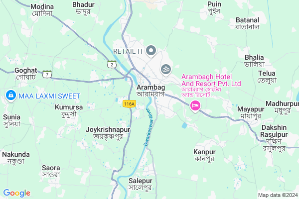
Arambag
Arambag Map
EDIT Map
Add Your House
 ..
..
Current Corona Virus Infected Patients Count in Hooghly District
| City Name | District Name | Total Covid cases |
|---|---|---|
| Hooghly District | Hooghly | 1 |
Village Name :
Arambag
( আরামবাগ )
Block Name : Arambagh
District : Hooghly
State : West Bengal
Division : Burdwan
Language : Bengali
Current Time 12:17 PM
Date: Tuesday , Apr 29,2025 (IST)
Time zone: IST (UTC+5:30)
Elevation / Altitude: 16 meters. Above Seal level
Telephone Code / Std Code: 03211
Ward : Ward
Assembly constituency : Arambagh assembly constituency
Assembly MLA : Madhusudan Bag
Lok Sabha constituency : Arambagh parliamentary constituency
Parliament MP : APARUPA PODDAR (AFRIN ALI)
Pin Code : 712601
Post Office Name : Arambagh
Commodities Prices : Champadanga Market / Mandi
Arambag Live Weather
Temperature: 36.3 °C
clear sky
Humidity: 30%
Wind : 0.99 mt/sec towards SE
StationName : "ArÄ\u0081mbÄ\u0081gh"
observed on 7 Mins Back
Temperature: 36.3 °C
clear sky
Humidity: 30%
Wind : 0.99 mt/sec towards SE
StationName : "ArÄ\u0081mbÄ\u0081gh"
observed on 7 Mins Back
Arambag Weather Forecast for Next 5 days
30-04-2025
23.5°C to 37.2°C
clear sky, light rain, moderate rain, scattered clouds, overcast clouds
23.5°C to 37.2°C
clear sky, light rain, moderate rain, scattered clouds, overcast clouds
01-05-2025
23.8°C to 37.5°C
overcast clouds, clear sky, few clouds, light rain
23.8°C to 37.5°C
overcast clouds, clear sky, few clouds, light rain
02-05-2025
23.5°C to 37.5°C
light rain, clear sky, overcast clouds
23.5°C to 37.5°C
light rain, clear sky, overcast clouds
03-05-2025
24.4°C to 36.6°C
overcast clouds, scattered clouds, few clouds, clear sky, light rain, broken clouds
24.4°C to 36.6°C
overcast clouds, scattered clouds, few clouds, clear sky, light rain, broken clouds
04-05-2025
23.5°C to 35.4°C
broken clouds, scattered clouds, light rain, moderate rain
23.5°C to 35.4°C
broken clouds, scattered clouds, light rain, moderate rain
National Highways Reachable To Arambag
Nationa High Way :NH19
Nationa High Way :NH19
Rivers Near Arambag
Shilabati
Damodar
Shilabati
Damodar
About Arambag
Correct below Info and add more info about ArambagArambag is a Locality in Arambagh City in West Bengal State, India. It is belongs to Burdwan Division .
Arambag Pin code is 712601 and postal head office is Arambagh .
Azad Pally , Satitala , Nabapalli , Salepur , Mandra are the nearby Localities to Arambag.
Arambagh , Tarakeswar , Bardhaman , Memari are the nearby Cities to Arambagh.
Demographics of Arambag
Bengali is the Local Language here.Politics in Arambag
CPM , CPI(M) , AITC , All India Trinamool Congress , INC are the major political parties in this area.Polling Stations /Booths near Arambag
1)Paradra Prathamik Bidyalay2)Parul Kashinath Prathamik Bidyalay
3)Uttar Rasulapur Prathamik Bidyalay
4)Arambag Prathamik Bidyalay
5)Arambagh Boys High School
HOW TO REACH Arambag
By Rail
Arambagh P C Sen Rail Way Station , Mayapur Rail Way Station are the very nearby railway station to Arambag.Govt Health Centers near Arambag
1) Salepur GP HQ SC , Salepur I GP Bulding , 24 no Route , Chowdhury Pukur2) Rangtakhali PHC SC , Rangtakhali S/C , Rangtakhali Bus Route , Rangtakhali Pri. School
3) Arambagh Sub Divisional Hospital , Arambagh S D Hospital , Arambagh Hospital Road , Arambagh Rabindra Sadan
Petrol Bunks in Arambag,Arambagh
HP Petrol Pump Samanto Brothers Arambag
SH 2; Arambagh; West Bengal ৭১২৬০১; India
0.8 KM distance Detail
Sambhabami Service Station Private Limited
Link Road; Gourhati more; SH 2; Arambagh; West Bengal 712601; India
1.0 KM distance Detail
more ..
Colleges in Arambag,Arambagh
S N P TECHNICAL INSTITUTE PVT ITI
24 No. ROUTE; ARAMBAGH;; Satitala; Arambagh; West Bengal 712601; India
0.7 KM distance Detail
ARAMBAGH NABADIGANTA PVT ITI
Mansatala (Tildanga Math); Ward No-2; District Hooghly; Arambagh; West Bengal 712601; India
0.8 KM distance Detail
Arambagh Institute of Advanced Studies
Gourhati More; Ahilyabai Holkar Road; Opposite SBI ADB Branch; Arambagh; West Bengal 712601; India
0.8 KM distance Detail
ARAMBAGH TECHNICAL AND SURVEY INSTITUTION
P C Sen Rd; Arambagh; West Bengal 712601; India
0.9 KM distance Detail
more ..
Electronic Shops in Arambag,Arambagh
DELL EXCLUSIVE STORE
LINK ROAD; ARAMBAGH; HOOGHLY; KOLKATA; West Bengal 712601; India
0.4 KM distance Detail
Radhakrishna Electric
Linkroad; Near Gourhati More; Arambagh;; Kolkata; West Bengal 712601; India
0.4 KM distance Detail
My Jio Store
My Jio Store 819/38 Gourhata More 24 No. RoadArambagh; Arambagh; West Bengal 712611; India
0.4 KM distance Detail
Police Stations near Arambag,Arambagh
Arambagh Police Station
Near Gourhati More; Hooghly; Arambagh; West Bengal 712601; India
0.9 KM distance Detail
Governement Offices near Arambag,Arambagh
Alordisha New Life Care (Ceragem)
Arambagh;Basudebpur more;Upper flore of; Dena bank; Arambagh; West Bengal; India
0.9 KM distance Detail
About Arambag &
History
How to reach Arambag
Tourist Places Near By Arambag
Schools in Arambag
Colleges in Arambag
Temperature & weather of Arambag
places in Arambag
Arambag photos
More Information
How to reach Arambag
Tourist Places Near By Arambag
Schools in Arambag
Colleges in Arambag
Temperature & weather of Arambag
places in Arambag
Arambag photos
More Information
Locality Talk
Post News or Events about this Locality
Near Cities
Arambagh 2 KM near
Tarakeswar 25 KM near
Bardhaman 47 KM near
Memari 55 KM near
Arambagh 2 KM near
Tarakeswar 25 KM near
Bardhaman 47 KM near
Memari 55 KM near
Near By Taluks
Arambagh 0 KM near
Goghat-I 8 KM near
Goghat-Ii 15 KM near
Pursurah 19 KM near
Arambagh 0 KM near
Goghat-I 8 KM near
Goghat-Ii 15 KM near
Pursurah 19 KM near
Near By Air Ports
Netaji Subhas Chandra Bose Airport 79 KM near
Ranchi Airport 288 KM near
Bhubaneswar Airport 398 KM near
Gaya Airport 399 KM near
Netaji Subhas Chandra Bose Airport 79 KM near
Ranchi Airport 288 KM near
Bhubaneswar Airport 398 KM near
Gaya Airport 399 KM near
Near By Tourist Places
Jairambati 19 KM near
Shankarpur 20 KM near
Bardhaman 46 KM near
Burdwan 46 KM near
Bishnupur 59 KM near
Jairambati 19 KM near
Shankarpur 20 KM near
Bardhaman 46 KM near
Burdwan 46 KM near
Bishnupur 59 KM near
Near By Districts
Bardhaman 46 KM near
Hooghly 69 KM near
Howrah 69 KM near
Medinipur East 73 KM near
Bardhaman 46 KM near
Hooghly 69 KM near
Howrah 69 KM near
Medinipur East 73 KM near
Near By RailWay Station
Arambagh P C Sen Rail Way Station 2.3 KM near
Mayapur Rail Way Station 4.2 KM near
Barddhaman Junction Rail Way Station 48 KM near
Garhbeta Rail Way Station 53 KM near
Arambagh P C Sen Rail Way Station 2.3 KM near
Mayapur Rail Way Station 4.2 KM near
Barddhaman Junction Rail Way Station 48 KM near
Garhbeta Rail Way Station 53 KM near