| Home | City Bus | Maps | Villages | Cities | Rail | Tourist Places | School | College | Pin Codes | Corona Cases Count |
| Distance Calculator Bus Services IFSC Codes Trace Mobile Number Weather Search Place Trace IP Available Cash ATM/Banks Locate Polling Booth Report an Error contact People |
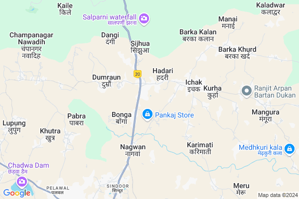
Bariyath
Bariyath Map
EDIT Map
Add Your House
 ..
..
Current Corona Virus Infected Patients Count in Hazaribagh District
| City Name | District Name | Total Covid cases |
|---|---|---|
| Hazaribagh District | Hazaribagh | 3 |
Locality Name :
Bariyath
( बरियात )
Block Name : Ichak
District : Hazaribagh
State : Jharkhand
Language : Hindi and Santali
Current Time 12:17 PM
Date: Tuesday , Apr 29,2025 (IST)
Time zone: IST (UTC+5:30)
Elevation / Altitude: 371 meters. Above Seal level
Telephone Code / Std Code: 06548
Assembly constituency : Barkatha assembly constituency
Assembly MLA :
Lok Sabha constituency : Kodarma parliamentary constituency
Parliament MP :
Serpanch Name :
Pin Code : 825402
Post Office Name : Ichak
Commodities Prices : Khunti Market / Mandi
Bariyath Live Weather
Temperature: 31.2 °C
scattered clouds
Humidity: 29%
Wind : 2.86 mt/sec towards SE
StationName : "Hazaribagh"
observed on 2 Hours Back
Temperature: 31.2 °C
scattered clouds
Humidity: 29%
Wind : 2.86 mt/sec towards SE
StationName : "Hazaribagh"
observed on 2 Hours Back
Bariyath Weather Forecast for Next 5 days
30-04-2025
21.3°C to 32.4°C
scattered clouds, light rain, clear sky, few clouds
21.3°C to 32.4°C
scattered clouds, light rain, clear sky, few clouds
01-05-2025
20.9°C to 35.0°C
few clouds, clear sky, broken clouds, light rain
20.9°C to 35.0°C
few clouds, clear sky, broken clouds, light rain
02-05-2025
21.0°C to 34.1°C
clear sky, light rain, broken clouds, heavy intensity rain, overcast clouds
21.0°C to 34.1°C
clear sky, light rain, broken clouds, heavy intensity rain, overcast clouds
03-05-2025
21.0°C to 34.4°C
scattered clouds, clear sky, light rain, few clouds, broken clouds
21.0°C to 34.4°C
scattered clouds, clear sky, light rain, few clouds, broken clouds
04-05-2025
23.8°C to 35.9°C
broken clouds, few clouds, light rain, overcast clouds
23.8°C to 35.9°C
broken clouds, few clouds, light rain, overcast clouds
Edit below overview about Bariyath
Edit below overview about Bariyath
OverView of Bariyath
Bariyath is very beautiful place for tourist. In the west side, Play ground, in the east Chaat nadi is there.Edit below overview about Bariyath
Rivers Near Bariyath
Mohana
Chakora Nadi
Mohana
Chakora Nadi
About Bariyath
Bariyath is a Village in Ichak Block in Hazaribagh District of Jharkhand State, India. It is located 12 KM towards North from District head quarters Hazaribagh. 8 KM from Purana Ichak. 96 KM from State capital Ranchi
Bariyath Pin code is 825402 and postal head office is Ichak .
Hadari ( 2 KM ) , Bonga ( 3 KM ) , Parasi ( 3 KM ) , Kurha ( 5 KM ) , Pabra ( 5 KM ) are the nearby Villages to Bariyath. Bariyath is surrounded by Sadar Block towards South , Hazaribagh Block towards South , Padma Block towards North , Katkamsandi Block towards west .
Hazaribag , Jhumri Tilaiya , Saunda , Patratu are the near by Cities to Bariyath.
Demographics of Bariyath
Hindi is the Local Language here.Politics in Bariyath
JVM , Bharatiya Janata Party , CPI(ML)(L) , BJP , JVMP , are the major political parties in this area.Polling Stations /Booths near Bariyath
1)Middle School Gorhar West Part2)Primary School Chehal
3)Primary School Gobarbanda North Part
4)Primary School Chandgadh
5)Primary School Bedokhurd
HOW TO REACH Bariyath
By Rail
There is no railway station near to Bariyath in less than 10 km.Colleges near Bariyath
Sariya College Suriya
Address :
Kisan Mazdoor Inter Science College
Address :
Karnpura College ,barkagaon
Address :
Bharat International Collage Bic
Address : Chouparan Hazaribag Jharkhrand
Bishnugarh Inter College Bishnugarh
Address :
Schools near Bariyath
Prathmik School Bharajo
Address : Bharajo, Hanuman Mandir (near- Talao)
K.n.10+2 High School Hadari ,ichak
Address : AT HADARI, NEAR POLICE STATION
Rajkiya Kanya Prathmik Vidyalaya Kariyatpur, Ichak
Address : Kariyatpur,Ichak,Hazaribagh
Govt Health Centers near Bariyath
1) HSC BARIYATH , Health Sub center BARIYATH , BARIYATH ,2) HSC BONGA , Health Sub center BONGA , BONGA ,
3) HSC TILRA , Health Sub center TILRA , TILRA , near gov.school
Petrol Bunks in Bariyath,Ichak
AJMERA & COMPANY
BAREYAT; NH 33 DIST HAZARI; HAZARIBAGH; Jharkhand 825402; India
0.9 KM distance Detail
HARSHIT FUEL FILLING STATION
SIJHUA; ICHAK; HAZARIBAGH; Jharkhand 825402; India
2.3 KM distance Detail
more ..
Local Parks in Bariyath,Ichak
Hazaribag National Park
Canery Hill Road; Hazaribagh; Jharkhand 825301; India
8.4 KM distance Detail
Governement Offices near Bariyath,Ichak
Jharkhand Urja Sancharan Nigam LTD.
Canery Hill Rd; Dipugarha; Hazaribagh; Jharkhand 825317; India
8.8 KM distance Detail
About Bariyath &
History
How to reach Bariyath
Tourist Places Near By Bariyath
Schools in Bariyath
Colleges in Bariyath
Temperature & weather of Bariyath
places in Bariyath
Bariyath photos
More Information
How to reach Bariyath
Tourist Places Near By Bariyath
Schools in Bariyath
Colleges in Bariyath
Temperature & weather of Bariyath
places in Bariyath
Bariyath photos
More Information
Village Talk
Post News or Events about this Village
Near Cities
Hazaribag 13 KM near
Jhumri Tilaiya 45 KM near
Saunda 52 KM near
Patratu 55 KM near
Hazaribag 13 KM near
Jhumri Tilaiya 45 KM near
Saunda 52 KM near
Patratu 55 KM near
Near By Taluks
Ichak 7 KM near
Sadar 10 KM near
Hazaribagh 10 KM near
Padma 14 KM near
Ichak 7 KM near
Sadar 10 KM near
Hazaribagh 10 KM near
Padma 14 KM near
Near By Air Ports
Ranchi Airport 95 KM near
Gaya Airport 97 KM near
Patna Airport 191 KM near
Varanasi Airport 334 KM near
Ranchi Airport 95 KM near
Gaya Airport 97 KM near
Patna Airport 191 KM near
Varanasi Airport 334 KM near
Near By Tourist Places
Koderma 46 KM near
Jhumri telaiya 46 KM near
Hazaribagh 56 KM near
Chatra 61 KM near
Bodh Gaya 90 KM near
Koderma 46 KM near
Jhumri telaiya 46 KM near
Hazaribagh 56 KM near
Chatra 61 KM near
Bodh Gaya 90 KM near
Near By Districts
Hazaribagh 11 KM near
Koderma 53 KM near
Ramgarh 57 KM near
Chatra 61 KM near
Hazaribagh 11 KM near
Koderma 53 KM near
Ramgarh 57 KM near
Chatra 61 KM near
Near By RailWay Station
Koderma Junction Rail Way Station 46 KM near
Parsabad Rail Way Station 47 KM near
Koderma Junction Rail Way Station 46 KM near
Parsabad Rail Way Station 47 KM near