| Home | City Bus | Maps | Villages | Cities | Rail | Tourist Places | School | College | Pin Codes | Corona Cases Count |
| Distance Calculator Bus Services IFSC Codes Trace Mobile Number Weather Search Place Trace IP Available Cash ATM/Banks Locate Polling Booth Report an Error contact People |
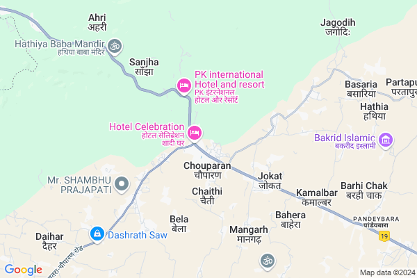
Chauparan
Chauparan Map
EDIT Map
Add Your House
 ..
..
Current Corona Virus Infected Patients Count in Hazaribagh District
| City Name | District Name | Total Covid cases |
|---|---|---|
| Hazaribagh District | Hazaribagh | 3 |
Locality Name :
Chauparan
( चौपारण )
Block Name : Chouparan
District : Hazaribagh
State : Jharkhand
Language : Hindi and Santali
Current Time 10:38 AM
Date: Friday , Apr 25,2025 (IST)
Time zone: IST (UTC+5:30)
Elevation / Altitude: 386 meters. Above Seal level
Telephone Code / Std Code: 06547
Assembly constituency : Barhi assembly constituency
Assembly MLA : Umashankar Akela
Lok Sabha constituency : Hazaribagh parliamentary constituency
Parliament MP : JAYANT SINHA
Serpanch Name :
Pin Code : 825406
Post Office Name : Chouparan
Edit below overview about Chauparan
Edit below overview about Chauparan
OverView of Chauparan
Chouparan is a small township in hazaribagh district of jharkhad. It is 19 km far from barhi. Chouparan is situated near highway(kolkata-delhi) so can be reached by bus from anywhere. It is a good place having natural scenic beauty and surrounded by small villages and forests. Weather is also good here. Basic amentities and basic needs like hospitals, schools, convenience all are easily avaialable in chouparan.Edit below overview about Chauparan
Rivers Near Chauparan
Barakar River
Brakar river
Barakar River
Brakar river
About Chauparan
Chauparan is a Town in Chouparan Block in Hazaribagh District of Jharkhand State, India. It is located 54 KM towards North from District head quarters Hazaribagh. It is a Block head quarter.
Chauparan Pin code is 825406 and postal head office is Chouparan .
Chaithi ( 3 KM ) , Karma ( 3 KM ) , Bela ( 5 KM ) , Dadpur ( 5 KM ) , Chaikala ( 6 KM ) are the nearby Villages to Chauparan. Chauparan is surrounded by Itkhori Block towards South , Chandwara Block towards East , Padma Block towards South , Barhi Block towards East .
Jhumri Tilaiya , Bodh Gaya , Chatra , Hazaribag are the nearby Cities to Chauparan.
This Place is in the border of the Hazaribagh District and Gaya District. Gaya District Barachatti is west towards this place . Also it is in the Border of other district Koderma . It is near to the Bihar State Border.
Demographics of Chauparan
Hindi is the Local Language here.Politics in Chauparan
Bharatiya Janata Party , BJP , INC are the major political parties in this area.Polling Stations /Booths near Chauparan
1)High School Rampur2)K.b. High School Chouparan (n.part)
3)K.b. High School Chouparan (s.part)
4)K.b. High School Chouparan (w.part)
5)Charwaha P.s.goriyakarma West Part
HOW TO REACH Chauparan
By Rail
There is no railway station near to Chauparan in less than 10 km.Govt Health Centers near Chauparan
1) CHC CHAUPARAN , Community Health Center Chaoparan , Chouparan , Chatra More2) HSC BHUSHANDIH , Sub Center Bhushandi , Bhushandi , Near Middle School
3) HCS Chaikala , Sub Center Chaikala , Chaikala , Near Middle School
Sub Villages in Chauparan
Hospitals in Chauparan,Chouparan
Community Health Center; Chauparan
National Highway 2; Chouparan; Jharkhand 825406; India
1.0 KM distance Detail
more ..
Petrol Bunks in Chauparan,Chouparan
HP PETROL PUMP - BHADRAKALI FUELS
Joket; ON NH-2 Chouparan; Jharkhand 835406; India
4.4 KM distance Detail
more ..
Schools in Chauparan,Chouparan
chauparan junior government school
National Highway 2; Chouparan; Jharkhand 825406; India
1.0 KM distance Detail
Electronic Shops in Chauparan,Chouparan
Rahul Mobile Recharge Centre And Hd Video Graphy
Chouparan; Jharkhand 825406; India
0.8 KM distance Detail
Police Stations near Chauparan,Chouparan
Chouparan Police Station
NH2; Chaithi More; Chouparan; Jharkhand 825406; India
1.7 KM distance Detail
Governement Offices near Chauparan,Chouparan
About Chauparan &
History
How to reach Chauparan
Tourist Places Near By Chauparan
Schools in Chauparan
Colleges in Chauparan
Temperature & weather of Chauparan
places in Chauparan
Chauparan photos
More Information
How to reach Chauparan
Tourist Places Near By Chauparan
Schools in Chauparan
Colleges in Chauparan
Temperature & weather of Chauparan
places in Chauparan
Chauparan photos
More Information
Town Talk
Post News or Events about this Town
Near Cities
Jhumri Tilaiya 29 KM near
Bodh Gaya 48 KM near
Chatra 49 KM near
Hazaribag 52 KM near
Jhumri Tilaiya 29 KM near
Bodh Gaya 48 KM near
Chatra 49 KM near
Hazaribag 52 KM near
Near By Taluks
Chouparan 3 KM near
Itkhori 12 KM near
Chandwara 26 KM near
Padma 27 KM near
Chouparan 3 KM near
Itkhori 12 KM near
Chandwara 26 KM near
Padma 27 KM near
Near By Air Ports
Gaya Airport 56 KM near
Ranchi Airport 133 KM near
Patna Airport 151 KM near
Varanasi Airport 302 KM near
Gaya Airport 56 KM near
Ranchi Airport 133 KM near
Patna Airport 151 KM near
Varanasi Airport 302 KM near
Near By Tourist Places
Koderma 30 KM near
Jhumri telaiya 31 KM near
Chatra 49 KM near
Bodh Gaya 49 KM near
Kakolat 68 KM near
Koderma 30 KM near
Jhumri telaiya 31 KM near
Chatra 49 KM near
Bodh Gaya 49 KM near
Kakolat 68 KM near
Near By Districts
Koderma 39 KM near
Chatra 49 KM near
Hazaribagh 51 KM near
Gaya 58 KM near
Koderma 39 KM near
Chatra 49 KM near
Hazaribagh 51 KM near
Gaya 58 KM near
Near By RailWay Station
Paharpur Rail Way Station 29 KM near
Koderma Junction Rail Way Station 30 KM near
Paharpur Rail Way Station 29 KM near
Koderma Junction Rail Way Station 30 KM near