| Home | City Bus | Maps | Villages | Cities | Rail | Tourist Places | School | College | Pin Codes | Corona Cases Count |
| Distance Calculator Bus Services IFSC Codes Trace Mobile Number Weather Search Place Trace IP Available Cash ATM/Banks Locate Polling Booth Report an Error contact People |
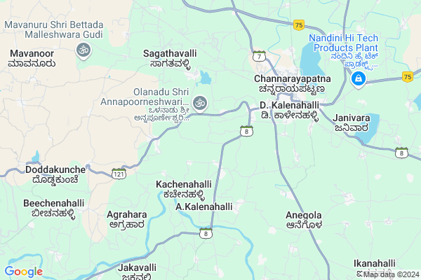
Noranakki
Noranakki Map
EDIT Map
Add Your House
 ..
..
Current Corona Virus Infected Patients Count in Hassan District
| City Name | District Name | Total Covid cases |
|---|
Locality Name :
Noranakki
( ನೊರಣಕ್ಕೀ )
Taluk Name : Channarayapatna
District : Hassan
State : Karnataka
Division : Mysore
Language : Kannada and Sanskrit, Tamil, Marathi, Marwari And Mahajani
Current Time 12:42 PM
Date: Wednesday , Apr 30,2025 (IST)
Time zone: IST (UTC+5:30)
Elevation / Altitude: 800 meters. Above Seal level
Telephone Code / Std Code: 08176
Assembly constituency : Holenarasipur assembly constituency
Assembly MLA : H.D. Revanna
Lok Sabha constituency : Hassan parliamentary constituency
Parliament MP : PRAJWAL REVANNA
Serpanch Name :
Pin Code : 573116
Post Office Name : Channarayapatna
Commodities Prices : Channarayapatna Market / Mandi
National Highways Reachable To Noranakki
Nationa High Way :NH373
Nationa High Way :NH75
Nationa High Way :NH373
Nationa High Way :NH75
Rivers Near Noranakki
Hemavati :ಹೇಮಾವತಿ
Hemavati :ಹೇಮಾವತಿ
Hemavati :ಹೇಮಾವತಿ
Hemavati :ಹೇಮಾವತಿ
About Noranakki
Correct below Info and add more info about NoranakkiNoranakki is a Village in Channarayapatna Taluk in Hassan District of Karnataka State, India. It belongs to Mysore Division . It is located 35 KM towards East from District head quarters Hassan. 15 KM from Channarayapatna. 158 KM from State capital Bangalore
Noranakki Pin code is 573116 and postal head office is Channarayapatna .
Nallur ( 5 KM ) , Channarayapatna ( 6 KM ) , Kodihalli ( 7 KM ) , Janivara ( 9 KM ) , Doddakunche ( 9 KM ) are the nearby Villages to Noranakki. Noranakki is surrounded by Holenarsipur Taluk towards South , Krishnarajpet Taluk towards South , Hassan Taluk towards west , Arkalgud Taluk towards west .
Hassan , Tiptur , Arasikere , Sakleshpur are the near by Cities to Noranakki.
Noranakki 2011 Census Details
Noranakki Local Language is Kannada. Noranakki Village Total population is 432 and number of houses are 112. Female Population is 49.8%. Village literacy rate is 70.1% and the Female Literacy rate is 29.9%.
Population
| Census Parameter | Census Data |
| Total Population | 432 |
| Total No of Houses | 112 |
| Female Population % | 49.8 % ( 215) |
| Total Literacy rate % | 70.1 % ( 303) |
| Female Literacy rate | 29.9 % ( 129) |
| Scheduled Tribes Population % | 1.9 % ( 8) |
| Scheduled Caste Population % | 11.3 % ( 49) |
| Working Population % | 58.1 % |
| Child(0 -6) Population by 2011 | 34 |
| Girl Child(0 -6) Population % by 2011 | 52.9 % ( 18) |
Noranakki Census More Deatils.
Politics in Noranakki
Janata Dal (Secular) , JD(S) , BJP , Janata Dal (Secular) (JD(S)) , INC are the major political parties in this area.Polling Stations /Booths near Noranakki
1)Govt Lower Primary School Hittala Aladahalli2)Govt Higher Primary School Muttige Hirehalli
3)Govt Pre University Collage Halekote
4)Govt Lower Primary School Agraharakoppalu
5)Govt Lower Primary School Kallenahalli
HOW TO REACH Noranakki
By Rail
There is no railway station near to Noranakki in less than 10 km. Tiptur Rail Way Station (near to Tiptur) , Arsikere Junction Rail Way Station (near to Arasikere) , Shri Sharada Nagar Rail Way Station (near to Tiptur) are the Rail way stations reachable from near by towns.By Road
Channarayapatna , Tiptur , Arasikere are the nearby by towns to Noranakki having road connectivity to NoranakkiColleges near Noranakki
Mangala College Of Nursing
Address :
Governament Pu College
Address :
Vidyaranya Pre University College
Address :
Govt.pre University College Thatanahally
Address :
Ck College Of Tears
Address :
Schools in Noranakki
Guhps Nornakki Gate
Address : noranakki , channarayapatna , hassan , Karnataka . PIN- 573116 , Post - Channarayapatna
Govt Health Centers near Noranakki
1) Juttnally , JUNIOR HEALTH ASSISTANT FEMALE , ,2) Biravalli , panchayathi Building , near school ,
3) Chalya , JUNIOR HEALTH ASSISTANT FEMALE , ,
Hospitals in Noranakki,Channarayapatna
Punya Hospital
Byrapura; Hassan; SH-8; Mysore Road; CR Patna; CR Patna; Karnataka 573116; India
5.4 KM distance Detail
Bharathi Hospital
Byrapura; Hassan; SH-8; Mysore Road; CR Patna; CR Patna; Karnataka 573116; India
5.4 KM distance Detail
more ..
Petrol Bunks in Noranakki,Channarayapatna
Hemorothy Co-Operative Society Bharat Petroleum
Srinivasapura; Hemavathi; Hassan; SH-8; CR Patna Road; CR Patna; CR Patna; Karnataka 573116; India
2.5 KM distance Detail
Hindustan Petroleum
Devasthana Kalenahalli; Hassan; SH-7; Mysore Road; Channarayapattana; Channarayapattana; Karnataka 573225; India
4.2 KM distance Detail
Akoshatha Service Station Indian Oil Petrol Pump
Byrapura; Hassan; SH-8; CR Patna Road; CR Patna; CR Patna; Karnataka 573116; India
4.9 KM distance Detail
more ..
Colleges in Noranakki,Channarayapatna
New Alliance Commerce College
Ragavendra Saw Mill Road; Near Vivekananda International School; Gayathri Extension;; Channarayapattana; Karnataka; India
5.1 KM distance Detail
Sri Manjunatha ITI
Adarshanagar 5th Main; Mysore Road; SH 7; Byrapura; Channarayapattana; Karnataka 573116; India
5.3 KM distance Detail
Soudamini English Medium School
SH 8; Byrapura; Channarayapattana; Karnataka 573225; India
5.4 KM distance Detail
Sri Adichunchanagiri College of Education
Mysore Road; Hassan; Channarayapattana; Karnataka 573116; India
5.6 KM distance Detail
more ..
Schools in Noranakki,Channarayapatna
Sarvodaya Vidya Mandira
Srinivasapura; A.Kalenahalli; Hassan; SH-8; HN Pura Road; CR Patna; CR Patna; Karnataka 573116; India
3.3 KM distance Detail
Government Lower Primary School
MG Kopplu; Hassan; SH-8; CR Patna Road; CR Patna; CR Patna; Karnataka 573211; India
4.3 KM distance Detail
Jnanasagara International Public School
Nagasamudra Rd; Byrapura; Channarayapattana; Karnataka 573116; India
5.4 KM distance Detail
Electronic Shops in Noranakki,Channarayapatna
Padmashree Sarviec Senter
Byrapura; Channarayapattana; Karnataka 573116; India
5.7 KM distance Detail
Super Markets in Noranakki,Channarayapatna
Channarayapatna Coconut Bazar
SH 7; Byrapura; Channarayapattana; Karnataka 573116; India
5.7 KM distance Detail
Police Stations near Noranakki,Channarayapatna
Channarayapatna City Limits Police Station
Mangalore - Bangalore Highway; Byrapura; Channarayapatana; Karnataka 573225; India
5.9 KM distance Detail
Governement Offices near Noranakki,Channarayapatna
Grama Panchayat Devasthana Kalenahalli
Devasthana Kalenahalli; Hassan; SH-7; Mysore Road; Channarayapattana; Channarayapattana; Karnataka 573225; India
4.0 KM distance Detail
KRRDA- PMGSY
336; Bangalore - Mangalore Hwy; Byrapura; Channarayapattana; Karnataka 573116; India
5.6 KM distance Detail
Taluka Office
Megalakere; Hassan; NH-48; Bangalore Mangalore; CR Patna; CR Patna; Karnataka 573116; India
5.8 KM distance Detail
About Noranakki &
History
How to reach Noranakki
Tourist Places Near By Noranakki
Schools in Noranakki
Colleges in Noranakki
Temperature & weather of Noranakki
places in Noranakki
Noranakki photos
More Information
How to reach Noranakki
Tourist Places Near By Noranakki
Schools in Noranakki
Colleges in Noranakki
Temperature & weather of Noranakki
places in Noranakki
Noranakki photos
More Information
Village Talk
Post News or Events about this Village
Near Cities
Hassan 39 KM near
Tiptur 49 KM near
Arasikere 54 KM near
Sakleshpur 69 KM near
Hassan 39 KM near
Tiptur 49 KM near
Arasikere 54 KM near
Sakleshpur 69 KM near
Near By Taluks
Channarayapatna 14 KM near
Holenarsipur 17 KM near
Krishnarajpet 31 KM near
Hassan 31 KM near
Channarayapatna 14 KM near
Holenarsipur 17 KM near
Krishnarajpet 31 KM near
Hassan 31 KM near
Near By Air Ports
Mysore Airport 80 KM near
Bengaluru International Airport 169 KM near
Bajpe Airport 177 KM near
Calicut Airport 222 KM near
Mysore Airport 80 KM near
Bengaluru International Airport 169 KM near
Bajpe Airport 177 KM near
Calicut Airport 222 KM near
Near By Tourist Places
Sravanabelagola 16 KM near
Hassan 33 KM near
Halebid 60 KM near
Belur 68 KM near
Sakleshpur 68 KM near
Sravanabelagola 16 KM near
Hassan 33 KM near
Halebid 60 KM near
Belur 68 KM near
Sakleshpur 68 KM near
Near By Districts
Hassan 33 KM near
Mysore 79 KM near
Mandya 79 KM near
Chikmagalur 89 KM near
Hassan 33 KM near
Mysore 79 KM near
Mandya 79 KM near
Chikmagalur 89 KM near
Near By RailWay Station
Hole Narsipur Rail Way Station 17 KM near
Hassan Junction Rail Way Station 32 KM near
Hole Narsipur Rail Way Station 17 KM near
Hassan Junction Rail Way Station 32 KM near