| Home | City Bus | Maps | Villages | Cities | Rail | Tourist Places | School | College | Pin Codes | Corona Cases Count |
| Distance Calculator Bus Services IFSC Codes Trace Mobile Number Weather Search Place Trace IP Available Cash ATM/Banks Locate Polling Booth Report an Error contact People |
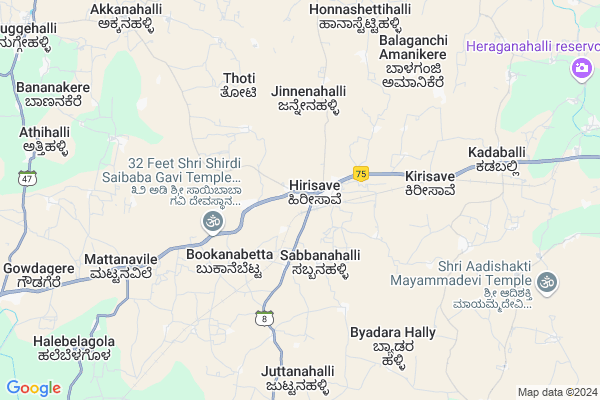
Hirisave
Hirisave Map
EDIT Map
Add Your House
 ..
..
Current Corona Virus Infected Patients Count in Hassan District
| City Name | District Name | Total Covid cases |
|---|
Locality Name :
Hirisave
( ಹಿರಿಸಾವೆ )
Taluk Name : Channarayapatna
District : Hassan
State : Karnataka
Division : Mysore
Language : Kannada and Sanskrit, Tamil, Marathi, Marwari And Mahajani
Current Time 07:10 AM
Date: Saturday , Apr 26,2025 (IST)
Time zone: IST (UTC+5:30)
Elevation / Altitude: 800 meters. Above Seal level
Telephone Code / Std Code: 08176
Assembly constituency : Shravanabelagola assembly constituency
Assembly MLA : C.N. Balakrishna
Lok Sabha constituency : Hassan parliamentary constituency
Parliament MP : PRAJWAL REVANNA
Serpanch Name :
Pin Code : 573124
Post Office Name : Hirisave
Commodities Prices : Channarayapatna Market / Mandi
National Highways Reachable To Hirisave
Nationa High Way :NH373
Nationa High Way :NH75
Nationa High Way :NH373
Nationa High Way :NH75
Rivers Near Hirisave
Hemavati :ಹೇಮಾವತಿ
Hemavati :ಹೇಮಾವತಿ
Hemavati :ಹೇಮಾವತಿ
Hemavati :ಹೇಮಾವತಿ
About Hirisave
Correct below Info and add more info about HirisaveHirisave is a Village in Channarayapatna Taluk in Hassan District of Karnataka State, India. It belongs to Mysore Division . It is located 60 KM towards East from District head quarters Hassan. 17 KM from Channarayapatna. 129 KM from State capital Bangalore
Hirisave Pin code is 573124 and postal head office is Hirisave .
Jinnenahalli ( 4 KM ) , Mathigatta ( 4 KM ) , Balaganchi ( 7 KM ) , Juttanahalli ( 8 KM ) , Mattanavile ( 8 KM ) are the nearby Villages to Hirisave. Hirisave is surrounded by Nagamangala Taluk towards East , Turuvekere Taluk towards North , Krishnarajpet Taluk towards South , Tiptur Taluk towards North .
Tiptur , Arasikere , Hassan , Mandya are the near by Cities to Hirisave.
Hirisave 2011 Census Details
Hirisave Local Language is Kannada. Hirisave Village Total population is 5009 and number of houses are 1265. Female Population is 49.6%. Village literacy rate is 75.1% and the Female Literacy rate is 34.2%.
Population
| Census Parameter | Census Data |
| Total Population | 5009 |
| Total No of Houses | 1265 |
| Female Population % | 49.6 % ( 2483) |
| Total Literacy rate % | 75.1 % ( 3764) |
| Female Literacy rate | 34.2 % ( 1715) |
| Scheduled Tribes Population % | 2.9 % ( 143) |
| Scheduled Caste Population % | 14.4 % ( 719) |
| Working Population % | 42.6 % |
| Child(0 -6) Population by 2011 | 489 |
| Girl Child(0 -6) Population % by 2011 | 48.1 % ( 235) |
Hirisave Census More Deatils.
Politics in Hirisave
Janata Dal (Secular) , JD(S) , Janata Dal (Secular) (JD(S)) , BJP , INC are the major political parties in this area.Polling Stations /Booths near Hirisave
1)Govt Higher Primary School Balaganchi (north Wing)2)Govt Higher Primary School Baddikere
3)Govt Higher Primary School Valagera Somanahalli
4)Govt Higher Primary School Byadarahalli (bagur Hobli)
5)Govt High School (left Side) Jinnenahalli-1
HOW TO REACH Hirisave
By Rail
There is no railway station near to Hirisave in less than 10 km. Tiptur Rail Way Station (near to Tiptur) , Arsikere Junction Rail Way Station (near to Arasikere) , Shri Sharada Nagar Rail Way Station (near to Tiptur) are the Rail way stations reachable from near by towns.By Road
Channarayapatna , Tiptur , Arasikere are the nearby by towns to Hirisave having road connectivity to HirisaveColleges near Hirisave
Mangala College Of Nursing
Address :
Governament Pu College
Address :
Vidyaranya Pre University College
Address :
Govt.pre University College Thatanahally
Address :
Ck College Of Tears
Address :
Schools in Hirisave
Sharada Nikethana Vidyasamste Hps
Address : hirisave , channarayapatna , hassan , Karnataka . PIN- 573724
Jayaprakash Vidya Samste
Address : hirisave , channarayapatna , hassan , Karnataka . PIN- 573124 , Post - Hirisave
Saroja Vidya Samste
Address : hirisave , channarayapatna , hassan , Karnataka . PIN- 573124 , Post - Hirisave
Ghpbs Hirisave
Address : hirisave , channarayapatna , hassan , Karnataka . PIN- 573124 , Post - Hirisave
Ghpgs Hirisave
Address : hirisave , channarayapatna , hassan , Karnataka . PIN- 573124 , Post - Hirisave
Govt Health Centers near Hirisave
1) D.Hosahally , JUNIOR HEALTH ASSISTANT FEMALE , ,2) Chalya , JUNIOR HEALTH ASSISTANT FEMALE , ,
3) Juttnally , JUNIOR HEALTH ASSISTANT FEMALE , ,
Hospitals in Hirisave,Channarayapatna
Community Health Center Hirisave
old B; M road; Hunsur; Karnataka 571105; India
0.7 KM distance Detail
more ..
Petrol Bunks in Hirisave,Channarayapatna
Sri Nagachowdeswari Agencies Indian Oil Petrol Pump
Hirisave; Hassan; NH-48; Mangalore Bangalore Highway; CR Patna; CR Patna; Karnataka 573124; India
0.4 KM distance Detail
SS Service Station Indian Oil Petrol Pump
Hirisave; Hassan; NH-48; Mangalore Bangalore Highway; CR Patna; CR Patna; Karnataka 573124; India
1.2 KM distance Detail
more ..
Colleges in Hirisave,Channarayapatna
Government Pre University College
Hirisave; Hassan; NH-48; BM Road; CR Patna; CR Patna; Karnataka 573124; India
0.6 KM distance Detail
National Institute of Prakrit Studies and Research
Shri Dhavala Teertham; Chalya Post; Shravanabelagola; SH 8; Karnataka 573135; India
11.7 KM distance Detail
more ..
Schools in Hirisave,Channarayapatna
Government Girls High School
Hirisave; Hassan; NH-48; BM Road; CR Patna; CR Patna; Karnataka 573124; India
0.6 KM distance Detail
Super Markets in Hirisave,Channarayapatna
ಎಸ್. ಎಂ. ಬೇಕರಿ S M Bekary Hcs Circle B M Road Nh75 Hirisave 573124
Hirisave; Karnataka 573124; India
0.6 KM distance Detail
Governement Offices near Hirisave,Channarayapatna
Grama Panchayat Mathigatta
Mathigatta; Hassan; SH-8; Nirisare Road; Channarayapattana; Channarayapattana; Karnataka 573124; India
5.7 KM distance Detail
Grama Panchayat juttanahally Bare
Juttanahally Bare; Hassan; SH-8; hirisare Road; Channarayapattana; Channarayapattana; Karnataka 573135; India
8.9 KM distance Detail
About Hirisave &
History
How to reach Hirisave
Tourist Places Near By Hirisave
Schools in Hirisave
Colleges in Hirisave
Temperature & weather of Hirisave
places in Hirisave
Hirisave photos
More Information
How to reach Hirisave
Tourist Places Near By Hirisave
Schools in Hirisave
Colleges in Hirisave
Temperature & weather of Hirisave
places in Hirisave
Hirisave photos
More Information
Village Talk
Post News or Events about this Village
Near Cities
Tiptur 39 KM near
Arasikere 59 KM near
Hassan 62 KM near
Mandya 65 KM near
Tiptur 39 KM near
Arasikere 59 KM near
Hassan 62 KM near
Mandya 65 KM near
Near By Taluks
Channarayapatna 16 KM near
Nagamangala 22 KM near
Turuvekere 29 KM near
Krishnarajpet 37 KM near
Channarayapatna 16 KM near
Nagamangala 22 KM near
Turuvekere 29 KM near
Krishnarajpet 37 KM near
Near By Air Ports
Mysore Airport 81 KM near
Bengaluru International Airport 141 KM near
Bajpe Airport 203 KM near
Calicut Airport 237 KM near
Mysore Airport 81 KM near
Bengaluru International Airport 141 KM near
Bajpe Airport 203 KM near
Calicut Airport 237 KM near
Near By Tourist Places
Sravanabelagola 15 KM near
Hassan 56 KM near
Srirangapatna 69 KM near
Halebid 77 KM near
Mysore 81 KM near
Sravanabelagola 15 KM near
Hassan 56 KM near
Srirangapatna 69 KM near
Halebid 77 KM near
Mysore 81 KM near
Near By Districts
Hassan 56 KM near
Mandya 65 KM near
Mysore 79 KM near
Tumkur 80 KM near
Hassan 56 KM near
Mandya 65 KM near
Mysore 79 KM near
Tumkur 80 KM near
Near By RailWay Station
Tiptur Rail Way Station 39 KM near
Hole Narsipur Rail Way Station 44 KM near
Tiptur Rail Way Station 39 KM near
Hole Narsipur Rail Way Station 44 KM near