| Home | City Bus | Maps | Villages | Cities | Rail | Tourist Places | School | College | Pin Codes | Corona Cases Count |
| Distance Calculator Bus Services IFSC Codes Trace Mobile Number Weather Search Place Trace IP Available Cash ATM/Banks Locate Polling Booth Report an Error contact People |
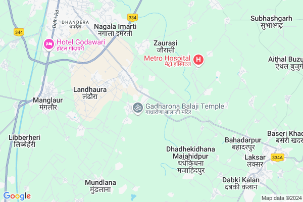
Thathaula
Thathaula Map
EDIT Map
Add Your House
 ..
..
Current Corona Virus Infected Patients Count in Haridwar District
| City Name | District Name | Total Covid cases |
|---|---|---|
| Haridwar District | Haridwar | 7 |
Locality Name :
Thathaula
( ठठौला )
Block Name : Narsan
District : Haridwar
State : Uttarakhand
Language : Hindi and Urdu
Current Time 12:45 PM
Date: Sunday , Apr 27,2025 (IST)
Time zone: IST (UTC+5:30)
Elevation / Altitude: 261 meters. Above Seal level
Telephone Code / Std Code: 01334
Assembly constituency : Khanpur assembly constituency
Assembly MLA : Umesh Kumar
Lok Sabha constituency : Hardwar parliamentary constituency
Parliament MP : Ramesh Pokhriyal 'Nishank'
Serpanch Name :
Pin Code : 247664
Post Office Name : Landhaura
Commodities Prices : Manglaur Market / Mandi
Edit below overview about Thathaula
Edit below overview about Thathaula
OverView of Thathaula
Thithola is a beutiful village. It is only 10km from Roorkee. It is surround by many industrial units such as Gold plus glass factory, Indian oil corporation unit, Hindustan petroleam, Bharatgas, Goa gutkha and several upcoming units are also.trying to setup.theia units due to its proximity of Roorkee and good conditions provided for their units present. In Thithola, hindus and muslims lived peacefully. Gadaa are the dominent caste in this village. Gulzar Traders,Mohammad Talib khan, Pradhan Jabbar, Babu Jameel, Irshad are the prominent personalities in this village. A govt. Primary school and a private school present in this village. R.P.MODERN JUNIOR HIGH SCHOOL is the privately run school upto class 10th.Edit below overview about Thathaula
National Highways Reachable To Thathaula
Nationa High Way :NH534
Nationa High Way :NH 334
Nationa High Way :NH534
Nationa High Way :NH 334
Rivers Near Thathaula
Hindon River
Solani
Hindon River
Solani
About Thathaula
Thathaula is a Village in Narsan Block in Haridwar District of Uttarakhand State, India. It is located 30 KM towards west from District head quarters Haridwar. 9 KM from Narsan. 69 KM from State capital Dehradun
Thathaula Pin code is 247664 and postal head office is Landhaura .
Jainpur Jhanjheri ( 3 KM ) , Ladpur Kalan ( 3 KM ) , Bhagwanpur Chandanpur ( 4 KM ) , Dausni ( 4 KM ) , Nagala Imarti ( 5 KM ) are the nearby Villages to Thathaula. Thathaula is surrounded by Roorkee Block towards North , Laksar Block towards East , Khanpur Block towards South , Bahadrabad Block towards East .
Manglaur , Roorkee , Purquazi , Haridwar are the near by Cities to Thathaula.
This Place is in the border of the Haridwar District and Muzaffarnagar District. Muzaffarnagar District Purkaji is South towards this place . Also it is in the Border of other district Saharanpur . It is near to the Uttar Pradesh State Border.
Thathaula 2011 Census Details
Thathaula Local Language is Hindi. Thathaula Village Total population is 2025 and number of houses are 308. Female Population is 47.7%. Village literacy rate is 43.8% and the Female Literacy rate is 17.2%.
Population
| Census Parameter | Census Data |
| Total Population | 2025 |
| Total No of Houses | 308 |
| Female Population % | 47.7 % ( 965) |
| Total Literacy rate % | 43.8 % ( 886) |
| Female Literacy rate | 17.2 % ( 348) |
| Scheduled Tribes Population % | 0.0 % ( 0) |
| Scheduled Caste Population % | 43.4 % ( 878) |
| Working Population % | 24.9 % |
| Child(0 -6) Population by 2011 | 357 |
| Girl Child(0 -6) Population % by 2011 | 47.1 % ( 168) |
Thathaula Census More Deatils.
Politics in Thathaula
BJP , BSP , INC are the major political parties in this area.Polling Stations /Booths near Thathaula
1)Balchandwala2)Milapnagar
3)Milapnagar Dandhera R.no. 1
4)Dallavala R.no. 2
5)Mohanpur R.no. 1
HOW TO REACH Thathaula
By Rail
Landaura Rail Way Station , Dausni Rail Way Station are the very nearby railway stations to Thathaula.Colleges near Thathaula
Vidya Vikasinee College
Address :
Mip School
Address :
Schools near Thathaula
R.u.p.vidyalya Harjoli Jatt
Address : harjoli jat , narsan , hardwar , Uttarakhand . PIN- 249406
Uma Devi Mem Girls Ic Landhora
Address : landhora , narsan , hardwar , Uttarakhand . PIN- 247667 , Post - Roorkee
Sent Marks Acedmemy Seniour Sec.s
Address : dhandera , narsan , hardwar , Uttarakhand . PIN- 0
Charat Niketan V.b. Public Sch
Address : jhabreda , narsan , hardwar , Uttarakhand . PIN- 247665 , Post - Jhabrera
Govt Health Centers near Thathaula
1) CHC Landora , Community Health Center Landora , ,2) Manakpur , Sub Centre Manakpur , Manakpur ,
3) UPHC JWALAPUR I , 16/12 , DALALAN , NEAR MATA VASHNOV SCHOOL
Petrol Bunks in Thathaula,Narsan
IndianOil Roorkee TOP
Landhora Rd; Mohalla Kila; Manglaur; Uttarakhand 247656; India
1.3 KM distance Detail
HP PETROL PUMP - JAGDAMBE FILLING STATION
HPC Dealers Landhaura Roorkee; Dehradun; 247664; India
3.5 KM distance Detail
more ..
Colleges in Thathaula,Narsan
Government Inter College Landhaura Town
Pathanan; Landhaura; Uttarakhand 247664; India
2.7 KM distance Detail
Himgiri Education Institute
Opp.Landhaura Railway Station ; Sikarpur; Hardwar; Roorkee; Uttarakhand 247667; India
3.0 KM distance Detail
Institute of Progressive Studies and Development
Haridwar; Opp. Landhaura Railway Station; Roorkee; Uttarakhand 247667; India
3.0 KM distance Detail
more ..
Schools in Thathaula,Narsan
S.m Public Shool
Roorkee Laksar Rd; Rajpur Mustafabad Urf Gadharon; Uttarakhand 247656; India
1.5 KM distance Detail
RAJIV GANDHI NAVODAYA VIDYALAYA SHIKARPUR
Haridwar; Uttarakhand 247664; India
1.9 KM distance Detail
Satyam Public School Landhoura Haridwar Uttrakhand
Gadharona Rd; Rajpur Mustafabad Urf Gadharon; Uttarakhand 247664; India
2.3 KM distance Detail
Electronic Shops in Thathaula,Narsan
DJ SANJEET
Gadharona Rd; Rajpur Mustafabad Urf Gadharon; Uttarakhand 247664; India
1.7 KM distance Detail
Super Markets in Thathaula,Narsan
Khushi Beauty Parlr
Gadharona Rd; Rajpur Mustafabad Urf Gadharon; Uttarakhand 247664; India
2.6 KM distance Detail
Police Stations near Thathaula,Narsan
Police Station
58 National Highway; Opp Hameed villa; Manglaur; Uttarakhand 247666; India
8.4 KM distance Detail
Governement Offices near Thathaula,Narsan
Nagar Panchayat Office Landhaura Town
Ward no 5 Bahiri Qila; Landhaura; Uttarakhand 247664; India
3.2 KM distance Detail
Devbhomi Jansuvida Kendra
Buchri Phatak; Ashok Nagar; Roorkee; Uttarakhand 247667; India
8.3 KM distance Detail
About Thathaula &
History
How to reach Thathaula
Tourist Places Near By Thathaula
Schools in Thathaula
Colleges in Thathaula
Temperature & weather of Thathaula
places in Thathaula
Thathaula photos
More Information
How to reach Thathaula
Tourist Places Near By Thathaula
Schools in Thathaula
Colleges in Thathaula
Temperature & weather of Thathaula
places in Thathaula
Thathaula photos
More Information
Village Talk
Post News or Events about this Village
Near Cities
Manglaur 8 KM near
Roorkee 12 KM near
Purquazi 14 KM near
Haridwar 36 KM near
Manglaur 8 KM near
Roorkee 12 KM near
Purquazi 14 KM near
Haridwar 36 KM near
Near By Taluks
Narsan 9 KM near
Roorkee 12 KM near
Laksar 12 KM near
Khanpur 14 KM near
Narsan 9 KM near
Roorkee 12 KM near
Laksar 12 KM near
Khanpur 14 KM near
Near By Air Ports
Muzaffarnagar Airport 53 KM near
Dehra Dun Airport 66 KM near
Chandigarh Airport 165 KM near
Indira Gandhi International Airport 179 KM near
Muzaffarnagar Airport 53 KM near
Dehra Dun Airport 66 KM near
Chandigarh Airport 165 KM near
Indira Gandhi International Airport 179 KM near
Near By Tourist Places
Roorkee 12 KM near
Haridwar 30 KM near
Rajaji National Park 38 KM near
Rishikesh 50 KM near
Dehradun 66 KM near
Roorkee 12 KM near
Haridwar 30 KM near
Rajaji National Park 38 KM near
Rishikesh 50 KM near
Dehradun 66 KM near
Near By Districts
Haridwar 29 KM near
Saharanpur 48 KM near
Muzaffarnagar 48 KM near
Bijnor 55 KM near
Haridwar 29 KM near
Saharanpur 48 KM near
Muzaffarnagar 48 KM near
Bijnor 55 KM near
Near By RailWay Station
Landaura Rail Way Station 3.3 KM near
Dausni Rail Way Station 3.4 KM near
Dhandera Rail Way Station 8.8 KM near
Laksar Junction Rail Way Station 8 KM near
Roorkee Rail Way Station 11 KM near
Landaura Rail Way Station 3.3 KM near
Dausni Rail Way Station 3.4 KM near
Dhandera Rail Way Station 8.8 KM near
Laksar Junction Rail Way Station 8 KM near
Roorkee Rail Way Station 11 KM near