| Home | City Bus | Maps | Villages | Cities | Rail | Tourist Places | School | College | Pin Codes | Corona Cases Count |
| Distance Calculator Bus Services IFSC Codes Trace Mobile Number Weather Search Place Trace IP Available Cash ATM/Banks Locate Polling Booth Report an Error contact People |
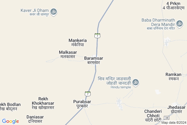
Baramsar
Baramsar Map
EDIT Map
Add Your House
 ..
..
Current Corona Virus Infected Patients Count in Hanumangarh District
| City Name | District Name | Total Covid cases |
|---|---|---|
| Hanumangarh District | Hanumangarh | 11 |
Locality Name :
Baramsar
( बरमसर )
Tehsil Name : Rawatsar
District : Hanumangarh
State : Rajasthan
Division : Bikaner
Language : Rajasthani and Hindi, Seraiki, Sindhi,punjabi
Current Time 09:20 AM
Date: Wednesday , Apr 30,2025 (IST)
Time zone: IST (UTC+5:30)
Elevation / Altitude: 193 meters. Above Seal level
Telephone Code / Std Code: 01539
Assembly constituency : Nohar assembly constituency
Assembly MLA : Amit Chachan
Lok Sabha constituency : Churu parliamentary constituency
Parliament MP : RAHUL KASWAN
Serpanch Name :
Pin Code : 335524
Post Office Name : Rawatsar (Hanumangarh)
Commodities Prices : Rawatsar Market / Mandi
Edit below overview about Baramsar
Edit below overview about Baramsar
OverView of Baramsar
Baramsar is small village on mega highway no. 11 between rawatsar and Pallu. The population of villages in around 4000. Most people of here is farmers. It is also known for Shri Kesra Ji Temple. It own a industrial area near of it. They language used to be speak here is rajasthani.Edit below overview about Baramsar
National Highways Reachable To Baramsar
Nationa High Way :NH754K
Nationa High Way :NH754K
About Baramsar
Baramsar is a Village in Rawatsar Tehsil in Hanumangarh District of Rajasthan State, India. It belongs to Bikaner Division . It is located 69 KM towards South from District head quarters Hanumangarh. 19 KM from Rawatsar. 330 KM from State capital Jaipur
Baramsar Pin code is 335524 and postal head office is Rawatsar (Hanumangarh).
Purabsar ( 12 KM ) are the nearby Villages to Baramsar. Baramsar is surrounded by Nohar Tehsil towards East , Pilibanga Tehsil towards North , Suratgarh Tehsil towards west , Ellenabad Tehsil towards North .
Rawatsar , Nohar , Suratgarh , Pilibanga are the near by Cities to Baramsar.
BARAMSAR 2011 Census Details
Baramsar Local Language is Rajasthani. BARAMSAR Village Total population is 3407 and number of houses are 579. Female Population is 48.8%. Village literacy rate is 60.2% and the Female Literacy rate is 24.9%.
Population
| Census Parameter | Census Data |
| Total Population | 3407 |
| Total No of Houses | 579 |
| Female Population % | 48.8 % ( 1661) |
| Total Literacy rate % | 60.2 % ( 2051) |
| Female Literacy rate | 24.9 % ( 850) |
| Scheduled Tribes Population % | 0.1 % ( 2) |
| Scheduled Caste Population % | 21.0 % ( 716) |
| Working Population % | 50.0 % |
| Child(0 -6) Population by 2011 | 512 |
| Girl Child(0 -6) Population % by 2011 | 48.8 % ( 250) |
BARAMSAR Census More Deatils.
Politics in Baramsar
BJP , INC , INLD are the major political parties in this area.Polling Stations /Booths near Baramsar
1)Govt. Secondary School 6 Barani2)Govt. Primary School 24 N.t.r.
3)Govt. Secondary School Right Part Kelniya
4)Govt. Secondary School Left Part Padampura
5)Govt. Secondary School Left Part Sonari
HOW TO REACH Baramsar
By Rail
There is no railway station near to Baramsar in less than 10 km.Colleges near Baramsar
Rajastahn Collage Pallu
Address :
Saraswati College Purabsar
Address :
Indian (p.g.)college
Address :
Rajastahn Collage Pallu
Address :
Indian P.g. College
Address :
Schools near Baramsar
Rawtaram Public Senior Sec School,kanwani
Address : vpo Kanwani,Th-Rawatsar,Dist-Hanumangarh(raj)
Saraswati Vidya Mandir Senior Secondary School School
Address : Near shri shayam goshala bherusary
Sri Veer Biggaji Upper Primary School Malasar
Address : MALASAR PO.NAIYASAR, TEHSIL RAWATSAR, DISTT.HANUMANGARH (RAJ.) PIN 335524
B.r. Public Sr. Sec. School Hardaswali Purvi
Address : CHAK 5 J.B.D. HARDASWALI PURVI, HARDASWALI, , 5 JBD
Govt Health Centers near Baramsar
1) Baramsar , village Baramsar , ,2) Modhunagar , village Modhunagar , ,
3) Dhani Ranasar , Dhani Ranasar , sardarshahar ,
Schools in Baramsar,Rawatsar
govt.high sec.school
Mahajan - pallu - Mandarpura - Nohar Rd; Lakhera; Rajasthan 335524; India
14.3 KM distance Detail
Electronic Shops in Baramsar,Rawatsar
Super Markets in Baramsar,Rawatsar
Local Parks in Baramsar,Rawatsar
Police Stations near Baramsar,Rawatsar
Governement Offices near Baramsar,Rawatsar
About Baramsar &
History
How to reach Baramsar
Tourist Places Near By Baramsar
Schools in Baramsar
Colleges in Baramsar
Temperature & weather of Baramsar
places in Baramsar
Baramsar photos
More Information
How to reach Baramsar
Tourist Places Near By Baramsar
Schools in Baramsar
Colleges in Baramsar
Temperature & weather of Baramsar
places in Baramsar
Baramsar photos
More Information
Village Talk
Post News or Events about this Village
Near Cities
Rawatsar 27 KM near
Nohar 52 KM near
Suratgarh 53 KM near
Pilibanga 55 KM near
Rawatsar 27 KM near
Nohar 52 KM near
Suratgarh 53 KM near
Pilibanga 55 KM near
Near By Taluks
Rawatsar 18 KM near
Nohar 51 KM near
Pilibanga 61 KM near
Suratgarh 61 KM near
Rawatsar 18 KM near
Nohar 51 KM near
Pilibanga 61 KM near
Suratgarh 61 KM near
Near By Air Ports
Surat Gujarat Airport 50 KM near
Ludhiana Airport 282 KM near
Indira Gandhi International Airport 312 KM near
Sanganeer Airport 325 KM near
Surat Gujarat Airport 50 KM near
Ludhiana Airport 282 KM near
Indira Gandhi International Airport 312 KM near
Sanganeer Airport 325 KM near
Near By Tourist Places
Shri Ganganagar 115 KM near
Churu 121 KM near
Muktsar 155 KM near
Mandawa 157 KM near
Tal Chhapar Sanctuary 159 KM near
Shri Ganganagar 115 KM near
Churu 121 KM near
Muktsar 155 KM near
Mandawa 157 KM near
Tal Chhapar Sanctuary 159 KM near
Near By Districts
Hanumangarh 66 KM near
Sirsa 99 KM near
Ganganagar 114 KM near
Churu 120 KM near
Hanumangarh 66 KM near
Sirsa 99 KM near
Ganganagar 114 KM near
Churu 120 KM near
Near By RailWay Station
Suratgarh Junction Rail Way Station 53 KM near
Pilibanga Rail Way Station 56 KM near
Suratgarh Junction Rail Way Station 53 KM near
Pilibanga Rail Way Station 56 KM near