| Home | City Bus | Maps | Villages | Cities | Rail | Tourist Places | School | College | Pin Codes | Corona Cases Count |
| Distance Calculator Bus Services IFSC Codes Trace Mobile Number Weather Search Place Trace IP Available Cash ATM/Banks Locate Polling Booth Report an Error contact People |
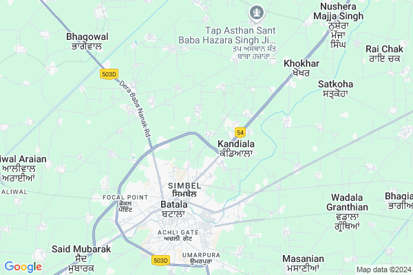
Kala Nangal Map
EDIT Map
Add Your House
 ..
..
Current Corona Virus Infected Patients Count in Gurdaspur District
| City Name | District Name | Total Covid cases |
|---|---|---|
| Gurdaspur District | Gurdaspur | 3 |
Locality Name :
Kala Nangal
( ਕਲਾ ਨੰਗਲ )
Tehsil Name : Batala
District : Gurdaspur
State : Punjab
Language : Punjabi
Current Time 08:31 AM
Date: Thursday , Apr 24,2025 (IST)
Time zone: IST (UTC+5:30)
Elevation / Altitude: 250 meters. Above Seal level
Telephone Code / Std Code: 01871
Assembly constituency : Fatehgarh Churian assembly constituency
Assembly MLA : Tript Rajinder Singh Bajwa
Lok Sabha constituency : Gurdaspur parliamentary constituency
Parliament MP : SUNNY DEOL
Serpanch Name :
Pin Code : 143506
Post Office Name : Govt. Poly. Tech Batala
Commodities Prices : Batala Market / Mandi
Kala Nangal Live Weather
Temperature: 22.9 °C
clear sky
Humidity: 24%
Wind : 2.86 mt/sec towards NE
StationName : "BatÄ\u0081la"
observed on 2 Hours Back
Temperature: 22.9 °C
clear sky
Humidity: 24%
Wind : 2.86 mt/sec towards NE
StationName : "BatÄ\u0081la"
observed on 2 Hours Back
Kala Nangal Weather Forecast for Next 5 days
25-04-2025
25.5°C to 40.2°C
clear sky, broken clouds
25.5°C to 40.2°C
clear sky, broken clouds
26-04-2025
24.1°C to 42.7°C
scattered clouds, clear sky, broken clouds
24.1°C to 42.7°C
scattered clouds, clear sky, broken clouds
27-04-2025
24.7°C to 42.2°C
clear sky, few clouds, scattered clouds, broken clouds
24.7°C to 42.2°C
clear sky, few clouds, scattered clouds, broken clouds
28-04-2025
24.6°C to 42.7°C
clear sky
24.6°C to 42.7°C
clear sky
29-04-2025
24.5°C to 42.9°C
clear sky
24.5°C to 42.9°C
clear sky
National Highways Reachable To Kala Nangal
Nationa High Way :NH54
Nationa High Way :NH354
Nationa High Way :NH54
Nationa High Way :NH354
Rivers Near Kala Nangal
Kiran Saiki nala
Ravi
Kiran Saiki nala
Ravi
About Kala Nangal
Correct below Info and add more info about Kala NangalKala Nangal is a Village in Batala Tehsil in Gurdaspur District of Punjab State, India. It is located 29 KM towards South from District head quarters Gurdaspur. 4 KM from Batala. 226 KM from State capital Chandigarh
Kala Nangal Pin code is 143506 and postal head office is Govt. Poly. Tech Batala .
Kotla Shahia ( 1 KM ) , Bhullar ( 1 KM ) , Qila Tek Singh ( 1 KM ) , Shampur ( 1 KM ) , Qila Darshan Singh ( 2 KM ) are the nearby Villages to Kala Nangal. Kala Nangal is surrounded by Dhariwal Tehsil towards North , Qadian Tehsil towards East , Fatehgarh Churian Tehsil towards west , Kalanaur Tehsil towards North .
Batala , Qadian , Gurdaspur , Dinanagar are the near by Cities to Kala Nangal.
This Place is in the border of the Gurdaspur District and Amritsar District. Amritsar District Majitha-3 is west towards this place .
Kala Nangal 2011 Census Details
Kala Nangal Local Language is Punjabi. Kala Nangal Village Total population is 1537 and number of houses are 262. Female Population is 47.2%. Village literacy rate is 65.1% and the Female Literacy rate is 29.9%.
Population
| Census Parameter | Census Data |
| Total Population | 1537 |
| Total No of Houses | 262 |
| Female Population % | 47.2 % ( 726) |
| Total Literacy rate % | 65.1 % ( 1000) |
| Female Literacy rate | 29.9 % ( 460) |
| Scheduled Tribes Population % | 0.0 % ( 0) |
| Scheduled Caste Population % | 52.9 % ( 813) |
| Working Population % | 30.1 % |
| Child(0 -6) Population by 2011 | 190 |
| Girl Child(0 -6) Population % by 2011 | 42.6 % ( 81) |
Kala Nangal Census More Deatils.
Politics in Kala Nangal
Bharatiya Janata Party , SAD , INC are the major political parties in this area.Polling Stations /Booths near Kala Nangal
1)Kala Nangal2)Kala Afgana
3)Talwandi Bharath
4)Bhullar
5)Bholeke
HOW TO REACH Kala Nangal
By Rail
Batala Sugar Mills Rail Way Station , Batala Junction Rail Way Station are the very nearby railway stations to Kala Nangal.Colleges near Kala Nangal
Guru Nanak College Batala , Under Sgpc Amritsar .
Address :
Cheema College Of Education
Address : Cheema College Of Education,vpo Kishan Kot,tehsil
Vms College Of Pharmacy,
Address : Vms College Of Pharmacy,amritsar Road, Batala
Vishwa Mitar Shekhri College Of Law
Address : Vishwa Mitar Shekhri College Of Law, Vill. Said Mu
Schools in Kala Nangal
Dreamland Pub School Kala Nangal
Address : kala nangal , batala , gurdaspur , Punjab . PIN- 143505 , Post - Batala
Govt Health Centers near Kala Nangal
1) Kala Nangal , Subcentre Kalanangal , Kalanangal , Within Govt. Primary School Kalanangal2) Bhullar , SubCentre Bhullar , Bhullar , Near Govt. High School and Water Tank
3) PHC Bhullar , Primary Health Centre Bhullar , Village Bhullar , Near Govt. High School and Water Tank Bhullar
Hospitals in Kala Nangal,Batala
Ora Max Dental Clinic and Trauma Centre
G T Road; Near sharda foundry; Simbel; Batala; Punjab 143505; India
3.4 KM distance Detail
Satsar Hospital Batala
Dera Baba Nanak Road; Mann Nagar; Batala; Punjab 143505; India
3.4 KM distance Detail
more ..
Petrol Bunks in Kala Nangal,Batala
Indian Oil Petrol Pump
Kandiala; Gurdaspur; NH-15; Gurdaspur Road; Batala; Batala; Punjab 143534; India
1.3 KM distance Detail
DIESEL/PETROL PUMP SHARMA FILLING STATION
National Highway 15; Kandiala; Punjab 143506; India
1.5 KM distance Detail
Bharat Petroleum
Shampur; Gurdaspur; NH-15; Gurdaspur Road; Batala; Batala; Punjab 143505; India
2.2 KM distance Detail
more ..
Colleges in Kala Nangal,Batala
Govt Polytechnic College
G T Road; Prem Nagar; Model Town; Batala; Punjab 143505; India
2.0 KM distance Detail
Lilly Swords Methodist College of Education
Kahnuwan Road; Simbel; Batala; Punjab 143505; India
3.6 KM distance Detail
Hasta Shilpa Industrial Training Centre and Degree College - Technical Education College in Batala
Kahnuwan Road; Simbel; Batala; Punjab 143506; India
3.7 KM distance Detail
Shivalik College
Gokhuwal; Gurdaspur; NH-15; Dera Baba Nanak Gurdaspur Road; Batala; Batala; Punjab 143521; India
3.8 KM distance Detail
more ..
Police Stations near Kala Nangal,Batala
Police Station Batala
NH-15; Gurdaspur Road; Shampur; Gurdaspur; Batala; Punjab 143505; India
4.4 KM distance Detail
Governement Offices near Kala Nangal,Batala
Punjab State Power Corporation Sub Division Batala
Shastri Nagar; Batala; Punjab 143505; India
4.0 KM distance Detail
About Kala Nangal &
History
How to reach Kala Nangal
Tourist Places Near By Kala Nangal
Schools in Kala Nangal
Colleges in Kala Nangal
Temperature & weather of Kala Nangal
places in Kala Nangal
Kala Nangal photos
More Information
How to reach Kala Nangal
Tourist Places Near By Kala Nangal
Schools in Kala Nangal
Colleges in Kala Nangal
Temperature & weather of Kala Nangal
places in Kala Nangal
Kala Nangal photos
More Information
Village Talk
Post News or Events about this Village
Near Cities
Batala 6 KM near
Qadian 18 KM near
Gurdaspur 28 KM near
Dinanagar 43 KM near
Batala 6 KM near
Qadian 18 KM near
Gurdaspur 28 KM near
Dinanagar 43 KM near
Near By Taluks
Batala 4 KM near
Dhariwal 13 KM near
Qadian 15 KM near
Fatehgarh Churian 19 KM near
Batala 4 KM near
Dhariwal 13 KM near
Qadian 15 KM near
Fatehgarh Churian 19 KM near
Near By Air Ports
Raja Sansi Airport 47 KM near
Pathankot Airport 63 KM near
Satwari Airport 110 KM near
Gaggal Airport 123 KM near
Raja Sansi Airport 47 KM near
Pathankot Airport 63 KM near
Satwari Airport 110 KM near
Gaggal Airport 123 KM near
Near By Tourist Places
Gurdaspur 28 KM near
Amritsar 45 KM near
Kapurthala 61 KM near
Pathankot 68 KM near
Kathua 72 KM near
Gurdaspur 28 KM near
Amritsar 45 KM near
Kapurthala 61 KM near
Pathankot 68 KM near
Kathua 72 KM near
Near By Districts
Gurdaspur 28 KM near
Amritsar 45 KM near
Tarn Taran 59 KM near
Kapurthala 59 KM near
Gurdaspur 28 KM near
Amritsar 45 KM near
Tarn Taran 59 KM near
Kapurthala 59 KM near
Near By RailWay Station
Batala Sugar Mills Rail Way Station 0.2 KM near
Batala Junction Rail Way Station 4.7 KM near
Chhina Rail Way Station 8.4 KM near
Dhariwal Rail Way Station 15 KM near
Batala Sugar Mills Rail Way Station 0.2 KM near
Batala Junction Rail Way Station 4.7 KM near
Chhina Rail Way Station 8.4 KM near
Dhariwal Rail Way Station 15 KM near