| Home | City Bus | Maps | Villages | Cities | Rail | Tourist Places | School | College | Pin Codes | Corona Cases Count |
| Distance Calculator Bus Services IFSC Codes Trace Mobile Number Weather Search Place Trace IP Available Cash ATM/Banks Locate Polling Booth Report an Error contact People |
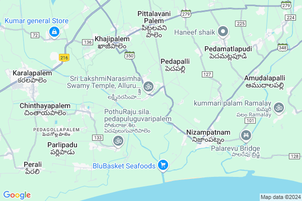
Alluru
Alluru Map
EDIT Map
Add Your House
 ..
..
Current Corona Virus Infected Patients Count in Guntur District
| City Name | District Name | Total Covid cases |
|---|---|---|
| Guntur District | Guntur | 129 |
| Anandpet | Guntur | 19 |
| Kummari Bazar | Guntur | 13 |
| Guntur | Guntur | 9 |
| Dachepalli | Guntur | 5 |
| Sangadi Gunta | Guntur | 5 |
| Buchayathota | Guntur | 4 |
| Srinivasaraopeta | Guntur | 3 |
| Arundelpeta | Guntur | 3 |
| Narasarao Peta | Guntur | 3 |
| Anandpeta | Guntur | 3 |
| Vuruvakatta | Guntur | 2 |
| Macherla | Guntur | 2 |
| Sujata Convent | Guntur | 1 |
| Ponnur | Guntur | 1 |
| Koretipadu | Guntur | 1 |
| Chatenyapuri | Guntur | 1 |
| Gandhi Nagar | Guntur | 1 |
| Srinivasaraopet | Guntur | 1 |
| Karampudi | Guntur | 1 |
| Narsaraopet | Guntur | 1 |
| Ponnur Mandal | Guntur | 1 |
| Arundalpet | Guntur | 1 |
| Kortepadu | Guntur | 1 |
| Vedigadla | Guntur | 1 |
Locality Name :
Alluru
( అల్లూరు )
Mandal Name : Pittalavanipalem
District : Guntur
State : Andhra Pradesh
Region : Andhra
Language : Telugu and Urdu
Current Time 12:19 PM
Date: Monday , Apr 28,2025 (IST)
Time zone: IST (UTC+5:30)
Elevation / Altitude: 7 meters. Above Seal level
Telephone Code / Std Code: 08643
Assembly constituency : assembly constituency
Assembly MLA : KONA RAGHUPATHI
Lok Sabha constituency : parliamentary constituency
Parliament MP :
Serpanch Name :
Pin Code : 522314
Post Office Name : Nizampatnam
Commodities Prices : Tenali Market / Mandi
Edit below overview about Alluru
Edit below overview about Alluru
OverView of Alluru
It is looks very nice place one side estuary canal it connected to Sea and other side fresh water canal it connect to Krishna river. here they cultivate both Agriculture and Aquaculture.Edit below overview about Alluru
National Highways Reachable To Alluru
Nationa High Way :NH216
Nationa High Way :NH167A
Nationa High Way :NH216
Nationa High Way :NH167A
Rivers Near Alluru
Nallamada Vagu
Krishna :クリシュナ :ಕೃಷ್ಣಾ :कृष्णा :కృష్ణా
Nallamada Vagu
Krishna :クリシュナ :ಕೃಷ್ಣಾ :कृष्णा :కృష్ణా
About Alluru
Alluru is a Village in Pittalavanipalem Mandal in Guntur District of Andhra Pradesh State, India. It belongs to Andhra region . It is located 53 KM towards South from District head quarters Guntur. 5 KM from Pittuvaripalem. 326 KM from State capital Hyderabad
Alluru Pin code is 522314 and postal head office is Nizampatnam .
Pedapalli ( 3 KM ) , Pedapuluguvaripalem ( 5 KM ) , Khajipalem ( 5 KM ) , Pothanakattavaripalem ( 6 KM ) , Nizampatnam ( 6 KM ) are the nearby Villages to Alluru. Alluru is surrounded by Karlapalem Mandal towards west , Nizampatnam Mandal towards East , Cherukupalle Mandal towards North , Nagaram Mandal towards East .
Bapatla , Ponnur , Repalle , Chirala are the near by Cities to Alluru.
It is near to bay of bengal. There is a chance of humidity in the weather.
Allur 2011 Census Details
Alluru Local Language is Telugu. Allur Village Total population is 5146 and number of houses are 1506. Female Population is 50.7%. Village literacy rate is 60.6% and the Female Literacy rate is 28.1%.
Population
| Census Parameter | Census Data |
| Total Population | 5146 |
| Total No of Houses | 1506 |
| Female Population % | 50.7 % ( 2611) |
| Total Literacy rate % | 60.6 % ( 3116) |
| Female Literacy rate | 28.1 % ( 1444) |
| Scheduled Tribes Population % | 14.8 % ( 762) |
| Scheduled Caste Population % | 27.2 % ( 1401) |
| Working Population % | 51.0 % |
| Child(0 -6) Population by 2011 | 499 |
| Girl Child(0 -6) Population % by 2011 | 51.7 % ( 258) |
Allur Census More Deatils.
HOW TO REACH Alluru
By Road
Ponnur is the Nearest Town to Alluru. Ponnur is 20 km from Alluru. Road connectivity is there from Ponnur to Alluru.By Rail
There is no railway station near to Alluru in less than 10 km. How ever there are railway Stations from Near By town Ponnur. are the railway Stations near to Ponnur. You can reach from Ponnur to Alluru by road after .By Bus
Chandol APSRTC Bus Station , Nagaram(Rpl) APSRTC Bus Station , Cherukupalli APSRTC Bus Station are the nearby by Bus Stations to Alluru .APSRTC runs Number of busses from major cities to here.Colleges near Alluru
Dr Ds Raju Iti C0llege
Address :
Dr D S Raju Jr College Khajipalem
Address : Dr D S Raju Jr College Khajipalem
Kvr & Mkr Degree College
Address : Khajipalem, Guntur Dist. - 522 329.
Schools near Alluru
Care Institute P.v.palem
Address : pittalavanipalem , pittalavanipalem , guntur , Andhra Pradesh . PIN- 522348
Bharathi Vid Hs
Address : khajipalem , pittalavanipalem , guntur , Andhra Pradesh . PIN- 522329 , Post - Pittalavanipalem
Cheris Public School
Address : chandole , pittalavanipalem , guntur , Andhra Pradesh . PIN- 522311 , Post - Chandole
Govt Hs Pittlavanipalem
Address : pittalavanipalem , pittalavanipalem , guntur , Andhra Pradesh . PIN- 522329 , Post - Pittalavanipalem
Govt Health Centers near Alluru
1) Alluru , , , Back Side of Narasimha Swamy Temple2) Gokarnamatam , 21-106, SC Gokarna Matam , Harber Road, Nizampatnam , Katu samatha Bulding, GK Matma
3) Khajipalem , 3-72C , PVPalem Road , Near Byrraju Water Plant
Sub Villages in Alluru
Hospitals in Alluru,Pittalavanipalem
Subhan Khan House Nizamptnam Govt Hospital
Nizampatnam; Andhra Pradesh 522314; India
5.6 KM distance Detail
Ayurvedic Government Hospital
Chinala; Khajipalem; Andhra Pradesh 522329; India
5.7 KM distance Detail
more ..
Petrol Bunks in Alluru,Pittalavanipalem
HP PETROL PUMP - CHANDOLU FUELS
Hpcl Retail Outlet Chandole Village Pittalavanipalem Mandal; Vijayawada; Andhra Pradesh 522311; India
10.5 KM distance Detail
more ..
Colleges in Alluru,Pittalavanipalem
KVR ;KVR & MKR Degree & PG College
KVR KVR & MKR College Ground Road; Khajipalem; Andhra Pradesh 522329; India
6.4 KM distance Detail
Govt. Junior College; Pittalavanipalem
Pittalavani Palem; Andhra Pradesh 522329; India
6.5 KM distance Detail
more ..
Schools in Alluru,Pittalavanipalem
Mandala Parishet Pradamikonnatha Patashal Pedwpuluguvaripalem
Ganapavaram; Andhra Pradesh 522111; India
5.1 KM distance Detail
Super Markets in Alluru,Pittalavanipalem
Rama Krishna Kirana Shop;peddapulugu Vari Palem
Ganapavaram; Andhra Pradesh 522101; India
4.8 KM distance Detail
Local Parks in Alluru,Pittalavanipalem
Lakshmipathi Residency And Gardend
Kotta Reddy Palem; Andhra Pradesh 522329; India
9.0 KM distance Detail
Governement Offices near Alluru,Pittalavanipalem
MeeSeva Center
17-29/1;Nizampatnam; Bavaji Palem; Andhra Pradesh 522314; India
6.0 KM distance Detail
About Alluru &
History
How to reach Alluru
Tourist Places Near By Alluru
Schools in Alluru
Colleges in Alluru
Temperature & weather of Alluru
places in Alluru
Alluru photos
More Information
How to reach Alluru
Tourist Places Near By Alluru
Schools in Alluru
Colleges in Alluru
Temperature & weather of Alluru
places in Alluru
Alluru photos
More Information
Village Talk
Post News or Events about this Village
Near Cities
Bapatla 19 KM near
Ponnur 20 KM near
Repalle 27 KM near
Chirala 35 KM near
Bapatla 19 KM near
Ponnur 20 KM near
Repalle 27 KM near
Chirala 35 KM near
Near By Taluks
Pittalavanipalem 6 KM near
Karlapalem 7 KM near
Nizampatnam 12 KM near
Cherukupalle 16 KM near
Pittalavanipalem 6 KM near
Karlapalem 7 KM near
Nizampatnam 12 KM near
Cherukupalle 16 KM near
Near By Air Ports
Vijayawada Airport 77 KM near
Rajahmundry Airport 204 KM near
Rajiv Gandhi International Airport 309 KM near
Tirupati Airport 314 KM near
Vijayawada Airport 77 KM near
Rajahmundry Airport 204 KM near
Rajiv Gandhi International Airport 309 KM near
Tirupati Airport 314 KM near
Near By Tourist Places
Guntur 52 KM near
Machelipatnam 68 KM near
Vijayawada 72 KM near
Amaravathi 85 KM near
Nagarjunakonda 133 KM near
Guntur 52 KM near
Machelipatnam 68 KM near
Vijayawada 72 KM near
Amaravathi 85 KM near
Nagarjunakonda 133 KM near
Near By Districts
Guntur 51 KM near
Krishna 66 KM near
Prakasam 88 KM near
West Godavari 112 KM near
Guntur 51 KM near
Krishna 66 KM near
Prakasam 88 KM near
West Godavari 112 KM near
Near By RailWay Station
Nidubrolu Rail Way Station 19 KM near
Bapatla Rail Way Station 19 KM near
Nidubrolu Rail Way Station 19 KM near
Bapatla Rail Way Station 19 KM near