| Home | City Bus | Maps | Villages | Cities | Rail | Tourist Places | School | College | Pin Codes | Corona Cases Count |
| Distance Calculator Bus Services IFSC Codes Trace Mobile Number Weather Search Place Trace IP Available Cash ATM/Banks Locate Polling Booth Report an Error contact People |
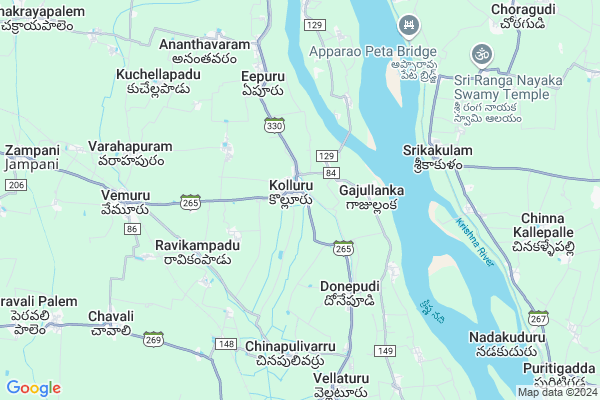
Kolluru
Kolluru Map
EDIT Map
Add Your House
 ..
..
Current Corona Virus Infected Patients Count in Guntur District
| City Name | District Name | Total Covid cases |
|---|---|---|
| Guntur District | Guntur | 129 |
| Anandpet | Guntur | 19 |
| Kummari Bazar | Guntur | 13 |
| Guntur | Guntur | 9 |
| Sangadi Gunta | Guntur | 5 |
| Dachepalli | Guntur | 5 |
| Buchayathota | Guntur | 4 |
| Anandpeta | Guntur | 3 |
| Srinivasaraopeta | Guntur | 3 |
| Arundelpeta | Guntur | 3 |
| Narasarao Peta | Guntur | 3 |
| Vuruvakatta | Guntur | 2 |
| Macherla | Guntur | 2 |
| Narsaraopet | Guntur | 1 |
| Karampudi | Guntur | 1 |
| Ponnur Mandal | Guntur | 1 |
| Arundalpet | Guntur | 1 |
| Kortepadu | Guntur | 1 |
| Vedigadla | Guntur | 1 |
| Sujata Convent | Guntur | 1 |
| Ponnur | Guntur | 1 |
| Koretipadu | Guntur | 1 |
| Chatenyapuri | Guntur | 1 |
| Srinivasaraopet | Guntur | 1 |
| Gandhi Nagar | Guntur | 1 |
Locality Name :
Kolluru
( కొల్లూరు )
Mandal Name : Kollur
District : Guntur
State : Andhra Pradesh
Region : Andhra
Language : Telugu and Urdu
Current Time 09:00 AM
Date: Thursday , Apr 24,2025 (IST)
Time zone: IST (UTC+5:30)
Elevation / Altitude: 10 meters. Above Seal level
Telephone Code / Std Code: 08644
Assembly constituency : assembly constituency
Assembly MLA :
Lok Sabha constituency : parliamentary constituency
Parliament MP :
Serpanch Name :
Pin Code : 522324
Post Office Name : Kolluru
Alternate Village Name : Kollur
Commodities Prices : Tenali Market / Mandi
Kolluru Live Weather
Temperature: 30.5 °C
scattered clouds
Humidity: 67%
Wind : 4.35 mt/sec towards S
StationName : "Bhattiprolu"
observed on 1 Hours Back
Temperature: 30.5 °C
scattered clouds
Humidity: 67%
Wind : 4.35 mt/sec towards S
StationName : "Bhattiprolu"
observed on 1 Hours Back
Kolluru Weather Forecast for Next 5 days
25-04-2025
28.1°C to 38.2°C
scattered clouds, few clouds, overcast clouds, broken clouds
28.1°C to 38.2°C
scattered clouds, few clouds, overcast clouds, broken clouds
26-04-2025
27.8°C to 38.5°C
scattered clouds, overcast clouds, broken clouds, clear sky
27.8°C to 38.5°C
scattered clouds, overcast clouds, broken clouds, clear sky
27-04-2025
27.6°C to 38.3°C
scattered clouds, broken clouds, clear sky, few clouds
27.6°C to 38.3°C
scattered clouds, broken clouds, clear sky, few clouds
28-04-2025
26.9°C to 38.3°C
clear sky, few clouds, scattered clouds
26.9°C to 38.3°C
clear sky, few clouds, scattered clouds
29-04-2025
27.8°C to 37.8°C
broken clouds, scattered clouds, few clouds, clear sky
27.8°C to 37.8°C
broken clouds, scattered clouds, few clouds, clear sky
Edit below overview about Kolluru
Edit below overview about Kolluru
OverView of Kolluru
Zph school(boys), kolluru(md) guntur(dist) pin-522324, Zph school(girls), sri sai vasavi vidhyanikethan high school, srichaitanya vidhya Bihar, Loyola English medium school, montessori English medium school.
Edit below overview about Kolluru
National Highways Reachable To Kolluru
Nationa High Way :NH216
Nationa High Way :NH167A
Nationa High Way :NH216
Nationa High Way :NH167A
About Kolluru
Kolluru is a Town in Kollur Mandal in Guntur District of Andhra Pradesh State, India. It belongs to Andhra region . It is located 48 KM towards East from District head quarters Guntur. It is a Mandal head quarter.
Kolluru Pin code is 522324 and postal head office is Kolluru .
Boddulurupadu ( 3 KM ) , Krapa ( 3 KM ) , Mosalipadu ( 4 KM ) , Chintallanka ( 4 KM ) , Ravikampadu ( 4 KM ) are the nearby Villages to Kolluru. Kolluru is surrounded by Vemuru Mandal towards west , Bhattiprolu Mandal towards South , Kollipara Mandal towards North , Ghantasala Mandal towards East .
Tenali , Repalle , Ponnur , Machilipatnam are the nearby Cities to Kolluru.
This Place is in the border of the Guntur District and Krishna District. Krishna District Movva is East towards this place .
Kollur 2011 Census Details
Kolluru Local Language is Telugu. Kollur town Total population is 16079 and number of houses are 4598. Female Population is 50.6%. town literacy rate is 65.5% and the Female Literacy rate is 32.0%.
Population
| Census Parameter | Census Data |
| Total Population | 16079 |
| Total No of Houses | 4598 |
| Female Population % | 50.6 % ( 8131) |
| Total Literacy rate % | 65.5 % ( 10529) |
| Female Literacy rate | 32.0 % ( 5148) |
| Scheduled Tribes Population % | 10.8 % ( 1740) |
| Scheduled Caste Population % | 27.5 % ( 4416) |
| Working Population % | 50.5 % |
| Child(0 -6) Population by 2011 | 1523 |
| Girl Child(0 -6) Population % by 2011 | 48.1 % ( 732) |
Kollur Census More Deatils.
Demographics of Kolluru
Telugu is the Local Language here. Total population of Kolluru is 16025 .Males are 7969 and Females are 8,056 living in 4065 Houses. Total area of Kolluru is 1856 hectares.HOW TO REACH Kolluru
By Road
Tenali is the Nearest Town to Kolluru. Tenali is 20 km from Kolluru. Road connectivity is there from Tenali to Kolluru.By Rail
Vemuru Rail Way Station , Penumarru Rail Way Station are the very nearby railway stations to Kolluru. Also you can consider railway Stations from Near By town Tenali. Tenali Junction Rail Way Station , Chinnaravuru Rail Way Station are the railway stations near to Tenali. You can reach from Tenali to Kolluru by road after .By Bus
Kolluru APSRTC Bus Station , Battiprolu APSRTC Bus Station , Kodali APSRTC Bus Station are the nearby by Bus Stations to Kolluru .APSRTC runs Number of busses from major cities to here.Govt Health Centers near Kolluru
1) Kolluru(E) , 16/25 , UPPUVARI VEEDHI , Beside of post OFFICE2) Kolluru , , Policestation opposite road , PANCHAYATI OFFICE
3) Kolluru(W) , 13-67 , Brahmamgari Temple Bazar , Chaitanya convent
Sub Villages in Kolluru
Hospitals in Kolluru,Kollur
SVS Multy Speciality Health Care Hospital
Kolluru; Andhra Pradesh 522324; India
0.4 KM distance Detail
Dr K.RamaKrishna Rao Memorial Nursing Home
Kolluru; Andhra Pradesh 522324; India
0.6 KM distance Detail
Lv Prasad Eye Hospital Kollur
Lock Road; Kolluru; Andhra Pradesh 522324; India
0.7 KM distance Detail
more ..
Colleges in Kolluru,Kollur
Sri Rama Rural Academy
Chilumuru; Via Ananthavaram; Kolluru mandal; Chilumuru; Andhra Pradesh 522301; India
6.4 KM distance Detail
more ..
Electronic Shops in Kolluru,Kollur
Sri Venkateswara Mobiles
Kolluru - Eepuru Rd; Kolluru; Andhra Pradesh 522324; India
0.5 KM distance Detail
Janakiram's Smart Phones World
Tenali - Kollur Rd; Kolluru; Andhra Pradesh 522324; India
0.5 KM distance Detail
Local Parks in Kolluru,Kollur
Comrade Mandava VenkataSubbaiah Memorial Stupam
Amudara Lanka; Andhra Pradesh 522324; India
11.7 KM distance Detail
Police Stations near Kolluru,Kollur
Vemuru Police Station
Tenali - Kollur Rd; Vemuru; Andhra Pradesh 522261; India
7.9 KM distance Detail
About Kolluru &
History
How to reach Kolluru
Tourist Places Near By Kolluru
Schools in Kolluru
Colleges in Kolluru
Temperature & weather of Kolluru
places in Kolluru
Kolluru photos
More Information
How to reach Kolluru
Tourist Places Near By Kolluru
Schools in Kolluru
Colleges in Kolluru
Temperature & weather of Kolluru
places in Kolluru
Kolluru photos
More Information
Town Talk
Post News or Events about this Town
Near Cities
Tenali 20 KM near
Repalle 20 KM near
Ponnur 32 KM near
Machilipatnam 36 KM near
Tenali 20 KM near
Repalle 20 KM near
Ponnur 32 KM near
Machilipatnam 36 KM near
Near By Taluks
Kollur 1 KM near
Vemuru 7 KM near
Bhattiprolu 12 KM near
Challapalli 14 KM near
Kollur 1 KM near
Vemuru 7 KM near
Bhattiprolu 12 KM near
Challapalli 14 KM near
Near By Air Ports
Vijayawada Airport 43 KM near
Rajahmundry Airport 168 KM near
Rajiv Gandhi International Airport 312 KM near
Vishakhapatnam Airport 347 KM near
Vijayawada Airport 43 KM near
Rajahmundry Airport 168 KM near
Rajiv Gandhi International Airport 312 KM near
Vishakhapatnam Airport 347 KM near
Near By Tourist Places
Machelipatnam 40 KM near
Guntur 46 KM near
Vijayawada 46 KM near
Amaravathi 70 KM near
Nagarjunakonda 129 KM near
Machelipatnam 40 KM near
Guntur 46 KM near
Vijayawada 46 KM near
Amaravathi 70 KM near
Nagarjunakonda 129 KM near
Near By Districts
Krishna 38 KM near
Guntur 46 KM near
West Godavari 75 KM near
Prakasam 123 KM near
Krishna 38 KM near
Guntur 46 KM near
West Godavari 75 KM near
Prakasam 123 KM near
Near By RailWay Station
Penumarru Rail Way Station 7.1 KM near
Vemuru Rail Way Station 7.2 KM near
Tenali Junction Rail Way Station 20 KM near
Nidubrolu Rail Way Station 32 KM near
Penumarru Rail Way Station 7.1 KM near
Vemuru Rail Way Station 7.2 KM near
Tenali Junction Rail Way Station 20 KM near
Nidubrolu Rail Way Station 32 KM near