| Home | City Bus | Maps | Villages | Cities | Rail | Tourist Places | School | College | Pin Codes | Corona Cases Count |
| Distance Calculator Bus Services IFSC Codes Trace Mobile Number Weather Search Place Trace IP Available Cash ATM/Banks Locate Polling Booth Report an Error contact People |
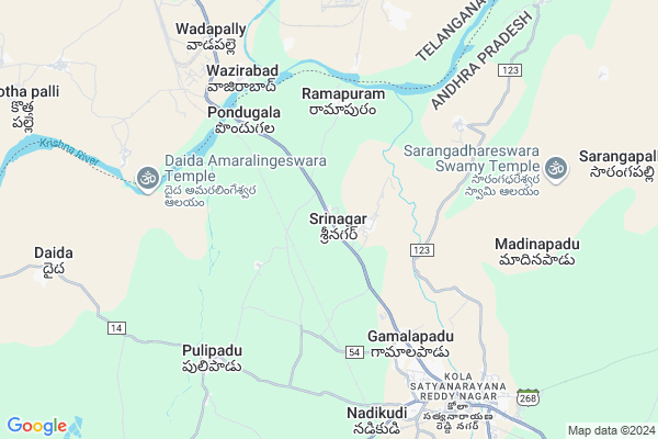
Srinagar
Srinagar Map
EDIT Map
Add Your House
 ..
..
Current Corona Virus Infected Patients Count in Guntur District
| City Name | District Name | Total Covid cases |
|---|---|---|
| Guntur District | Guntur | 129 |
| Anandpet | Guntur | 19 |
| Kummari Bazar | Guntur | 13 |
| Guntur | Guntur | 9 |
| Sangadi Gunta | Guntur | 5 |
| Dachepalli | Guntur | 5 |
| Buchayathota | Guntur | 4 |
| Narasarao Peta | Guntur | 3 |
| Anandpeta | Guntur | 3 |
| Srinivasaraopeta | Guntur | 3 |
| Arundelpeta | Guntur | 3 |
| Vuruvakatta | Guntur | 2 |
| Macherla | Guntur | 2 |
| Srinivasaraopet | Guntur | 1 |
| Gandhi Nagar | Guntur | 1 |
| Narsaraopet | Guntur | 1 |
| Karampudi | Guntur | 1 |
| Ponnur Mandal | Guntur | 1 |
| Arundalpet | Guntur | 1 |
| Kortepadu | Guntur | 1 |
| Vedigadla | Guntur | 1 |
| Sujata Convent | Guntur | 1 |
| Ponnur | Guntur | 1 |
| Koretipadu | Guntur | 1 |
| Chatenyapuri | Guntur | 1 |
Locality Name :
Srinagar
( శ్రీనగర్ )
Mandal Name : Dachepalle
District : Guntur
State : Andhra Pradesh
Region : Andhra
Language : Telugu and Urdu
Current Time 08:30 PM
Date: Wednesday , Feb 05,2025 (IST)
Time zone: IST (UTC+5:30)
Elevation / Altitude: 98 meters. Above Seal level
Telephone Code / Std Code: 08649
Assembly constituency : assembly constituency
Assembly MLA :
Lok Sabha constituency : parliamentary constituency
Parliament MP : LAVU SRI KRISHNA DEVARAYALU
Serpanch Name :
Pin Code : 522414
Post Office Name : Dachpalle
Commodities Prices : Neredcherla Market / Mandi
Srinagar Live Weather
Temperature: 25.9 °C
clear sky
Humidity: 47%
Wind : 5.42 mt/sec towards S
StationName : "MÄ\u0081cherla"
observed on 11 Mins Back
Temperature: 25.9 °C
clear sky
Humidity: 47%
Wind : 5.42 mt/sec towards S
StationName : "MÄ\u0081cherla"
observed on 11 Mins Back
Srinagar Weather Forecast for Next 5 days
06-02-2025
21.0°C to 25.7°C
few clouds, clear sky, scattered clouds
21.0°C to 25.7°C
few clouds, clear sky, scattered clouds
07-02-2025
19.9°C to 34.5°C
scattered clouds, clear sky
19.9°C to 34.5°C
scattered clouds, clear sky
08-02-2025
21.1°C to 35.1°C
clear sky
21.1°C to 35.1°C
clear sky
09-02-2025
21.3°C to 35.5°C
clear sky
21.3°C to 35.5°C
clear sky
10-02-2025
20.9°C to 35.8°C
clear sky
20.9°C to 35.8°C
clear sky
Edit below overview about Srinagar
Edit below overview about Srinagar
OverView of Srinagar
Srinagar is one of the village in Dachepalle Mandal in Guntur District in Andhra Pradesh State . Srinagar is 85.45 km far from its District Main City Guntur . It is 170 km far from its State Main City Hyderabad .Edit below overview about Srinagar
National Highways Reachable To Srinagar
Nationa High Way :NH167A
Nationa High Way :NH167A
Rivers Near Srinagar
Krishna :クリシュナ :ಕೃಷ್ಣಾ :कृष्णा :కృష్ణా
Musi River
Krishna :クリシュナ :ಕೃಷ್ಣಾ :कृष्णा :కృష్ణా
Musi River
About Srinagar
Srinagar is a Village in Dachepalle Mandal in Guntur District of Andhra Pradesh State, India. It belongs to Andhra region . It is located 102 KM towards west from District head quarters Guntur. 6 KM from Dachepalli. 178 KM from State capital Hyderabad
Srinagar Pin code is 522414 and postal head office is Dachpalle .
Pondugula ( 5 KM ) , Gamalapadu ( 5 KM ) , Bhatrupalem ( 6 KM ) , Pulipadu ( 7 KM ) , Nadikudi ( 7 KM ) are the nearby Villages to Srinagar. Srinagar is surrounded by Gurazala Mandal towards South , Dameracherla Mandal towards west , Karempudi Mandal towards South , Rentachintala Mandal towards west .
Miryalaguda , Macherla , Kodad , Jaggaiahpet are the near by Cities to Srinagar.
This Place is in the border of the Guntur District and Nalgonda District. Nalgonda District Dameracherla is west towards this place . It is near to the Telangana State Border.
Demographics of Srinagar
Telugu is the Local Language here.HOW TO REACH Srinagar
By Rail
Pondugula Rail Way Station , Nadikude Junction Rail Way Station are the very nearby railway stations to Srinagar. Macherla Rail Way Station (near to Macherla) are the Rail way stations reachable from near by towns.By Road
Macherla are the nearby by towns to Srinagar having road connectivity to SrinagarBy Bus
Dachepally APSRTC Bus Station , Dameracherla APSRTC Bus Station , Gurazala APSRTC Bus Station are the nearby by Bus Stations to Srinagar .APSRTC runs Number of busses from major cities to here.Colleges near Srinagar
Nobel Sai Junior Collage
Address : Mansoore Pet
Noble Sai Jr Coll, Narayanapuram, Dachepalli
Address : Narayanapuram, Dachepalli
Sri Vikas Jr Coll N Puram Dachepalli
Address : Sri Vikas Jr Coll N Puram Dachepalli
Govt Junior College Dachepalli
Address : Govt Junior College Dachepalli
Saraswathi College Of Arts & Science
Address : D.no.8-6, Narayanapuram, Dachepalli, Guntur Dist.
Schools in Srinagar
Government School Pradamika Patashala
Address :
Govt Health Centers near Srinagar
1) Pondugula , 1-151 PATTLAVETI LALU , mainroad , MAINROAD2) Pondugala , 1-100 , ,
3) Gamalapadu , 1-26 CHAPAVENKATIAHA , muthyalammaveedhi , MUTHYALAMMA GUDI
Hospitals in Srinagar,Dachepalle
Gayatri Nursing Home
Kola Satyanarayana Reddy Nagar; Dachepalle; Andhra Pradesh 522414; India
8.8 KM distance Detail
more ..
Petrol Bunks in Srinagar,Dachepalle
Hindustan Petroleum
HPC Dealer Macherla Road Nadikudi; Dachepalli Mandal; Vijayawada; Andhra Pradesh 522414; India
7.8 KM distance Detail
SRI DEVI OIL FILLING & SERVICE STA
DACHEPALLI ON NADIKUDI ROA; GUNTUR; Andhra Pradesh 522414; India
9.9 KM distance Detail
more ..
Colleges in Srinagar,Dachepalle
MPRM Polytechnic College
Tangeda Road; Nadikudi; Andhra Pradesh 522414; India
7.5 KM distance Detail
Fatima College of Education
Near Petrol Bunk; Guntur to Miryalaguda Highway;Nadikudi Post; Dachepalli Mandal; Andhra Pradesh 522414; India
8.3 KM distance Detail
more ..
Schools in Srinagar,Dachepalle
Government School
Govt school Road; 522414; Gamalapadu; Andhra Pradesh; India
5.8 KM distance Detail
Sri Sai Chaitanya High School Gamalapadu
Gamalapadu; Andhra Pradesh 522414; India
6.1 KM distance Detail
Electronic Shops in Srinagar,Dachepalle
Kanaka durga electricals
Kola Satyanarayana Reddy Nagar; Dachepalle; Andhra Pradesh 522414; India
8.8 KM distance Detail
Appolo Electronics
near maseed centre;old police station road; Dachepalle; Andhra Pradesh; India; pin code:522414; India
8.8 KM distance Detail
Local Parks in Srinagar,Dachepalle
Mandapati Nagi Reddy Pranganamu
Narayanapuram; Dachepalli;; Kola Satyanarayana Reddy Nagar; Nadikudi; Andhra Pradesh 522414; India
9.0 KM distance Detail
Brahma Naidu meeting and Playground
Kola Satyanarayana Reddy Nagar; Dachepalle; Andhra Pradesh 522414; India
9.0 KM distance Detail
Governement Offices near Srinagar,Dachepalle
MeeSeva Center
Narayanapuram; Nadikudi Rd; Dachepalle; Andhra Pradesh 522414; India
7.9 KM distance Detail
MeeSeva Center
1-6B; Ramamurthy Shopping Complex; Main Road; Dachepalli; Opp sbi atm; SH2 -Narkatpalli-Addanki- Medarametla Road (State High Way); Dachepalle; Andhra Pradesh 522414; India
10.1 KM distance Detail
About Srinagar &
History
How to reach Srinagar
Tourist Places Near By Srinagar
Schools in Srinagar
Colleges in Srinagar
Temperature & weather of Srinagar
places in Srinagar
Srinagar photos
More Information
How to reach Srinagar
Tourist Places Near By Srinagar
Schools in Srinagar
Colleges in Srinagar
Temperature & weather of Srinagar
places in Srinagar
Srinagar photos
More Information
Village Talk
Post News or Events about this Village
Near Cities
Miryalaguda 28 KM near
Macherla 36 KM near
Kodad 55 KM near
Jaggaiahpet 57 KM near
Miryalaguda 28 KM near
Macherla 36 KM near
Kodad 55 KM near
Jaggaiahpet 57 KM near
Near By Taluks
Dachepalle 6 KM near
Gurazala 12 KM near
Dameracherla 14 KM near
Karempudi 21 KM near
Dachepalle 6 KM near
Gurazala 12 KM near
Dameracherla 14 KM near
Karempudi 21 KM near
Near By Air Ports
Vijayawada Airport 132 KM near
Rajiv Gandhi International Airport 167 KM near
Rajahmundry Airport 260 KM near
Tirupati Airport 375 KM near
Vijayawada Airport 132 KM near
Rajiv Gandhi International Airport 167 KM near
Rajahmundry Airport 260 KM near
Tirupati Airport 375 KM near
Near By Tourist Places
Nagarjunakonda 23 KM near
Nagarjunsagar 45 KM near
Amaravathi 81 KM near
Khammam 92 KM near
Guntur 98 KM near
Nagarjunakonda 23 KM near
Nagarjunsagar 45 KM near
Amaravathi 81 KM near
Khammam 92 KM near
Guntur 98 KM near
Near By Districts
Nalgonda 71 KM near
Khammam 92 KM near
Guntur 98 KM near
Prakasam 148 KM near
Nalgonda 71 KM near
Khammam 92 KM near
Guntur 98 KM near
Prakasam 148 KM near
Near By RailWay Station
Pondugula Rail Way Station 4.5 KM near
Nadikude Junction Rail Way Station 8.8 KM near
Vishnupuram Rail Way Station 9 KM near
Pondugula Rail Way Station 4.5 KM near
Nadikude Junction Rail Way Station 8.8 KM near
Vishnupuram Rail Way Station 9 KM near