| Home | City Bus | Maps | Villages | Cities | Rail | Tourist Places | School | College | Pin Codes | Corona Cases Count |
| Distance Calculator Bus Services IFSC Codes Trace Mobile Number Weather Search Place Trace IP Available Cash ATM/Banks Locate Polling Booth Report an Error contact People |
Pandurangapuram
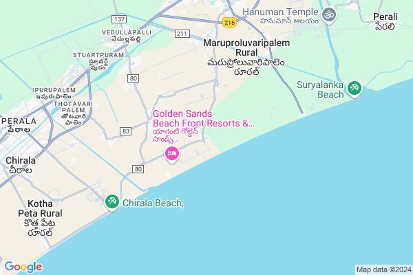
Pandurangapuram Map
EDIT Map
Add Your House
 ..
..
Current Corona Virus Infected Patients Count in Guntur District
| City Name | District Name | Total Covid cases |
|---|---|---|
| Guntur District | Guntur | 129 |
| Anandpet | Guntur | 19 |
| Kummari Bazar | Guntur | 13 |
| Guntur | Guntur | 9 |
| Dachepalli | Guntur | 5 |
| Sangadi Gunta | Guntur | 5 |
| Buchayathota | Guntur | 4 |
| Srinivasaraopeta | Guntur | 3 |
| Arundelpeta | Guntur | 3 |
| Narasarao Peta | Guntur | 3 |
| Anandpeta | Guntur | 3 |
| Vuruvakatta | Guntur | 2 |
| Macherla | Guntur | 2 |
| Sujata Convent | Guntur | 1 |
| Ponnur | Guntur | 1 |
| Koretipadu | Guntur | 1 |
| Chatenyapuri | Guntur | 1 |
| Gandhi Nagar | Guntur | 1 |
| Srinivasaraopet | Guntur | 1 |
| Karampudi | Guntur | 1 |
| Narsaraopet | Guntur | 1 |
| Ponnur Mandal | Guntur | 1 |
| Arundalpet | Guntur | 1 |
| Kortepadu | Guntur | 1 |
| Vedigadla | Guntur | 1 |
Locality Name :
Pandurangapuram
( పాండురంగాపురం )
Mandal Name : Bapatla
District : Guntur
State : Andhra Pradesh
Region : Andhra
Language : Telugu and Urdu
Current Time 11:36 AM
Date: Monday , Apr 28,2025 (IST)
Time zone: IST (UTC+5:30)
Elevation / Altitude: 10 meters. Above Seal level
Telephone Code / Std Code: 08643
Assembly constituency : assembly constituency
Assembly MLA : KONA RAGHUPATHI
Lok Sabha constituency : parliamentary constituency
Parliament MP :
Serpanch Name :
Pin Code : 522101
Post Office Name : Bapatla
Commodities Prices : Tenali Market / Mandi
Pandurangapuram Live Weather
Temperature: 30.4 °C
scattered clouds
Humidity: 67%
Wind : 4.48 mt/sec towards S
StationName : "BÄ\u0081patla"
observed on Now
Temperature: 30.4 °C
scattered clouds
Humidity: 67%
Wind : 4.48 mt/sec towards S
StationName : "BÄ\u0081patla"
observed on Now
Pandurangapuram Weather Forecast for Next 5 days
29-04-2025
28.4°C to 31.3°C
scattered clouds, few clouds, clear sky
28.4°C to 31.3°C
scattered clouds, few clouds, clear sky
30-04-2025
28.2°C to 31.9°C
few clouds, scattered clouds, clear sky
28.2°C to 31.9°C
few clouds, scattered clouds, clear sky
01-05-2025
28.5°C to 32.1°C
few clouds, clear sky, broken clouds, scattered clouds
28.5°C to 32.1°C
few clouds, clear sky, broken clouds, scattered clouds
02-05-2025
28.8°C to 32.4°C
few clouds, scattered clouds, clear sky, broken clouds
28.8°C to 32.4°C
few clouds, scattered clouds, clear sky, broken clouds
03-05-2025
28.9°C to 32.4°C
clear sky, few clouds, scattered clouds
28.9°C to 32.4°C
clear sky, few clouds, scattered clouds
Edit below overview about Pandurangapuram
Edit below overview about Pandurangapuram
OverView of Pandurangapuram
this is good naturally peace ful nice village
Edit below overview about Pandurangapuram
National Highways Reachable To Pandurangapuram
Nationa High Way :NH216
Nationa High Way :NH544D
Nationa High Way :NH216
Nationa High Way :NH544D
Rivers Near Pandurangapuram
Nallamada Vagu
Nallamada Vagu
About Pandurangapuram
Pandurangapuram is a Village in Bapatla Mandal in Guntur District of Andhra Pradesh State, India. It belongs to Andhra region . It is located 61 KM towards South from District head quarters Guntur. 10 KM from Bapatla. 318 KM from State capital Hyderabad
Pandurangapuram Pin code is 522101 and postal head office is Bapatla .
Asodivaripalem ( 7 KM ) , Muthayapalem ( 7 KM ) , Vedullapalli ( 8 KM ) , Vijaya Lakshmi Puram ( 8 KM ) , Vivekananda Colony ( 8 KM ) are the nearby Villages to Pandurangapuram. Pandurangapuram is surrounded by Chirala Mandal towards west , Vetapalem Mandal towards west , Karlapalem Mandal towards East , Karamchedu Mandal towards west .
Bapatla , Chirala , Ponnur , Chilakaluripet are the near by Cities to Pandurangapuram.
This Place is in the border of the Guntur District and Prakasam District. Prakasam District Chirala is west towards this place . It is near to bay of bengal. There is a chance of humidity in the weather.
Demographics of Pandurangapuram
Telugu is the Local Language here.HOW TO REACH Pandurangapuram
By Rail
Stuartpuram Rail Way Station , Ipurupalem Rail Way Station are the very nearby railway stations to Pandurangapuram.By Bus
Bapatla APSRTC Bus Station , Chirala APSRTC Bus Station , Karamchedu APSRTC Bus Station are the nearby by Bus Stations to Pandurangapuram .APSRTC runs Number of busses from major cities to here.Colleges near Pandurangapuram
St.anns Jr College
Address :
Sri Sai Jr College Bapatla
Address : Sri Sai Jr College Bapatla
M C Jr College Bapatla
Address : M C Jr College Bapatla
Bharathi Jr Colelge Bapatla
Address : Bharathi Jr Colelge Bapatla
Bapatla Jr College Bapatla
Address : Bapatla Jr College Bapatla
Schools near Pandurangapuram
Apswr School
Address : bapatla (m) , bapatla , guntur , Andhra Pradesh . PIN- 522101 , Post - Bapatla
Kendriya Vidyalaya
Address : adivi , bapatla , guntur , Andhra Pradesh . PIN- 522101 , Post - Bapatla
J.b.high School
Address : bapatla (m) , bapatla , guntur , Andhra Pradesh . PIN- 522101 , Post - Bapatla
Bhashyam (em) Hs
Address : bapatla (m) , bapatla , guntur , Andhra Pradesh . PIN- 522101 , Post - Bapatla
Govt Health Centers near Pandurangapuram
1) GAVINIVARIPALEM , PANCHAYATHI OFFICE , mainbazar gavinivaripalem , near panchayathi office2) Vedullapalli , GOVT , VRUKSHANAGAR , VEDULAPALLI CENTER
3) Vedullapalli , GOVT , VRUKSHANAGAR , VEDULAPALLI CENTER
Hospitals in Pandurangapuram,Bapatla
Dr. Anjaneyachari Clinic
GBC Rd; Vedullapalli; Bapatla West Rural; Andhra Pradesh 522317; India
7.7 KM distance Detail
bapuji Hospital
1-116;Gavinivaripalem Road; NH216; Vedullapalli; Chirala; Andhra Pradesh 522317; India
7.8 KM distance Detail
governmenthospital vedullapalli
Vedullapalli; Bapatla; Andhra Pradesh 522317; India
8.1 KM distance Detail
Rachana Eye Hospital
Bapatla;; Maddiboinavaripalem; Bapatla; Andhra Pradesh 522101; India
9.3 KM distance Detail
more ..
Petrol Bunks in Pandurangapuram,Bapatla
Gas Gudam
AG College Road; Maddiboinavaripalem; Bapatla; Andhra Pradesh 522101; India
7.9 KM distance Detail
Reliance Petroleum
M/S SAI RAM SERVICES; SY.NO:-1335/2E & 2F; Bapatla; Andhra Pradesh 522101; India
9.1 KM distance Detail
Petrol Station
NH216; 13th Ward; Satyannarayana Puram; Bapatla; Andhra Pradesh 522101; India
9.9 KM distance Detail
Akhil petrol station
Yadava Palam; Satyannarayana Puram; Bapatla; Andhra Pradesh 522101; India
9.9 KM distance Detail
more ..
Colleges in Pandurangapuram,Bapatla
Women's College
AG College Road; Maddiboinavaripalem; Bapatla; Andhra Pradesh 522101; India
7.8 KM distance Detail
PACE Hospitality Training center
C/O Near Kamma Kalyana Mandapam; Dist; Bapatla; Andhra Pradesh 522101; India
7.9 KM distance Detail
BEC General Engineering Block
Malleswari; Bapatla; Andhra Pradesh 522102; India
8.0 KM distance Detail
more ..
Schools in Pandurangapuram,Bapatla
Primary school
Panduranga Puram Beach Rd; Hanuman Nagar; Andhra Pradesh 522101; India
5.7 KM distance Detail
Vikas U.P School Maruproluvari Palem
Maruproluvaripalem Rural; Andhra Pradesh 522101; India
6.3 KM distance Detail
Nirantara Vidya Kendra
1-116;Gavinivaripalem Road; NH216; Vedullapalli; Bapatla West Rural; Andhra Pradesh 522317; India
7.7 KM distance Detail
Electronic Shops in Pandurangapuram,Bapatla
Rajesh reddy cool drinks
Mahatmaji puram;Bapatla engineering college; Bapatla; Andhra Pradesh 522101; India
8.5 KM distance Detail
M.V.R.Tyressop
Salvation Army William Booth Jr College; S.N.P. Agraharam; Bapatla; Andhra Pradesh opposite; India
9.3 KM distance Detail
Super Markets in Pandurangapuram,Bapatla
Chandra Kirana Shop
R T C Line; Kothapalem; Bapatla West Rural; Andhra Pradesh 522317; India
8.5 KM distance Detail
Surya Supermarket
Radham Road; Maddiboinavaripalem; Bapatla; Andhra Pradesh 522101; India
9.4 KM distance Detail
Bhavapuri Supermarket
Radham Road; Maddiboinavaripalem; Bapatla; Andhra Pradesh 522101; India
9.4 KM distance Detail
Local Parks in Pandurangapuram,Bapatla
Ravi Garden Sub-Branch
GBC Rd; Malleswari; Bapatla; Andhra Pradesh 522102; India
8.3 KM distance Detail
Police Stations near Pandurangapuram,Bapatla
Agriculture Committee Police Check Post
1-116;Gavinivaripalem Road; NH216; Vedullapalli; Bapatla West Rural; Andhra Pradesh 522317; India
7.6 KM distance Detail
Police Station
13th Ward; Satyannarayana Puram; Bapatla; Andhra Pradesh 522101; India
9.9 KM distance Detail
Bapatla Rural Police Station
13th Ward; Satyannarayana Puram; Bapatla; Andhra Pradesh 522101; India
10.0 KM distance Detail
Governement Offices near Pandurangapuram,Bapatla
MeeSeva Center
Vedullapalli(L);Bapatla(M);Guntur(Dist); Vedullapalli; Andhra Pradesh 522317; India
7.7 KM distance Detail
MeeSeva Center
eSeva Centre; NEAR ANJANEYA AGRAHARAM; Bapatla; Andhra Pradesh 522101; India
9.3 KM distance Detail
About Pandurangapuram &
History
How to reach Pandurangapuram
Tourist Places Near By Pandurangapuram
Schools in Pandurangapuram
Colleges in Pandurangapuram
Temperature & weather of Pandurangapuram
places in Pandurangapuram
Pandurangapuram photos
More Information
How to reach Pandurangapuram
Tourist Places Near By Pandurangapuram
Schools in Pandurangapuram
Colleges in Pandurangapuram
Temperature & weather of Pandurangapuram
places in Pandurangapuram
Pandurangapuram photos
More Information
Village Talk
Post News or Events about this Village
Near Cities
Bapatla 9 KM near
Chirala 12 KM near
Ponnur 32 KM near
Chilakaluripet 48 KM near
Bapatla 9 KM near
Chirala 12 KM near
Ponnur 32 KM near
Chilakaluripet 48 KM near
Near By Taluks
Bapatla 9 KM near
Chirala 10 KM near
Vetapalem 16 KM near
Karlapalem 17 KM near
Bapatla 9 KM near
Chirala 10 KM near
Vetapalem 16 KM near
Karlapalem 17 KM near
Near By Air Ports
Vijayawada Airport 95 KM near
Rajahmundry Airport 227 KM near
Tirupati Airport 294 KM near
Rajiv Gandhi International Airport 299 KM near
Vijayawada Airport 95 KM near
Rajahmundry Airport 227 KM near
Tirupati Airport 294 KM near
Rajiv Gandhi International Airport 299 KM near
Near By Tourist Places
Guntur 59 KM near
Vijayawada 87 KM near
Machelipatnam 92 KM near
Amaravathi 92 KM near
Nagarjunakonda 131 KM near
Guntur 59 KM near
Vijayawada 87 KM near
Machelipatnam 92 KM near
Amaravathi 92 KM near
Nagarjunakonda 131 KM near
Near By Districts
Guntur 58 KM near
Prakasam 64 KM near
Krishna 90 KM near
West Godavari 134 KM near
Guntur 58 KM near
Prakasam 64 KM near
Krishna 90 KM near
West Godavari 134 KM near
Near By RailWay Station
Stuartpuram Rail Way Station 8.2 KM near
Bapatla Rail Way Station 9 KM near
Chirala Rail Way Station 12 KM near
Stuartpuram Rail Way Station 8.2 KM near
Bapatla Rail Way Station 9 KM near
Chirala Rail Way Station 12 KM near