| Home | City Bus | Maps | Villages | Cities | Rail | Tourist Places | School | College | Pin Codes | Corona Cases Count |
| Distance Calculator Bus Services IFSC Codes Trace Mobile Number Weather Search Place Trace IP Available Cash ATM/Banks Locate Polling Booth Report an Error contact People |
Dharnwada
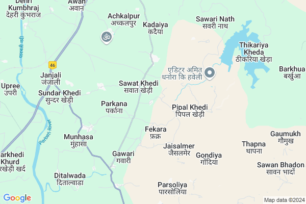
Dharnwada Map
EDIT Map
Add Your House
 ..
..
Current Corona Virus Infected Patients Count in Guna District
| City Name | District Name | Total Covid cases |
|---|
Locality Name :
Dharnwada
( धारणवादा )
Tehsil Name : Raghogarh
District : Guna
State : Madhya Pradesh
Division : Gwalior
Language : Hindi
Current Time 08:16 PM
Date: Wednesday , Feb 05,2025 (IST)
Time zone: IST (UTC+5:30)
Elevation / Altitude: 421 meters. Above Seal level
Telephone Code / Std Code: 07544
Assembly constituency : Raghogarh assembly constituency
Assembly MLA : Jaivardhan Singh
Lok Sabha constituency : Rajgarh parliamentary constituency
Parliament MP : RODMAL NAGAR
Serpanch Name :
Pin Code : 473110
Post Office Name : Ruthiyai
Alternate Village Name : Dharnawada
Commodities Prices : Kumbhraj Market / Mandi
Dharnwada Live Weather
Temperature: 23.1 °C
clear sky
Humidity: 24%
Wind : 4.94 mt/sec towards NW
StationName : "RÄ\u0081ghogarh"
observed on 2 Hours Back
Temperature: 23.1 °C
clear sky
Humidity: 24%
Wind : 4.94 mt/sec towards NW
StationName : "RÄ\u0081ghogarh"
observed on 2 Hours Back
Dharnwada Weather Forecast for Next 5 days
06-02-2025
13.9°C to 21.4°C
clear sky
13.9°C to 21.4°C
clear sky
07-02-2025
12.3°C to 25.5°C
clear sky
12.3°C to 25.5°C
clear sky
08-02-2025
12.5°C to 26.3°C
clear sky, scattered clouds, few clouds, broken clouds
12.5°C to 26.3°C
clear sky, scattered clouds, few clouds, broken clouds
09-02-2025
13.6°C to 27.9°C
scattered clouds, overcast clouds, broken clouds
13.6°C to 27.9°C
scattered clouds, overcast clouds, broken clouds
10-02-2025
16.6°C to 30.3°C
overcast clouds, broken clouds, scattered clouds, clear sky, few clouds
16.6°C to 30.3°C
overcast clouds, broken clouds, scattered clouds, clear sky, few clouds
National Highways Reachable To Dharnwada
Nationa High Way :NH46
Nationa High Way :NH52
Nationa High Way :NH46
Nationa High Way :NH52
Rivers Near Dharnwada
Parvan
Gaumukh Nadi
Parvan
Gaumukh Nadi
About Dharnwada
Correct below Info and add more info about DharnwadaDharnwada is a Village in Raghogarh Tehsil in Guna District of Madhya Pradesh State, India. It belongs to Gwalior Division . It is located 40 KM towards South from District head quarters Guna. 144 KM from State capital Bhopal
Dharnwada Pin code is 473110 and postal head office is Ruthiyai .
Dharnwada is surrounded by Chanchoda Tehsil towards west , Aron Tehsil towards East , Lateri Tehsil towards South , Guna Tehsil towards North .
Raghogarh-Vijaypur , Ashok Nagar , Guna , Sironj are the near by Cities to Dharnwada.
Dharnawada 2011 Census Details
Dharnwada Local Language is Hindi. Dharnawada Village Total population is 2996 and number of houses are 536. Female Population is 48.8%. Village literacy rate is 59.0% and the Female Literacy rate is 24.0%.
Population
| Census Parameter | Census Data |
| Total Population | 2996 |
| Total No of Houses | 536 |
| Female Population % | 48.8 % ( 1461) |
| Total Literacy rate % | 59.0 % ( 1767) |
| Female Literacy rate | 24.0 % ( 718) |
| Scheduled Tribes Population % | 0.4 % ( 13) |
| Scheduled Caste Population % | 10.7 % ( 321) |
| Working Population % | 46.9 % |
| Child(0 -6) Population by 2011 | 437 |
| Girl Child(0 -6) Population % by 2011 | 47.1 % ( 206) |
Dharnawada Census More Deatils.
Politics in Dharnwada
Bharatiya Janata Party , BJP , INC are the major political parties in this area.Polling Stations /Booths near Dharnwada
1)Sarverpur2)Pataleshvar
3)Phekara
4)Ram Nagar
5)Raghougadh
HOW TO REACH Dharnwada
By Rail
Raghogarh Rail Way Station is the very nearby railway stations to Dharnwada.Colleges near Dharnwada
P.g. Collage
Address :
Cresent College Of Technology
Address : Opp. Bhopal Memorial Hospital , Karod, Bhopal
Government College, Guna, Madhya Pradesh
Address : Government College, Guna, Madhya Pradesh Chachoda
Sha-shib Aerospace Engineering
Address : Vivek Colony,opp. Guna Airport,
Govt. P. G. College
Address : Govt. P. G. Collegegunadistrict- Gunamadhya Prades
Schools near Dharnwada
Acharya Banspati Shukal Sanskrit
Address : awan , raghogarh , guna , Madhya Pradesh . PIN- 473226 , Post - Raghogarh
Shree Satya Sai Vidya Bihar Gail
Address : ward 5 , raghogarh , guna , Madhya Pradesh . PIN- 473226 , Post - Raghogarh
D.p.s. Nfl
Address : ward 5 , raghogarh , guna , Madhya Pradesh . PIN- 473111 , Post - N.F.L.Vijaipur
St Mary School Dourana
Address : ward 4 , raghogarh , guna , Madhya Pradesh . PIN- 473287 , Post - Maksudangarh
Govt Health Centers near Dharnwada
1) SHC Pilaghata , 22 , Village , Aww ke pas2) SHC Ramnagar , 58 , Village , school ke pas
3) SHC Parkana , 24 , Village , near the aww center
Hospitals in Dharnwada,Raghogarh
Mohini Pathology Lab Raghogarh Guna M.p.
Raghogarh -Vijaypur; Madhya Pradesh 473226; India
11.9 KM distance Detail
Urban Primary Health Centre
Kila Rd; Raghogarh; Madhya Pradesh 473226; India
12.0 KM distance Detail
Mohini Pathology Lab.
473226; Prem Nagar Rd; Prem Nagar; Rajgarh Kothi; Roop Ram Nagar; Indore; Madhya Pradesh 452007; India
12.2 KM distance Detail
Sahu Clinic;Subhash Tiraha
Katra Rd; Raghogarh; Madhya Pradesh 473226; India
12.2 KM distance Detail
more ..
Petrol Bunks in Dharnwada,Raghogarh
Jyotirmaya Petrol Pump
Jyotirmaya Petrol Pump Near Rest House Barbat Pura Aron Road Raghogarh; Raghogarh; Madhya Pradesh 473226; India
13.3 KM distance Detail
more ..
Colleges in Dharnwada,Raghogarh
Jaypee University Of Engineering And Technology
Agra Bombay Road; Raghogarh -Vijaypur; Madhya Pradesh 473226; India
11.6 KM distance Detail
Govt. Polytechnic College; Raghogarh
Near Pagara Village; A.B.Road; Guna; Madhya Pradesh 473226; India
12.3 KM distance Detail
Prakharonline
ward 02; katra mohalla; Raghogarh -Vijaypur; Madhya Pradesh 473226; India
12.4 KM distance Detail
more ..
Schools in Dharnwada,Raghogarh
Anand Sanskar Convent SchoolGawri
Jamner Rd; gaori; Janjali; Madhya Pradesh 473287; India
6.0 KM distance Detail
Electronic Shops in Dharnwada,Raghogarh
satish dhakad csc and mp online
gram barsat tahsil raghogarh; raghogarh; Madhya Pradesh 473287; India
11.9 KM distance Detail
Governement Offices near Dharnwada,Raghogarh
Public Works Department
Block Colony; Raghogarh; Madhya Pradesh 473226; India
12.7 KM distance Detail
The Vijaypur Public Carrier Union Office
Vijaipur; Madhya Pradesh 473112; India
15.4 KM distance Detail
About Dharnwada &
History
How to reach Dharnwada
Tourist Places Near By Dharnwada
Schools in Dharnwada
Colleges in Dharnwada
Temperature & weather of Dharnwada
places in Dharnwada
Dharnwada photos
More Information
How to reach Dharnwada
Tourist Places Near By Dharnwada
Schools in Dharnwada
Colleges in Dharnwada
Temperature & weather of Dharnwada
places in Dharnwada
Dharnwada photos
More Information
Village Talk
Post News or Events about this Village
Near Cities
Raghogarh-Vijaypur 11 KM near
Ashok Nagar 27 KM near
Guna 39 KM near
Sironj 64 KM near
Raghogarh-Vijaypur 11 KM near
Ashok Nagar 27 KM near
Guna 39 KM near
Sironj 64 KM near
Near By Taluks
Raghogarh 0 KM near
Chanchoda 23 KM near
Aron 28 KM near
Lateri 42 KM near
Raghogarh 0 KM near
Chanchoda 23 KM near
Aron 28 KM near
Lateri 42 KM near
Near By Air Ports
Bhopal Airport 133 KM near
Indore Airport 256 KM near
Gwalior Airport 268 KM near
Khajuraho Airport 314 KM near
Bhopal Airport 133 KM near
Indore Airport 256 KM near
Gwalior Airport 268 KM near
Khajuraho Airport 314 KM near
Near By Tourist Places
Guna 39 KM near
Chanderi 116 KM near
Deogarh 120 KM near
Vidisha 124 KM near
Sanchi 124 KM near
Guna 39 KM near
Chanderi 116 KM near
Deogarh 120 KM near
Vidisha 124 KM near
Sanchi 124 KM near
Near By Districts
Guna 39 KM near
Rajgarh 67 KM near
Ashoknagar 67 KM near
Baran 119 KM near
Guna 39 KM near
Rajgarh 67 KM near
Ashoknagar 67 KM near
Baran 119 KM near
Near By RailWay Station
Ruthiyai Junction Rail Way Station 22 KM near
Chachaura Binaganj Rail Way Station 29 KM near
Ruthiyai Junction Rail Way Station 22 KM near
Chachaura Binaganj Rail Way Station 29 KM near