| Home | City Bus | Maps | Villages | Cities | Rail | Tourist Places | School | College | Pin Codes | Corona Cases Count |
| Distance Calculator Bus Services IFSC Codes Trace Mobile Number Weather Search Place Trace IP Available Cash ATM/Banks Locate Polling Booth Report an Error contact People |
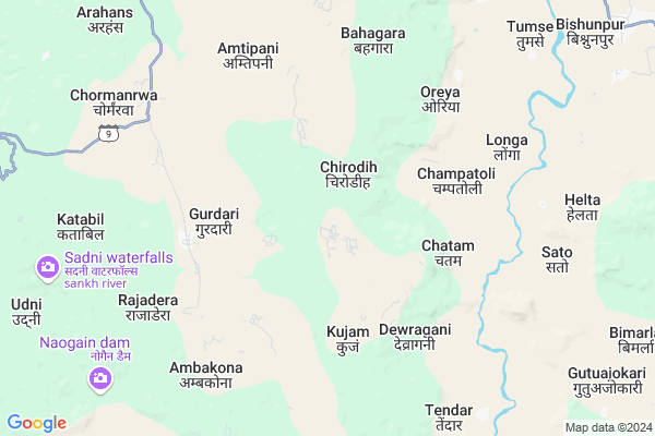
Chirodih Map
EDIT Map
Add Your House
 ..
..
Current Corona Virus Infected Patients Count in Gumla District
| City Name | District Name | Total Covid cases |
|---|
Locality Name :
Chirodih
( चिरूडीह )
Block Name : Bishunpur
District : Gumla
State : Jharkhand
Language : Nagpuri and Hindi, Oriya, Bihari, Kurukh.
Current Time 10:06 AM
Date: Wednesday , Mar 12,2025 (IST)
Time zone: IST (UTC+5:30)
Elevation / Altitude: 643 meters. Above Seal level
Telephone Code / Std Code: 06523
Assembly constituency : Bishunpur assembly constituency
Assembly MLA : CHAMRA LINDA
Lok Sabha constituency : Lohardaga parliamentary constituency
Parliament MP : SUDARSHAN BHAGAT
Serpanch Name :
Pin Code : 835230
Post Office Name : Noadih
Commodities Prices : Kusmee Market / Mandi
Chirodih Live Weather
Temperature: 31.3 °C
clear sky
Humidity: 13%
Wind : 5.75 mt/sec towards NW
StationName : "NeturhÄ\u0081t"
observed on Now
Temperature: 31.3 °C
clear sky
Humidity: 13%
Wind : 5.75 mt/sec towards NW
StationName : "NeturhÄ\u0081t"
observed on Now
Chirodih Weather Forecast for Next 5 days
13-03-2025
19.9°C to 33.0°C
clear sky
19.9°C to 33.0°C
clear sky
14-03-2025
18.5°C to 34.2°C
clear sky
18.5°C to 34.2°C
clear sky
15-03-2025
18.6°C to 35.2°C
clear sky
18.6°C to 35.2°C
clear sky
16-03-2025
19.8°C to 36.2°C
clear sky, few clouds
19.8°C to 36.2°C
clear sky, few clouds
17-03-2025
21.6°C to 35.9°C
few clouds, broken clouds, overcast clouds, scattered clouds
21.6°C to 35.9°C
few clouds, broken clouds, overcast clouds, scattered clouds
Rivers Near Chirodih
South Koel River
Tati
South Koel River
Tati
About Chirodih
Correct below Info and add more info about ChirodihChirodih is a Village in Bishunpur Block in Gumla District of Jharkhand State, India. It is located 46 KM towards North from District head quarters Gumla. 11 KM from Bishunpur. 121 KM from State capital Ranchi
Chirodih Pin code is 835230 and postal head office is Noadih .
Amtipani ( 6 KM ) , Helta ( 9 KM ) , Janawal ( 9 KM ) , Narma ( 10 KM ) , Bishunpur ( 11 KM ) are the nearby Villages to Chirodih. Chirodih is surrounded by Chainpur Block towards South , Mahuadanr Block towards west , Dumri Block towards South , Ghaghra Block towards East .
Gumla , Lohardaga , Jashpurnagar , Simdega are the near by Cities to Chirodih.
Chirodih 2011 Census Details
Chirodih Local Language is Nagpuri. Chirodih Village Total population is 1862 and number of houses are 320. Female Population is 52.0%. Village literacy rate is 40.9% and the Female Literacy rate is 19.4%.
Population
| Census Parameter | Census Data |
| Total Population | 1862 |
| Total No of Houses | 320 |
| Female Population % | 52.0 % ( 969) |
| Total Literacy rate % | 40.9 % ( 762) |
| Female Literacy rate | 19.4 % ( 361) |
| Scheduled Tribes Population % | 94.7 % ( 1764) |
| Scheduled Caste Population % | 0.0 % ( 0) |
| Working Population % | 47.4 % |
| Child(0 -6) Population by 2011 | 410 |
| Girl Child(0 -6) Population % by 2011 | 48.3 % ( 198) |
Chirodih Census More Deatils.
Politics in Chirodih
Bharatiya Janata Party , BJP , RAKAP , JMM , INC are the major political parties in this area.Polling Stations /Booths near Chirodih
1)G. E. L. Mission Primary School Serenghatu2)Project High School Sato
3)Upg. Middle School Dewragani
4)Primary School Burhu
5)Upg. Girls Middle School Manhe
HOW TO REACH Chirodih
By Rail
There is no railway station near to Chirodih in less than 10 km.Colleges near Chirodih
Baij Nath Jalan College
Address :
Tana Bhagat College
Address :
Albert Ekka Collage
Address :
Schools near Chirodih
Govt Health Centers near Chirodih
1) HSC Chaurapat , Chaurapat , ,2) HSC SAKHUWAPANI , Sakhuwapani , ,
3) HSC CHAMPATOLI , Champatoli , ,
Sub Villages in Chirodih
Hospitals in Chirodih,Bishunpur
High Scool Road Bishunpur
Ghaghra - Netarhat Rd; Bishunpur; Jharkhand 835231; India
13.2 KM distance Detail
more ..
Schools in Chirodih,Bishunpur
Swami Vivekanand Public School Bishunpur
C/o- Bindeshwar Sahu; village- karamtoli(dipu maidan);dist; Jharkhand 835231; India
12.7 KM distance Detail
Electronic Shops in Chirodih,Bishunpur
Amit Mobile & Digital Studio
Bishunpur Netarhat Rd; Rehe; Jharkhand 835231; India
13.5 KM distance Detail
Governement Offices near Chirodih,Bishunpur
About Chirodih &
History
How to reach Chirodih
Tourist Places Near By Chirodih
Schools in Chirodih
Colleges in Chirodih
Temperature & weather of Chirodih
places in Chirodih
Chirodih photos
More Information
How to reach Chirodih
Tourist Places Near By Chirodih
Schools in Chirodih
Colleges in Chirodih
Temperature & weather of Chirodih
places in Chirodih
Chirodih photos
More Information
Village Talk
Post News or Events about this Village
Near Cities
Gumla 44 KM near
Lohardaga 46 KM near
Jashpurnagar 54 KM near
Simdega 91 KM near
Gumla 44 KM near
Lohardaga 46 KM near
Jashpurnagar 54 KM near
Simdega 91 KM near
Near By Taluks
Bishunpur 11 KM near
Chainpur 21 KM near
Mahuadanr 24 KM near
Dumri 26 KM near
Bishunpur 11 KM near
Chainpur 21 KM near
Mahuadanr 24 KM near
Dumri 26 KM near
Near By Air Ports
Ranchi Airport 118 KM near
Gaya Airport 192 KM near
Patna Airport 297 KM near
Varanasi Airport 311 KM near
Ranchi Airport 118 KM near
Gaya Airport 192 KM near
Patna Airport 297 KM near
Varanasi Airport 311 KM near
Near By Tourist Places
Netarhat 18 KM near
Gumla 44 KM near
Lohardaga 46 KM near
Jashpur 56 KM near
Latehar 57 KM near
Netarhat 18 KM near
Gumla 44 KM near
Lohardaga 46 KM near
Jashpur 56 KM near
Latehar 57 KM near
Near By Districts
Gumla 44 KM near
Lohardaga 47 KM near
Jashpur 57 KM near
Latehar 57 KM near
Gumla 44 KM near
Lohardaga 47 KM near
Jashpur 57 KM near
Latehar 57 KM near
Near By RailWay Station
Latehar Rail Way Station 54 KM near
Barwadih Junction Rail Way Station 68 KM near
Latehar Rail Way Station 54 KM near
Barwadih Junction Rail Way Station 68 KM near