| Home | City Bus | Maps | Villages | Cities | Rail | Tourist Places | School | College | Pin Codes | Corona Cases Count |
| Distance Calculator Bus Services IFSC Codes Trace Mobile Number Weather Search Place Trace IP Available Cash ATM/Banks Locate Polling Booth Report an Error contact People |
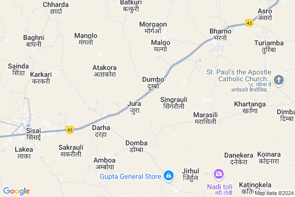
Karanjtoli Map
EDIT Map
Add Your House
 ..
..
Current Corona Virus Infected Patients Count in Gumla District
| City Name | District Name | Total Covid cases |
|---|
Locality Name :
Karanjtoli
( करंजटोली )
Block Name : Bharno
District : Gumla
State : Jharkhand
Language : Nagpuri and Hindi, Oriya, Bihari, Kurukh.
Current Time 05:57 AM
Date: Saturday , Apr 26,2025 (IST)
Time zone: IST (UTC+5:30)
Elevation / Altitude: 694 meters. Above Seal level
Telephone Code / Std Code: 06529
Assembly constituency : Sisai assembly constituency
Assembly MLA : JIGA SUSARAN HORO
Lok Sabha constituency : Lohardaga parliamentary constituency
Parliament MP : SUDARSHAN BHAGAT
Serpanch Name :
Main Village Name : Karanj
Commodities Prices : Lohardaga Market / Mandi
National Highways Reachable To Karanjtoli
Nationa High Way :NH43
Nationa High Way :NH20;NH43
Nationa High Way :NH43
Nationa High Way :NH20;NH43
Rivers Near Karanjtoli
Bandi Koel Nadi
Sankh River :Sankh River
Bandi Koel Nadi
Sankh River :Sankh River
About Karanjtoli
Correct below Info and add more info about KaranjtoliKaranjtoli is a small Village/hamlet in Bharno Block in Gumla District of Jharkhand State, India. It comes under Karanj Panchayath. It is located 40 KM towards East from District head quarters Gumla. 59 KM from State capital Ranchi
Karanjtoli is surrounded by Sisai Block towards west , Lapung Block towards East , Bhandra Block towards North , Bero Block towards East .
Lohardaga , Gumla , Khunti , Ranchi are the near by Cities to Karanjtoli.
This Place is in the border of the Gumla District and Ranchi District. Ranchi District Lapung is East towards this place . Also it is in the Border of other district Lohardaga .
Demographics of Karanjtoli
Nagpuri is the Local Language here.Politics in Karanjtoli
Bharatiya Janata Party , BJP , JMM , INC are the major political parties in this area.Polling Stations /Booths near Karanjtoli
1)Middle School Jamdih2)Primary School Dikdon
3)Primary School Dumbo
4)Nav. Primary School Kathaitkura
5)Anganbari Kendra Mada
HOW TO REACH Karanjtoli
By Rail
There is no railway station near to Karanjtoli in less than 10 km.Pincodes near Karanjtoli
835203 ( Bharno ) , 835324 ( Sisai (Gumla) ) , 835202 ( Bero )Colleges near Karanjtoli
Baij Nath Jalan College
Address :
Tana Bhagat College
Address :
Albert Ekka Collage
Address :
Schools near Karanjtoli
Govt Health Centers near Karanjtoli
1) HSC JURA , , ,2) HSC DOMBA , , DOMBA ,
3) HSC MARASILI , , MARASILI ,
Petrol Bunks in Karanjtoli,Bharno
RAJEEV AUTO SERVICE
ASRO;NH23;DISTRICT RANCHI; RANCHI; Jharkhand 835202; India
8.9 KM distance Detail
more ..
Electronic Shops in Karanjtoli,Bharno
ACER LAPTOP SERVICE CENTER (UNAUTHORISED)
109;Capital Plaza;Dangra toli; ranchi; Jharkhand 834001; India
6.9 KM distance Detail
About Karanjtoli &
History
How to reach Karanjtoli
Tourist Places Near By Karanjtoli
Schools in Karanjtoli
Colleges in Karanjtoli
Temperature & weather of Karanjtoli
places in Karanjtoli
Karanjtoli photos
More Information
How to reach Karanjtoli
Tourist Places Near By Karanjtoli
Schools in Karanjtoli
Colleges in Karanjtoli
Temperature & weather of Karanjtoli
places in Karanjtoli
Karanjtoli photos
More Information
Village Talk
Post News or Events about this Village
Near Cities
Lohardaga 35 KM near
Gumla 38 KM near
Khunti 52 KM near
Ranchi 57 KM near
Lohardaga 35 KM near
Gumla 38 KM near
Khunti 52 KM near
Ranchi 57 KM near
Near By Taluks
Bharno 0 KM near
Sisai 12 KM near
Lapung 16 KM near
Bhandra 21 KM near
Bharno 0 KM near
Sisai 12 KM near
Lapung 16 KM near
Bhandra 21 KM near
Near By Air Ports
Ranchi Airport 57 KM near
Gaya Airport 194 KM near
Patna Airport 300 KM near
Varanasi Airport 360 KM near
Ranchi Airport 57 KM near
Gaya Airport 194 KM near
Patna Airport 300 KM near
Varanasi Airport 360 KM near
Near By Tourist Places
Chotanagpur 30 KM near
Lohardaga 35 KM near
Gumla 39 KM near
Ranchi 57 KM near
Netarhat 73 KM near
Chotanagpur 30 KM near
Lohardaga 35 KM near
Gumla 39 KM near
Ranchi 57 KM near
Netarhat 73 KM near
Near By Districts
Lohardaga 35 KM near
Gumla 38 KM near
Khunti 52 KM near
Ranchi 57 KM near
Lohardaga 35 KM near
Gumla 38 KM near
Khunti 52 KM near
Ranchi 57 KM near
Near By RailWay Station
Hatia Rail Way Station 55 KM near
Ranchi Junction Rail Way Station 60 KM near
Hatia Rail Way Station 55 KM near
Ranchi Junction Rail Way Station 60 KM near