| Home | City Bus | Maps | Villages | Cities | Rail | Tourist Places | School | College | Pin Codes | Corona Cases Count |
| Distance Calculator Bus Services IFSC Codes Trace Mobile Number Weather Search Place Trace IP Available Cash ATM/Banks Locate Polling Booth Report an Error contact People |
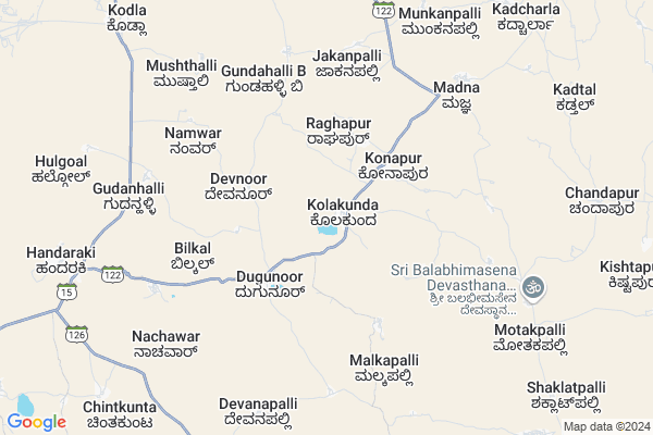
Kolkunda Map
EDIT Map
Add Your House
 ..
..
Current Corona Virus Infected Patients Count in Gulbarga District
| City Name | District Name | Total Covid cases |
|---|
Locality Name :
Kolkunda
( ಕೊಲಕುಂದ )
Taluk Name : Sedam
District : Gulbarga
State : Karnataka
Division : Gulbarga
Language : Kannada and Urdu
Current Time 10:21 AM
Date: Sunday , Apr 27,2025 (IST)
Time zone: IST (UTC+5:30)
Elevation / Altitude: 420 meters. Above Seal level
Telephone Code / Std Code: 08441
Assembly constituency : Sedam assembly constituency
Assembly MLA : Dr. Sharanprakash Rudrappa Patil
Lok Sabha constituency : Gulbarga parliamentary constituency
Parliament MP : DR. UMESH G JADHAV
Serpanch Name :
Pin Code : 585318
Post Office Name : Mudhol (Gulbarga)
Commodities Prices : Sedam Market / Mandi
Kolkunda Live Weather
Temperature: 36.0 °C
broken clouds
Humidity: 27%
Wind : 3.63 mt/sec towards S
StationName : "GurmatkÄ\u0081l"
observed on Now
Temperature: 36.0 °C
broken clouds
Humidity: 27%
Wind : 3.63 mt/sec towards S
StationName : "GurmatkÄ\u0081l"
observed on Now
Kolkunda Weather Forecast for Next 5 days
28-04-2025
31.2°C to 37.0°C
broken clouds, light rain, overcast clouds
31.2°C to 37.0°C
broken clouds, light rain, overcast clouds
29-04-2025
28.3°C to 38.9°C
broken clouds, clear sky, few clouds, overcast clouds
28.3°C to 38.9°C
broken clouds, clear sky, few clouds, overcast clouds
30-04-2025
30.1°C to 39.6°C
broken clouds, clear sky, scattered clouds
30.1°C to 39.6°C
broken clouds, clear sky, scattered clouds
01-05-2025
28.3°C to 41.6°C
few clouds, clear sky, scattered clouds, overcast clouds, broken clouds
28.3°C to 41.6°C
few clouds, clear sky, scattered clouds, overcast clouds, broken clouds
02-05-2025
29.4°C to 42.7°C
scattered clouds, clear sky, broken clouds, few clouds
29.4°C to 42.7°C
scattered clouds, clear sky, broken clouds, few clouds
National Highways Reachable To Kolkunda
Nationa High Way :NH150
Nationa High Way :NH50
Nationa High Way :NH150
Nationa High Way :NH50
Rivers Near Kolkunda
Kagina :ಕಾಗಿನಾ
Bhima :ಭೀಮಾ :भीमा :కృష్ణా
Kagina :ಕಾಗಿನಾ
Bhima :ಭೀಮಾ :भीमा :కృష్ణా
About Kolkunda
Correct below Info and add more info about KolkundaKolkunda is a Village in Sedam Taluk in Gulbarga District of Karnataka State, India. It belongs to Gulbarga Division . It is located 76 KM towards East from District head quarters Gulbarga. 12 KM from Sedam. 522 KM from State capital Bangalore
Kolkunda Pin code is 585318 and postal head office is Mudhol (Gulbarga) .
Jakanpalli ( 5 KM ) , Motakpalli ( 8 KM ) , Itkal ( 11 KM ) , Ranjol ( 12 KM ) , Mudhol ( 14 KM ) are the nearby Villages to Kolkunda. Kolkunda is surrounded by Yadgir Taluk towards South , Doulatabad Taluk towards East , Damaragidda Taluk towards East , Basheerabad Taluk towards North .
Sedam , Yadgir , Narayanpet , Wadi are the near by Cities to Kolkunda.
This Place is in the border of the Gulbarga District and Rangareddi District. Rangareddi District Basheerabad is North towards this place . It is near to the Telangana State Border.
Kolkunda 2011 Census Details
Kolkunda Local Language is Kannada. Kolkunda Village Total population is 5176 and number of houses are 943. Female Population is 50.0%. Village literacy rate is 35.1% and the Female Literacy rate is 13.3%.
Population
| Census Parameter | Census Data |
| Total Population | 5176 |
| Total No of Houses | 943 |
| Female Population % | 50.0 % ( 2589) |
| Total Literacy rate % | 35.1 % ( 1816) |
| Female Literacy rate | 13.3 % ( 689) |
| Scheduled Tribes Population % | 0.6 % ( 32) |
| Scheduled Caste Population % | 46.4 % ( 2404) |
| Working Population % | 48.7 % |
| Child(0 -6) Population by 2011 | 801 |
| Girl Child(0 -6) Population % by 2011 | 51.9 % ( 416) |
Kolkunda Census More Deatils.
Politics in Kolkunda
Bharatiya Janata Party , BJP , Bharatiya Janata Party (BJP) , INC are the major political parties in this area.Polling Stations /Booths near Kolkunda
1)Govt Higher Primary School Kishan Nayak Tanda (right Wing)2)Govt Higher Primary School New Building (left Side)
3)Govt Lower Primary School Building
4)Govt.higher Primary School Building (left Wing)
5)Govt.higher Primary School Building (east Wing)
HOW TO REACH Kolkunda
By Road
Sedam is the Nearest Town to Kolkunda. Sedam is 29 km from Kolkunda. Road connectivity is there from Sedam to Kolkunda.By Rail
There is no railway station near to Kolkunda in less than 10 km. How ever there are railway Stations from Near By town Sedam. are the railway Stations near to Sedam. You can reach from Sedam to Kolkunda by road after .Colleges near Kolkunda
Govt.first Grade College And Pg Center, Sedam
Address :
Om Sai Degree College Sedam
Address : Chincholli Cross Sedam
Rajiv Gandhi Education Society’s Sri Veerendra Patil Business Management College
Address : Sedam,dist. Gulbarga.
N.v. Arts College.
Address : Science & Commerce College, Sedam Road, Gulbarga.
Nrupatunga Arts & Commerce College
Address : Sedam, Gulbarga District Pin Code 585 222
Schools in Kolkunda
Shri Veerabhadreshwara Vidya Mandira
Address : AT post kolkunda tq sedam
Govt Health Centers near Kolkunda
1) Sedam GGH , Sedam GGH , ,2) Sedam GGH , Sedam GGH , ,
3) Sedam GGH , Sedam GGH , ,
Hospitals in Kolkunda,Sedam
Sri Mouneshwara Medical
Main Road Motakpalli 585318; Motakpalli; Karnataka; Karnataka 585318; India
8.7 KM distance Detail
more ..
Petrol Bunks in Kolkunda,Sedam
Bharat Petroleum
Kodla; Korla; Gulbarga; SH-15; Gurmtakal Sedam Road; Seedam; Karnataka 585222; India
11.3 KM distance Detail
HP PETROL PUMP - SHREE SANGAM PETROLEUM
Sedam Yadgir Road Village; Opposite PHC Hospital; SH 15; Kodla; Karnataka 585222; India
11.6 KM distance Detail
more ..
Colleges in Kolkunda,Sedam
CESS Degree College Yadgir
Behind Govt.Jr College; Yadgir; Gulbarga; Karnataka 585101; India
11.2 KM distance Detail
more ..
Electronic Shops in Kolkunda,Sedam
Shree Banadeshwar Enterprises
opposite; Bus Stop Ln; Kurla West; Bhandup West; Mumbai; Maharashtra 400078; India
11.3 KM distance Detail
Local Parks in Kolkunda,Sedam
Police Stations near Kolkunda,Sedam
Mudhol Police Station
Mudhol Police Station;; Mudhol; Karnataka 585318; India
14.0 KM distance Detail
About Kolkunda &
History
How to reach Kolkunda
Tourist Places Near By Kolkunda
Schools in Kolkunda
Colleges in Kolkunda
Temperature & weather of Kolkunda
places in Kolkunda
Kolkunda photos
More Information
How to reach Kolkunda
Tourist Places Near By Kolkunda
Schools in Kolkunda
Colleges in Kolkunda
Temperature & weather of Kolkunda
places in Kolkunda
Kolkunda photos
More Information
Village Talk
Post News or Events about this Village
Near Cities
Sedam 24 KM near
Yadgir 34 KM near
Narayanpet 35 KM near
Wadi 40 KM near
Sedam 24 KM near
Yadgir 34 KM near
Narayanpet 35 KM near
Wadi 40 KM near
Near By Taluks
Sedam 12 KM near
Yadgir 25 KM near
Doulatabad 27 KM near
Damaragidda 29 KM near
Sedam 12 KM near
Yadgir 25 KM near
Doulatabad 27 KM near
Damaragidda 29 KM near
Near By Air Ports
Rajiv Gandhi International Airport 135 KM near
Sholapur Airport 183 KM near
Latur Airport 204 KM near
Nanded Airport 274 KM near
Rajiv Gandhi International Airport 135 KM near
Sholapur Airport 183 KM near
Latur Airport 204 KM near
Nanded Airport 274 KM near
Near By Tourist Places
Gulbarga 72 KM near
Bidar 117 KM near
Mantralayam 129 KM near
Hyderabad 147 KM near
Kurnool 168 KM near
Gulbarga 72 KM near
Bidar 117 KM near
Mantralayam 129 KM near
Hyderabad 147 KM near
Kurnool 168 KM near
Near By Districts
Yadgir 34 KM near
Gulbarga 73 KM near
Mahbubnagar 85 KM near
Raichur 96 KM near
Yadgir 34 KM near
Gulbarga 73 KM near
Mahbubnagar 85 KM near
Raichur 96 KM near
Near By RailWay Station
Sedam Rail Way Station 25 KM near
Malkhaid Road Rail Way Station 27 KM near
Sedam Rail Way Station 25 KM near
Malkhaid Road Rail Way Station 27 KM near