| Home | City Bus | Maps | Villages | Cities | Rail | Tourist Places | School | College | Pin Codes | Corona Cases Count |
| Distance Calculator Bus Services IFSC Codes Trace Mobile Number Weather Search Place Trace IP Available Cash ATM/Banks Locate Polling Booth Report an Error contact People |
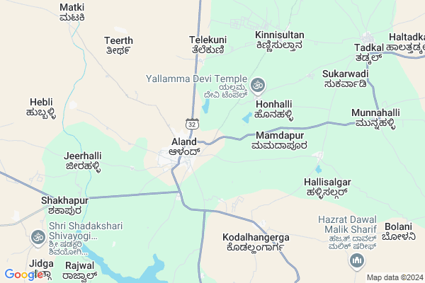
Munnalli Map
EDIT Map
Add Your House
 ..
..
Current Corona Virus Infected Patients Count in Gulbarga District
| City Name | District Name | Total Covid cases |
|---|
Locality Name :
Munnalli
( ಮುನ್ನಲ್ಲಿ )
Taluk Name : Aland
District : Gulbarga
State : Karnataka
Division : Gulbarga
Language : Kannada and Urdu
Current Time 02:08 PM
Date: Tuesday , Apr 29,2025 (IST)
Time zone: IST (UTC+5:30)
Elevation / Altitude: 449 meters. Above Seal level
Telephone Code / Std Code: 08477
Assembly constituency : Aland assembly constituency
Assembly MLA : Bhojaraj
Lok Sabha constituency : Bidar parliamentary constituency
Parliament MP : BHAGWANTH KHUBA
Serpanch Name :
Pin Code : 585302
Post Office Name : Alund
Alternate Village Name : Munnalli
Commodities Prices : Umarga Market / Mandi
Munnalli Live Weather
Temperature: 39.6 °C
few clouds
Humidity: 13%
Wind : 0.48 mt/sec towards W
StationName : "Aland"
observed on Now
Temperature: 39.6 °C
few clouds
Humidity: 13%
Wind : 0.48 mt/sec towards W
StationName : "Aland"
observed on Now
Munnalli Weather Forecast for Next 5 days
30-04-2025
34.4°C to 40.1°C
few clouds, scattered clouds, broken clouds, overcast clouds
34.4°C to 40.1°C
few clouds, scattered clouds, broken clouds, overcast clouds
01-05-2025
32.4°C to 42.4°C
overcast clouds, broken clouds, few clouds, clear sky
32.4°C to 42.4°C
overcast clouds, broken clouds, few clouds, clear sky
02-05-2025
30.4°C to 41.9°C
overcast clouds, scattered clouds, few clouds, clear sky, broken clouds
30.4°C to 41.9°C
overcast clouds, scattered clouds, few clouds, clear sky, broken clouds
03-05-2025
29.4°C to 42.1°C
broken clouds, scattered clouds, few clouds, clear sky
29.4°C to 42.1°C
broken clouds, scattered clouds, few clouds, clear sky
04-05-2025
30.3°C to 41.6°C
clear sky, scattered clouds, few clouds, overcast clouds
30.3°C to 41.6°C
clear sky, scattered clouds, few clouds, overcast clouds
Edit below overview about Munnalli
Edit below overview about Munnalli
OverView of Munnalli
Munnalli is one of the best village in Kalburagi district. One of the famous temple named as masanasiddeshwara temple which takes place in the munnalli, the wale members are worshiper of that temple who lives in that village. The lovely peoples are living in the village. Anilkumar wale.Edit below overview about Munnalli
National Highways Reachable To Munnalli
Nationa High Way :NH50
Nationa High Way :NH150
Nationa High Way :NH50
Nationa High Way :NH150
Rivers Near Munnalli
Bennetora :ಬೆಣ್ಣೆತೊರ :बेन्नीतुरा
Gandori :ಗಂಡೋರಿ
Bennetora :ಬೆಣ್ಣೆತೊರ :बेन्नीतुरा
Gandori :ಗಂಡೋರಿ
About Munnalli
Munnalli is a Village in Aland Taluk in Gulbarga District of Karnataka State, India. It belongs to Gulbarga Division . It is located 42 KM towards west from District head quarters Gulbarga. 611 KM from State capital Bangalore
Munnalli Pin code is 585302 and postal head office is Alund .
Munnalli is surrounded by Omerga Taluk towards North , Gulbarga Taluk towards East , Afzalpur Taluk towards South , Akkalkot Taluk towards west .
Umarga , Gulbarga , Kalburgi , Shahabad are the near by Cities to Munnalli.
Demographics of Munnalli
Kannada is the Local Language here.Politics in Munnalli
Bharatiya Janata Party , BJP , Bharatiya Janata Party (BJP) , INC are the major political parties in this area.Polling Stations /Booths near Munnalli
1)Govt. Higher Primary School Hatya Galli Aland (right Wing)2)Govt. Higher Primary School Duttargaon (centre Wing)
3)Govt. Higher Primary School Hatya Galli Aland (left Wing)
4)Govt. Primary School (girls) Kadaganchi
5)Govt. Pri-university College (girls) (left Wing) Aland
HOW TO REACH Munnalli
By Rail
There is no railway station near to Munnalli in less than 10 km. Bablad Rail Way Station (near to Gulbarga) , Kalaburagi Junction Rail Way Station (near to Gulbarga) are the Rail way stations reachable from near by towns.By Road
Aland , Umarga , Gulbarga are the nearby by towns to Munnalli having road connectivity to MunnalliColleges near Munnalli
Dr. V.s.patil Charitable Trust's Hospital Aditya Clinic Institute Of Naturopathy And Yoga Science College & Hospital
Address : 6-1-16 /34 Mahadevi Nagar Revansiddheshwar Colony Road Near Jay Bhahani Mandir Navaratra Madal Trust Committee Mahadevi Nagar Revansiddheshwar Colony Road Taluka Aland Dist Kalburgi Karnataka 585302
Govt. Pre-university College
Address :
Dr.c.c.mattie Electrohomoeopathic Medical College Research Center At Post Village Jamaga_jidaga Aland Karnataka 585302(india)
Address : Near Jidaga Cross Bus Stop Main Street Road
Dr Mattie Naturopathy Electrohomeopathy Medical College Research Center At Post Jamaga_jidaga Taluka Aland District Kalburgi Karnataka 585302
Address : Jidaga Cross Bus Stop Aland Karnataka 585302
Dr. V.s.patil Trust's Ayurvigyan Vidyapeeth Naturopathy Yoga Anusandhan Kendra At Post Jamaga_jidaga Taluka Aland District Kalburgi Karnataka 585302 (india)
Address : At Post Village Jamaga_jidaga Taluka Aland District Kalburgi Karnataka 585302 (india)
Schools near Munnalli
Murajidesai Resi. Tadakal
Address : tadakal , aland , gulbarga , Karnataka . PIN- 585302 , Post - Alund
Muraraji Desai Belamagi
Address : belamagi , aland , gulbarga , Karnataka . PIN- 585316 , Post - Mahagaon (Gulbarga)
Govt Hps Vaijapur
Address : vaijapur , aland , gulbarga , Karnataka . PIN- 585213 , Post - Station Ghanagapur
Glps Hebli Tanda
Address : hebbali , aland , gulbarga , Karnataka . PIN- 585302 , Post - Alund
Govt Health Centers near Munnalli
1) ASKIHAL , Ashihal , ashihal , ashihal2) Mudhol CHC , Mudhol CHC , ,
3) Malakheda , Malkhed CHC , ,
Petrol Bunks in Munnalli,Aland
HP PETROL PUMP - SWAMI AYYAPPA FILLING STATION
HPC Dealers Aland; Belgaum; Karnataka 585302; India
1.4 KM distance Detail
more ..
Schools in Munnalli,Aland
Shree Basaveshwar English Medium School
1; SH 34; Aland; Karnataka 585302; India
1.0 KM distance Detail
Srinivas Desai Educational Socity
1; State Highway 34; Aland; Karnataka 585302; India
1.1 KM distance Detail
Governement Offices near Munnalli,Aland
Office of The Executive Engineer Electricity
Gulbarga; SH-54; Aland Gulbarga Road; Aland; Aland; Karnataka 585302; India
1.4 KM distance Detail
About Munnalli &
History
How to reach Munnalli
Tourist Places Near By Munnalli
Schools in Munnalli
Colleges in Munnalli
Temperature & weather of Munnalli
places in Munnalli
Munnalli photos
More Information
How to reach Munnalli
Tourist Places Near By Munnalli
Schools in Munnalli
Colleges in Munnalli
Temperature & weather of Munnalli
places in Munnalli
Munnalli photos
More Information
Village Talk
Post News or Events about this Village
Near Cities
Umarga 32 KM near
Gulbarga 41 KM near
Kalburgi 42 KM near
Shahabad 70 KM near
Umarga 32 KM near
Gulbarga 41 KM near
Kalburgi 42 KM near
Shahabad 70 KM near
Near By Taluks
Aland 0 KM near
Omerga 35 KM near
Gulbarga 42 KM near
Akkalkot 46 KM near
Aland 0 KM near
Omerga 35 KM near
Gulbarga 42 KM near
Akkalkot 46 KM near
Near By Air Ports
Sholapur Airport 77 KM near
Latur Airport 105 KM near
Nanded Airport 218 KM near
Rajiv Gandhi International Airport 223 KM near
Sholapur Airport 77 KM near
Latur Airport 105 KM near
Nanded Airport 218 KM near
Rajiv Gandhi International Airport 223 KM near
Near By Tourist Places
Gulbarga 42 KM near
Solapur 79 KM near
Tuljapur 82 KM near
Bidar 122 KM near
Bijapur 138 KM near
Gulbarga 42 KM near
Solapur 79 KM near
Tuljapur 82 KM near
Bidar 122 KM near
Bijapur 138 KM near
Near By Districts
Gulbarga 41 KM near
Solapur 79 KM near
Osmanabad 99 KM near
Latur 103 KM near
Gulbarga 41 KM near
Solapur 79 KM near
Osmanabad 99 KM near
Latur 103 KM near
Near By RailWay Station
Ganagapur Road Rail Way Station 28 KM near
Dudhani Rail Way Station 35 KM near
Ganagapur Road Rail Way Station 28 KM near
Dudhani Rail Way Station 35 KM near