| Home | City Bus | Maps | Villages | Cities | Rail | Tourist Places | School | College | Pin Codes | Corona Cases Count |
| Distance Calculator Bus Services IFSC Codes Trace Mobile Number Weather Search Place Trace IP Available Cash ATM/Banks Locate Polling Booth Report an Error contact People |
Marwat
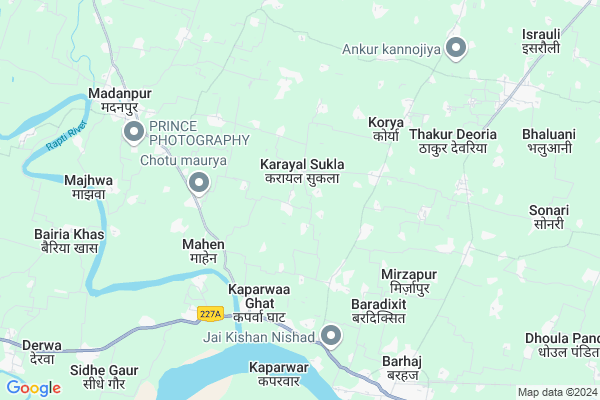
Marwat Map
EDIT Map
Add Your House
 ..
..
Current Corona Virus Infected Patients Count in Gorakhpur District
| City Name | District Name | Total Covid cases |
|---|
Locality Name :
Marwat
( मारवत )
Block Name : Barhalganj
District : Gorakhpur
State : Uttar Pradesh
Division : Gorakhpur
Language : Hindi and Urdu, Bhojpuri
Current Time 07:24 PM
Date: Tuesday , Apr 29,2025 (IST)
Time zone: IST (UTC+5:30)
Elevation / Altitude: 71 meters. Above Seal level
Telephone Code / Std Code: 05461
Assembly constituency : Barhaj assembly constituency
Assembly MLA : Deepak Kumar Mishr
Lok Sabha constituency : Bansgaon parliamentary constituency
Parliament MP : Kamlesh Paswan
Serpanch Name :
Alternate Village Name : Marawat
Commodities Prices : Barhaj Market / Mandi
Marwat Live Weather
Temperature: 36.0 °C
scattered clouds
Humidity: 22%
Wind : 2.83 mt/sec towards E
StationName : "KaparwÄ\u0081r"
observed on 2 Hours Back
Temperature: 36.0 °C
scattered clouds
Humidity: 22%
Wind : 2.83 mt/sec towards E
StationName : "KaparwÄ\u0081r"
observed on 2 Hours Back
Marwat Weather Forecast for Next 5 days
30-04-2025
27.8°C to 35.5°C
broken clouds, scattered clouds, clear sky
27.8°C to 35.5°C
broken clouds, scattered clouds, clear sky
01-05-2025
26.4°C to 37.7°C
few clouds, clear sky, broken clouds
26.4°C to 37.7°C
few clouds, clear sky, broken clouds
02-05-2025
28.5°C to 37.5°C
scattered clouds, overcast clouds, broken clouds
28.5°C to 37.5°C
scattered clouds, overcast clouds, broken clouds
03-05-2025
26.8°C to 38.1°C
light rain, scattered clouds, few clouds, clear sky
26.8°C to 38.1°C
light rain, scattered clouds, few clouds, clear sky
04-05-2025
28.5°C to 40.6°C
clear sky, broken clouds, few clouds
28.5°C to 40.6°C
clear sky, broken clouds, few clouds
National Highways Reachable To Marwat
Nationa High Way :NH727A;NH727B
Nationa High Way :NH727A
Nationa High Way :NH727A;NH727B
Nationa High Way :NH727A
Rivers Near Marwat
Rapti River :Rapti River
Aami
Rapti River :Rapti River
Aami
About Marwat
Correct below Info and add more info about MarwatMarwat is a Village in Barhalganj Block in Gorakhpur District of Uttar Pradesh State, India. It belongs to Gorakhpur Division . It is located 66 KM towards South from District head quarters Gorakhpur. 21 KM from Barhya Tikur. 326 KM from State capital Lucknow
Patana ( 6 KM ) , Mohan Pauharia ( 9 KM ) , Bairia Khas ( 9 KM ) , Semara Khurd ( 10 KM ) , Subedar Nagar ( 10 KM ) are the nearby Villages to Marwat. Marwat is surrounded by Bhaluani Block towards East , Rudrapur Block towards west , Deoria Block towards North , Barhalganj Block towards west .
Rudrapur , Deoria , Lar , Adari are the near by Cities to Marwat.
This Place is in the border of the Gorakhpur District and Mau District. Mau District Dohri Ghat is South towards this place . Also it is in the Border of other district Deoria .
Marawat 2011 Census Details
Marwat Local Language is Hindi. Marawat Village Total population is 1472 and number of houses are 249. Female Population is 48.8%. Village literacy rate is 61.5% and the Female Literacy rate is 23.9%.
Population
| Census Parameter | Census Data |
| Total Population | 1472 |
| Total No of Houses | 249 |
| Female Population % | 48.8 % ( 718) |
| Total Literacy rate % | 61.5 % ( 906) |
| Female Literacy rate | 23.9 % ( 352) |
| Scheduled Tribes Population % | 0.0 % ( 0) |
| Scheduled Caste Population % | 58.7 % ( 864) |
| Working Population % | 31.1 % |
| Child(0 -6) Population by 2011 | 222 |
| Girl Child(0 -6) Population % by 2011 | 53.6 % ( 119) |
Marawat Census More Deatils.
Politics in Marwat
BJP , SP , BSP , are the major political parties in this area.Polling Stations /Booths near Marwat
1)P.v. Piparapuran2)P.v. Karayal Shukla R.no.1
3)P.v. Bayana
4)P.v. Karaudi
5)P.v.karaudi
HOW TO REACH Marwat
By Rail
Barhaj Bazar Rail Way Station is the very nearby railway stations to Marwat.Pincodes near Marwat
274603 ( Gaura Jai Nagar ) , 274182 ( Bhaluani ) , 274205 ( Madanpur (Deoria) )Colleges near Marwat
Shree Gurkul Pg Collage
Address : Gurkul Nagar Dadari
Schools near Marwat
P.m.v. Durgapur
Address : durgapur , badhalganj , gorakhpur , Uttar Pradesh . PIN- 273402 , Post - Barhalganj
P.m.v. Basavan Pur
Address : basavan pur , badhalganj , gorakhpur , Uttar Pradesh . PIN- 273402 , Post - Barhalganj
P.m.v Pipardandi
Address : pipardandi , badhalganj , gorakhpur , Uttar Pradesh . PIN- 273402 , Post - Barhalganj
P.m.v Kodari
Address : kodari , badhalganj , gorakhpur , Uttar Pradesh . PIN- 273402 , Post - Barhalganj
Govt Health Centers near Marwat
1) Sirsiya , , SIRSIYA , PANCHAYAT BHAWAN2) Pakadi , Pakadi , Pakadi ,
3) Samogar , Samogar , Samogar ,
Sub Villages in Marwat
Hospitals in Marwat,Barhalganj
Dr. Pappu Singh
Major District Road 78E; Bhadila Doyam; Uttar Pradesh 274603; India
4.1 KM distance Detail
Mahen hospital
mahendra nath temple; Bhadila Doyam; Uttar Pradesh 274603; India
4.3 KM distance Detail
more ..
Petrol Bunks in Marwat,Barhalganj
Essar Petrol Pump
Karuana Bazaar; Barhaj Road; Sonughat; Uttar Pradesh; India
7.0 KM distance Detail
संजय फिलिंग स्टेशन; इंडियन आयल
मदनपुर; पोस्ट मदनपुर जिला- देवरिया उत्तर प्रदेश भारत पिन कोड नंबर; Kamupur; Uttar Pradesh 274205; India
7.1 KM distance Detail
more ..
Colleges in Marwat,Barhalganj
shree hanuman vidhya mandir intermediate collage baraon
Major District Road 78E; Baraon; Uttar Pradesh 274205; India
5.8 KM distance Detail
Shri Krishna Inter Collage Ashram; Barahaj
Barhaj; Uttar Pradesh 274601; India
7.9 KM distance Detail
more ..
Schools in Marwat,Barhalganj
Karayal Upadhyay Shanti Shiksha Niketan School
Puraina Sukla; Uttar Pradesh 274603; India
1.2 KM distance Detail
Electronic Shops in Marwat,Barhalganj
Soni Mobile Mahen
Main Rd; Mahen Bajar; Bhadila Doyam; Uttar Pradesh 274603; India
4.2 KM distance Detail
Super Markets in Marwat,Barhalganj
madhesiya Rice Mill. Maa Saryu Bhog ;Lai And Chura
Barahaj-Rudrapur Bypass; Barhaj; Uttar Pradesh 274601; India
7.6 KM distance Detail
Local Parks in Marwat,Barhalganj
Baba Raghaw Das Park
Gaura Shamshan Ghat; Barhaj; Uttar Pradesh 274601; India
8.6 KM distance Detail
Police Stations near Marwat,Barhalganj
police sub chauki barahal ganj gorakhpur
Pauharia; Uttar Pradesh 273402; India
5.7 KM distance Detail
Madanpur police staion
Major District Road 78E; Kamupur; Uttar Pradesh 274205; India
7.8 KM distance Detail
Police Station GAURA Jainagar
274603; Gaura Shamshan Ghat; Barhaj; Uttar Pradesh 274601; India
8.0 KM distance Detail
About Marwat &
History
How to reach Marwat
Tourist Places Near By Marwat
Schools in Marwat
Colleges in Marwat
Temperature & weather of Marwat
places in Marwat
Marwat photos
More Information
How to reach Marwat
Tourist Places Near By Marwat
Schools in Marwat
Colleges in Marwat
Temperature & weather of Marwat
places in Marwat
Marwat photos
More Information
Village Talk
Post News or Events about this Village
Near Cities
Rudrapur 15 KM near
Deoria 22 KM near
Lar 35 KM near
Adari 44 KM near
Rudrapur 15 KM near
Deoria 22 KM near
Lar 35 KM near
Adari 44 KM near
Near By Taluks
Barhaj 1 KM near
Bhaluani 9 KM near
Rudrapur 15 KM near
Barhalganj 20 KM near
Barhaj 1 KM near
Bhaluani 9 KM near
Rudrapur 15 KM near
Barhalganj 20 KM near
Near By Air Ports
Gorakhpur Airport 57 KM near
Varanasi Airport 145 KM near
Patna Airport 182 KM near
Gaya Airport 243 KM near
Gorakhpur Airport 57 KM near
Varanasi Airport 145 KM near
Patna Airport 182 KM near
Gaya Airport 243 KM near
Near By Tourist Places
Kushinagar 54 KM near
Gorakhpur 62 KM near
Lauria Nandangarh 112 KM near
Basti 119 KM near
Kesariya 132 KM near
Kushinagar 54 KM near
Gorakhpur 62 KM near
Lauria Nandangarh 112 KM near
Basti 119 KM near
Kesariya 132 KM near
Near By Districts
Deoria 22 KM near
Mau 53 KM near
Kushi Nagar 56 KM near
Gorakhpur 63 KM near
Deoria 22 KM near
Mau 53 KM near
Kushi Nagar 56 KM near
Gorakhpur 63 KM near
Near By RailWay Station
Barhaj Bazar Rail Way Station 8.7 KM near
Deoria Sadar Rail Way Station 23 KM near
Salempur Junction Rail Way Station 26 KM near
Barhaj Bazar Rail Way Station 8.7 KM near
Deoria Sadar Rail Way Station 23 KM near
Salempur Junction Rail Way Station 26 KM near