| Home | City Bus | Maps | Villages | Cities | Rail | Tourist Places | School | College | Pin Codes | Corona Cases Count |
| Distance Calculator Bus Services IFSC Codes Trace Mobile Number Weather Search Place Trace IP Available Cash ATM/Banks Locate Polling Booth Report an Error contact People |
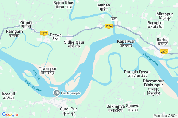
Gonghat
Gonghat Map
EDIT Map
Add Your House
 ..
..
Current Corona Virus Infected Patients Count in Gorakhpur District
| City Name | District Name | Total Covid cases |
|---|
Locality Name :
Gonghat
( घूंघट )
Block Name : Barhalganj
District : Gorakhpur
State : Uttar Pradesh
Division : Gorakhpur
Language : Hindi and Urdu, Bhojpuri
Current Time 03:26 PM
Date: Tuesday , Apr 29,2025 (IST)
Time zone: IST (UTC+5:30)
Elevation / Altitude: 71 meters. Above Seal level
Telephone Code / Std Code: 05461
Assembly constituency : Barhaj assembly constituency
Assembly MLA : Deepak Kumar Mishr
Lok Sabha constituency : Bansgaon parliamentary constituency
Parliament MP : Kamlesh Paswan
Serpanch Name :
Pin Code : 273402
Post Office Name : Barhalganj
Commodities Prices : Barhaj Market / Mandi
Gonghat Live Weather
Temperature: 36.7 °C
scattered clouds
Humidity: 22%
Wind : 4.1 mt/sec towards SE
StationName : "KaparwÄ\u0081r"
observed on 1 Hours Back
Temperature: 36.7 °C
scattered clouds
Humidity: 22%
Wind : 4.1 mt/sec towards SE
StationName : "KaparwÄ\u0081r"
observed on 1 Hours Back
Gonghat Weather Forecast for Next 5 days
30-04-2025
27.9°C to 36.6°C
broken clouds, scattered clouds, clear sky
27.9°C to 36.6°C
broken clouds, scattered clouds, clear sky
01-05-2025
26.7°C to 38.6°C
clear sky, scattered clouds, broken clouds, few clouds
26.7°C to 38.6°C
clear sky, scattered clouds, broken clouds, few clouds
02-05-2025
28.8°C to 37.9°C
few clouds, broken clouds, overcast clouds, clear sky, scattered clouds
28.8°C to 37.9°C
few clouds, broken clouds, overcast clouds, clear sky, scattered clouds
03-05-2025
26.7°C to 38.1°C
light rain, broken clouds, scattered clouds, clear sky
26.7°C to 38.1°C
light rain, broken clouds, scattered clouds, clear sky
04-05-2025
28.6°C to 40.3°C
clear sky, light rain, broken clouds, overcast clouds
28.6°C to 40.3°C
clear sky, light rain, broken clouds, overcast clouds
National Highways Reachable To Gonghat
Nationa High Way :NH727A;NH727B
Nationa High Way :NH727A
Nationa High Way :NH727A;NH727B
Nationa High Way :NH727A
Rivers Near Gonghat
Rapti River :Rapti River
Aami
Rapti River :Rapti River
Aami
About Gonghat
Correct below Info and add more info about GonghatGonghat is a Village in Barhalganj Block in Gorakhpur District of Uttar Pradesh State, India. It belongs to Gorakhpur Division . It is located 71 KM towards South from District head quarters Gorakhpur. 15 KM from Barhya Tikur. 322 KM from State capital Lucknow
Gonghat Pin code is 273402 and postal head office is Barhalganj .
Gayghat ( 4 KM ) , Patana ( 5 KM ) , Subedar Nagar ( 5 KM ) , Pauharia ( 6 KM ) , Mohan Pauharia ( 6 KM ) are the nearby Villages to Gonghat. Gonghat is surrounded by Dohri Ghat Block towards South , Barhalganj Block towards west , Fatehpur Madaun Block towards South , Bhaluani Block towards North .
Rudrapur , Deoria , Adari , Lar are the near by Cities to Gonghat.
This Place is in the border of the Gorakhpur District and Mau District. Mau District Dohri Ghat is South towards this place . Also it is in the Border of other district Deoria .
Gonghat 2011 Census Details
Gonghat Local Language is Hindi. Gonghat Village Total population is 618 and number of houses are 124. Female Population is 44.5%. Village literacy rate is 25.9% and the Female Literacy rate is 7.4%.
Population
| Census Parameter | Census Data |
| Total Population | 618 |
| Total No of Houses | 124 |
| Female Population % | 44.5 % ( 275) |
| Total Literacy rate % | 25.9 % ( 160) |
| Female Literacy rate | 7.4 % ( 46) |
| Scheduled Tribes Population % | 0.2 % ( 1) |
| Scheduled Caste Population % | 23.0 % ( 142) |
| Working Population % | 67.0 % |
| Child(0 -6) Population by 2011 | 61 |
| Girl Child(0 -6) Population % by 2011 | 50.8 % ( 31) |
Gonghat Census More Deatils.
Politics in Gonghat
BJP , SP , BSP , are the major political parties in this area.Polling Stations /Booths near Gonghat
1)P.v.parsiya Chaubey2)Pu.ma.v.bijapur Jhantaur R.no.2
3)Pu.ma.v.kaparawar R.no.1
4)Pu.ma.v.kaparawar R.no.2
5)P.v.vadipur
HOW TO REACH Gonghat
By Rail
Barhaj Bazar Rail Way Station is the very nearby railway stations to Gonghat.Colleges near Gonghat
Shree Gurkul Pg Collage
Address : Gurkul Nagar Dadari
Schools near Gonghat
P.m.v. Durgapur
Address : durgapur , badhalganj , gorakhpur , Uttar Pradesh . PIN- 273402 , Post - Barhalganj
P.m.v. Basavan Pur
Address : basavan pur , badhalganj , gorakhpur , Uttar Pradesh . PIN- 273402 , Post - Barhalganj
P.m.v Pipardandi
Address : pipardandi , badhalganj , gorakhpur , Uttar Pradesh . PIN- 273402 , Post - Barhalganj
P.m.v Kodari
Address : kodari , badhalganj , gorakhpur , Uttar Pradesh . PIN- 273402 , Post - Barhalganj
Govt Health Centers near Gonghat
1) Derwa I , Derwa I , ,2) Derwa , BARAHALGANJ , ,
3) Bankata Mishra , Bankata Mishra , Bankata Mishra ,
Hospitals in Gonghat,Barhalganj
Hindu Temple
Kaparwar Ghat - Barahal Ganj Rd; Sarya Khas; Uttar Pradesh 273402; India
3.9 KM distance Detail
Dr. Pappu Singh
Major District Road 78E; Bhadila Doyam; Uttar Pradesh 274603; India
7.5 KM distance Detail
more ..
Petrol Bunks in Gonghat,Barhalganj
INDEAN PETROL PUMP NETAWAR PATII
Kaparwar Ghat - Barahal Ganj Rd; Netavar Patti; Uttar Pradesh 273402; India
3.9 KM distance Detail
more ..
Colleges in Gonghat,Barhalganj
Shri Krishna Inter Collage Ashram; Barahaj
Barhaj; Uttar Pradesh 274601; India
9.4 KM distance Detail
B.R.D.B.D.P.G. collage
Degree collage Rd; Barhaj; Uttar Pradesh 274601; India
9.6 KM distance Detail
more ..
Schools in Gonghat,Barhalganj
Savitri Yog Training Sansthaan
Kaparwar Ghat - Barahal Ganj Rd; Turkwalia; Uttar Pradesh 273402; India
4.8 KM distance Detail
Electronic Shops in Gonghat,Barhalganj
Vijay Mobile Shop
Kaparwar Ghat - Barahal Ganj Road; Sarya Khas; Uttar Pradesh 273402; India
3.7 KM distance Detail
Local Parks in Gonghat,Barhalganj
Baba Raghaw Das Park
Gaura Shamshan Ghat; Barhaj; Uttar Pradesh 274601; India
9.4 KM distance Detail
Police Stations near Gonghat,Barhalganj
police sub chauki barahal ganj gorakhpur
Pauharia; Uttar Pradesh 273402; India
5.1 KM distance Detail
Police Station GAURA Jainagar
274603; Gaura Shamshan Ghat; Barhaj; Uttar Pradesh 274601; India
8.0 KM distance Detail
About Gonghat &
History
How to reach Gonghat
Tourist Places Near By Gonghat
Schools in Gonghat
Colleges in Gonghat
Temperature & weather of Gonghat
places in Gonghat
Gonghat photos
More Information
How to reach Gonghat
Tourist Places Near By Gonghat
Schools in Gonghat
Colleges in Gonghat
Temperature & weather of Gonghat
places in Gonghat
Gonghat photos
More Information
Village Talk
Post News or Events about this Village
Near Cities
Rudrapur 21 KM near
Deoria 33 KM near
Adari 35 KM near
Lar 37 KM near
Rudrapur 21 KM near
Deoria 33 KM near
Adari 35 KM near
Lar 37 KM near
Near By Taluks
Barhaj 9 KM near
Dohri Ghat 10 KM near
Barhalganj 14 KM near
Fatehpur Madaun 19 KM near
Barhaj 9 KM near
Dohri Ghat 10 KM near
Barhalganj 14 KM near
Fatehpur Madaun 19 KM near
Near By Air Ports
Gorakhpur Airport 63 KM near
Varanasi Airport 134 KM near
Patna Airport 182 KM near
Bamrauli Airport 237 KM near
Gorakhpur Airport 63 KM near
Varanasi Airport 134 KM near
Patna Airport 182 KM near
Bamrauli Airport 237 KM near
Near By Tourist Places
Kushinagar 64 KM near
Gorakhpur 67 KM near
Basti 119 KM near
Lauria Nandangarh 122 KM near
Jaunpur 126 KM near
Kushinagar 64 KM near
Gorakhpur 67 KM near
Basti 119 KM near
Lauria Nandangarh 122 KM near
Jaunpur 126 KM near
Near By Districts
Deoria 33 KM near
Mau 43 KM near
Azamgarh 57 KM near
Kushi Nagar 66 KM near
Deoria 33 KM near
Mau 43 KM near
Azamgarh 57 KM near
Kushi Nagar 66 KM near
Near By RailWay Station
Belthara Road Rail Way Station 29 KM near
Lar Road Rail Way Station 30 KM near
Belthara Road Rail Way Station 29 KM near
Lar Road Rail Way Station 30 KM near