| Home | City Bus | Maps | Villages | Cities | Rail | Tourist Places | School | College | Pin Codes | Corona Cases Count |
| Distance Calculator Bus Services IFSC Codes Trace Mobile Number Weather Search Place Trace IP Available Cash ATM/Banks Locate Polling Booth Report an Error contact People |
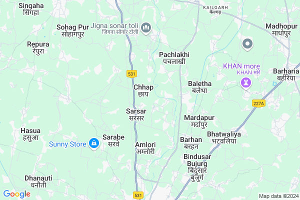
Chhap Map
EDIT Map
Add Your House
 ..
..
Current Corona Virus Infected Patients Count in Gopalganj District
| City Name | District Name | Total Covid cases |
|---|---|---|
| Gopalganj District | Gopalganj | 8 |
| Bhore | Gopalganj | 1 |
| Phulwari | Gopalganj | 1 |
| Sadar | Gopalganj | 1 |
| Pachdewari | Gopalganj | 1 |
Locality Name :
Chhap
( छाप )
Block Name : Hathua
District : Gopalganj
State : Bihar
Division : Saran
Language : Maithili and Bhojpuri, Hindi, Urdu
Current Time 04:09 PM
Date: Tuesday , Apr 29,2025 (IST)
Time zone: IST (UTC+5:30)
Elevation / Altitude: 71 meters. Above Seal level
Telephone Code / Std Code: 06150
Assembly constituency : Hathua assembly constituency
Assembly MLA : Rajesh Kumar Singh
Lok Sabha constituency : Gopalganj parliamentary constituency
Parliament MP : DR. ALOK KUMAR SUMAN
Serpanch Name :
Pin Code : 841405
Post Office Name : Barauli (Gopalganj)
Commodities Prices : Tamkuhi Road Market / Mandi
Chhap Live Weather
Temperature: 35.6 °C
broken clouds
Humidity: 23%
Wind : 3.33 mt/sec towards SE
StationName : "SiwÄ\u0081n"
observed on 1 Hours Back
Temperature: 35.6 °C
broken clouds
Humidity: 23%
Wind : 3.33 mt/sec towards SE
StationName : "SiwÄ\u0081n"
observed on 1 Hours Back
Chhap Weather Forecast for Next 5 days
30-04-2025
27.5°C to 35.4°C
broken clouds, few clouds
27.5°C to 35.4°C
broken clouds, few clouds
01-05-2025
25.9°C to 37.8°C
scattered clouds, clear sky, few clouds, broken clouds
25.9°C to 37.8°C
scattered clouds, clear sky, few clouds, broken clouds
02-05-2025
26.9°C to 36.2°C
broken clouds, overcast clouds, light rain
26.9°C to 36.2°C
broken clouds, overcast clouds, light rain
03-05-2025
25.6°C to 36.5°C
light rain, few clouds, clear sky
25.6°C to 36.5°C
light rain, few clouds, clear sky
04-05-2025
27.7°C to 40.0°C
few clouds, clear sky, scattered clouds, overcast clouds
27.7°C to 40.0°C
few clouds, clear sky, scattered clouds, overcast clouds
National Highways Reachable To Chhap
Nationa High Way :NH727A;NH727B
Nationa High Way :NH727A
Nationa High Way :NH727A;NH727B
Nationa High Way :NH727A
Rivers Near Chhap
Baya Nadi
Rapti River :Rapti River
Baya Nadi
Rapti River :Rapti River
About Chhap
Correct below Info and add more info about ChhapChhap is a Village in Hathua Block in Gopalganj District of Bihar State, India. It belongs to Saran Division . It is located 23 KM towards South from District head quarters Gopalganj. 12 KM from Hathua. 127 KM from State capital Patna
Chhap Pin code is 841405 and postal head office is Barauli (Gopalganj).
Manikpur ( 6 KM ) , Sohag Pur ( 7 KM ) , Bari Ishar ( 8 KM ) , Hathua ( 8 KM ) , Mahaicha ( 8 KM ) are the nearby Villages to Chhap. Chhap is surrounded by Hathua Block towards west , Barharia Block towards East , Pachrukhi Block towards South , Nautan Block towards west .
Mirganj , Siwan , Gopalganj , Barauli are the near by Cities to Chhap.
This Place is in the border of the Gopalganj District and Siwan District. Siwan District Nautan is west towards this place .
Chhap 2011 Census Details
Chhap Local Language is Maithili. Chhap Village Total population is 4988 and number of houses are 868. Female Population is 50.2%. Village literacy rate is 58.2% and the Female Literacy rate is 25.4%.
Population
| Census Parameter | Census Data |
| Total Population | 4988 |
| Total No of Houses | 868 |
| Female Population % | 50.2 % ( 2506) |
| Total Literacy rate % | 58.2 % ( 2901) |
| Female Literacy rate | 25.4 % ( 1267) |
| Scheduled Tribes Population % | 7.8 % ( 389) |
| Scheduled Caste Population % | 19.9 % ( 991) |
| Working Population % | 29.3 % |
| Child(0 -6) Population by 2011 | 912 |
| Girl Child(0 -6) Population % by 2011 | 44.2 % ( 403) |
Chhap Census More Deatils.
Politics in Chhap
JD(U) , BJP , Janata Dal (United) , RJD , HAM(S) , INC are the major political parties in this area.Polling Stations /Booths near Chhap
1)Utkramit Madhya Vidyalay Chap Daya Bahg2)Utkramit Madhya Vidyalay Chhap Baya Bhag
3)Samudayik Bhavan Vishunapur
4)Madhya Vidyalay Repura Baya Bhag
5)Panchayat Bhavan Singaha Tola Basadila
HOW TO REACH Chhap
By Rail
Amlori Sarsar Rail Way Station , Hathua Junction Rail Way Station are the very nearby railway stations to Chhap. Thawe Junction Rail Way Station (near to Mirganj) , Siwan Kachari Rail Way Station (near to Siwan) , Siwan Junction Rail Way Station (near to Siwan) , Hathua Junction Rail Way Station (near to Mirganj) are the Rail way stations reachable from near by towns.By Road
Mirganj , Siwan are the nearby by towns to Chhap having road connectivity to ChhapColleges near Chhap
Gopeshwar College
Address : Hathua, Gopalganj
Schools in Chhap
P.s.chhap Matiya
Address : chhap , hathua , gopalganj , Bihar . PIN- 841436 , Post - Hathwa
P.s.chhap
Address : chhap , hathua , gopalganj , Bihar . PIN- 841426 , Post - Bhore
Govt Health Centers near Chhap
1) Aurai , HSC Aurai , Aurai , Aurai2) Sadar Hospital , Sadar Hospital , Sadar Hospital , Hospital Road
3) Sub Div Hospital Hathua , Anumandaliye Aspatal, Hathuwa , Sabeya Road , SDH Hathua
Hospitals in Chhap,Hathua
Pankaj Medicalhall Baletha
Baletha-Mahuaari Rd; Baletha Bazar; Bihar 841436; India
2.5 KM distance Detail
more ..
Petrol Bunks in Chhap,Hathua
Indian Oil Petrol Pump
Matihani Nain; Siwan; NH-85; Gopalganj Siwan Road; Siwan; Siwan; Bihar 841226; India
1.5 KM distance Detail
Bhardwaj Bharatgas Gramin Vitrak
Gopalganj - Siwan Rd; Matihani Nain; Bihar 841438; India
3.0 KM distance Detail
more ..
Schools in Chhap,Hathua
Upgrade Middle School CHHAP Gopalganj
Gopalganj-Siwan Rd; Chhap; Bihar 841227; India
1.4 KM distance Detail
Government Primary School
Amlori Sarsar; Siwan; NH-85; Gopalganj Siwan Road; Siwan; Siwan; Bihar 841226; India
1.4 KM distance Detail
Electronic Shops in Chhap,Hathua
amar jyoti automobiles pvt.ltd(mahindra)
Chhapra - Gopalganj Road; Sarsar; Bihar 841226; India
1.3 KM distance Detail
Super Markets in Chhap,Hathua
Sabir General Store
Siwan - Barharia - Sarfara Rd; Mansahata; Bihar 841232; India
7.5 KM distance Detail
About Chhap &
History
How to reach Chhap
Tourist Places Near By Chhap
Schools in Chhap
Colleges in Chhap
Temperature & weather of Chhap
places in Chhap
Chhap photos
More Information
How to reach Chhap
Tourist Places Near By Chhap
Schools in Chhap
Colleges in Chhap
Temperature & weather of Chhap
places in Chhap
Chhap photos
More Information
Village Talk
Post News or Events about this Village
Near Cities
Mirganj 8 KM near
Siwan 10 KM near
Gopalganj 23 KM near
Barauli 27 KM near
Mirganj 8 KM near
Siwan 10 KM near
Gopalganj 23 KM near
Barauli 27 KM near
Near By Taluks
Siwan 7 KM near
Barharia 12 KM near
Hathua 12 KM near
Pachrukhi 14 KM near
Siwan 7 KM near
Barharia 12 KM near
Hathua 12 KM near
Pachrukhi 14 KM near
Near By Air Ports
Gorakhpur Airport 116 KM near
Patna Airport 120 KM near
Varanasi Airport 199 KM near
Gaya Airport 204 KM near
Gorakhpur Airport 116 KM near
Patna Airport 120 KM near
Varanasi Airport 199 KM near
Gaya Airport 204 KM near
Near By Tourist Places
Kesariya 57 KM near
Buddha Stupa 57 KM near
Kushinagar 76 KM near
Motihari 76 KM near
Lauria Nandangarh 85 KM near
Kesariya 57 KM near
Buddha Stupa 57 KM near
Kushinagar 76 KM near
Motihari 76 KM near
Lauria Nandangarh 85 KM near
Near By Districts
Siwan 10 KM near
Gopalganj 22 KM near
Pashchim Champaran 65 KM near
Deoria 70 KM near
Siwan 10 KM near
Gopalganj 22 KM near
Pashchim Champaran 65 KM near
Deoria 70 KM near
Near By RailWay Station
Amlori Sarsar Rail Way Station 4.2 KM near
Siwan Junction Rail Way Station 11 KM near
Mairwa Rail Way Station 24 KM near
Amlori Sarsar Rail Way Station 4.2 KM near
Siwan Junction Rail Way Station 11 KM near
Mairwa Rail Way Station 24 KM near