| Home | City Bus | Maps | Villages | Cities | Rail | Tourist Places | School | College | Pin Codes | Corona Cases Count |
| Distance Calculator Bus Services IFSC Codes Trace Mobile Number Weather Search Place Trace IP Available Cash ATM/Banks Locate Polling Booth Report an Error contact People |
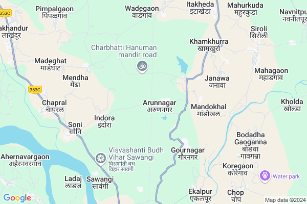
Arunnagar
Arunnagar Map
EDIT Map
Add Your House
 ..
..
Current Corona Virus Infected Patients Count in Gondia District
| City Name | District Name | Total Covid cases |
|---|
Locality Name :
Arunnagar
( अरुणनगर )
Taluka Name : Arjuni Morgaon
District : Gondia
State : Maharashtra
Region : Vidarbh
Division : Nagpur
Language : Marathi
Current Time 08:48 AM
Date: Wednesday , Apr 30,2025 (IST)
Time zone: IST (UTC+5:30)
Elevation / Altitude: 245 meters. Above Seal level
Telephone Code / Std Code: 07181
Assembly constituency : Arjuni Morgaon assembly constituency
Assembly MLA : Chandrikapure Manohar Gowardhan
Lok Sabha constituency : Bhandara-Gondiya parliamentary constituency
Parliament MP : Sunil Baburao Mendhe
Serpanch Name :
Pin Code : 441701
Post Office Name : Arjuni Morgaon
Commodities Prices : Mahagaon Market / Mandi
Edit below overview about Arunnagar
Edit below overview about Arunnagar
OverView of Arunnagar
Arunnagar is a bengali village, people here are mostly migrated residents from bangladesh/pakistan during second partition.Edit below overview about Arunnagar
National Highways Reachable To Arunnagar
Nationa High Way :NH543
Nationa High Way :NH753;NH543
Nationa High Way :NH543
Nationa High Way :NH753;NH543
Rivers Near Arunnagar
Sasakuran
Chadan
Sasakuran
Chadan
About Arunnagar
Arunnagar is a Village in Arjuni Morgaon Taluka in Gondia District of Maharashtra State, India. It belongs to Vidarbh region . It belongs to Nagpur Division . It is located 101 KM towards South from District head quarters Gondia. 16 KM from Arjuni-Morgaon. 899 KM from State capital Mumbai
Arunnagar Pin code is 441701 and postal head office is Arjuni Morgaon .
Korambhi ( 3 KM ) , Korambhitola ( 3 KM ) , Mandokhal ( 4 KM ) , Bori ( 5 KM ) , Khamkhurra ( 6 KM ) are the nearby Villages to Arunnagar. Arunnagar is surrounded by Arjuni Morgaon Taluka towards North , Lakhandur Taluka towards west , Brahmapuri Taluka towards South , Armori Taluka towards South .
Pauni , Gadchiroli , Bhandara , Umred are the near by Cities to Arunnagar.
This Place is in the border of the Gondia District and Bhandara District. Bhandara District Lakhandur is west towards this place .
Arunnagar 2011 Census Details
Arunnagar Local Language is Marathi. Arunnagar Village Total population is 2448 and number of houses are 514. Female Population is 47.4%. Village literacy rate is 75.9% and the Female Literacy rate is 33.3%.
Population
| Census Parameter | Census Data |
| Total Population | 2448 |
| Total No of Houses | 514 |
| Female Population % | 47.4 % ( 1161) |
| Total Literacy rate % | 75.9 % ( 1857) |
| Female Literacy rate | 33.3 % ( 815) |
| Scheduled Tribes Population % | 0.0 % ( 0) |
| Scheduled Caste Population % | 0.0 % ( 1) |
| Working Population % | 48.2 % |
| Child(0 -6) Population by 2011 | 272 |
| Girl Child(0 -6) Population % by 2011 | 44.9 % ( 122) |
Arunnagar Census More Deatils.
Politics in Arunnagar
BJP , NCP , BJS , INC are the major political parties in this area.Polling Stations /Booths near Arunnagar
1)Arunanagar2)Kokna (jami )
3)Arjuni
4)Arunanagar
5)Korambhi
HOW TO REACH Arunnagar
By Rail
Arun Nagar Rail Way Station , Wadegaon Rail Way Station are the very nearby railway stations to Arunnagar. Wadsa Rail Way Station (near to Desaiganj) , Arun Nagar Rail Way Station (near to Desaiganj) , Nagradham P.h. Rail Way Station (near to Gondiya) , Gondia Junction Rail Way Station (near to Gondiya) are the Rail way stations reachable from near by towns.By Road
Desaiganj , Gondiya are the nearby by towns to Arunnagar having road connectivity to ArunnagarColleges near Arunnagar
Sivprasad Sadanad Jaiswal College Arjuni/mor
Address :
P.d.jr.college
Address :
Shyama Prasad Mahagaon
Address :
Schools in Arunnagar
Nutan Hindi High School
Address : arunnagar , arjuni mor , gondiya , Maharashtra . PIN- 441701 , Post - Arjuni Morgaon
Z.p.u. P. School
Address : arunnagar , arjuni mor , gondiya , Maharashtra . PIN- 441701 , Post - Arjuni Morgaon
Govt Health Centers near Arunnagar
1) Koregaon , PHC KOREGAON , SHANKARPUR TO MAHAGAON ,2) Pimpalgaon , Sub Centre Pimpalgaon, 455 , Ward No.3, , New Plot Mohalla
3) Sondri , Sub Centre Sondri, 360 , Ward No.1, Teli Mohalla , Near Z.P. Primary School
Hospitals in Arunnagar,Arjuni Morgaon
P. H. C. Sawangi
Gandhinagar Nagar Road; Sakoli Warsa Rd; Maharashtra 441207; India
6.4 KM distance Detail
more ..
Petrol Bunks in Arunnagar,Arjuni Morgaon
Nakade Petrol Pump
Armori-Bhandara Hwy; Desaiganj; Maharashtra 441207; India
11.2 KM distance Detail
more ..
Colleges in Arunnagar,Arjuni Morgaon
Adarsh Krishi Tantraniketan; Dhabetekadi
Dhabetekari; Maharashtra 441803; India
10.5 KM distance Detail
Kuthe Patil College
Brahmapuri - Wadsa Rd; Gandhi Ward; Wadsa; Maharashtra 441207; India
11.1 KM distance Detail
more ..
Schools in Arunnagar,Arjuni Morgaon
Swami Vivekananda High School
Behind Baba Sahab Status; Near Jilla Parshad School; Morgaon; Ithkheda; Arjuni; Maharashtra 441701; India
8.8 KM distance Detail
Super Markets in Arunnagar,Arjuni Morgaon
Sughandha Kirana And General Store
Itkheda; Aurangabad; Maharashtra 441701; India
8.9 KM distance Detail
Local Parks in Arunnagar,Arjuni Morgaon
Hutatma Garden; Wadsa
Armori-Bhandara Hwy; Desaiganj; Maharashtra 441207; India
11.9 KM distance Detail
Police Stations near Arunnagar,Arjuni Morgaon
Wadsa Police Station
Armori-Bhandara Hwy; Desaiganj; Maharashtra 441207; India
12.2 KM distance Detail
Governement Offices near Arunnagar,Arjuni Morgaon
Panchayat Samiti Desaiganj
Panchayat Samiti; Desaiganj; Maharashtra 441207; India
12.3 KM distance Detail
About Arunnagar &
History
How to reach Arunnagar
Tourist Places Near By Arunnagar
Schools in Arunnagar
Colleges in Arunnagar
Temperature & weather of Arunnagar
places in Arunnagar
Arunnagar photos
More Information
How to reach Arunnagar
Tourist Places Near By Arunnagar
Schools in Arunnagar
Colleges in Arunnagar
Temperature & weather of Arunnagar
places in Arunnagar
Arunnagar photos
More Information
Village Talk
Post News or Events about this Village
Near Cities
Pauni 42 KM near
Gadchiroli 65 KM near
Bhandara 68 KM near
Umred 76 KM near
Pauni 42 KM near
Gadchiroli 65 KM near
Bhandara 68 KM near
Umred 76 KM near
Near By Taluks
Desaiganj (Wadsa) 14 KM near
Arjuni Morgaon 16 KM near
Lakhandur 17 KM near
Brahmapuri 22 KM near
Desaiganj (Wadsa) 14 KM near
Arjuni Morgaon 16 KM near
Lakhandur 17 KM near
Brahmapuri 22 KM near
Near By Air Ports
Sonegaon Airport 117 KM near
Raipur Airport 213 KM near
Jabalpur Airport 243 KM near
Nanded Airport 365 KM near
Sonegaon Airport 117 KM near
Raipur Airport 213 KM near
Jabalpur Airport 243 KM near
Nanded Airport 365 KM near
Near By Tourist Places
Bhandara 68 KM near
Tadoba 86 KM near
Nagpur 118 KM near
Chandrapur 123 KM near
Rajnandgaon 131 KM near
Bhandara 68 KM near
Tadoba 86 KM near
Nagpur 118 KM near
Chandrapur 123 KM near
Rajnandgaon 131 KM near
Near By Districts
Gadchiroli 65 KM near
Bhandara 68 KM near
Gondia 96 KM near
Nagpur 117 KM near
Gadchiroli 65 KM near
Bhandara 68 KM near
Gondia 96 KM near
Nagpur 117 KM near
Near By RailWay Station
Arun Nagar Rail Way Station 0.9 KM near
Wadegaon Rail Way Station 7.0 KM near
Bhandara Road Rail Way Station 76 KM near
Tumsar Road Junction Rail Way Station 83 KM near
Arun Nagar Rail Way Station 0.9 KM near
Wadegaon Rail Way Station 7.0 KM near
Bhandara Road Rail Way Station 76 KM near
Tumsar Road Junction Rail Way Station 83 KM near