| Home | City Bus | Maps | Villages | Cities | Rail | Tourist Places | School | College | Pin Codes | Corona Cases Count |
| Distance Calculator Bus Services IFSC Codes Trace Mobile Number Weather Search Place Trace IP Available Cash ATM/Banks Locate Polling Booth Report an Error contact People |
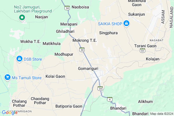
Ratanpur
Ratanpur Map
EDIT Map
Add Your House
 ..
..
Current Corona Virus Infected Patients Count in Golaghat District
| City Name | District Name | Total Covid cases |
|---|---|---|
| Golaghat District | Golaghat | 1 |
Locality Name :
Ratanpur
( रतनपुर )
Tehsil Name : Gomariguri
District : Golaghat
State : Assam
Language : Assamese and Bengali, English
Current Time 09:48 AM
Date: Thursday , Apr 24,2025 (IST)
Time zone: IST (UTC+5:30)
Telephone Code / Std Code: 03774
Assembly constituency : Golaghat assembly constituency
Assembly MLA : Ajanta Neog
Lok Sabha constituency : Kaliabor parliamentary constituency
Parliament MP : Gaurav Gogoi
Serpanch Name :
Commodities Prices : Baghry Market / Mandi
National Highways Reachable To Ratanpur
Nationa High Way :NH702D
Nationa High Way :NH702A
Nationa High Way :NH702D
Nationa High Way :NH702A
Rivers Near Ratanpur
Mening
Khenari
Mening
Khenari
About Ratanpur
Correct below Info and add more info about RatanpurRatanpur is a Village in Gomariguri Tehsil in Golaghat District of Assam State, India. It is located 24 KM towards South from District head quarters Golaghat. 274 KM from State capital Dispur
Ratanpur is surrounded by Bhandari Tehsil towards South , Golaghat East Tehsil towards North , Sanis Tehsil towards South , Golaghat Tehsil towards North .
Golaghat , Wokha , Mariani , Mokokchung are the near by Cities to Ratanpur.
Ratanpur 2011 Census Details
Ratanpur Local Language is Assamese. Ratanpur Village Total population is 464 and number of houses are 94. Female Population is 48.1%. Village literacy rate is 55.6% and the Female Literacy rate is 21.8%.
Population
| Census Parameter | Census Data |
| Total Population | 464 |
| Total No of Houses | 94 |
| Female Population % | 48.1 % ( 223) |
| Total Literacy rate % | 55.6 % ( 258) |
| Female Literacy rate | 21.8 % ( 101) |
| Scheduled Tribes Population % | 31.5 % ( 146) |
| Scheduled Caste Population % | 0.0 % ( 0) |
| Working Population % | 50.6 % |
| Child(0 -6) Population by 2011 | 60 |
| Girl Child(0 -6) Population % by 2011 | 50.0 % ( 30) |
Ratanpur Census More Deatils.
Politics in Ratanpur
Indian National Congress , BJP , AGP , 84.06% , 72704 , INC are the major political parties in this area.Polling Stations /Booths near Ratanpur
1)Doyang Bagan L.p. School (r/s)2)Doyang High School (l/s)
3)Arunachal Borkachari Lp School (l/s)
4)Tritiya Bosha Lp School
5)No.2 Chaudangpather L.p. School
HOW TO REACH Ratanpur
By Rail
There is no railway station near to Ratanpur in less than 10 km.Pincodes near Ratanpur
785603 ( Oating ) , 785631 ( Borholla ) , 785610 ( Furkating )Colleges near Ratanpur
D.k.d. College
Address : Dergaon, Golaghat, Assam
Forkating College
Address : Po- Furkating, Golaghat Distassam
Joya Gogai College
Address : Khumtai P.o.- Khumtai District Golaghat-785 619 As
Debraj Roy College,golaghat, Assam
Address : Assam
Golaghat Commerce Colleg
Address :
Schools near Ratanpur
Govt Health Centers near Ratanpur
1) Herheri SC , , Barpathar to Golaghat road ,2) Dhondashyam SC , , side of Barpathar to golaghat road ,
3) Bilgaon MPHC , , , Near Bilgaon railway station
Colleges in Ratanpur,Gomariguri
Furkating College Departmental Building
Golaghat; Tarphat; Assam 785610; India
17.5 KM distance Detail
Golaghat Polytechnic College; Furkating.
Golaghat; Borphukah Khat; Assam 785702; India
17.6 KM distance Detail
more ..
Police Stations near Ratanpur,Gomariguri
Barpathar Police Station
Ward Number 3; Kalyani Para; Barpathar; Assam 785602; India
23.0 KM distance Detail
About Ratanpur &
History
How to reach Ratanpur
Tourist Places Near By Ratanpur
Schools in Ratanpur
Colleges in Ratanpur
Temperature & weather of Ratanpur
places in Ratanpur
Ratanpur photos
More Information
How to reach Ratanpur
Tourist Places Near By Ratanpur
Schools in Ratanpur
Colleges in Ratanpur
Temperature & weather of Ratanpur
places in Ratanpur
Ratanpur photos
More Information
Village Talk
Post News or Events about this Village
Near Cities
Golaghat 24 KM near
Wokha 36 KM near
Mariani 49 KM near
Mokokchung 51 KM near
Golaghat 24 KM near
Wokha 36 KM near
Mariani 49 KM near
Mokokchung 51 KM near
Near By Taluks
Gomariguri 0 KM near
Bhandari 13 KM near
Golaghat East 20 KM near
Sanis 22 KM near
Gomariguri 0 KM near
Bhandari 13 KM near
Golaghat East 20 KM near
Sanis 22 KM near
Near By Air Ports
Rowriah Airport 50 KM near
Dimapur Airport 66 KM near
Lilabari Airport 118 KM near
Salonibari Airport 150 KM near
Rowriah Airport 50 KM near
Dimapur Airport 66 KM near
Lilabari Airport 118 KM near
Salonibari Airport 150 KM near
Near By Tourist Places
Wokha 36 KM near
Mokokchung 46 KM near
Jorhat 53 KM near
Kaziranga National Park 75 KM near
Majuli 76 KM near
Wokha 36 KM near
Mokokchung 46 KM near
Jorhat 53 KM near
Kaziranga National Park 75 KM near
Majuli 76 KM near
Near By Districts
Golaghat 23 KM near
Wokha 35 KM near
Mokokchung 51 KM near
Jorhat 52 KM near
Golaghat 23 KM near
Wokha 35 KM near
Mokokchung 51 KM near
Jorhat 52 KM near
Near By RailWay Station
Furkating Junction Rail Way Station 17 KM near
Sarupathar Rail Way Station 30 KM near
Furkating Junction Rail Way Station 17 KM near
Sarupathar Rail Way Station 30 KM near