| Home | City Bus | Maps | Villages | Cities | Rail | Tourist Places | School | College | Pin Codes | Corona Cases Count |
| Distance Calculator Bus Services IFSC Codes Trace Mobile Number Weather Search Place Trace IP Available Cash ATM/Banks Locate Polling Booth Report an Error contact People |
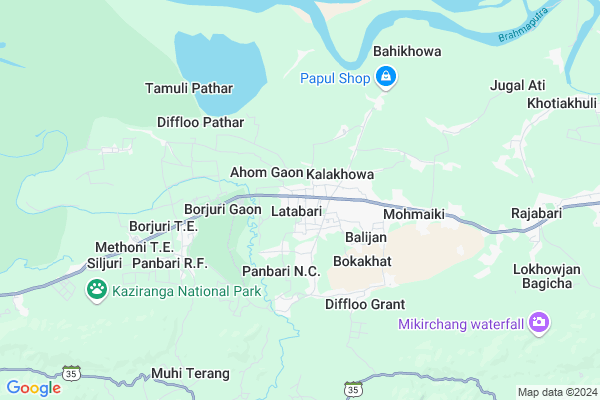
Behora
Behora Map
EDIT Map
Add Your House
 ..
..
Current Corona Virus Infected Patients Count in Golaghat District
| City Name | District Name | Total Covid cases |
|---|---|---|
| Golaghat District | Golaghat | 1 |
Locality Name :
Behora
( बेहोरा )
Tehsil Name : Golaghat West
District : Golaghat
State : Assam
Language : Assamese and Bengali, English
Current Time 04:34 AM
Date: Saturday , Apr 26,2025 (IST)
Time zone: IST (UTC+5:30)
Elevation / Altitude: 79 meters. Above Seal level
Telephone Code / Std Code: 03776
Assembly constituency : Bokakhat assembly constituency
Assembly MLA : Atul Bora
Lok Sabha constituency : Kaliabor parliamentary constituency
Parliament MP : Gaurav Gogoi
Serpanch Name :
Pin Code : 785615
Post Office Name : Numaligarh
Commodities Prices : Dimapur Market / Mandi
Behora Live Weather
Temperature: 21.0 °C
clear sky
Humidity: 89%
Wind : 2.5 mt/sec towards E
StationName : "BokÄ\u0081khÄ\u0081t"
observed on 1 Hours Back
Temperature: 21.0 °C
clear sky
Humidity: 89%
Wind : 2.5 mt/sec towards E
StationName : "BokÄ\u0081khÄ\u0081t"
observed on 1 Hours Back
Behora Weather Forecast for Next 5 days
27-04-2025
21.0°C to 32.8°C
light rain, few clouds, clear sky, scattered clouds
21.0°C to 32.8°C
light rain, few clouds, clear sky, scattered clouds
28-04-2025
22.1°C to 34.1°C
light rain, scattered clouds, overcast clouds
22.1°C to 34.1°C
light rain, scattered clouds, overcast clouds
29-04-2025
22.8°C to 29.4°C
overcast clouds
22.8°C to 29.4°C
overcast clouds
30-04-2025
22.2°C to 32.0°C
light rain, overcast clouds, clear sky
22.2°C to 32.0°C
light rain, overcast clouds, clear sky
National Highways Reachable To Behora
Nationa High Way :NH702D
Nationa High Way :NH702D
Rivers Near Behora
Kaliyani
Daigurung
Kaliyani
Daigurung
About Behora
Correct below Info and add more info about BehoraBehora is a Village in Golaghat West Tehsil in Golaghat District of Assam State, India. It is located 47 KM towards west from District head quarters Golaghat. 225 KM from State capital Dispur
Behora Pin code is 785615 and postal head office is Numaligarh .
Behora is surrounded by Morongi Tehsil towards East , Chaiduar Tehsil towards North , Pub Chaiduar Tehsil towards North , Behali Tehsil towards west .
Golaghat , Itanagar , Naharlagun , Jorhat are the near by Cities to Behora.
This Place is in the border of the Golaghat District and Sivasagar District. Sivasagar District Demow is East towards this place .
Behora 2011 Census Details
Behora Local Language is Assamese. Behora Village Total population is 4054 and number of houses are 852. Female Population is 50.9%. Village literacy rate is 48.2% and the Female Literacy rate is 19.7%.
Population
| Census Parameter | Census Data |
| Total Population | 4054 |
| Total No of Houses | 852 |
| Female Population % | 50.9 % ( 2064) |
| Total Literacy rate % | 48.2 % ( 1953) |
| Female Literacy rate | 19.7 % ( 800) |
| Scheduled Tribes Population % | 0.2 % ( 7) |
| Scheduled Caste Population % | 0.5 % ( 21) |
| Working Population % | 50.0 % |
| Child(0 -6) Population by 2011 | 558 |
| Girl Child(0 -6) Population % by 2011 | 53.2 % ( 297) |
Behora Census More Deatils.
Politics in Behora
85.71% , Indian National Congress , 51310 , BJP , AGP , INC are the major political parties in this area.Polling Stations /Booths near Behora
1)Jyotipur L.p. School (rw)2)Koilakhat L.p. School
3)Kolakhowa L.p. School (lw)
4)Bokakhat Chah Bagicha Lp School(rw)
5)Nak-kati M.e. School
HOW TO REACH Behora
By Rail
There is no railway station near to Behora in less than 10 km.Colleges near Behora
D.k.d. College
Address : Dergaon, Golaghat, Assam
Forkating College
Address : Po- Furkating, Golaghat Distassam
Joya Gogai College
Address : Khumtai P.o.- Khumtai District Golaghat-785 619 As
Debraj Roy College,golaghat, Assam
Address : Assam
Golaghat Commerce Colleg
Address :
Schools near Behora
Bokakhat Jatiya Bidyalaya
Address : bokakhat town ward 1 , west , golaghat , Assam . PIN- 785612 , Post - Bokakhat
Delhi Public School
Address : numaligarh , west , golaghat , Assam . PIN- 785699 , Post - Numaligarh Refinery Project
Kuruabahi Higher Secondary Sch
Address : kuruabahi , west , golaghat , Assam . PIN- 785615 , Post - Numaligarh
Bokakhat Higher Secondary Scho
Address : bokakhat town ward 1 , west , golaghat , Assam . PIN- 785612 , Post - Bokakhat
Govt Health Centers near Behora
1) Pokimuri SC , , Bokakhat Diffloo road ,2) Kalakhowa SC , , , Anandapur LP School
3) Naharjan SC , , Difloo Naharjan Road ,
Petrol Bunks in Behora,Golaghat West
Ramdhenu Filling Energy Station . Latabari
Golaghat; Ahom Gaon; Assam 785612; India
1.7 KM distance Detail
more ..
Schools in Behora,Golaghat West
KALYANPUR L.P SCHOOL
-2; Ward Number 2; Golaghat; Bokakhat; Assam 785612; India
0.4 KM distance Detail
কলাখোৱা প্ৰাথমিক বিদ্যালয়
kolakhuwa gaon;Bokakhat; Golaghat; Bokakhat; Assam 785612; India
0.5 KM distance Detail
Kalakhowa L.P SCHOOL
Bokakhat Ct Rd; Golaghat; Kalakhowa; Assam 785612; India
0.5 KM distance Detail
About Behora &
History
How to reach Behora
Tourist Places Near By Behora
Schools in Behora
Colleges in Behora
Temperature & weather of Behora
places in Behora
Behora photos
More Information
How to reach Behora
Tourist Places Near By Behora
Schools in Behora
Colleges in Behora
Temperature & weather of Behora
places in Behora
Behora photos
More Information
Village Talk
Post News or Events about this Village
Near Cities
Golaghat 45 KM near
Itanagar 55 KM near
Naharlagun 60 KM near
Jorhat 68 KM near
Golaghat 45 KM near
Itanagar 55 KM near
Naharlagun 60 KM near
Jorhat 68 KM near
Near By Taluks
Golaghat West 0 KM near
Morongi 26 KM near
Chaiduar 28 KM near
Pub Chaiduar 34 KM near
Golaghat West 0 KM near
Morongi 26 KM near
Chaiduar 28 KM near
Pub Chaiduar 34 KM near
Near By Air Ports
Rowriah Airport 67 KM near
Salonibari Airport 88 KM near
Dimapur Airport 96 KM near
Lilabari Airport 98 KM near
Rowriah Airport 67 KM near
Salonibari Airport 88 KM near
Dimapur Airport 96 KM near
Lilabari Airport 98 KM near
Near By Tourist Places
Kaziranga National Park 14 KM near
Itanagar 55 KM near
Yupia 68 KM near
Jorhat 70 KM near
Majuli 75 KM near
Kaziranga National Park 14 KM near
Itanagar 55 KM near
Yupia 68 KM near
Jorhat 70 KM near
Majuli 75 KM near
Near By Districts
Golaghat 45 KM near
Sonitpur 62 KM near
Jorhat 68 KM near
Papum Pare 83 KM near
Golaghat 45 KM near
Sonitpur 62 KM near
Jorhat 68 KM near
Papum Pare 83 KM near
Near By RailWay Station
Furkating Junction Rail Way Station 50 KM near
Sarupathar Rail Way Station 63 KM near
Furkating Junction Rail Way Station 50 KM near
Sarupathar Rail Way Station 63 KM near