| Home | City Bus | Maps | Villages | Cities | Rail | Tourist Places | School | College | Pin Codes | Corona Cases Count |
| Distance Calculator Bus Services IFSC Codes Trace Mobile Number Weather Search Place Trace IP Available Cash ATM/Banks Locate Polling Booth Report an Error contact People |
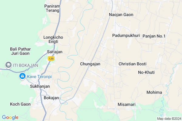
Chungajan
Chungajan Map
EDIT Map
Add Your House
 ..
..
Current Corona Virus Infected Patients Count in Golaghat District
| City Name | District Name | Total Covid cases |
|---|---|---|
| Golaghat District | Golaghat | 1 |
Locality Name :
Chungajan
( चुंगजां )
Tehsil Name : Golaghat South
District : Golaghat
State : Assam
Language : Assamese and Bengali, English
Current Time 10:53 AM
Date: Friday , Apr 25,2025 (IST)
Time zone: IST (UTC+5:30)
Elevation / Altitude: 123 meters. Above Seal level
Telephone Code / Std Code: 03675
Assembly constituency : Sarupathar assembly constituency
Assembly MLA : Biswajit Phukan
Lok Sabha constituency : Kaliabor parliamentary constituency
Parliament MP : Gaurav Gogoi
Serpanch Name :
Commodities Prices : Dimapur Market / Mandi
National Highways Reachable To Chungajan
Nationa High Way :NH702A
Nationa High Way :NH2
Nationa High Way :NH702A
Nationa High Way :NH2
Rivers Near Chungajan
Diyung
Dhansiri River
Diyung
Dhansiri River
About Chungajan
Correct below Info and add more info about ChungajanChungajan is a Village in Golaghat South Tehsil in Golaghat District of Assam State, India. It is located 60 KM towards South from District head quarters Golaghat. 15 KM from Golaghat South. 243 KM from State capital Dispur
Rajapukhuri ( 15 KM ) are the nearby Villages to Chungajan. Chungajan is surrounded by Wozhuro-Ralan Tehsil towards East , Dimapur Tehsil towards South , Medziphema Tehsil towards South , Niuland Tehsil towards South .
Dimapur , Diphu , Wokha , Kohima are the near by Cities to Chungajan.
Chungajan Gaon 2011 Census Details
Chungajan Local Language is Assamese. Chungajan Gaon Village Total population is 153 and number of houses are 31. Female Population is 47.1%. Village literacy rate is 78.4% and the Female Literacy rate is 34.6%.
Population
| Census Parameter | Census Data |
| Total Population | 153 |
| Total No of Houses | 31 |
| Female Population % | 47.1 % ( 72) |
| Total Literacy rate % | 78.4 % ( 120) |
| Female Literacy rate | 34.6 % ( 53) |
| Scheduled Tribes Population % | 0.0 % ( 0) |
| Scheduled Caste Population % | 0.0 % ( 0) |
| Working Population % | 45.8 % |
| Child(0 -6) Population by 2011 | 23 |
| Girl Child(0 -6) Population % by 2011 | 52.2 % ( 12) |
Chungajan Gaon Census More Deatils.
Politics in Chungajan
90396 , Indian National Congress , BJP , AGP , INC , 82.29% are the major political parties in this area.Polling Stations /Booths near Chungajan
1)Chophala Tea Estate Club2)Padumoni M.e. School (r)
3)Padumpukhuri L P School (l)
4)Chungajan Central School
5)Chungajan Pragati L P School (l)
HOW TO REACH Chungajan
By Rail
Chongajan Rail Way Station , Bokajan Rail Way Station are the very nearby railway stations to Chungajan.Pincodes near Chungajan
785601 ( Sarupathar ) , 785602 ( Barpathar ) , 785603 ( Oating )Colleges near Chungajan
D.k.d. College
Address : Dergaon, Golaghat, Assam
Forkating College
Address : Po- Furkating, Golaghat Distassam
Joya Gogai College
Address : Khumtai P.o.- Khumtai District Golaghat-785 619 As
Debraj Roy College,golaghat, Assam
Address : Assam
Golaghat Commerce Colleg
Address :
Schools in Chungajan
Sancha Memorial English Academy
Address : Chungajan Block no3,
PO+PS-Chungaja,
Dist.-Golaghat,
PIN-785601
Chungajan High School
Address : Near Panchayat office,
PO+PS-Chungajan,
Dist.-Golaghat,
PIN-785601
Govt Health Centers near Chungajan
1) Podumpukhuri SC , , Padumpukhuri road , Padumpukhuri LP School2) Matikhula SC , , Matikhula Road , Matikhula Water Supply schem
3) No. 2 Sarupathar SC , , Bengoligaon tiniali , Near Shiv mandir road
Petrol Bunks in Chungajan,Golaghat South
INDANE PETROL PUMP BOKAJAN ( LADULAL JAIN & SONS )
Sukhanjan; Assam 782480; India
7.8 KM distance Detail
HP PETROL PUMP - KHATKATI SERVICE STATION
Vill & PO Khatkhati Dist Assam; Gauhati; Assam 782480; India
15.0 KM distance Detail
more ..
Colleges in Chungajan,Golaghat South
Bokajan College
Silonijan-Barpathar-Sarupathar-Naojan-Bokajanghat Raod; Sukhanjan; Assam 782480; India
7.7 KM distance Detail
more ..
Local Parks in Chungajan,Golaghat South
Children Park Sarupathar
Link road to Hospital via Block Office; Golaghat; No.1 Padumoni; Assam 785601; India
20.1 KM distance Detail
Police Stations near Chungajan,Golaghat South
Bokajan Police Station; Bokajan Karbi Anglong Assam
Bokajan; Assam 782480; India
7.4 KM distance Detail
Naojan Police Station
Silonijan-Barpathar-Sarupathar-Naojan-Bokajanghat Raod; Golaghat; No.1 Kori Gaon; Assam 785601; India
8.8 KM distance Detail
�¦?ৰি�§?াম�¦?া�¦? �¦?ৰ�¦?�§?ষ�§? �¦?�¦?�§?। Uriamghat Police Station
Uriamghat; Assam 785601; India
17.9 KM distance Detail
About Chungajan &
History
How to reach Chungajan
Tourist Places Near By Chungajan
Schools in Chungajan
Colleges in Chungajan
Temperature & weather of Chungajan
places in Chungajan
Chungajan photos
More Information
How to reach Chungajan
Tourist Places Near By Chungajan
Schools in Chungajan
Colleges in Chungajan
Temperature & weather of Chungajan
places in Chungajan
Chungajan photos
More Information
Village Talk
Post News or Events about this Village
Near Cities
Dimapur 26 KM near
Diphu 49 KM near
Wokha 50 KM near
Kohima 58 KM near
Dimapur 26 KM near
Diphu 49 KM near
Wokha 50 KM near
Kohima 58 KM near
Near By Taluks
Golaghat South 14 KM near
Wozhuro-Ralan 21 KM near
Dimapur 22 KM near
Medziphema 25 KM near
Golaghat South 14 KM near
Wozhuro-Ralan 21 KM near
Dimapur 22 KM near
Medziphema 25 KM near
Near By Air Ports
Dimapur Airport 23 KM near
Rowriah Airport 93 KM near
Salonibari Airport 140 KM near
Lilabari Airport 156 KM near
Dimapur Airport 23 KM near
Rowriah Airport 93 KM near
Salonibari Airport 140 KM near
Lilabari Airport 156 KM near
Near By Tourist Places
Wokha 50 KM near
Diphu 51 KM near
Kohima 59 KM near
Kaziranga National Park 77 KM near
Mokokchung 82 KM near
Wokha 50 KM near
Diphu 51 KM near
Kohima 59 KM near
Kaziranga National Park 77 KM near
Mokokchung 82 KM near
Near By Districts
Dimapur 23 KM near
Wokha 48 KM near
Golaghat 57 KM near
Kohima 57 KM near
Dimapur 23 KM near
Wokha 48 KM near
Golaghat 57 KM near
Kohima 57 KM near
Near By RailWay Station
Chongajan Rail Way Station 4.5 KM near
Naojan Rail Way Station 6.9 KM near
Bokajan Rail Way Station 7.1 KM near
Sarupathar Rail Way Station 17 KM near
Chongajan Rail Way Station 4.5 KM near
Naojan Rail Way Station 6.9 KM near
Bokajan Rail Way Station 7.1 KM near
Sarupathar Rail Way Station 17 KM near