| Home | City Bus | Maps | Villages | Cities | Rail | Tourist Places | School | College | Pin Codes | Corona Cases Count |
| Distance Calculator Bus Services IFSC Codes Trace Mobile Number Weather Search Place Trace IP Available Cash ATM/Banks Locate Polling Booth Report an Error contact People |
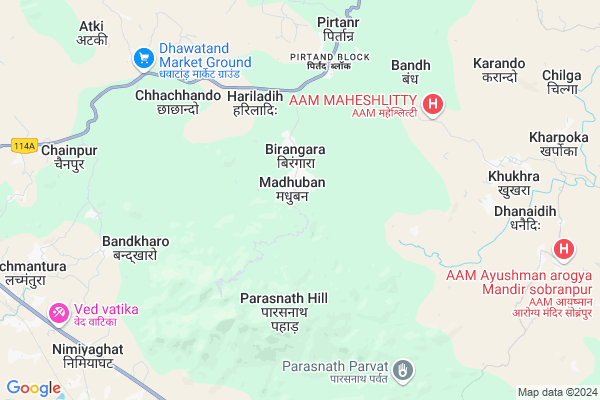
Madhuban Map
EDIT Map
Add Your House
 ..
..
Current Corona Virus Infected Patients Count in Giridih District
| City Name | District Name | Total Covid cases |
|---|---|---|
| Giridih District | Giridih | 1 |
Locality Name :
Madhuban
( मधुबन )
Block Name : Pirtand
District : Giridih
State : Jharkhand
Language : Hindi and Santali
Current Time 09:02 AM
Date: Thursday , Apr 24,2025 (IST)
Time zone: IST (UTC+5:30)
Elevation / Altitude: 332 meters. Above Seal level
Telephone Code / Std Code: 06532
Assembly constituency : Giridih assembly constituency
Assembly MLA :
Lok Sabha constituency : Giridih parliamentary constituency
Parliament MP :
Serpanch Name :
Pin Code : 825108
Post Office Name : Pirtand
Commodities Prices : Purulia Market / Mandi
Madhuban Live Weather
Temperature: 32.5 °C
clear sky
Humidity: 6%
Wind : 1.42 mt/sec towards SW
StationName : "TopchÄ\u0081nchi"
observed on 1 Hours Back
Temperature: 32.5 °C
clear sky
Humidity: 6%
Wind : 1.42 mt/sec towards SW
StationName : "TopchÄ\u0081nchi"
observed on 1 Hours Back
Madhuban Weather Forecast for Next 5 days
25-04-2025
28.1°C to 42.8°C
clear sky
28.1°C to 42.8°C
clear sky
26-04-2025
27.2°C to 42.9°C
clear sky
27.2°C to 42.9°C
clear sky
27-04-2025
26.5°C to 43.8°C
clear sky, few clouds, scattered clouds, broken clouds
26.5°C to 43.8°C
clear sky, few clouds, scattered clouds, broken clouds
28-04-2025
26.3°C to 41.2°C
clear sky, scattered clouds, overcast clouds, broken clouds, light rain
26.3°C to 41.2°C
clear sky, scattered clouds, overcast clouds, broken clouds, light rain
29-04-2025
23.9°C to 38.7°C
overcast clouds, broken clouds, scattered clouds, moderate rain, clear sky
23.9°C to 38.7°C
overcast clouds, broken clouds, scattered clouds, moderate rain, clear sky
National Highways Reachable To Madhuban
Nationa High Way :NH218
Nationa High Way :NH218
Rivers Near Madhuban
Puthro
Barakar River
Puthro
Barakar River
About Madhuban
Correct below Info and add more info about MadhubanMadhuban is a Village in Pirtand Block in Giridih District of Jharkhand State, India. It is located 30 KM towards South from District head quarters Giridih. 10 KM from Pirtand. 131 KM from State capital Ranchi
Madhuban Pin code is 825108 and postal head office is Pirtand .
Chhachhando ( 6 KM ) , Bandh ( 6 KM ) , Bandkharo ( 6 KM ) , Chainpur ( 9 KM ) , Poraiya ( 10 KM ) are the nearby Villages to Madhuban. Madhuban is surrounded by Pirtand Block towards East , Topchanchi Block towards South , Nawadih Block towards South , Giridih Block towards North .
Gomoh , Giridih , Chandrapura , Phusro are the near by Cities to Madhuban.
This Place is in the border of the Giridih District and Dhanbad District. Dhanbad District Topchanchi is South towards this place .
Madhuban 2011 Census Details
Madhuban Local Language is Hindi. Madhuban Village Total population is 3059 and number of houses are 662. Female Population is 46.2%. Village literacy rate is 57.8% and the Female Literacy rate is 22.8%.
Population
| Census Parameter | Census Data |
| Total Population | 3059 |
| Total No of Houses | 662 |
| Female Population % | 46.2 % ( 1413) |
| Total Literacy rate % | 57.8 % ( 1768) |
| Female Literacy rate | 22.8 % ( 697) |
| Scheduled Tribes Population % | 2.5 % ( 77) |
| Scheduled Caste Population % | 35.2 % ( 1078) |
| Working Population % | 36.2 % |
| Child(0 -6) Population by 2011 | 488 |
| Girl Child(0 -6) Population % by 2011 | 46.5 % ( 227) |
Madhuban Census More Deatils.
Politics in Madhuban
AJSU Party , JVM , BJP , JMM , are the major political parties in this area.Polling Stations /Booths near Madhuban
1)U.m.s Barasingha2)U.m.s Pipradih
3)U.m.s Khandiha South Part
4)U.m.s Chengdhari
5)U.m.s Chilga
HOW TO REACH Madhuban
By Rail
There is no railway station near to Madhuban in less than 10 km.Colleges near Madhuban
Parasnath Inter College , Isri Bazaar
Address :
Ramnam College Ghoranji
Address :
Sariya College Suriya
Address :
Rupeshwoods College
Address :
Govt Polytechnic Ranchi
Address :
Schools near Madhuban
Middle School, Palganj
Address : Palganj, giridih
Govt Health Centers near Madhuban
1) HSC MADHUBAN , MAIN ROAD MADHUBAN , MADHUBAN , MADHUBAN THANA KE SAMANE2) HSC HARLADIH , 6 , HARALADIH , MAIN ROAD HARALADIH
3) HSC BARIYARPUR , 8 , BARIYARPUR , MAIN ROAD BARIYARPUR
Petrol Bunks in Madhuban,Pirtand
OM SHIVSHAKTI FUEL CENTRE
CHIRKI (SH14) ; DISTT.:GIR; GIRIDIH; Jharkhand 825108; India
5.1 KM distance Detail
more ..
Colleges in Madhuban,Pirtand
Parasnath Inter College Isri Bazar
Isri Bazar; Dumri; Jharkhand 825167; India
13.9 KM distance Detail
GHAUSIA JAMA MASJID KHAKI KALA
Dumri - Bermo - Jaina Road; Khakhikalan; Jharkhand 825167; India
15.1 KM distance Detail
more ..
About Madhuban &
History
How to reach Madhuban
Tourist Places Near By Madhuban
Schools in Madhuban
Colleges in Madhuban
Temperature & weather of Madhuban
places in Madhuban
Madhuban photos
More Information
How to reach Madhuban
Tourist Places Near By Madhuban
Schools in Madhuban
Colleges in Madhuban
Temperature & weather of Madhuban
places in Madhuban
Madhuban photos
More Information
Village Talk
Post News or Events about this Village
Near Cities
Gomoh 16 KM near
Giridih 29 KM near
Chandrapura 31 KM near
Phusro 33 KM near
Gomoh 16 KM near
Giridih 29 KM near
Chandrapura 31 KM near
Phusro 33 KM near
Near By Taluks
Pirtand 9 KM near
Dumri 10 KM near
Topchanchi 17 KM near
Nawadih 23 KM near
Pirtand 9 KM near
Dumri 10 KM near
Topchanchi 17 KM near
Nawadih 23 KM near
Near By Air Ports
Ranchi Airport 126 KM near
Gaya Airport 165 KM near
Patna Airport 231 KM near
Netaji Subhas Chandra Bose Airport 311 KM near
Ranchi Airport 126 KM near
Gaya Airport 165 KM near
Patna Airport 231 KM near
Netaji Subhas Chandra Bose Airport 311 KM near
Near By Tourist Places
Giridh 28 KM near
Hazaribagh 35 KM near
Dhanbad 40 KM near
Bokaro Steel City 44 KM near
Jamtara 77 KM near
Giridh 28 KM near
Hazaribagh 35 KM near
Dhanbad 40 KM near
Bokaro Steel City 44 KM near
Jamtara 77 KM near
Near By Districts
Giridih 29 KM near
Bokaro 38 KM near
Dhanbad 40 KM near
Jamtara 74 KM near
Giridih 29 KM near
Bokaro 38 KM near
Dhanbad 40 KM near
Jamtara 74 KM near
Near By RailWay Station
Parasnath Rail Way Station 12 KM near
Netaji Sc Bose Junction Gomoh Rail Way Station 15 KM near
Parasnath Rail Way Station 12 KM near
Netaji Sc Bose Junction Gomoh Rail Way Station 15 KM near