| Home | City Bus | Maps | Villages | Cities | Rail | Tourist Places | School | College | Pin Codes | Corona Cases Count |
| Distance Calculator Bus Services IFSC Codes Trace Mobile Number Weather Search Place Trace IP Available Cash ATM/Banks Locate Polling Booth Report an Error contact People |
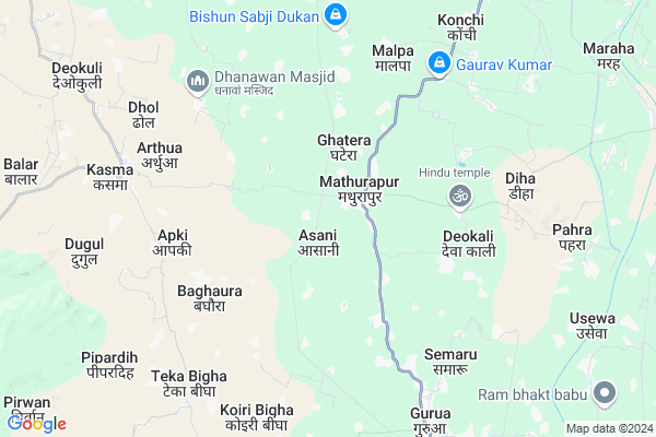
Ghatera Map
EDIT Map
Add Your House
 ..
..
Current Corona Virus Infected Patients Count in Gaya District
| City Name | District Name | Total Covid cases |
|---|---|---|
| Gaya District | Gaya | 6 |
Locality Name :
Ghatera
( घटेरा )
Block Name : Guraru
District : Gaya
State : Bihar
Division : Magadh
Language : Maithili and Hindi, Urdu, English
Current Time 10:49 AM
Date: Wednesday , Apr 30,2025 (IST)
Time zone: IST (UTC+5:30)
Elevation / Altitude: 114 meters. Above Seal level
Telephone Code / Std Code: 06327
Assembly constituency : Gurua assembly constituency
Assembly MLA : Vinay Kumar
Lok Sabha constituency : Aurangabad parliamentary constituency
Parliament MP : SUSHIL KUMAR SINGH
Serpanch Name :
Pin Code : 824118
Post Office Name : Guraru Mills
Ghatera Live Weather
Temperature: 31.0 °C
clear sky
Humidity: 30%
Wind : 4.58 mt/sec towards E
StationName : "Rafiganj"
observed on Now
Temperature: 31.0 °C
clear sky
Humidity: 30%
Wind : 4.58 mt/sec towards E
StationName : "Rafiganj"
observed on Now
Ghatera Weather Forecast for Next 5 days
01-05-2025
28.4°C to 37.1°C
clear sky, light rain
28.4°C to 37.1°C
clear sky, light rain
02-05-2025
26.9°C to 37.9°C
clear sky, broken clouds, scattered clouds, few clouds, overcast clouds
26.9°C to 37.9°C
clear sky, broken clouds, scattered clouds, few clouds, overcast clouds
03-05-2025
25.7°C to 39.2°C
broken clouds, clear sky, light rain
25.7°C to 39.2°C
broken clouds, clear sky, light rain
04-05-2025
28.4°C to 41.0°C
broken clouds, scattered clouds, few clouds, light rain, clear sky
28.4°C to 41.0°C
broken clouds, scattered clouds, few clouds, light rain, clear sky
05-05-2025
27.9°C to 41.9°C
light rain, clear sky, overcast clouds
27.9°C to 41.9°C
light rain, clear sky, overcast clouds
Edit below overview about Ghatera
Edit below overview about Ghatera
OverView of Ghatera
there is small village its pretty village and narrow space and i should be prefer to take tea and normaly to be dehearted and fluence of falgu sacrified and too much cool village we are saisfied of this villageEdit below overview about Ghatera
National Highways Reachable To Ghatera
Nationa High Way :NH22;NH120
Nationa High Way :NH120
Nationa High Way :NH22;NH120
Nationa High Way :NH120
Rivers Near Ghatera
Morhar
Phalgu :نهر فالغو :Falgu River :फल्गु :ಫಲ್ಗು :فالغو
Morhar
Phalgu :نهر فالغو :Falgu River :फल्गु :ಫಲ್ಗು :فالغو
About Ghatera
Ghatera is a Village in Guraru Block in Gaya District of Bihar State, India. It belongs to Magadh Division . It is located 30 KM towards west from District head quarters Gaya. 7 KM from Guraru. 123 KM from State capital Patna
Ghatera Pin code is 824118 and postal head office is Guraru Mills .
Malpa ( 6 KM ) , Manda ( 6 KM ) , Tineri ( 6 KM ) , Raghunath Khap ( 6 KM ) , Semaru ( 7 KM ) are the nearby Villages to Ghatera. Ghatera is surrounded by Gurua Block towards South , Amas Block towards South , Paraiya Block towards East , Rafiganj Block towards west .
Rafiganj , Sherghati , Bodh Gaya , Gaya are the near by Cities to Ghatera.
This Place is in the border of the Gaya District and Aurangabad District. Aurangabad District Rafiganj is west towards this place .
Ghatera 2011 Census Details
Ghatera Local Language is Maithili. Ghatera Village Total population is 5351 and number of houses are 782. Female Population is 47.9%. Village literacy rate is 55.4% and the Female Literacy rate is 22.2%.
Population
| Census Parameter | Census Data |
| Total Population | 5351 |
| Total No of Houses | 782 |
| Female Population % | 47.9 % ( 2564) |
| Total Literacy rate % | 55.4 % ( 2964) |
| Female Literacy rate | 22.2 % ( 1188) |
| Scheduled Tribes Population % | 0.0 % ( 1) |
| Scheduled Caste Population % | 34.4 % ( 1841) |
| Working Population % | 43.7 % |
| Child(0 -6) Population by 2011 | 985 |
| Girl Child(0 -6) Population % by 2011 | 50.4 % ( 496) |
Ghatera Census More Deatils.
Politics in Ghatera
JD(U) , Bharatiya Janata Party , BJP , RJD , INC are the major political parties in this area.Polling Stations /Booths near Ghatera
1)Prathmik Vidyalay Kuramain2)Prathmik Vidyalay Bandaul
3)Utkramit Madhya Vidhyalay Bajubigha(east Part)
4)Madhya Vidyalay Gaderi Vigha Utari Bhag
5)Uchcha Vidyalay Diha Dakshini Bhag
HOW TO REACH Ghatera
By Rail
Ismailpur Rail Way Station is the very nearby railway stations to Ghatera. Gaya Junction Rail Way Station (near to Gaya) , Shaheed Ishwar Chowdhary Halt Rail Way Station (near to Gaya) are the Rail way stations reachable from near by towns.By Road
Tikari , Gaya are the nearby by towns to Ghatera having road connectivity to GhateraColleges near Ghatera
Sanjay Gandhi Inter College
Address :
B.n.s.college Shobh
Address :
Upendarnath Inter Collage
Address :
Madrasa.nurulislamia.alawalpur
Address :
M G Khan College Tilora(gaya)
Address :
Schools in Ghatera
Ur.p.s.bajubigha
Address : ghatera , guraru , gaya , Bihar . PIN- 824118 , Post - Guraru Mills
M.s.ghatera
Address : ghatera , guraru , gaya , Bihar . PIN- 824118 , Post - Guraru Mills
Govt Health Centers near Ghatera
1) Burma , Burma , Burma ,2) Chedhokher , , ,
3) Kalona , HSC Kolauna , Kolauna South ,
Petrol Bunks in Ghatera,Guraru
Bharat Petroleum
Konchi; Gaya; SH-69; Karamain Ahiyapur Road; Gaya; Gaya; Bihar 824205; India
6.6 KM distance Detail
Indian Oil Petrol Pump
Gurua; Gaya; SH-69; Karamain Ahiyapur Road; Gaya; Gaya; Bihar 824205; India
9.6 KM distance Detail
more ..
Schools in Ghatera,Guraru
Government Middle School
Persodaha; Gurua; Gaya; SH-69; Gaya; Gaya; Bihar 824205; India
1.6 KM distance Detail
Balchand Parjapti Kirna Store
Gurua - Guraru Rd; Mathurapur; Bihar 824118; India
1.6 KM distance Detail
About Ghatera &
History
How to reach Ghatera
Tourist Places Near By Ghatera
Schools in Ghatera
Colleges in Ghatera
Temperature & weather of Ghatera
places in Ghatera
Ghatera photos
More Information
How to reach Ghatera
Tourist Places Near By Ghatera
Schools in Ghatera
Colleges in Ghatera
Temperature & weather of Ghatera
places in Ghatera
Ghatera photos
More Information
Village Talk
Post News or Events about this Village
Near Cities
Rafiganj 16 KM near
Sherghati 20 KM near
Bodh Gaya 28 KM near
Gaya 29 KM near
Rafiganj 16 KM near
Sherghati 20 KM near
Bodh Gaya 28 KM near
Gaya 29 KM near
Near By Taluks
Guraru 7 KM near
Gurua 9 KM near
Amas 16 KM near
Paraiya 16 KM near
Guraru 7 KM near
Gurua 9 KM near
Amas 16 KM near
Paraiya 16 KM near
Near By Air Ports
Gaya Airport 23 KM near
Patna Airport 114 KM near
Ranchi Airport 187 KM near
Varanasi Airport 230 KM near
Gaya Airport 23 KM near
Patna Airport 114 KM near
Ranchi Airport 187 KM near
Varanasi Airport 230 KM near
Near By Tourist Places
Bodh Gaya 27 KM near
Chatra 67 KM near
Sasaram 86 KM near
Kakolat 91 KM near
Rohtasgarh Fort 94 KM near
Bodh Gaya 27 KM near
Chatra 67 KM near
Sasaram 86 KM near
Kakolat 91 KM near
Rohtasgarh Fort 94 KM near
Near By Districts
Gaya 29 KM near
Aurangabad 41 KM near
Arwal 64 KM near
Jehanabad 65 KM near
Gaya 29 KM near
Aurangabad 41 KM near
Arwal 64 KM near
Jehanabad 65 KM near
Near By RailWay Station
Guraru Rail Way Station 11 KM near
Rafiganj Rail Way Station 16 KM near
Guraru Rail Way Station 11 KM near
Rafiganj Rail Way Station 16 KM near