| Home | City Bus | Maps | Villages | Cities | Rail | Tourist Places | School | College | Pin Codes | Corona Cases Count |
| Distance Calculator Bus Services IFSC Codes Trace Mobile Number Weather Search Place Trace IP Available Cash ATM/Banks Locate Polling Booth Report an Error contact People |
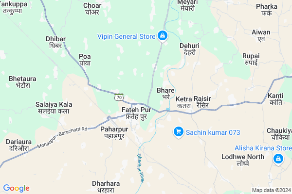
Bagodar Map
EDIT Map
Add Your House
 ..
..
Current Corona Virus Infected Patients Count in Gaya District
| City Name | District Name | Total Covid cases |
|---|---|---|
| Gaya District | Gaya | 6 |
Locality Name :
Bagodar
( बगोदर )
Block Name : Fatehpur
District : Gaya
State : Bihar
Division : Magadh
Language : Maithili and Hindi, Urdu, English
Current Time 10:11 AM
Date: Wednesday , Mar 12,2025 (IST)
Time zone: IST (UTC+5:30)
Elevation / Altitude: 150 meters. Above Seal level
Telephone Code / Std Code: 06322
Assembly constituency : Bodh Gaya assembly constituency
Assembly MLA : Kumar Sarvjeet
Lok Sabha constituency : Gaya parliamentary constituency
Parliament MP : Vijay Kumar
Serpanch Name :
Pin Code : 805128
Post Office Name : Tarwan
Main Village Name : Bagodar
Bagodar Live Weather
Temperature: 29.7 °C
clear sky
Humidity: 12%
Wind : 4.48 mt/sec towards W
StationName : "Bodh Gaya"
observed on 4 Mins Back
Temperature: 29.7 °C
clear sky
Humidity: 12%
Wind : 4.48 mt/sec towards W
StationName : "Bodh Gaya"
observed on 4 Mins Back
Bagodar Weather Forecast for Next 5 days
13-03-2025
22.8°C to 38.0°C
clear sky
22.8°C to 38.0°C
clear sky
14-03-2025
22.0°C to 39.3°C
clear sky
22.0°C to 39.3°C
clear sky
15-03-2025
23.0°C to 40.5°C
clear sky
23.0°C to 40.5°C
clear sky
16-03-2025
22.8°C to 41.2°C
clear sky, scattered clouds
22.8°C to 41.2°C
clear sky, scattered clouds
17-03-2025
24.2°C to 42.0°C
broken clouds, overcast clouds
24.2°C to 42.0°C
broken clouds, overcast clouds
Edit below overview about Bagodar
Edit below overview about Bagodar
OverView of Bagodar
I belong to this village. My father was born and brought up here, so my roots are from this village.Intitially this place was totally backward. But with Nitish Kumar as the CM, I have seen the place develop by leaps and bound. You now have a proper road right upto the village. Previously you had to walk 2-3 kms from the main road just to reach the village. There is electricity now in almost every home. But the best part is the percolation on education among the girls. I believe almost every girl of the village goes to school now. I wish the development continues and brings joy to the people of this sweet village.Edit below overview about Bagodar
National Highways Reachable To Bagodar
Nationa High Way :NH19
Nationa High Way :NH22
Nationa High Way :NH19
Nationa High Way :NH22
Rivers Near Bagodar
Sakri
Morhar
Sakri
Morhar
About Bagodar
Bagodar is a small Village/hamlet in Fatehpur Block in Gaya District of Bihar State, India. It comes under Bagodar Panchayath. It belongs to Magadh Division . It is located 34 KM towards East from District head quarters Gaya. 127 KM from State capital Patna
Bagodar Pin code is 805128 and postal head office is Tarwan .
Bagodar is surrounded by Tankuppa Block towards west , Wazirganj Block towards North , Mescaur Block towards North , Mohanpur Block towards west .
Bodh Gaya , Gaya , Hisua , Jhumri Tilaiya are the near by Cities to Bagodar.
This Place is in the border of the Gaya District and Nawada District. Nawada District Sirdala is East towards this place .
Bagodar 2011 Census Details
Bagodar Local Language is Maithili. Bagodar Village Total population is 1363 and number of houses are 220. Female Population is 48.1%. Village literacy rate is 61.9% and the Female Literacy rate is 24.4%.
Population
| Census Parameter | Census Data |
| Total Population | 1363 |
| Total No of Houses | 220 |
| Female Population % | 48.1 % ( 656) |
| Total Literacy rate % | 61.9 % ( 844) |
| Female Literacy rate | 24.4 % ( 333) |
| Scheduled Tribes Population % | 0.0 % ( 0) |
| Scheduled Caste Population % | 1.5 % ( 21) |
| Working Population % | 53.9 % |
| Child(0 -6) Population by 2011 | 207 |
| Girl Child(0 -6) Population % by 2011 | 48.3 % ( 100) |
Bagodar Census More Deatils.
Politics in Bagodar
LJP , BJP , Janata Dal (United) , RJD are the major political parties in this area.Polling Stations /Booths near Bagodar
1)Utkramit Madhya Vidyalay Aivo2)Prathamik Vidyalay Dhibar (south Part)
3)Madhya Vidhyalay Raisir
4)Madhya Vidyalay Fatehapur Da0 Bhag
5)Sanskrit High School Manikapur
HOW TO REACH Bagodar
By Rail
Paharpur Rail Way Station , Bansinala Halt Rail Way Station are the very nearby railway stations to Bagodar. Gaya Junction Rail Way Station (near to Gaya) , Shaheed Ishwar Chowdhary Halt Rail Way Station (near to Gaya) are the Rail way stations reachable from near by towns.By Road
Gaya are the nearby by towns to Bagodar having road connectivity to BagodarColleges near Bagodar
Sanjay Gandhi Inter College
Address :
B.n.s.college Shobh
Address :
Upendarnath Inter Collage
Address :
Madrasa.nurulislamia.alawalpur
Address :
M G Khan College Tilora(gaya)
Address :
Schools in Bagodar
M.s.bagodar
Address : bagodar , fatehpur , gaya , Bihar . PIN- 805128 , Post - Tarwan
Govt Health Centers near Bagodar
1) Gamhari , 0 , 0 , 02) Nagwa , 0 , 0 , 0
3) Shila Pathara , , ,
Hospitals in Bagodar,Fatehpur
Mehi Maharsi Aqupesor & Homio Pathik Chitiksak
SH 70; Fatehpur; Bihar 824232; India
1.1 KM distance Detail
Primary Health Centre Fatehpur
Bihar State Highway 70; Fatehpur; Bihar 824232; India
1.3 KM distance Detail
more ..
Petrol Bunks in Bagodar,Fatehpur
HP PETROL PUMP - CHANDAN FUEL STATION
Mauza -raghopur; P.S.- Fatehpur Thana NO. 502; DSR &; Patna; Bihar 824232; India
5.2 KM distance Detail
more ..
Colleges in Bagodar,Fatehpur
Kunti Mahadev Çharitable Trust
Near Smp College; Paharpur Station; Fatehpur; Bihar 212601; India
3.6 KM distance Detail
more ..
Schools in Bagodar,Fatehpur
gauri Kanya Middle School
w n 40; GAYA International Airport; Gaya; Bihar; India
0.6 KM distance Detail
About Bagodar &
History
How to reach Bagodar
Tourist Places Near By Bagodar
Schools in Bagodar
Colleges in Bagodar
Temperature & weather of Bagodar
places in Bagodar
Bagodar photos
More Information
How to reach Bagodar
Tourist Places Near By Bagodar
Schools in Bagodar
Colleges in Bagodar
Temperature & weather of Bagodar
places in Bagodar
Bagodar photos
More Information
Village Talk
Post News or Events about this Village
Near Cities
Bodh Gaya 27 KM near
Gaya 31 KM near
Hisua 32 KM near
Jhumri Tilaiya 41 KM near
Bodh Gaya 27 KM near
Gaya 31 KM near
Hisua 32 KM near
Jhumri Tilaiya 41 KM near
Near By Taluks
Fatehpur 0 KM near
Tankuppa 11 KM near
Wazirganj 18 KM near
Mescaur 19 KM near
Fatehpur 0 KM near
Tankuppa 11 KM near
Wazirganj 18 KM near
Mescaur 19 KM near
Near By Air Ports
Gaya Airport 34 KM near
Patna Airport 119 KM near
Ranchi Airport 164 KM near
Varanasi Airport 286 KM near
Gaya Airport 34 KM near
Patna Airport 119 KM near
Ranchi Airport 164 KM near
Varanasi Airport 286 KM near
Near By Tourist Places
Bodh Gaya 28 KM near
Koderma 42 KM near
Jhumri telaiya 43 KM near
Kakolat 45 KM near
Chatra 67 KM near
Bodh Gaya 28 KM near
Koderma 42 KM near
Jhumri telaiya 43 KM near
Kakolat 45 KM near
Chatra 67 KM near
Near By Districts
Gaya 33 KM near
Nawada 45 KM near
Koderma 46 KM near
Chatra 67 KM near
Gaya 33 KM near
Nawada 45 KM near
Koderma 46 KM near
Chatra 67 KM near
Near By RailWay Station
Paharpur Rail Way Station 3.5 KM near
Bansinala Halt Rail Way Station 8.7 KM near
Gaya Junction Rail Way Station 33 KM near
Paharpur Rail Way Station 3.5 KM near
Bansinala Halt Rail Way Station 8.7 KM near
Gaya Junction Rail Way Station 33 KM near