| Home | City Bus | Maps | Villages | Cities | Rail | Tourist Places | School | College | Pin Codes | Corona Cases Count |
| Distance Calculator Bus Services IFSC Codes Trace Mobile Number Weather Search Place Trace IP Available Cash ATM/Banks Locate Polling Booth Report an Error contact People |
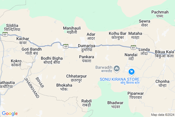
Piprahi Map
EDIT Map
Add Your House
 ..
..
Current Corona Virus Infected Patients Count in Gaya District
| City Name | District Name | Total Covid cases |
|---|---|---|
| Gaya District | Gaya | 6 |
Locality Name :
Piprahi
( पिपराही )
Block Name : Dumaria
District : Gaya
State : Bihar
Division : Magadh
Language : Maithili and Hindi, Urdu, English
Current Time 12:09 PM
Date: Sunday , Apr 27,2025 (IST)
Time zone: IST (UTC+5:30)
Elevation / Altitude: 93 meters. Above Seal level
Telephone Code / Std Code: 06331
Assembly constituency : Imamganj assembly constituency
Assembly MLA : Jitan Ram Manjhi
Lok Sabha constituency : Aurangabad parliamentary constituency
Parliament MP : SUSHIL KUMAR SINGH
Serpanch Name :
Main Village Name : Piprahi
Commodities Prices : Gadhwah Market / Mandi
Piprahi Live Weather
Temperature: 39.5 °C
overcast clouds
Humidity: 14%
Wind : 5.47 mt/sec towards SW
StationName : "Nabīnagar"
observed on Now
Temperature: 39.5 °C
overcast clouds
Humidity: 14%
Wind : 5.47 mt/sec towards SW
StationName : "Nabīnagar"
observed on Now
Piprahi Weather Forecast for Next 5 days
28-04-2025
26.2°C to 39.4°C
broken clouds, light rain, overcast clouds
26.2°C to 39.4°C
broken clouds, light rain, overcast clouds
29-04-2025
24.9°C to 41.0°C
overcast clouds, broken clouds, scattered clouds, light rain
24.9°C to 41.0°C
overcast clouds, broken clouds, scattered clouds, light rain
30-04-2025
25.3°C to 40.9°C
broken clouds, overcast clouds, scattered clouds, clear sky, few clouds
25.3°C to 40.9°C
broken clouds, overcast clouds, scattered clouds, clear sky, few clouds
01-05-2025
23.8°C to 41.9°C
clear sky, scattered clouds, few clouds
23.8°C to 41.9°C
clear sky, scattered clouds, few clouds
02-05-2025
24.8°C to 38.8°C
clear sky, light rain, scattered clouds, broken clouds
24.8°C to 38.8°C
clear sky, light rain, scattered clouds, broken clouds
Rivers Near Piprahi
North Koel River
Morhar
North Koel River
Morhar
About Piprahi
Correct below Info and add more info about PiprahiPiprahi is a small Village/hamlet in Dumaria Block in Gaya District of Bihar State, India. It comes under Piprahi Panchayath. It belongs to Magadh Division . It is located 84 KM towards west from District head quarters Gaya. 176 KM from State capital Patna
Piprahi is surrounded by Imamganj Block towards East , Hariharganj Block towards west , Chhatarpur Block towards west , Deo Block towards North .
Aurangabad , Hussainabad , Sherghati , Rafiganj are the near by Cities to Piprahi.
Demographics of Piprahi
Maithili is the Local Language here.Politics in Piprahi
JD(U) , Bharatiya Janata Party , BJP , RJD , HAM(S) , INC are the major political parties in this area.Polling Stations /Booths near Piprahi
1)Madhya Vidyalay Ganasa2)Prathamik Vidyalay Bishunapur
3)Madhya Vidyalay Banshi
4)Prathamik Vidyalay Pipara
5)Prathamik Vidyalay Bhidaha
HOW TO REACH Piprahi
By Rail
There is no railway station near to Piprahi in less than 10 km. are the Rail way stations reachable from near by towns.By Road
Sherghati are the nearby by towns to Piprahi having road connectivity to PiprahiPincodes near Piprahi
824206 ( Imamganj ) , 824202 ( Deo ) , 824210 ( Raniganj (Gaya) )Colleges near Piprahi
Sanjay Gandhi Inter College
Address :
B.n.s.college Shobh
Address :
Upendarnath Inter Collage
Address :
Madrasa.nurulislamia.alawalpur
Address :
M G Khan College Tilora(gaya)
Address :
Schools near Piprahi
P-s. Pathra
Address : pathra , dumaria , gaya , Bihar . PIN- 824206 , Post - Imamganj
P.s. Maunbar
Address : maun baar , dumaria , gaya , Bihar . PIN- 824206 , Post - Imamganj
P.s. Mahulniya
Address : mahulniya , dumaria , gaya , Bihar . PIN- 824206 , Post - Imamganj
P.s. Hesrampur
Address : rampur , dumaria , gaya , Bihar . PIN- 824206 , Post - Imamganj
Govt Health Centers near Piprahi
1) Kothi , , ,2) Malhariya , HSC Malhariya , Malhariya ,
3) Dibra Dhani , Health Sub Centre Dibra Dhani , Dibra Dhani , Rural
Hospitals in Piprahi,Dumaria
Verma sewa sadan; Dr.S.P.Verma & Dr. Prabha Verma
Cinema Hall Rd; Hariharganj; Jharkhand 822131; India
20.3 KM distance Detail
more ..
Petrol Bunks in Piprahi,Dumaria
HP PETROL PUMP - MANOJ SERVICE STATION IMAMGANJ HP
HP Petrol Pump Post- Imamganj Bihar; Patna; Bihar 824206; India
21.8 KM distance Detail
more ..
Colleges in Piprahi,Dumaria
Lovely Professional University Study Centre
National Highway 98; Hariharganj; Jharkhand 822131; India
20.7 KM distance Detail
more ..
Schools in Piprahi,Dumaria
P. School Mandar
824206; Kali Mandir - Bihar School Rd; Kiriburu; Jharkhand 833222; India
6.6 KM distance Detail
Electronic Shops in Piprahi,Dumaria
Guddu Mobile $ Tent House
Deo - Bishanpur - Dumari Rd; Baluganj Barandi; Bihar 824218; India
19.8 KM distance Detail
Super Markets in Piprahi,Dumaria
Anjali Shringar Store
औरंगाबाद - राजहरा - डाल्टेनगंज रोड; Hariharganj; Jharkhand 822131; India
20.4 KM distance Detail
Police Stations near Piprahi,Dumaria
Hariharganj Police Station
National Highway 98; Hariharganj; Jharkhand 822131; India
21.0 KM distance Detail
police barrek
National Highway 98; Satganwan alias Hariharganj; Bihar 822131; India
21.2 KM distance Detail
Governement Offices near Piprahi,Dumaria
Imamganj Agriculture Devlopment Office
824206; Manatu Imamganj Main Rd; Jamuna; Bihar 824206; India
20.4 KM distance Detail
Block Cum Circle Office
Hariharganj; Palamu; NH-98; Aurangabad Road; Chhatarpur; Chhatarpur; Jharkhand 822131; India
21.5 KM distance Detail
About Piprahi &
History
How to reach Piprahi
Tourist Places Near By Piprahi
Schools in Piprahi
Colleges in Piprahi
Temperature & weather of Piprahi
places in Piprahi
Piprahi photos
More Information
How to reach Piprahi
Tourist Places Near By Piprahi
Schools in Piprahi
Colleges in Piprahi
Temperature & weather of Piprahi
places in Piprahi
Piprahi photos
More Information
Village Talk
Post News or Events about this Village
Near Cities
Aurangabad 39 KM near
Hussainabad 41 KM near
Sherghati 46 KM near
Rafiganj 54 KM near
Aurangabad 39 KM near
Hussainabad 41 KM near
Sherghati 46 KM near
Rafiganj 54 KM near
Near By Taluks
Dumaria 0 KM near
Imamganj 17 KM near
Hariharganj 20 KM near
Chhatarpur 21 KM near
Dumaria 0 KM near
Imamganj 17 KM near
Hariharganj 20 KM near
Chhatarpur 21 KM near
Near By Air Ports
Gaya Airport 73 KM near
Patna Airport 164 KM near
Ranchi Airport 173 KM near
Varanasi Airport 215 KM near
Gaya Airport 73 KM near
Patna Airport 164 KM near
Ranchi Airport 173 KM near
Varanasi Airport 215 KM near
Near By Tourist Places
Rohtasgarh Fort 59 KM near
Chatra 60 KM near
Palamu 64 KM near
Betla National Park 71 KM near
Bodh Gaya 74 KM near
Rohtasgarh Fort 59 KM near
Chatra 60 KM near
Palamu 64 KM near
Betla National Park 71 KM near
Bodh Gaya 74 KM near
Near By Districts
Aurangabad 40 KM near
Chatra 60 KM near
Palamu 61 KM near
Garhwa 74 KM near
Aurangabad 40 KM near
Chatra 60 KM near
Palamu 61 KM near
Garhwa 74 KM near
Near By RailWay Station
Nabinagar Road Rail Way Station 44 KM near
Japla Rail Way Station 47 KM near
Nabinagar Road Rail Way Station 44 KM near
Japla Rail Way Station 47 KM near