| Home | City Bus | Maps | Villages | Cities | Rail | Tourist Places | School | College | Pin Codes | Corona Cases Count |
| Distance Calculator Bus Services IFSC Codes Trace Mobile Number Weather Search Place Trace IP Available Cash ATM/Banks Locate Polling Booth Report an Error contact People |
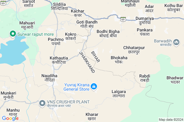
Bhangia Map
EDIT Map
Add Your House
 ..
..
Current Corona Virus Infected Patients Count in Gaya District
| City Name | District Name | Total Covid cases |
|---|---|---|
| Gaya District | Gaya | 6 |
Locality Name :
Bhangia
( भंगिआ )
Block Name : Dumaria
District : Gaya
State : Bihar
Division : Magadh
Language : Maithili and Hindi, Urdu, English
Current Time 09:42 AM
Date: Wednesday , Apr 30,2025 (IST)
Time zone: IST (UTC+5:30)
Elevation / Altitude: 93 meters. Above Seal level
Telephone Code / Std Code: 06331
Assembly constituency : Imamganj assembly constituency
Assembly MLA : Jitan Ram Manjhi
Lok Sabha constituency : Aurangabad parliamentary constituency
Parliament MP : SUSHIL KUMAR SINGH
Serpanch Name :
Pin Code : 824206
Post Office Name : Imamganj
Commodities Prices : Gadhwah Market / Mandi
Bhangia Live Weather
Temperature: 31.4 °C
clear sky
Humidity: 34%
Wind : 2.45 mt/sec towards E
StationName : "Nabīnagar"
observed on 13 Mins Back
Temperature: 31.4 °C
clear sky
Humidity: 34%
Wind : 2.45 mt/sec towards E
StationName : "Nabīnagar"
observed on 13 Mins Back
Bhangia Weather Forecast for Next 5 days
01-05-2025
27.4°C to 37.5°C
clear sky
27.4°C to 37.5°C
clear sky
02-05-2025
25.5°C to 39.3°C
clear sky, few clouds, light rain, overcast clouds
25.5°C to 39.3°C
clear sky, few clouds, light rain, overcast clouds
03-05-2025
24.2°C to 39.5°C
broken clouds, clear sky, light rain, overcast clouds
24.2°C to 39.5°C
broken clouds, clear sky, light rain, overcast clouds
04-05-2025
27.1°C to 40.9°C
broken clouds, scattered clouds, light rain, clear sky
27.1°C to 40.9°C
broken clouds, scattered clouds, light rain, clear sky
05-05-2025
26.2°C to 41.8°C
light rain, clear sky, scattered clouds, broken clouds
26.2°C to 41.8°C
light rain, clear sky, scattered clouds, broken clouds
Rivers Near Bhangia
North Koel River
Morhar
North Koel River
Morhar
About Bhangia
Correct below Info and add more info about BhangiaBhangia is a Village in Dumaria Block in Gaya District of Bihar State, India. It belongs to Magadh Division . It is located 91 KM towards west from District head quarters Gaya. 7 KM from Dumaria. 182 KM from State capital Patna
Bhangia Pin code is 824206 and postal head office is Imamganj .
Mahuri ( 5 KM ) , Kachar ( 6 KM ) , Pankara ( 7 KM ) , Dumaria ( 8 KM ) , Salaiya ( 9 KM ) are the nearby Villages to Bhangia. Bhangia is surrounded by Chhatarpur Block towards west , Hariharganj Block towards west , Imamganj Block towards East , Deo Block towards North .
Hussainabad , Aurangabad , Daltonganj , Sherghati are the near by Cities to Bhangia.
Bhangia 2011 Census Details
Bhangia Local Language is Maithili. Bhangia Village Total population is 1942 and number of houses are 361. Female Population is 50.6%. Village literacy rate is 46.7% and the Female Literacy rate is 18.7%.
Population
| Census Parameter | Census Data |
| Total Population | 1942 |
| Total No of Houses | 361 |
| Female Population % | 50.6 % ( 983) |
| Total Literacy rate % | 46.7 % ( 906) |
| Female Literacy rate | 18.7 % ( 363) |
| Scheduled Tribes Population % | 0.0 % ( 0) |
| Scheduled Caste Population % | 14.7 % ( 285) |
| Working Population % | 30.9 % |
| Child(0 -6) Population by 2011 | 433 |
| Girl Child(0 -6) Population % by 2011 | 45.0 % ( 195) |
Bhangia Census More Deatils.
Politics in Bhangia
JD(U) , Bharatiya Janata Party , BJP , RJD , HAM(S) , INC are the major political parties in this area.Polling Stations /Booths near Bhangia
1)Madhya Vidyalay Baseta2)Prathamik Vidyalay Haranakel
3)Prathamik Vidhalay Chapari(daya Bhag)
4)Angalabadi Kendra Bedauli
5)Madhya Vidyalay Kendua
HOW TO REACH Bhangia
By Rail
There is no railway station near to Bhangia in less than 10 km. are the Rail way stations reachable from near by towns.By Road
Sherghati are the nearby by towns to Bhangia having road connectivity to BhangiaColleges near Bhangia
Sanjay Gandhi Inter College
Address :
B.n.s.college Shobh
Address :
Upendarnath Inter Collage
Address :
Madrasa.nurulislamia.alawalpur
Address :
M G Khan College Tilora(gaya)
Address :
Schools in Bhangia
M.s.bhangia
Address : bhangia , dumaria , gaya , Bihar . PIN- 824206 , Post - Imamganj
Govt Health Centers near Bhangia
1) Kothi , , ,2) Dibra Dhani , Health Sub Centre Dibra Dhani , Dibra Dhani , Rural
3) Malhariya , HSC Malhariya , Malhariya ,
Hospitals in Bhangia,Dumaria
Community Health Center
Hariharganj; Palamu; NH-98; Aurangabad Road; Chhatarpur; Chhatarpur; Jharkhand 824119; India
19.8 KM distance Detail
प्रजापति भवन;युवा नेता संतोष प्रजापति (आजसू पार्टी)
Hariharganj; Jharkhand 822131; India
19.8 KM distance Detail
Jaundice Hospital
Hariharganj; Palamu; NH-98; Aurangabad Road; Chhatarpur; Chhatarpur; Jharkhand 824119; India
19.9 KM distance Detail
more ..
Colleges in Bhangia,Dumaria
Lovely Professional University Study Centre
National Highway 98; Hariharganj; Jharkhand 822131; India
20.5 KM distance Detail
more ..
Schools in Bhangia,Dumaria
P. School Mandar
824206; Kali Mandir - Bihar School Rd; Kiriburu; Jharkhand 833222; India
14.5 KM distance Detail
Moti Raj Inter Mahila College Hariharganj
Ararua Khurd; Jharkhand 822131; India
19.8 KM distance Detail
Electronic Shops in Bhangia,Dumaria
Munna Electric And Electronic
Cinema Hall Rd; Hariharganj; Jharkhand 822131; India
20.3 KM distance Detail
Super Markets in Bhangia,Dumaria
Anjali Shringar Store
औरंगाबाद - राजहरा - डाल्टेनगंज रोड; Hariharganj; Jharkhand 822131; India
19.8 KM distance Detail
Local Parks in Bhangia,Dumaria
Police Stations near Bhangia,Dumaria
Hariharganj Police Station
National Highway 98; Hariharganj; Jharkhand 822131; India
20.9 KM distance Detail
police barrek
National Highway 98; Satganwan alias Hariharganj; Bihar 822131; India
21.0 KM distance Detail
Governement Offices near Bhangia,Dumaria
Block Cum Circle Office
Hariharganj; Palamu; NH-98; Aurangabad Road; Chhatarpur; Chhatarpur; Jharkhand 822131; India
21.4 KM distance Detail
About Bhangia &
History
How to reach Bhangia
Tourist Places Near By Bhangia
Schools in Bhangia
Colleges in Bhangia
Temperature & weather of Bhangia
places in Bhangia
Bhangia photos
More Information
How to reach Bhangia
Tourist Places Near By Bhangia
Schools in Bhangia
Colleges in Bhangia
Temperature & weather of Bhangia
places in Bhangia
Bhangia photos
More Information
Village Talk
Post News or Events about this Village
Near Cities
Hussainabad 38 KM near
Aurangabad 43 KM near
Daltonganj 49 KM near
Sherghati 54 KM near
Hussainabad 38 KM near
Aurangabad 43 KM near
Daltonganj 49 KM near
Sherghati 54 KM near
Near By Taluks
Dumaria 7 KM near
Chhatarpur 14 KM near
Hariharganj 15 KM near
Imamganj 24 KM near
Dumaria 7 KM near
Chhatarpur 14 KM near
Hariharganj 15 KM near
Imamganj 24 KM near
Near By Air Ports
Gaya Airport 81 KM near
Patna Airport 171 KM near
Ranchi Airport 175 KM near
Varanasi Airport 212 KM near
Gaya Airport 81 KM near
Patna Airport 171 KM near
Ranchi Airport 175 KM near
Varanasi Airport 212 KM near
Near By Tourist Places
Rohtasgarh Fort 55 KM near
Palamu 60 KM near
Chatra 65 KM near
Betla National Park 66 KM near
Sasaram 77 KM near
Rohtasgarh Fort 55 KM near
Palamu 60 KM near
Chatra 65 KM near
Betla National Park 66 KM near
Sasaram 77 KM near
Near By Districts
Aurangabad 44 KM near
Palamu 54 KM near
Chatra 65 KM near
Garhwa 67 KM near
Aurangabad 44 KM near
Palamu 54 KM near
Chatra 65 KM near
Garhwa 67 KM near
Near By RailWay Station
Japla Rail Way Station 41 KM near
Nabinagar Road Rail Way Station 42 KM near
Japla Rail Way Station 41 KM near
Nabinagar Road Rail Way Station 42 KM near