| Home | City Bus | Maps | Villages | Cities | Rail | Tourist Places | School | College | Pin Codes | Corona Cases Count |
| Distance Calculator Bus Services IFSC Codes Trace Mobile Number Weather Search Place Trace IP Available Cash ATM/Banks Locate Polling Booth Report an Error contact People |
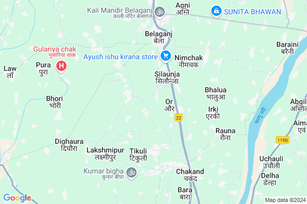
Ramanand Bigha Map
EDIT Map
Add Your House
 ..
..
Current Corona Virus Infected Patients Count in Gaya District
| City Name | District Name | Total Covid cases |
|---|---|---|
| Gaya District | Gaya | 6 |
Locality Name :
Ramanand Bigha
( रामानंद बीघा )
Block Name : Belaganj
District : Gaya
State : Bihar
Division : Magadh
Language : Maithili and Hindi, Urdu, English
Current Time 12:46 PM
Date: Tuesday , Apr 29,2025 (IST)
Time zone: IST (UTC+5:30)
Elevation / Altitude: 92 meters. Above Seal level
Telephone Code / Std Code: 0631
Assembly constituency : Belaganj assembly constituency
Assembly MLA : Surendra Prasad Yadav
Lok Sabha constituency : Gaya parliamentary constituency
Parliament MP : Vijay Kumar
Serpanch Name :
Pin Code : 804403
Post Office Name : Belaganj
Main Village Name : Ramanand bigha
Ramanand Bigha Live Weather
Temperature: 30.1 °C
haze
Humidity: 51%
Wind : 3.6 mt/sec towards E
StationName : "Gaya"
observed on 59 Mins Back
Temperature: 30.1 °C
haze
Humidity: 51%
Wind : 3.6 mt/sec towards E
StationName : "Gaya"
observed on 59 Mins Back
Ramanand Bigha Weather Forecast for Next 5 days
30-04-2025
27.1°C to 34.1°C
broken clouds, scattered clouds, clear sky
27.1°C to 34.1°C
broken clouds, scattered clouds, clear sky
01-05-2025
25.8°C to 39.7°C
few clouds, clear sky, light rain
25.8°C to 39.7°C
few clouds, clear sky, light rain
02-05-2025
26.4°C to 39.8°C
clear sky, scattered clouds, overcast clouds, broken clouds
26.4°C to 39.8°C
clear sky, scattered clouds, overcast clouds, broken clouds
03-05-2025
26.1°C to 39.2°C
broken clouds, few clouds, scattered clouds, clear sky, overcast clouds
26.1°C to 39.2°C
broken clouds, few clouds, scattered clouds, clear sky, overcast clouds
04-05-2025
28.8°C to 40.9°C
overcast clouds, few clouds, broken clouds, scattered clouds, light rain
28.8°C to 40.9°C
overcast clouds, few clouds, broken clouds, scattered clouds, light rain
National Highways Reachable To Ramanand Bigha
Nationa High Way :NH20
Nationa High Way :NH22
Nationa High Way :NH20
Nationa High Way :NH22
Rivers Near Ramanand Bigha
Phalgu :फल्गु
Dardha
Phalgu :फल्गु
Dardha
About Ramanand Bigha
Correct below Info and add more info about Ramanand BighaRamanand Bigha is a small Village/hamlet in Belaganj Block in Gaya District of Bihar State, India. It comes under Ramanand bigha Panchayath. It belongs to Magadh Division . It is located 17 KM towards North from District head quarters Gaya. 5 KM from Belaganj. 90 KM from State capital Patna
Ramanand Bigha Pin code is 804403 and postal head office is Belaganj .
Singhaul ( 4 KM ) , Bhalua-i ( 4 KM ) , Chakand ( 5 KM ) , Rauna ( 6 KM ) , Belhari ( 6 KM ) are the nearby Villages to Ramanand Bigha. Ramanand Bigha is surrounded by Tekari Block towards west , Gaya Block towards South , Manpur Block towards South , Khizarsarai Block towards East .
Makhdumpur , Gaya , Bodh Gaya , Jehanabad are the near by Cities to Ramanand Bigha.
This Place is in the border of the Gaya District and Jehanabad District. Jehanabad District Makhdumpur is North towards this place . Also it is in the Border of other district Arwal .
Ramanand Bigha 2011 Census Details
Ramanand Bigha Local Language is Maithili. Ramanand Bigha Village Total population is 988 and number of houses are 156. Female Population is 47.9%. Village literacy rate is 54.8% and the Female Literacy rate is 22.9%.
Population
| Census Parameter | Census Data |
| Total Population | 988 |
| Total No of Houses | 156 |
| Female Population % | 47.9 % ( 473) |
| Total Literacy rate % | 54.8 % ( 541) |
| Female Literacy rate | 22.9 % ( 226) |
| Scheduled Tribes Population % | 0.0 % ( 0) |
| Scheduled Caste Population % | 35.3 % ( 349) |
| Working Population % | 34.7 % |
| Child(0 -6) Population by 2011 | 174 |
| Girl Child(0 -6) Population % by 2011 | 54.0 % ( 94) |
Ramanand Bigha Census More Deatils.
Politics in Ramanand Bigha
JD(U) , BJP , Janata Dal (United) , RJD , HAM(S) are the major political parties in this area.Polling Stations /Booths near Ramanand Bigha
1)Utkramit Madhya Vidyalay Beldar Bigha2)Prathamik Vidyalay Kaladaspur
3)Utkramit Madhya Vidyalay Bhindaspur
4)Utkramit Madhya Vidyalay Raili
5)Samudayik Vikas Bhavan Neuri
HOW TO REACH Ramanand Bigha
By Rail
Ore Halt Rail Way Station , Neyamatpur Rail Way Station are the very nearby railway stations to Ramanand Bigha. Gaya Junction Rail Way Station (near to Gaya) , Shaheed Ishwar Chowdhary Halt Rail Way Station (near to Gaya) are the Rail way stations reachable from near by towns.By Road
Gaya are the nearby by towns to Ramanand Bigha having road connectivity to Ramanand BighaColleges near Ramanand Bigha
Madrasa.nurulislamia.alawalpur
Address :
Schools in Ramanand Bigha
P.s.ramanand Bigha
Address : ramanand bigha , belaganj , gaya , Bihar . PIN- 804403 , Post - Belaganj
Govt Health Centers near Ramanand Bigha
1) Aor , , ,2) Kachnawa , , ,
3) Bhindaspur , , ,
Petrol Bunks in Ramanand Bigha,Belaganj
Bharat Petroleum
Shekhpura Nehalpur; Gaya; NH-83; Patna Gaya Road; Gaya; Gaya; Bihar 804403; India
1.8 KM distance Detail
Indian Oil Petrol Pump
Belaganj; Gaya; NH-83; Patna Gaya Road; Gaya; Gaya; Bihar 804403; India
4.6 KM distance Detail
more ..
Colleges in Ramanand Bigha,Belaganj
mahabodhi college
Sekhpura Khurd Main Rd; Shekhpura Nehalpur; Bihar 804403; India
1.7 KM distance Detail
Vinayaka Vidyaapeeth College
Chakand; Gaya; NH-83; Patna Gaya Road; Gaya; Gaya; Bihar 804404; India
2.5 KM distance Detail
more ..
Schools in Ramanand Bigha,Belaganj
Gyan Bharti Global School
Belaganj; Gaya; Ramanand Bigha; Bihar 804403; India
0.3 KM distance Detail
Super Markets in Ramanand Bigha,Belaganj
maa laxmi general store(lala babu) fatehpur
Patna - Gaya Rd; Murgawan; Bihar 804404; India
2.1 KM distance Detail
Police Stations near Ramanand Bigha,Belaganj
PANCHANPUR OUT POST
Panchanpur Daudnagar Road; Panchanpur;; Bihar 824236; India
13.4 KM distance Detail
About Ramanand Bigha &
History
How to reach Ramanand Bigha
Tourist Places Near By Ramanand Bigha
Schools in Ramanand Bigha
Colleges in Ramanand Bigha
Temperature & weather of Ramanand Bigha
places in Ramanand Bigha
Ramanand Bigha photos
More Information
How to reach Ramanand Bigha
Tourist Places Near By Ramanand Bigha
Schools in Ramanand Bigha
Colleges in Ramanand Bigha
Temperature & weather of Ramanand Bigha
places in Ramanand Bigha
Ramanand Bigha photos
More Information
Village Talk
Post News or Events about this Village
Near Cities
Makhdumpur 17 KM near
Gaya 19 KM near
Bodh Gaya 29 KM near
Jehanabad 34 KM near
Makhdumpur 17 KM near
Gaya 19 KM near
Bodh Gaya 29 KM near
Jehanabad 34 KM near
Near By Taluks
Belaganj 5 KM near
Tekari 13 KM near
Gaya 17 KM near
Khizarsarai 17 KM near
Belaganj 5 KM near
Tekari 13 KM near
Gaya 17 KM near
Khizarsarai 17 KM near
Near By Air Ports
Gaya Airport 22 KM near
Patna Airport 83 KM near
Ranchi Airport 204 KM near
Varanasi Airport 247 KM near
Gaya Airport 22 KM near
Patna Airport 83 KM near
Ranchi Airport 204 KM near
Varanasi Airport 247 KM near
Near By Tourist Places
Bodh Gaya 28 KM near
Kakolat 63 KM near
Bihar Sharif 70 KM near
Nalanda 71 KM near
Agam Kuan 87 KM near
Bodh Gaya 28 KM near
Kakolat 63 KM near
Bihar Sharif 70 KM near
Nalanda 71 KM near
Agam Kuan 87 KM near
Near By Districts
Gaya 17 KM near
Jehanabad 34 KM near
Arwal 52 KM near
Nawada 64 KM near
Gaya 17 KM near
Jehanabad 34 KM near
Arwal 52 KM near
Nawada 64 KM near
Near By RailWay Station
Ore Halt Rail Way Station 2.5 KM near
Neyamatpur Rail Way Station 2.9 KM near
Chakand Rail Way Station 6.0 KM near
Gaya Junction Rail Way Station 16 KM near
Makhdumpur Gaya Rail Way Station 18 KM near
Ore Halt Rail Way Station 2.5 KM near
Neyamatpur Rail Way Station 2.9 KM near
Chakand Rail Way Station 6.0 KM near
Gaya Junction Rail Way Station 16 KM near
Makhdumpur Gaya Rail Way Station 18 KM near