| Home | City Bus | Maps | Villages | Cities | Rail | Tourist Places | School | College | Pin Codes | Corona Cases Count |
| Distance Calculator Bus Services IFSC Codes Trace Mobile Number Weather Search Place Trace IP Available Cash ATM/Banks Locate Polling Booth Report an Error contact People |
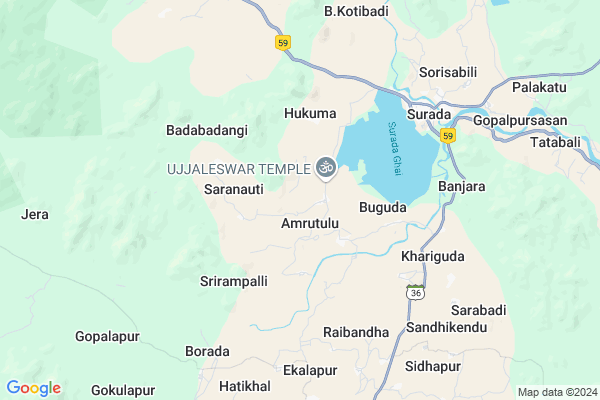
Chandrapur Map
EDIT Map
Add Your House
 ..
..
Current Corona Virus Infected Patients Count in Ganjam District
| City Name | District Name | Total Covid cases |
|---|
Locality Name :
Chandrapur
( ଚନ୍ଦ୍ରପୁର )
Tehsil Name : Surada
District : Ganjam
State : Odisha
Language : Oriya and Hindi , Telugu
Current Time 05:17 PM
Date: Wednesday , Feb 05,2025 (IST)
Time zone: IST (UTC+5:30)
Elevation / Altitude: 27 meters. Above Seal level
Telephone Code / Std Code: 06819
Assembly constituency : Surada assembly constituency
Assembly MLA : purna chandra swain
Lok Sabha constituency : Aska parliamentary constituency
Parliament MP : Pramila Bisoyi
Serpanch Name :
Commodities Prices : Bhanjanagar Market / Mandi
Chandrapur Live Weather
Temperature: 35.3 °C
broken clouds
Humidity: 22%
Wind : 4.1 mt/sec towards E
StationName : "Sorada"
observed on 1 Hours Back
Temperature: 35.3 °C
broken clouds
Humidity: 22%
Wind : 4.1 mt/sec towards E
StationName : "Sorada"
observed on 1 Hours Back
Chandrapur Weather Forecast for Next 5 days
06-02-2025
21.4°C to 33.2°C
broken clouds, overcast clouds
21.4°C to 33.2°C
broken clouds, overcast clouds
07-02-2025
20.5°C to 35.8°C
scattered clouds, few clouds, clear sky
20.5°C to 35.8°C
scattered clouds, few clouds, clear sky
08-02-2025
20.1°C to 34.9°C
clear sky, few clouds
20.1°C to 34.9°C
clear sky, few clouds
09-02-2025
19.3°C to 35.3°C
clear sky
19.3°C to 35.3°C
clear sky
10-02-2025
17.8°C to 34.9°C
clear sky
17.8°C to 34.9°C
clear sky
Rivers Near Chandrapur
River Rushikulya
River Rushikulya
About Chandrapur
Correct below Info and add more info about ChandrapurChandrapur is a small Village/hamlet in Surada Tehsil in Ganjam District of Odisha State, India. It is located 87 KM towards west from District head quarters Chhatrapur. 190 KM from State capital Bhubaneswar
Chandrapur is surrounded by Dharakote Tehsil towards East , Bellaguntha Tehsil towards East , Raikia Tehsil towards North , Aska Tehsil towards East .
Asika , Hinjilicut , Berhampur , Brahmapur are the near by Cities to Chandrapur.
Chandrapur 2011 Census Details
Chandrapur Local Language is Oriya. Chandrapur Village Total population is 179 and number of houses are 31. Female Population is 53.1%. Village literacy rate is 57.5% and the Female Literacy rate is 22.9%.
Population
| Census Parameter | Census Data |
| Total Population | 179 |
| Total No of Houses | 31 |
| Female Population % | 53.1 % ( 95) |
| Total Literacy rate % | 57.5 % ( 103) |
| Female Literacy rate | 22.9 % ( 41) |
| Scheduled Tribes Population % | 0.0 % ( 0) |
| Scheduled Caste Population % | 3.4 % ( 6) |
| Working Population % | 68.7 % |
| Child(0 -6) Population by 2011 | 23 |
| Girl Child(0 -6) Population % by 2011 | 60.9 % ( 14) |
Chandrapur Census More Deatils.
Politics in Chandrapur
BJP , BJD , INC are the major political parties in this area.Polling Stations /Booths near Chandrapur
1)K Nuagad Nups(e)2)Project U.p. School Borada
3)Hatikhal P. S.
4)Hukuma Nodal U.p.school
5)Kaithaguda P. S.
HOW TO REACH Chandrapur
By Rail
There is no railway station near to Chandrapur in less than 10 km.Pincodes near Chandrapur
761108 ( Surada ) , 761109 ( Badagada ) , 761107 ( Dharakote )Colleges near Chandrapur
Rushikulya Degree College
Address : Surada, Berhampur-760007.
Schools in Chandrapur
Chandrapur Project Ps
Address : chandrapur , surada , ganjam , Sikkim . PIN- 761109 , Post - Badagada
Govt Health Centers near Chandrapur
1) LATHIPADA SC , SUB CENTRE,LATHIPADA , , PANCHAYAT OFFICE2) GAHANGU SC , GAHANGU SUB CENTRE , MUNIGADI ,
3) BHETANAI SC , near ri office , bhetanai ,
Hospitals in Chandrapur,Surada
Community Health Center
Ganjam; NH-59; Surada Bhanjanagar Road; Sorada; Surada; Odisha 761108; India
6.2 KM distance Detail
more ..
Petrol Bunks in Chandrapur,Surada
HP PETROL PUMP - HIRA FILLING STN SURODA
AT/ P.O.: Suroda Suroda; Bhubaneshwar; Odisha 761108; India
6.0 KM distance Detail
more ..
Colleges in Chandrapur,Surada
Rushikulya Degree College
Rushikulya College CIrcle; Surada; Odisha 761107; India
6.8 KM distance Detail
more ..
Governement Offices near Chandrapur,Surada
Regional Transport Office
Ganjam; NH-59; Raipur Gopalpur Highway; Sorada; Surada; Odisha 761108; India
6.0 KM distance Detail
About Chandrapur &
History
How to reach Chandrapur
Tourist Places Near By Chandrapur
Schools in Chandrapur
Colleges in Chandrapur
Temperature & weather of Chandrapur
places in Chandrapur
Chandrapur photos
More Information
How to reach Chandrapur
Tourist Places Near By Chandrapur
Schools in Chandrapur
Colleges in Chandrapur
Temperature & weather of Chandrapur
places in Chandrapur
Chandrapur photos
More Information
Village Talk
Post News or Events about this Village
Near Cities
Asika 34 KM near
Hinjilicut 51 KM near
Berhampur 68 KM near
Brahmapur 68 KM near
Asika 34 KM near
Hinjilicut 51 KM near
Berhampur 68 KM near
Brahmapur 68 KM near
Near By Taluks
Surada 0 KM near
Dharakote 23 KM near
Bellaguntha 30 KM near
Raikia 34 KM near
Surada 0 KM near
Dharakote 23 KM near
Bellaguntha 30 KM near
Raikia 34 KM near
Near By Air Ports
Bhubaneswar Airport 179 KM near
Vishakhapatnam Airport 284 KM near
Raipur Airport 358 KM near
Rajahmundry Airport 445 KM near
Bhubaneswar Airport 179 KM near
Vishakhapatnam Airport 284 KM near
Raipur Airport 358 KM near
Rajahmundry Airport 445 KM near
Near By Tourist Places
Berhampur 70 KM near
Gopalpur 84 KM near
Phulbani 94 KM near
Chilika 101 KM near
Kalahandi 144 KM near
Berhampur 70 KM near
Gopalpur 84 KM near
Phulbani 94 KM near
Chilika 101 KM near
Kalahandi 144 KM near
Near By Districts
Gajapati 72 KM near
Ganjam 83 KM near
Nayagarh 94 KM near
Kandhamal 95 KM near
Gajapati 72 KM near
Ganjam 83 KM near
Nayagarh 94 KM near
Kandhamal 95 KM near
Near By RailWay Station
Brahmapur Rail Way Station 72 KM near
Chatrapur Rail Way Station 82 KM near
Brahmapur Rail Way Station 72 KM near
Chatrapur Rail Way Station 82 KM near