| Home | City Bus | Maps | Villages | Cities | Rail | Tourist Places | School | College | Pin Codes | Corona Cases Count |
| Distance Calculator Bus Services IFSC Codes Trace Mobile Number Weather Search Place Trace IP Available Cash ATM/Banks Locate Polling Booth Report an Error contact People |
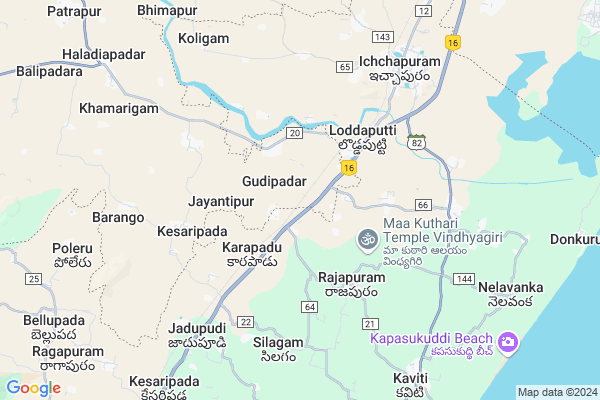
Pamagam Map
EDIT Map
Add Your House
 ..
..
Current Corona Virus Infected Patients Count in Ganjam District
| City Name | District Name | Total Covid cases |
|---|
Locality Name :
Pamagam
( ପାମଗାଁ )
Tehsil Name : Patrapur
District : Ganjam
State : Odisha
Language : Oriya and Hindi , Telugu
Current Time 12:19 PM
Date: Wednesday , Apr 30,2025 (IST)
Time zone: IST (UTC+5:30)
Elevation / Altitude: 18 meters. Above Seal level
Telephone Code / Std Code: 06814
Assembly constituency : Chikiti assembly constituency
Assembly MLA : usha devi
Lok Sabha constituency : Berhampur parliamentary constituency
Parliament MP : CHANDRA SEKHAR SAHU
Serpanch Name :
Pin Code : 761006
Post Office Name : Jayantipur
Commodities Prices : Digapahandi Market / Mandi
Rivers Near Pamagam
Mahendra Tanaya River :महेंद्र तनया नदी :ମହେନ୍ଦ୍ର ତନୟା ନଦୀ :ఎకువూరు
Bahuda
Mahendra Tanaya River :महेंद्र तनया नदी :ମହେନ୍ଦ୍ର ତନୟା ନଦୀ :ఎకువూరు
Bahuda
About Pamagam
Correct below Info and add more info about PamagamPamagam is a small Village/hamlet in Patrapur Tehsil in Ganjam District of Odisha State, India. It is located 54 KM towards west from District head quarters Chhatrapur. 18 KM from Patrapur. 213 KM from State capital Bhubaneswar
Pamagam Pin code is 761006 and postal head office is Jayantipur .
Jayantipur ( 3 KM ) , Kesaripada ( 4 KM ) , Baranga ( 7 KM ) , Samantiapalli ( 10 KM ) , Rampa ( 10 KM ) are the nearby Villages to Pamagam. Pamagam is surrounded by Kaviti Tehsil towards South , Kanchili Tehsil towards west , Chikiti Tehsil towards North , Patrapur Tehsil towards west .
Ichchapuram , Berhampur , Brahmapur , Hinjilicut are the near by Cities to Pamagam.
This Place is in the border of the Ganjam District and Srikakulam District. Srikakulam District Ichapuram is North towards this place . It is near to the Andhra Pradesh State Border. It is near to bay of bengal. There is a chance of humidity in the weather.
Pamagam 2011 Census Details
Pamagam Local Language is Oriya. Pamagam Village Total population is 401 and number of houses are 94. Female Population is 55.6%. Village literacy rate is 52.6% and the Female Literacy rate is 21.2%.
Population
| Census Parameter | Census Data |
| Total Population | 401 |
| Total No of Houses | 94 |
| Female Population % | 55.6 % ( 223) |
| Total Literacy rate % | 52.6 % ( 211) |
| Female Literacy rate | 21.2 % ( 85) |
| Scheduled Tribes Population % | 0.2 % ( 1) |
| Scheduled Caste Population % | 48.1 % ( 193) |
| Working Population % | 54.1 % |
| Child(0 -6) Population by 2011 | 43 |
| Girl Child(0 -6) Population % by 2011 | 46.5 % ( 20) |
Pamagam Census More Deatils.
Politics in Pamagam
BJD is the major political party in this area.Polling Stations /Booths near Pamagam
1)Bomeki Ps2)Jayantipur Hs (e)
3)Banasola Pups
4)Baranga Ups (e)
5)Tootipur Ps(e)
HOW TO REACH Pamagam
By Rail
Ichchapuram Rail Way Station , Jhadupudi Rail Way Station are the very nearby railway stations to Pamagam.Colleges near Pamagam
Sri Bharata Pati Maha Bidyalya,samantya Palli
Address :
Schools in Pamagam
Pamagam P.s.
Address : pamagam , patrapur , ganjam , Sikkim . PIN- 761006 , Post - Jayantipur
Govt Health Centers near Pamagam
1) Berhempur ZD , Berhempur ZD , Aska Road , Aska Road2) CITY HOSP , CITY HOSPITAL DHH , CITY HOSPITAL ROAD , IN RONT OF BIJU PATTNAIK HMEOPATHIC COLLEGE
3) PATAPUR , PHC(N) PATTAPUR , , NEAR BISWASRAY SCIENCE COLLEGE
Petrol Bunks in Pamagam,Patrapur
SHANTI FILLING STATION
ICHAPURAM; SRIKAKULAM; SRIKAKULAM; Andhra Pradesh 532312; India
6.0 KM distance Detail
IndianOil: OMM MAA CHINTAMANI SEKHER K.S.K PATRAPUR
PWD Road; Samantiapalli Gopinathpur; Odisha 761004; India
10.3 KM distance Detail
Indian Oil Petrol Pump -OMM MAA CHINTAMANI SEKHAR KISAN SEVA KENDRA
Samantiapalli-Patrapur Main road; Samantiapalli;Ganjam;PIN-761004; Samantiapalli; Odisha 761004; India
10.5 KM distance Detail
more ..
Colleges in Pamagam,Patrapur
Govt. Junior College(Boys) Ichapuram
Ichchapuram; Andhra Pradesh 532312; India
6.9 KM distance Detail
more ..
Schools in Pamagam,Patrapur
Sri Sai Vidya Nikethan
New Colony; Vill); Ichapuram(Mandal); Dist); Pin: 532312; Loddaputti; Andhra Pradesh; India
3.2 KM distance Detail
Electronic Shops in Pamagam,Patrapur
S3technology
45; 11; Brahmin St; 1 Town; Mallikarjunapeta; Vijayawada; Andhra Pradesh 520001; India
7.2 KM distance Detail
Local Parks in Pamagam,Patrapur
Ichchapuram's Town Park
National Hwy 5; Ichchapuram; Andhra Pradesh 532312; India
6.7 KM distance Detail
About Pamagam &
History
How to reach Pamagam
Tourist Places Near By Pamagam
Schools in Pamagam
Colleges in Pamagam
Temperature & weather of Pamagam
places in Pamagam
Pamagam photos
More Information
How to reach Pamagam
Tourist Places Near By Pamagam
Schools in Pamagam
Colleges in Pamagam
Temperature & weather of Pamagam
places in Pamagam
Pamagam photos
More Information
Village Talk
Post News or Events about this Village
Near Cities
Ichchapuram 8 KM near
Berhampur 34 KM near
Brahmapur 34 KM near
Hinjilicut 53 KM near
Ichchapuram 8 KM near
Berhampur 34 KM near
Brahmapur 34 KM near
Hinjilicut 53 KM near
Near By Taluks
Ichapuram 4 KM near
Kaviti 6 KM near
Kanchili 13 KM near
Chikiti 14 KM near
Ichapuram 4 KM near
Kaviti 6 KM near
Kanchili 13 KM near
Chikiti 14 KM near
Near By Air Ports
Bhubaneswar Airport 201 KM near
Vishakhapatnam Airport 237 KM near
Rajahmundry Airport 414 KM near
Raipur Airport 430 KM near
Bhubaneswar Airport 201 KM near
Vishakhapatnam Airport 237 KM near
Rajahmundry Airport 414 KM near
Raipur Airport 430 KM near
Near By Tourist Places
Berhampur 34 KM near
Gopalpur 38 KM near
Chilika 115 KM near
Puri 166 KM near
Phulbani 181 KM near
Berhampur 34 KM near
Gopalpur 38 KM near
Chilika 115 KM near
Puri 166 KM near
Phulbani 181 KM near
Near By Districts
Ganjam 52 KM near
Gajapati 64 KM near
Srikakulam 131 KM near
Nayagarh 139 KM near
Ganjam 52 KM near
Gajapati 64 KM near
Srikakulam 131 KM near
Nayagarh 139 KM near
Near By RailWay Station
Ichchapuram Rail Way Station 6.5 KM near
Jhadupudi Rail Way Station 7.1 KM near
Sompeta Rail Way Station 13 KM near
Ichchapuram Rail Way Station 6.5 KM near
Jhadupudi Rail Way Station 7.1 KM near
Sompeta Rail Way Station 13 KM near