| Home | City Bus | Maps | Villages | Cities | Rail | Tourist Places | School | College | Pin Codes | Corona Cases Count |
| Distance Calculator Bus Services IFSC Codes Trace Mobile Number Weather Search Place Trace IP Available Cash ATM/Banks Locate Polling Booth Report an Error contact People |
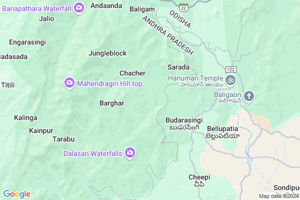
Kapadia Map
EDIT Map
Add Your House
 ..
..
Current Corona Virus Infected Patients Count in Ganjam District
| City Name | District Name | Total Covid cases |
|---|
Locality Name :
Kapadia
( କାପଡ଼ିଆ )
Tehsil Name : Patrapur
District : Ganjam
State : Odisha
Language : Oriya and Hindi , Telugu
Current Time 12:20 PM
Date: Tuesday , Apr 29,2025 (IST)
Time zone: IST (UTC+5:30)
Elevation / Altitude: 18 meters. Above Seal level
Telephone Code / Std Code: 06814
Assembly constituency : Chikiti assembly constituency
Assembly MLA : usha devi
Lok Sabha constituency : Berhampur parliamentary constituency
Parliament MP : CHANDRA SEKHAR SAHU
Serpanch Name :
Pin Code : 761212
Post Office Name : Narayanapur (Gajapati)
Alternate Village Name : Karpadia
Commodities Prices : Parlakhemundi Market / Mandi
Rivers Near Kapadia
Mahendra Tanaya River :महेंद्र तनया नदी :ମହେନ୍ଦ୍ର ତନୟା ନଦୀ :ఎకువూరు
Bahuda
Mahendra Tanaya River :महेंद्र तनया नदी :ମହେନ୍ଦ୍ର ତନୟା ନଦୀ :ఎకువూరు
Bahuda
About Kapadia
Correct below Info and add more info about KapadiaKapadia is a small Village/hamlet in Patrapur Tehsil in Ganjam District of Odisha State, India. It is located 85 KM towards west from District head quarters Chhatrapur. 20 KM from Patrapur. 243 KM from State capital Bhubaneswar
Kapadia Pin code is 761212 and postal head office is Narayanapur (Gajapati).
Kapadia is surrounded by Sompeta Tehsil towards East , Kanchili Tehsil towards East , Rayagada Tehsil towards west , Patrapur Tehsil towards North .
Parlakhemundi , Ichchapuram , Berhampur , Brahmapur are the near by Cities to Kapadia.
This Place is in the border of the Ganjam District and Srikakulam District. Srikakulam District Ichapuram is East towards this place . It is near to the Andhra Pradesh State Border. It is near to bay of bengal. There is a chance of humidity in the weather.
Kapadia 2011 Census Details
Kapadia Local Language is Oriya. Kapadia Village Total population is 13 and number of houses are 5. Female Population is 53.8%. Village literacy rate is 0.0% and the Female Literacy rate is 0.0%.
Population
| Census Parameter | Census Data |
| Total Population | 13 |
| Total No of Houses | 5 |
| Female Population % | 53.8 % ( 7) |
| Total Literacy rate % | 0.0 % ( 0) |
| Female Literacy rate | 0.0 % ( 0) |
| Scheduled Tribes Population % | 46.2 % ( 6) |
| Scheduled Caste Population % | 0.0 % ( 0) |
| Working Population % | 69.2 % |
| Child(0 -6) Population by 2011 | 1 |
| Girl Child(0 -6) Population % by 2011 | 0.0 % ( 0) |
Kapadia Census More Deatils.
Politics in Kapadia
BJD is the major political party in this area.Polling Stations /Booths near Kapadia
1)Tootipur Ps(w)2)P.s Kharanipada
3)Sumandi Ps
4)A.saradhapur Ps
5)Ups Jhatipadar Ansa
HOW TO REACH Kapadia
By Rail
There is no railway station near to Kapadia in less than 10 km.Colleges near Kapadia
Sri Bharata Pati Maha Bidyalya,samantya Palli
Address :
Schools near Kapadia
Jawahar Navdaya Vidyalay,surng
Address : surangi , patrapur , ganjam , Sikkim . PIN- 761037 , Post - Surangi
Kalpeswar Vidyapitha,samantara
Address : samantarapur , patrapur , ganjam , Sikkim . PIN- 761005 , Post - Jaradagada
Adivasi Vidyapitha, Buratal
Address : burutala , patrapur , ganjam , Sikkim . PIN- 761005 , Post - Jaradagada
S.c. Saraswata Vidya Mandir Sq
Address : tandipur , patrapur , ganjam , Sikkim . PIN- 761037 , Post - Surangi
Govt Health Centers near Kapadia
1) DHH PARALAKHEMUNDI , DHH Paralakhemundi , Paralakhemundi , Infront of CDMO Office2) Berhempur ZD , Berhempur ZD , Aska Road , Aska Road
3) CITY HOSP , CITY HOSPITAL DHH , CITY HOSPITAL ROAD , IN RONT OF BIJU PATTNAIK HMEOPATHIC COLLEGE
Electronic Shops in Kapadia,Patrapur
Sankar Electicals
Narayanpur-Jeranga; Ramagiri Rd; Ramgiri; Odisha 761016; India
23.4 KM distance Detail
Super Markets in Kapadia,Patrapur
Police Stations near Kapadia,Patrapur
About Kapadia &
History
How to reach Kapadia
Tourist Places Near By Kapadia
Schools in Kapadia
Colleges in Kapadia
Temperature & weather of Kapadia
places in Kapadia
Kapadia photos
More Information
How to reach Kapadia
Tourist Places Near By Kapadia
Schools in Kapadia
Colleges in Kapadia
Temperature & weather of Kapadia
places in Kapadia
Kapadia photos
More Information
Village Talk
Post News or Events about this Village
Near Cities
Parlakhemundi 32 KM near
Ichchapuram 38 KM near
Berhampur 61 KM near
Brahmapur 61 KM near
Parlakhemundi 32 KM near
Ichchapuram 38 KM near
Berhampur 61 KM near
Brahmapur 61 KM near
Near By Taluks
Mandasa 14 KM near
Sompeta 17 KM near
Kanchili 17 KM near
Rayagada 19 KM near
Mandasa 14 KM near
Sompeta 17 KM near
Kanchili 17 KM near
Rayagada 19 KM near
Near By Air Ports
Vishakhapatnam Airport 208 KM near
Bhubaneswar Airport 229 KM near
Rajahmundry Airport 384 KM near
Raipur Airport 418 KM near
Vishakhapatnam Airport 208 KM near
Bhubaneswar Airport 229 KM near
Rajahmundry Airport 384 KM near
Raipur Airport 418 KM near
Near By Tourist Places
Berhampur 62 KM near
Gopalpur 68 KM near
Chilika 143 KM near
Vizayanagaram 161 KM near
Kalahandi 185 KM near
Berhampur 62 KM near
Gopalpur 68 KM near
Chilika 143 KM near
Vizayanagaram 161 KM near
Kalahandi 185 KM near
Near By Districts
Gajapati 46 KM near
Ganjam 82 KM near
Srikakulam 103 KM near
Rayagada 121 KM near
Gajapati 46 KM near
Ganjam 82 KM near
Srikakulam 103 KM near
Rayagada 121 KM near
Near By RailWay Station
Sompeta Rail Way Station 19 KM near
Palasa Rail Way Station 25 KM near
Sompeta Rail Way Station 19 KM near
Palasa Rail Way Station 25 KM near