| Home | City Bus | Maps | Villages | Cities | Rail | Tourist Places | School | College | Pin Codes | Corona Cases Count |
| Distance Calculator Bus Services IFSC Codes Trace Mobile Number Weather Search Place Trace IP Available Cash ATM/Banks Locate Polling Booth Report an Error contact People |
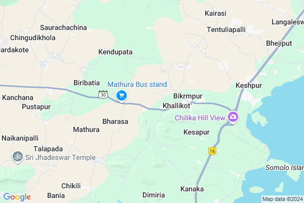
Jharapali
Jharapali Map
EDIT Map
Add Your House
 ..
..
Current Corona Virus Infected Patients Count in Ganjam District
| City Name | District Name | Total Covid cases |
|---|
Locality Name :
Jharapali
( ଝାରପଲ୍ଲୀ )
Tehsil Name : Khallikote
District : Ganjam
State : Odisha
Language : Oriya and Hindi , Telugu
Current Time 10:34 AM
Date: Tuesday , Apr 29,2025 (IST)
Time zone: IST (UTC+5:30)
Elevation / Altitude: 13 meters. Above Seal level
Telephone Code / Std Code: 06810
Assembly constituency : Khallikote assembly constituency
Assembly MLA : purna chandra sethy
Lok Sabha constituency : Aska parliamentary constituency
Parliament MP : Pramila Bisoyi
Serpanch Name :
Alternate Village Name : Jharapalli
Commodities Prices : Balugaon Market / Mandi
Jharapali Live Weather
Temperature: 34.4 °C
clear sky
Humidity: 44%
Wind : 3.36 mt/sec towards S
StationName : "Khallikot"
observed on 57 Mins Back
Temperature: 34.4 °C
clear sky
Humidity: 44%
Wind : 3.36 mt/sec towards S
StationName : "Khallikot"
observed on 57 Mins Back
Jharapali Weather Forecast for Next 5 days
30-04-2025
27.1°C to 36.9°C
clear sky, scattered clouds, light rain
27.1°C to 36.9°C
clear sky, scattered clouds, light rain
01-05-2025
24.2°C to 37.8°C
few clouds, clear sky, light rain, broken clouds, scattered clouds
24.2°C to 37.8°C
few clouds, clear sky, light rain, broken clouds, scattered clouds
02-05-2025
24.8°C to 35.1°C
few clouds, clear sky, light rain, scattered clouds
24.8°C to 35.1°C
few clouds, clear sky, light rain, scattered clouds
03-05-2025
23.0°C to 35.8°C
few clouds, clear sky, moderate rain, light rain, overcast clouds
23.0°C to 35.8°C
few clouds, clear sky, moderate rain, light rain, overcast clouds
04-05-2025
23.6°C to 34.6°C
broken clouds, clear sky, scattered clouds, overcast clouds
23.6°C to 34.6°C
broken clouds, clear sky, scattered clouds, overcast clouds
National Highways Reachable To Jharapali
Nationa High Way :NH16
Nationa High Way :NH16
Rivers Near Jharapali
River Rushikulya
River Rushikulya
About Jharapali
Correct below Info and add more info about JharapaliJharapali is a small Village/hamlet in Khallikote Tehsil in Ganjam District of Odisha State, India. It is located 34 KM towards North from District head quarters Chhatrapur. 128 KM from State capital Bhubaneswar
Jharapali is surrounded by Beguniapada Tehsil towards west , Ganjam Tehsil towards South , Purushottampur Tehsil towards west , Banapur Tehsil towards North .
Ganjam , Hinjilicut , Asika , Berhampur are the near by Cities to Jharapali.
Jharapalli 2011 Census Details
Jharapali Local Language is Oriya. Jharapalli Village Total population is 65 and number of houses are 14. Female Population is 58.5%. Village literacy rate is 36.9% and the Female Literacy rate is 13.8%.
Population
| Census Parameter | Census Data |
| Total Population | 65 |
| Total No of Houses | 14 |
| Female Population % | 58.5 % ( 38) |
| Total Literacy rate % | 36.9 % ( 24) |
| Female Literacy rate | 13.8 % ( 9) |
| Scheduled Tribes Population % | 100.0 % ( 65) |
| Scheduled Caste Population % | 0.0 % ( 0) |
| Working Population % | 47.7 % |
| Child(0 -6) Population by 2011 | 10 |
| Girl Child(0 -6) Population % by 2011 | 80.0 % ( 8) |
Jharapalli Census More Deatils.
Politics in Jharapali
BJD is the major political party in this area.Polling Stations /Booths near Jharapali
1)High School(e) Balunkeswarpur-12)Ps Kandarapada (w)
3)Manapalli (s) Pups
4)Mardharaj (n) H.s. Khallikot
5)Co-opp Socity Building Sabulia
HOW TO REACH Jharapali
By Rail
Khallikot Rail Way Station , Rambha Rail Way Station are the very nearby railway stations to Jharapali.Pincodes near Jharapali
761030 ( Khallikote ) , 761029 ( Khallikote RS ) , 761031 ( Beguniapada )Colleges near Jharapali
Kishore Pallai Sc. College Narayani Vihar Langaleswar Ganjam
Address :
R.c.m. Science College
Address : Berhampur-760007.
Schools in Jharapali
Jharapalli P.s.
Address : jharapalli , khallikote , ganjam , Sikkim . PIN- 761030 , Post - Khallikote
Govt Health Centers near Jharapali
1) TIRIDA SC , TIRIDA SC , , NEAR UP SCHOOL TIRIDA2) K. BARIDA SC , K BARIDA SC , , ROAD SIDE OF K BARIDA
3) SOURA SACHINA SC , SOURA SACHINA SC , , NEAR TRINATH TEMPLE
Hospitals in Jharapali,Khallikote
Community Health Center
Ganjam; SH-30; Khalikot Aska Road; Khallikote; Khallikot; Odisha 761030; India
3.3 KM distance Detail
more ..
Colleges in Jharapali,Khallikote
D.I.E.T;khallikote
Bus Stand; State Highway 30; Khallikot; Khallikot; Odisha; India
3.3 KM distance Detail
more ..
Schools in Jharapali,Khallikote
Premier English Medium School
Kairasi - Khallikote Road; Khallikot; Odisha 761029; India
1.9 KM distance Detail
Police Stations near Jharapali,Khallikote
Khallikote Police Station
SH-30; Khalikot Aska Road; Phosidi; Odisha 761029; India
5.3 KM distance Detail
Governement Offices near Jharapali,Khallikote
Forest Range Office
Ganjam; SH-30; Khalikot Aska Road; Khallikote; Khallikot; Odisha 761030; India
2.4 KM distance Detail
Marriage Registration Office
Ganjam; SH-30; Khalikot Aska Road; Khallikote; Khallikot; Odisha 761030; India
2.4 KM distance Detail
The Assistant Executive Engineer Office
Ganjam; SH-30; Khalikot Aska Road; Khallikote; Khallikot; Odisha 761030; India
2.6 KM distance Detail
About Jharapali &
History
How to reach Jharapali
Tourist Places Near By Jharapali
Schools in Jharapali
Colleges in Jharapali
Temperature & weather of Jharapali
places in Jharapali
Jharapali photos
More Information
How to reach Jharapali
Tourist Places Near By Jharapali
Schools in Jharapali
Colleges in Jharapali
Temperature & weather of Jharapali
places in Jharapali
Jharapali photos
More Information
Village Talk
Post News or Events about this Village
Near Cities
Ganjam 27 KM near
Hinjilicut 40 KM near
Asika 48 KM near
Berhampur 48 KM near
Ganjam 27 KM near
Hinjilicut 40 KM near
Asika 48 KM near
Berhampur 48 KM near
Near By Taluks
Khallikote 0 KM near
Beguniapada 10 KM near
Ganjam 19 KM near
Purushottampur 22 KM near
Khallikote 0 KM near
Beguniapada 10 KM near
Ganjam 19 KM near
Purushottampur 22 KM near
Near By Air Ports
Bhubaneswar Airport 119 KM near
Vishakhapatnam Airport 318 KM near
Raipur Airport 434 KM near
Ranchi Airport 462 KM near
Bhubaneswar Airport 119 KM near
Vishakhapatnam Airport 318 KM near
Raipur Airport 434 KM near
Ranchi Airport 462 KM near
Near By Tourist Places
Chilika 32 KM near
Gopalpur 47 KM near
Berhampur 48 KM near
Puri 93 KM near
Bhubaneswar 123 KM near
Chilika 32 KM near
Gopalpur 47 KM near
Berhampur 48 KM near
Puri 93 KM near
Bhubaneswar 123 KM near
Near By Districts
Ganjam 33 KM near
Nayagarh 62 KM near
Puri 92 KM near
Gajapati 121 KM near
Ganjam 33 KM near
Nayagarh 62 KM near
Puri 92 KM near
Gajapati 121 KM near
Near By RailWay Station
Khallikot Rail Way Station 8.3 KM near
Chilka Rail Way Station 16 KM near
Khallikot Rail Way Station 8.3 KM near
Chilka Rail Way Station 16 KM near