| Home | City Bus | Maps | Villages | Cities | Rail | Tourist Places | School | College | Pin Codes | Corona Cases Count |
| Distance Calculator Bus Services IFSC Codes Trace Mobile Number Weather Search Place Trace IP Available Cash ATM/Banks Locate Polling Booth Report an Error contact People |
Gopinathpur
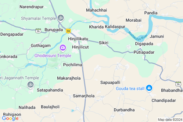
Gopinathpur Map
EDIT Map
Add Your House
 ..
..
Current Corona Virus Infected Patients Count in Ganjam District
| City Name | District Name | Total Covid cases |
|---|
Locality Name :
Gopinathpur
( ଗୋପୀନାଥପୁର )
Tehsil Name : Hinjilicut
District : Ganjam
State : Odisha
Language : Oriya and Hindi , Telugu
Current Time 07:37 AM
Date: Saturday , Apr 26,2025 (IST)
Time zone: IST (UTC+5:30)
Elevation / Altitude: 29 meters. Above Seal level
Telephone Code / Std Code: 06822
Assembly constituency : Hinjili assembly constituency
Assembly MLA : naveen patnaik
Lok Sabha constituency : Aska parliamentary constituency
Parliament MP : Pramila Bisoyi
Serpanch Name :
Pin Code : 761100
Post Office Name : Kukudakhandi
Alternate Village Name : Gopinathapur
Commodities Prices : Hinjilicut Market / Mandi
National Highways Reachable To Gopinathpur
Nationa High Way :NH59
Nationa High Way :NH59
Rivers Near Gopinathpur
River Rushikulya
Haribang Nadi :Harabhangi River
River Rushikulya
Haribang Nadi :Harabhangi River
About Gopinathpur
Correct below Info and add more info about GopinathpurGopinathpur is a small Village/hamlet in Hinjilicut Tehsil in Ganjam District of Odisha State, India. It is located 30 KM towards west from District head quarters Chhatrapur. 169 KM from State capital Bhubaneswar
Gopinathpur Pin code is 761100 and postal head office is Kukudakhandi .
Gopinathpur is surrounded by Sanakhemundi Tehsil towards west , Kukudakhandi Tehsil towards South , Sheragada Tehsil towards west , Purushottampur Tehsil towards East .
Hinjilicut , Berhampur , Brahmapur , Asika are the near by Cities to Gopinathpur.
Gopinathpur 2011 Census Details
Gopinathpur Local Language is Oriya. Gopinathpur Village Total population is 2036 and number of houses are 446. Female Population is 54.5%. Village literacy rate is 60.9% and the Female Literacy rate is 29.0%.
Population
| Census Parameter | Census Data |
| Total Population | 2036 |
| Total No of Houses | 446 |
| Female Population % | 54.5 % ( 1109) |
| Total Literacy rate % | 60.9 % ( 1240) |
| Female Literacy rate | 29.0 % ( 590) |
| Scheduled Tribes Population % | 0.1 % ( 2) |
| Scheduled Caste Population % | 26.4 % ( 537) |
| Working Population % | 42.0 % |
| Child(0 -6) Population by 2011 | 239 |
| Girl Child(0 -6) Population % by 2011 | 50.6 % ( 121) |
Gopinathpur Census More Deatils.
Politics in Gopinathpur
BJD is the major political party in this area.Polling Stations /Booths near Gopinathpur
1)Sapuapalli U.p.school (w)2)N.a.c High School New Bulding (w) Hinjili
3)N.p.s(e) Saru
4)Pry.school Nuasahi (w) Sikiri
5)Pry School Baisipal
HOW TO REACH Gopinathpur
By Rail
There is no railway station near to Gopinathpur in less than 10 km.Colleges near Gopinathpur
Baleshware Mahavidyalaya
Address :
Schools in Gopinathpur
N.c.l.p Purosottampur
Address : gopinathpur , hinjilicut , ganjam , Sikkim . PIN- 761100 , Post - Kukudakhandi
Govt Health Centers near Gopinathpur
1) Berhempur ZD , Berhempur ZD , Aska Road , Aska Road2) CITY HOSP , CITY HOSPITAL DHH , CITY HOSPITAL ROAD , IN RONT OF BIJU PATTNAIK HMEOPATHIC COLLEGE
3) PATAPUR , PHC(N) PATTAPUR , , NEAR BISWASRAY SCIENCE COLLEGE
Petrol Bunks in Gopinathpur,Hinjilicut
IOCL Petrol Pump - Radhakrishna Filling Station
Bainchabania; Ganjam; NH-59; Hinjilicut; Hinjilicut; Odisha 761102; India
1.9 KM distance Detail
Bharat Petrolium Corporation; Hinjilicut Branch
Hinjilicut; Odisha 761102; India
2.3 KM distance Detail
SANDEEP FILLING STATION
HINJILI; HINJILIKATU; GAN; GANJAM; Odisha 761102; India
2.3 KM distance Detail
more ..
Colleges in Gopinathpur,Hinjilicut
Khambeya Dora Junior Science collage;pochilima
Pochilima; Odisha 761101; India
1.8 KM distance Detail
Science College Hinjilicut Department Of Chemistry
Hinjillikatu; Odisha 761102; India
3.1 KM distance Detail
more ..
Electronic Shops in Gopinathpur,Hinjilicut
Srikant Electronics
Cinemahall Square; Main Road; Hinjilicut; Odisha 761102; India
2.5 KM distance Detail
LESCOM NETWORKS PVT LTD
ABOVE SWASTYA BHANDARA IN FRONT OF BUS STAND MAIN ROAD HINJILICUT; GANJAM; Odisha 761102; India
2.5 KM distance Detail
Governement Offices near Gopinathpur,Hinjilicut
JANA SEVA KENDRA SIKIRI
3/551; 9th Cross Road; 3rd Phase; JP Nagar; Bengaluru; India
3.0 KM distance Detail
About Gopinathpur &
History
How to reach Gopinathpur
Tourist Places Near By Gopinathpur
Schools in Gopinathpur
Colleges in Gopinathpur
Temperature & weather of Gopinathpur
places in Gopinathpur
Gopinathpur photos
More Information
How to reach Gopinathpur
Tourist Places Near By Gopinathpur
Schools in Gopinathpur
Colleges in Gopinathpur
Temperature & weather of Gopinathpur
places in Gopinathpur
Gopinathpur photos
More Information
Village Talk
Post News or Events about this Village
Near Cities
Hinjilicut 3 KM near
Berhampur 17 KM near
Brahmapur 17 KM near
Asika 21 KM near
Hinjilicut 3 KM near
Berhampur 17 KM near
Brahmapur 17 KM near
Asika 21 KM near
Near By Taluks
Hinjilicut 0 KM near
Sanakhemundi 14 KM near
Kukudakhandi 14 KM near
Sheragada 17 KM near
Hinjilicut 0 KM near
Sanakhemundi 14 KM near
Kukudakhandi 14 KM near
Sheragada 17 KM near
Near By Air Ports
Bhubaneswar Airport 158 KM near
Vishakhapatnam Airport 281 KM near
Raipur Airport 412 KM near
Rajahmundry Airport 454 KM near
Bhubaneswar Airport 158 KM near
Vishakhapatnam Airport 281 KM near
Raipur Airport 412 KM near
Rajahmundry Airport 454 KM near
Near By Tourist Places
Berhampur 18 KM near
Gopalpur 30 KM near
Chilika 71 KM near
Puri 133 KM near
Phulbani 140 KM near
Berhampur 18 KM near
Gopalpur 30 KM near
Chilika 71 KM near
Puri 133 KM near
Phulbani 140 KM near
Near By Districts
Ganjam 29 KM near
Gajapati 81 KM near
Nayagarh 89 KM near
Puri 132 KM near
Ganjam 29 KM near
Gajapati 81 KM near
Nayagarh 89 KM near
Puri 132 KM near
Near By RailWay Station
Brahmapur Rail Way Station 20 KM near
Chatrapur Rail Way Station 28 KM near
Brahmapur Rail Way Station 20 KM near
Chatrapur Rail Way Station 28 KM near