| Home | City Bus | Maps | Villages | Cities | Rail | Tourist Places | School | College | Pin Codes | Corona Cases Count |
| Distance Calculator Bus Services IFSC Codes Trace Mobile Number Weather Search Place Trace IP Available Cash ATM/Banks Locate Polling Booth Report an Error contact People |
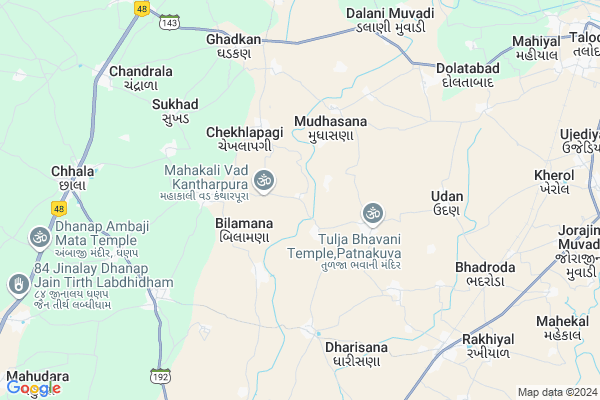
Kantharpur
Kantharpur Map
EDIT Map
Add Your House
 ..
..
Current Corona Virus Infected Patients Count in Gandhinagar District
| City Name | District Name | Total Covid cases |
|---|---|---|
| Gandhinagar District | Gandhinagar | 18 |
| Gandhinagar | Gandhinagar | 7 |
Locality Name :
Kantharpur
( કંથારપુરા )
Taluka Name : Dehgam
District : Gandhinagar
State : Gujarat
Language : Gujarati and Hindi
Current Time 08:59 AM
Date: Wednesday , Apr 30,2025 (IST)
Time zone: IST (UTC+5:30)
Elevation / Altitude: 76 meters. Above Seal level
Telephone Code / Std Code: 02716
Assembly constituency : Dahegam assembly constituency
Assembly MLA : Chauhan Balrajsinh Kalyansinh
Lok Sabha constituency : Ahmedabad East parliamentary constituency
Parliament MP : Patel Hasmukhbhai Somabhai
Serpanch Name :
Pin Code : 382321
Post Office Name : Chhala
Alternate Village Name : Kantharpura
Commodities Prices : Dehgam(Rekhiyal) Market / Mandi
Kantharpur Live Weather
Temperature: 26.8 °C
clear sky
Humidity: 61%
Wind : 2.83 mt/sec towards NW
StationName : "Chhala"
observed on 2 Hours Back
Temperature: 26.8 °C
clear sky
Humidity: 61%
Wind : 2.83 mt/sec towards NW
StationName : "Chhala"
observed on 2 Hours Back
Kantharpur Weather Forecast for Next 5 days
01-05-2025
26.8°C to 43.7°C
clear sky, few clouds
26.8°C to 43.7°C
clear sky, few clouds
02-05-2025
25.1°C to 43.9°C
clear sky
25.1°C to 43.9°C
clear sky
03-05-2025
24.8°C to 43.1°C
clear sky
24.8°C to 43.1°C
clear sky
04-05-2025
23.9°C to 41.4°C
clear sky
23.9°C to 41.4°C
clear sky
05-05-2025
25.2°C to 40.5°C
scattered clouds, clear sky, few clouds
25.2°C to 40.5°C
scattered clouds, clear sky, few clouds
Edit below overview about Kantharpur
Edit below overview about Kantharpur
OverView of Kantharpur
Kantharpur is having a temple of Mahakali with one huge banyan tree. Banyan tree is said to be 500 yrs old. Tree is almost 40 Meter high and is spreaded over more than half acre of land.Edit below overview about Kantharpur
National Highways Reachable To Kantharpur
Nationa High Way :NH147
Nationa High Way :NH48
Nationa High Way :NH147
Nationa High Way :NH48
About Kantharpur
Kantharpur is a Village in Dehgam Taluka in Gandhinagar District of Gujarat State, India. It is located 25 KM towards East from District head quarters Gandhinagar. 17 KM from . 25 KM from State capital Gandhinagar
Kantharpur Pin code is 382321 and postal head office is Chhala .
Bilamana ( 2 KM ) , Babra ( 2 KM ) , Chekhlapagi ( 2 KM ) , Patna Kuva ( 3 KM ) , Vasana Chaudhary ( 3 KM ) are the nearby Villages to Kantharpur. Kantharpur is surrounded by Dehgam Taluka towards South , Talod Taluka towards East , Gandhinagar Taluka towards west , Mansa Taluka towards west .
Dehgam , Prantij , Gandhinagar , Mansa are the near by Cities to Kantharpur.
Kantharpur 2011 Census Details
Kantharpur Local Language is Gujarati. Kantharpur Village Total population is 844 and number of houses are 169. Female Population is 46.0%. Village literacy rate is 69.3% and the Female Literacy rate is 25.8%.
Population
| Census Parameter | Census Data |
| Total Population | 844 |
| Total No of Houses | 169 |
| Female Population % | 46.0 % ( 388) |
| Total Literacy rate % | 69.3 % ( 585) |
| Female Literacy rate | 25.8 % ( 218) |
| Scheduled Tribes Population % | 0.0 % ( 0) |
| Scheduled Caste Population % | 0.0 % ( 0) |
| Working Population % | 57.9 % |
| Child(0 -6) Population by 2011 | 122 |
| Girl Child(0 -6) Population % by 2011 | 44.3 % ( 54) |
Kantharpur Census More Deatils.
Politics in Kantharpur
Bharatiya Janata Party , BJP , INC are the major political parties in this area.Polling Stations /Booths near Kantharpur
1)Kanipur-22)Babalpura Tabe Sampa
3)Patnakuva-2
4)Chamla-2
5)Chekhlapagi-2
HOW TO REACH Kantharpur
By Rail
Rakhiyal Rail Way Station , Kherol Rail Way Station are the very nearby railway stations to Kantharpur.Colleges near Kantharpur
C.h.m Shah College
Address :
Sahajanand College Of Nursing
Address :
S D Arts & B R Commerce College, Mansa
Address :
A
Address :
Sarada Adhyapan Mandir Ptc & Bed Colledge
Address :
Schools in Kantharpur
Kantharpura Pri.school
Address : kantharpura , dehgam , gandhinagar , Gujarat . PIN- 382325
Govt Health Centers near Kantharpur
1) Sadara , CHC SADARA , office of Supritendent CHC & TB CLINIC , NEAR GUJARAT VIDYAPITH2) Palaj , Urban Health Center,Palaj , , Near Lekawada
3) Sector-29 , Urban Health Center,Sector-29 , Sector-29 , Near Govt.Primary School
Petrol Bunks in Kantharpur,Dehgam
Essar Petrol Pump Arbuda Fuel Station
NH-8; Arbuda Nagar; Chhala; Gujarat 382321; India
9.7 KM distance Detail
more ..
Colleges in Kantharpur,Dehgam
Arihant Homoeopathic Medical College & Research Institute
at post dist.; Bhoyan Rathod; Gujarat; India
10.9 KM distance Detail
Saraswati Institute of Pharmaceutical Sciences
Gandhinagar; NH-8; Sabarkath Road; Himatnagar; Himatnagar; Gujarat 383001; India
11.6 KM distance Detail
more ..
Electronic Shops in Kantharpur,Dehgam
Jay Bramani Electric & Xerox Halisa
Dehgam Taluka; Gandhinagar District; Halisa; Gujarat 382321; India
7.1 KM distance Detail
Shree Harchuram Electronics
A 6 M G Amin Complex Nadol Road Dehgam; Ahmedabad; Gujarat 382315; India
8.1 KM distance Detail
Krishna Photo Studio
Near K.G.N Mobile Shop; GJ SH 68; Rakhiyal; Gujarat 382315; India
8.5 KM distance Detail
Governement Offices near Kantharpur,Dehgam
Gram Panchyat Office Magodi
Magodi; Gandhinagar; SH-141; Gandhinagar Road; Gandhi Nagar; Gandhi Nagar; Gujarat 382305; India
15.8 KM distance Detail
About Kantharpur &
History
How to reach Kantharpur
Tourist Places Near By Kantharpur
Schools in Kantharpur
Colleges in Kantharpur
Temperature & weather of Kantharpur
places in Kantharpur
Kantharpur photos
More Information
How to reach Kantharpur
Tourist Places Near By Kantharpur
Schools in Kantharpur
Colleges in Kantharpur
Temperature & weather of Kantharpur
places in Kantharpur
Kantharpur photos
More Information
Village Talk
Post News or Events about this Village
Near Cities
Dehgam 16 KM near
Prantij 17 KM near
Gandhinagar 25 KM near
Mansa 26 KM near
Dehgam 16 KM near
Prantij 17 KM near
Gandhinagar 25 KM near
Mansa 26 KM near
Near By Taluks
Dehgam 16 KM near
Prantij 17 KM near
Talod 18 KM near
Gandhinagar 24 KM near
Dehgam 16 KM near
Prantij 17 KM near
Talod 18 KM near
Gandhinagar 24 KM near
Near By Air Ports
Ahmedabad Airport 38 KM near
Vadodara Airport 127 KM near
Dabok Airport 202 KM near
Bhavnagar Airport 207 KM near
Ahmedabad Airport 38 KM near
Vadodara Airport 127 KM near
Dabok Airport 202 KM near
Bhavnagar Airport 207 KM near
Near By Tourist Places
Gandhinagar 24 KM near
Sabarkantha 39 KM near
Ahmedabad 45 KM near
Mehsana 63 KM near
Kheda 71 KM near
Gandhinagar 24 KM near
Sabarkantha 39 KM near
Ahmedabad 45 KM near
Mehsana 63 KM near
Kheda 71 KM near
Near By Districts
Gandhinagar 24 KM near
Sabar Kantha 38 KM near
Ahmadabad 44 KM near
Mahesana 63 KM near
Gandhinagar 24 KM near
Sabar Kantha 38 KM near
Ahmadabad 44 KM near
Mahesana 63 KM near
Near By RailWay Station
Rakhiyal Rail Way Station 8.4 KM near
Sabarmati Junction Rail Way Station 40 KM near
Ahmedabad Junction Rail Way Station 44 KM near
Rakhiyal Rail Way Station 8.4 KM near
Sabarmati Junction Rail Way Station 40 KM near
Ahmedabad Junction Rail Way Station 44 KM near