| Home | City Bus | Maps | Villages | Cities | Rail | Tourist Places | School | College | Pin Codes | Corona Cases Count |
| Distance Calculator Bus Services IFSC Codes Trace Mobile Number Weather Search Place Trace IP Available Cash ATM/Banks Locate Polling Booth Report an Error contact People |
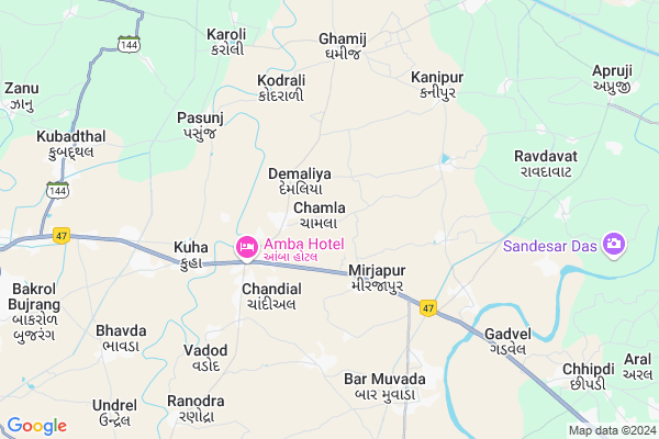
Chamla
Chamla Map
EDIT Map
Add Your House
 ..
..
Current Corona Virus Infected Patients Count in Gandhinagar District
| City Name | District Name | Total Covid cases |
|---|---|---|
| Gandhinagar District | Gandhinagar | 18 |
| Gandhinagar | Gandhinagar | 7 |
Locality Name :
Chamla
( ચામણાં )
Taluka Name : Dehgam
District : Gandhinagar
State : Gujarat
Language : Gujarati and Hindi
Current Time 08:51 AM
Date: Wednesday , Apr 30,2025 (IST)
Time zone: IST (UTC+5:30)
Elevation / Altitude: 76 meters. Above Seal level
Telephone Code / Std Code: 02716
Assembly constituency : Dahegam assembly constituency
Assembly MLA : Chauhan Balrajsinh Kalyansinh
Lok Sabha constituency : Ahmedabad East parliamentary constituency
Parliament MP : Patel Hasmukhbhai Somabhai
Serpanch Name :
Pin Code : 387610
Post Office Name : Attarsumba
Alternate Village Name : Chambla
Commodities Prices : Dehgam Market / Mandi
National Highways Reachable To Chamla
Nationa High Way :NH147
Nationa High Way :NH48
Nationa High Way :NH147
Nationa High Way :NH48
About Chamla
Correct below Info and add more info about ChamlaChamla is a Village in Dehgam Taluka in Gandhinagar District of Gujarat State, India. It is located 35 KM towards South from District head quarters Gandhinagar. 21 KM from . 36 KM from State capital Gandhinagar
Chamla Pin code is 387610 and postal head office is Attarsumba .
Pasuniya ( 3 KM ) , Pallano Math ( 3 KM ) , Mirapur ( 4 KM ) , Kodrali ( 5 KM ) , Hilol ( 5 KM ) are the nearby Villages to Chamla. Chamla is surrounded by Mehmedabad Taluka towards South , Dehgam Taluka towards North , Daskroi Taluka towards west , Kapadvanj Taluka towards East .
Dehgam , Mehmedabad , Kapadvanj , Ahmedabad are the near by Cities to Chamla.
Chamla 2011 Census Details
Chamla Local Language is Gujarati. Chamla Village Total population is 2128 and number of houses are 418. Female Population is 47.7%. Village literacy rate is 66.4% and the Female Literacy rate is 26.7%.
Population
| Census Parameter | Census Data |
| Total Population | 2128 |
| Total No of Houses | 418 |
| Female Population % | 47.7 % ( 1016) |
| Total Literacy rate % | 66.4 % ( 1412) |
| Female Literacy rate | 26.7 % ( 568) |
| Scheduled Tribes Population % | 0.3 % ( 6) |
| Scheduled Caste Population % | 2.0 % ( 42) |
| Working Population % | 45.8 % |
| Child(0 -6) Population by 2011 | 289 |
| Girl Child(0 -6) Population % by 2011 | 41.9 % ( 121) |
Chamla Census More Deatils.
Politics in Chamla
Bharatiya Janata Party , BJP , INC are the major political parties in this area.Polling Stations /Booths near Chamla
1)Bilamna-22)Chamla-1
3)Dahegam-9
4)Sanoda-4
5)Mithana Muvada-3
HOW TO REACH Chamla
By Rail
There is no railway station near to Chamla in less than 10 km.Colleges near Chamla
C.h.m Shah College
Address :
Sahajanand College Of Nursing
Address :
S D Arts & B R Commerce College, Mansa
Address :
A
Address :
Sarada Adhyapan Mandir Ptc & Bed Colledge
Address :
Schools near Chamla
Vardhman High (priv.non Grante
Address : dehgam , dehgam , gandhinagar , Gujarat . PIN- 382325
Sahyog Vidhayalaya(guj)
Address : dehgam , dehgam , gandhinagar , Gujarat . PIN- 382325
Uma Vidyalaya
Address : dehgam , dehgam , gandhinagar , Gujarat . PIN- 382325
Ramaji Na Chapra Pri.school
Address : ramajina chapra , dehgam , gandhinagar , Gujarat . PIN- 382325
Govt Health Centers near Chamla
1) Chandiyel , Sub Centre CHANDIYEL , ,2) Kuha , PRIMARY HEALTH CENTRE KUHA , , NR SHANTABEN SOMABHAI PATEL HIGH SCHOOL
3) Kuha , Sub Centre KUHA , , NR SHANTABEN SOMABHAI PATEL HIGH SCHOOL
Petrol Bunks in Chamla,Dehgam
Dwarkesh HP Petrol Pump
kubadthal patiya; bhavda patiya; Kuha; Gujarat 382433; India
9.8 KM distance Detail
more ..
Colleges in Chamla,Dehgam
Satish Goswami College Of Physiotherapy
Naroda - Dehgam Road; Ta. Dascroi; Dist. Ahmedabad; Vahelal; Gujarat 382330; India
13.7 KM distance Detail
more ..
Electronic Shops in Chamla,Dehgam
Bintu Electricals
opp. Sardar shopping centre; dehgam;; gandhinagar; Gujarat 382308; India
7.2 KM distance Detail
Local Parks in Chamla,Dehgam
Sahajanand Farm
Jhanu Village; Near Huka Village; Ahmedabad; Gujarat 380001; India
14.1 KM distance Detail
Police Stations near Chamla,Dehgam
Singarva Police Chowkey
Singarwa; Odhav Industrial Estate; Odhav; Ahmedabad; Gujarat 382418; India
18.1 KM distance Detail
C.I.S.F group head quarter
plot /1;;;-; Rd Number 6; Odhav; Ahmedabad; Gujarat 382415; India
19.1 KM distance Detail
Governement Offices near Chamla,Dehgam
Pasunj Gram Panchayat
NR PATEL STREET; Pasunj - Karoli Rd; Pasunj; Gujarat 382430; India
6.0 KM distance Detail
About Chamla &
History
How to reach Chamla
Tourist Places Near By Chamla
Schools in Chamla
Colleges in Chamla
Temperature & weather of Chamla
places in Chamla
Chamla photos
More Information
How to reach Chamla
Tourist Places Near By Chamla
Schools in Chamla
Colleges in Chamla
Temperature & weather of Chamla
places in Chamla
Chamla photos
More Information
Village Talk
Post News or Events about this Village
Near Cities
Dehgam 20 KM near
Mehmedabad 25 KM near
Kapadvanj 26 KM near
Ahmedabad 31 KM near
Dehgam 20 KM near
Mehmedabad 25 KM near
Kapadvanj 26 KM near
Ahmedabad 31 KM near
Near By Taluks
Kathlal 15 KM near
Mehmedabad 19 KM near
Dehgam 20 KM near
Daskroi 23 KM near
Kathlal 15 KM near
Mehmedabad 19 KM near
Dehgam 20 KM near
Daskroi 23 KM near
Near By Air Ports
Ahmedabad Airport 25 KM near
Vadodara Airport 95 KM near
Bhavnagar Airport 173 KM near
Dabok Airport 233 KM near
Ahmedabad Airport 25 KM near
Vadodara Airport 95 KM near
Bhavnagar Airport 173 KM near
Dabok Airport 233 KM near
Near By Tourist Places
Ahmedabad 31 KM near
Gandhinagar 33 KM near
Kheda 37 KM near
Anand 55 KM near
Sabarkantha 74 KM near
Ahmedabad 31 KM near
Gandhinagar 33 KM near
Kheda 37 KM near
Anand 55 KM near
Sabarkantha 74 KM near
Near By Districts
Ahmadabad 25 KM near
Gandhinagar 33 KM near
Kheda 36 KM near
Anand 56 KM near
Ahmadabad 25 KM near
Gandhinagar 33 KM near
Kheda 36 KM near
Anand 56 KM near
Near By RailWay Station
Mahemdavad Kheda Road Rail Way Station 25 KM near
Maninagar Rail Way Station 26 KM near
Mahemdavad Kheda Road Rail Way Station 25 KM near
Maninagar Rail Way Station 26 KM near