| Home | City Bus | Maps | Villages | Cities | Rail | Tourist Places | School | College | Pin Codes | Corona Cases Count |
| Distance Calculator Bus Services IFSC Codes Trace Mobile Number Weather Search Place Trace IP Available Cash ATM/Banks Locate Polling Booth Report an Error contact People |
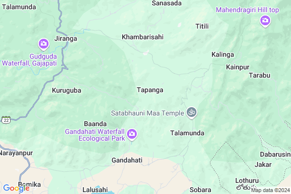
Tapanga Map
EDIT Map
Add Your House
 ..
..
Current Corona Virus Infected Patients Count in Gajapati District
| City Name | District Name | Total Covid cases |
|---|
Locality Name :
Tapanga
( ତାପଙ୍ଗ )
Tehsil Name : Rayagada
District : Gajapati
State : Odisha
Language : Oriya and Hindi
Current Time 09:41 AM
Date: Thursday , Apr 24,2025 (IST)
Time zone: IST (UTC+5:30)
Elevation / Altitude: 61 meters. Above Seal level
Telephone Code / Std Code: 06817
Assembly constituency : Mohana assembly constituency
Assembly MLA : basanti mallick
Lok Sabha constituency : Berhampur parliamentary constituency
Parliament MP : CHANDRA SEKHAR SAHU
Serpanch Name :
Pin Code : 761212
Post Office Name : Narayanapur (Gajapati)
Commodities Prices : Parlakhemundi Market / Mandi
Tapanga Live Weather
Temperature: 28.9 °C
few clouds
Humidity: 58%
Wind : 3.15 mt/sec towards SW
StationName : "Mandasa"
observed on 1 Hours Back
Temperature: 28.9 °C
few clouds
Humidity: 58%
Wind : 3.15 mt/sec towards SW
StationName : "Mandasa"
observed on 1 Hours Back
Tapanga Weather Forecast for Next 5 days
25-04-2025
23.2°C to 37.2°C
few clouds, clear sky, scattered clouds
23.2°C to 37.2°C
few clouds, clear sky, scattered clouds
26-04-2025
22.5°C to 36.5°C
clear sky, few clouds, scattered clouds, broken clouds
22.5°C to 36.5°C
clear sky, few clouds, scattered clouds, broken clouds
27-04-2025
23.4°C to 35.1°C
broken clouds, few clouds, clear sky, light rain, overcast clouds
23.4°C to 35.1°C
broken clouds, few clouds, clear sky, light rain, overcast clouds
28-04-2025
22.5°C to 35.6°C
broken clouds, scattered clouds, clear sky, light rain
22.5°C to 35.6°C
broken clouds, scattered clouds, clear sky, light rain
29-04-2025
21.7°C to 35.2°C
broken clouds, clear sky, moderate rain, light rain, few clouds
21.7°C to 35.2°C
broken clouds, clear sky, moderate rain, light rain, few clouds
Rivers Near Tapanga
Vamsadhara
Mahendra Tanaya River :महेंद्र तनया नदी :ମହେନ୍ଦ୍ର ତନୟା ନଦୀ :ఎకువూరు
Vamsadhara
Mahendra Tanaya River :महेंद्र तनया नदी :ମହେନ୍ଦ୍ର ତନୟା ନଦୀ :ఎకువూరు
About Tapanga
Correct below Info and add more info about TapangaTapanga is a small Village/hamlet in Rayagada Tehsil in Gajapati District of Odisha State, India. It is located 41 KM towards South from District head quarters Paralakhemundi. 3 KM from Rayagada. 258 KM from State capital Bhubaneswar
Tapanga Pin code is 761212 and postal head office is Narayanapur (Gajapati).
Talamunda ( 4 KM ) , Kainpur ( 5 KM ) , Gandahati ( 6 KM ) , Ghorani ( 10 KM ) , Garabandha ( 12 KM ) are the nearby Villages to Tapanga. Tapanga is surrounded by Paralakhemundi Tehsil towards South , Gosani Tehsil towards South , Palasa Tehsil towards South , Meliaputti Tehsil towards South .
Parlakhemundi , Ichchapuram , Palasa Kasibugga , Gunupur are the near by Cities to Tapanga.
Tapanga 2011 Census Details
Tapanga Local Language is Oriya. Tapanga Village Total population is 479 and number of houses are 115. Female Population is 51.1%. Village literacy rate is 37.0% and the Female Literacy rate is 16.1%.
Population
| Census Parameter | Census Data |
| Total Population | 479 |
| Total No of Houses | 115 |
| Female Population % | 51.1 % ( 245) |
| Total Literacy rate % | 37.0 % ( 177) |
| Female Literacy rate | 16.1 % ( 77) |
| Scheduled Tribes Population % | 99.8 % ( 478) |
| Scheduled Caste Population % | 0.0 % ( 0) |
| Working Population % | 54.5 % |
| Child(0 -6) Population by 2011 | 87 |
| Girl Child(0 -6) Population % by 2011 | 46.0 % ( 40) |
Tapanga Census More Deatils.
Politics in Tapanga
BJD , INC are the major political parties in this area.Polling Stations /Booths near Tapanga
1)Pry. School Kumutipankala2)U.p.school Labarsing
3)P.u.p. School Gatida
4)P.u.p.school Koinpur
5)Pry.school Puspanga
HOW TO REACH Tapanga
By Rail
There is no railway station near to Tapanga in less than 10 km.Colleges near Tapanga
M.k.d College
Address : Gurandi Bus Stand
Centurion School Of Rural Enterprise Management
Address : R. Seethapur, Via- Uppalada, Paralakhemundi, Gajap
S.k.c.g. College
Address : Paralakhemundi, Berhampur-760007.
Jagannath Institute For Technology And Management
Address : Orissa.
Meena Ketan Degree College
Address : Gurandi, Berhampur-760007.
Schools in Tapanga
Nuagan N.p.s.
Address : tapanga , rayagada , gajapati , Sikkim . PIN- 761212 , Post - Narayanapur (Gajapati)
Govt Health Centers near Tapanga
1) DHH PARALAKHEMUNDI , DHH Paralakhemundi , Paralakhemundi , Infront of CDMO Office2) SC-Akhusingi , , ,
3) Berhempur ZD , Berhempur ZD , Aska Road , Aska Road
Hospitals in Tapanga,Rayagada
Community Health Center
Hatibadi; Gajapati; SH-34; Mohana Paralakhemundi Road; Rayagada; Rayagada; Odisha 761207; India
16.6 KM distance Detail
more ..
Petrol Bunks in Tapanga,Rayagada
Maa Tara Tarini Petrol Pump
Macchamara - Gosani Rd; Gurandi; Odisha 761210; India
14.6 KM distance Detail
more ..
Colleges in Tapanga,Rayagada
Centurion School of Rural Enterprise Management
P.O.R. Seethapur; Via Uppalada; Paralakhemundi ; Gajapati; Orissa; Paralakhemundi; Odisha 761211; India
22.1 KM distance Detail
more ..
Schools in Tapanga,Rayagada
Gov.U.G.High School Peddakotturu ବଡକତୁରୁ
peddakotturu; Garabandha; Odisha 761215; India
11.9 KM distance Detail
Electronic Shops in Tapanga,Rayagada
Sankar Electicals
Narayanpur-Jeranga; Ramagiri Rd; Ramgiri; Odisha 761016; India
21.7 KM distance Detail
About Tapanga &
History
How to reach Tapanga
Tourist Places Near By Tapanga
Schools in Tapanga
Colleges in Tapanga
Temperature & weather of Tapanga
places in Tapanga
Tapanga photos
More Information
How to reach Tapanga
Tourist Places Near By Tapanga
Schools in Tapanga
Colleges in Tapanga
Temperature & weather of Tapanga
places in Tapanga
Tapanga photos
More Information
Village Talk
Post News or Events about this Village
Near Cities
Parlakhemundi 17 KM near
Ichchapuram 55 KM near
Palasa Kasibugga 57 KM near
Gunupur 58 KM near
Parlakhemundi 17 KM near
Ichchapuram 55 KM near
Palasa Kasibugga 57 KM near
Gunupur 58 KM near
Near By Taluks
Rayagada 3 KM near
Paralakhemundi 14 KM near
Gosani 15 KM near
Palasa 21 KM near
Rayagada 3 KM near
Paralakhemundi 14 KM near
Gosani 15 KM near
Palasa 21 KM near
Near By Air Ports
Vishakhapatnam Airport 193 KM near
Bhubaneswar Airport 245 KM near
Rajahmundry Airport 368 KM near
Raipur Airport 409 KM near
Vishakhapatnam Airport 193 KM near
Bhubaneswar Airport 245 KM near
Rajahmundry Airport 368 KM near
Raipur Airport 409 KM near
Near By Tourist Places
Berhampur 77 KM near
Gopalpur 84 KM near
Vizayanagaram 145 KM near
Chilika 158 KM near
Kalahandi 175 KM near
Berhampur 77 KM near
Gopalpur 84 KM near
Vizayanagaram 145 KM near
Chilika 158 KM near
Kalahandi 175 KM near
Near By Districts
Gajapati 39 KM near
Srikakulam 90 KM near
Ganjam 98 KM near
Rayagada 106 KM near
Gajapati 39 KM near
Srikakulam 90 KM near
Ganjam 98 KM near
Rayagada 106 KM near
Near By RailWay Station
Palasa Rail Way Station 26 KM near
Sompeta Rail Way Station 36 KM near
Palasa Rail Way Station 26 KM near
Sompeta Rail Way Station 36 KM near