| Home | City Bus | Maps | Villages | Cities | Rail | Tourist Places | School | College | Pin Codes | Corona Cases Count |
| Distance Calculator Bus Services IFSC Codes Trace Mobile Number Weather Search Place Trace IP Available Cash ATM/Banks Locate Polling Booth Report an Error contact People |
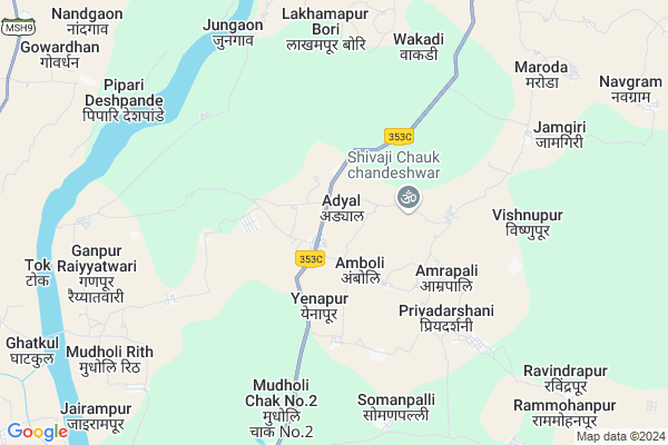
Adyal
Adyal Map
EDIT Map
Add Your House
 ..
..
Current Corona Virus Infected Patients Count in Gadchiroli District
| City Name | District Name | Total Covid cases |
|---|
Locality Name :
Adyal
( अद्दल )
Taluka Name : Chamorshi
District : Gadchiroli
State : Maharashtra
Region : Vidarbh
Division : Nagpur
Language : Marathi and Hindi,gondi,bengali, Telgu
Current Time 12:32 PM
Date: Sunday , Apr 27,2025 (IST)
Time zone: IST (UTC+5:30)
Elevation / Altitude: 200 meters. Above Seal level
Telephone Code / Std Code: 07135
Assembly constituency : Gadchiroli assembly constituency
Assembly MLA : Deorao Madguji Holi
Lok Sabha constituency : Gadchiroli-Chimur parliamentary constituency
Parliament MP : ASHOK MAHADEORAO NETE
Serpanch Name :
Pin Code : 442707
Post Office Name : Ashti (Gadchiroli)
Commodities Prices : Chamorshi Market / Mandi
Adyal Live Weather
Temperature: 37.1 °C
scattered clouds
Humidity: 32%
Wind : 4.35 mt/sec towards S
StationName : "MÅ«l"
observed on 9 Mins Back
Temperature: 37.1 °C
scattered clouds
Humidity: 32%
Wind : 4.35 mt/sec towards S
StationName : "MÅ«l"
observed on 9 Mins Back
Adyal Weather Forecast for Next 5 days
28-04-2025
28.3°C to 39.0°C
scattered clouds, light rain, clear sky
28.3°C to 39.0°C
scattered clouds, light rain, clear sky
29-04-2025
27.6°C to 41.5°C
clear sky, few clouds, scattered clouds, broken clouds
27.6°C to 41.5°C
clear sky, few clouds, scattered clouds, broken clouds
30-04-2025
28.6°C to 43.8°C
scattered clouds, clear sky, few clouds, broken clouds
28.6°C to 43.8°C
scattered clouds, clear sky, few clouds, broken clouds
01-05-2025
29.3°C to 44.8°C
broken clouds, scattered clouds, clear sky, few clouds
29.3°C to 44.8°C
broken clouds, scattered clouds, clear sky, few clouds
02-05-2025
29.6°C to 44.5°C
broken clouds, clear sky
29.6°C to 44.5°C
broken clouds, clear sky
National Highways Reachable To Adyal
Nationa High Way :NH930D
Nationa High Way :NH930D
Rivers Near Adyal
Dongri
Sirpur Vagu
Dongri
Sirpur Vagu
About Adyal
Correct below Info and add more info about AdyalAdyal is a Village in Chamorshi Taluka in Gadchiroli District of Maharashtra State, India. It belongs to Vidarbh region . It belongs to Nagpur Division . It is located 50 KM towards South from District head quarters Gadchiroli. 10 KM from Chamorshi. 862 KM from State capital Mumbai
Adyal Pin code is 442707 and postal head office is Ashti (Gadchiroli).
Lakhamapur Bori ( 7 KM ) , Waigaon ( 7 KM ) , Mudholi Chak No.2 ( 8 KM ) , Jamgiri ( 8 KM ) , Maroda ( 9 KM ) are the nearby Villages to Adyal. Adyal is surrounded by Pombhurna Taluka towards west , Gondpipri Taluka towards west , Mul Taluka towards North , Mulchera Taluka towards South .
Mul , Gadchiroli , Rajura , Chandrapur are the near by Cities to Adyal.
This Place is in the border of the Gadchiroli District and Chandrapur District. Chandrapur District Saoli is North towards this place .
Adyal 2011 Census Details
Adyal Local Language is Marathi. Adyal Village Total population is 1142 and number of houses are 250. Female Population is 46.1%. Village literacy rate is 74.9% and the Female Literacy rate is 32.0%.
Population
| Census Parameter | Census Data |
| Total Population | 1142 |
| Total No of Houses | 250 |
| Female Population % | 46.1 % ( 526) |
| Total Literacy rate % | 74.9 % ( 855) |
| Female Literacy rate | 32.0 % ( 365) |
| Scheduled Tribes Population % | 68.5 % ( 782) |
| Scheduled Caste Population % | 8.7 % ( 99) |
| Working Population % | 38.7 % |
| Child(0 -6) Population by 2011 | 81 |
| Girl Child(0 -6) Population % by 2011 | 50.6 % ( 41) |
Adyal Census More Deatils.
Politics in Adyal
BJP , NCP , INC are the major political parties in this area.Polling Stations /Booths near Adyal
1)Chingali2)Yedanur
3)Adpalli
4)Kotgal
5)Ambetola
HOW TO REACH Adyal
By Rail
There is no railway station near to Adyal in less than 10 km. Mul Marora Rail Way Station (near to Mul) , Tolewahi Halt Rail Way Station (near to Mul) are the Rail way stations reachable from near by towns.By Road
Mul , Gadchiroli are the nearby by towns to Adyal having road connectivity to AdyalColleges near Adyal
Namdeorao Poreddiwar College Of Engineering And Technology Gadchiroli
Address :
Yashwant Jr. College, Shankarpur
Address :
Shankarrao Bezalwar Mahvidylaya
Address :
Aadarsh College
Address :
Goverment Polythechnic Collage,gadchiroli
Address :
Schools in Adyal
Granted Ashram School
Address : adyal , chamorshi , gadchiroli , Maharashtra . PIN- 442707 , Post - Ashti (Gadchiroli)
Z.p. Upper Prm. School
Address : adyal , chamorshi , gadchiroli , Maharashtra . PIN- 442603 , Post - Chamorshi
Govt Health Centers near Adyal
1) Virur , PHC Virur Gadegaon Building , Main Road , Near ZP Primary School2) Dewada Bhuj , SubCentre Dewada Bhuj , Nandgaon Road , Near Grampanchayat
3) Navegaon More , SubCentre Navegaon More , Main Road Navegaon More , Near Ziila Parishad School
Petrol Bunks in Adyal,Chamorshi
Manesh Gandhi Petrol Pump
Near BOI; Ganesh Nagar; Mul Road; Chamorshi; Maharashtra 442603; India
15.6 KM distance Detail
ALANKAR PETROLEUM SERVICE
CHAMORSHI;MUL ROAD;GADCHIR; GADCHIROLI; Maharashtra 442603; India
17.1 KM distance Detail
more ..
Colleges in Adyal,Chamorshi
Mamta Medical And General Stores;Chittaranjanpur
Kishtapur; Maharashtra 442707; India
0.8 KM distance Detail
Kewalramji Harde College of Agriculture; Chamorshi
Mul-Chamorshi Hwy; Ganesh Nagar; Teachers Colony; Chamorshi; Maharashtra 442603; India
15.7 KM distance Detail
more ..
Electronic Shops in Adyal,Chamorshi
Hanuman Mandir
ghot; Pimpalgaon Ghat Rd; Marathwadi; Maharashtra 414202; India
15.1 KM distance Detail
Super Markets in Adyal,Chamorshi
Mangalmurti Super Bazar
near bus stand gadchiroli road panduranga complex; Chamorshi; Maharashtra; India
16.2 KM distance Detail
About Adyal &
History
How to reach Adyal
Tourist Places Near By Adyal
Schools in Adyal
Colleges in Adyal
Temperature & weather of Adyal
places in Adyal
Adyal photos
More Information
How to reach Adyal
Tourist Places Near By Adyal
Schools in Adyal
Colleges in Adyal
Temperature & weather of Adyal
places in Adyal
Adyal photos
More Information
Village Talk
Post News or Events about this Village
Near Cities
Mul 34 KM near
Gadchiroli 48 KM near
Rajura 60 KM near
Chandrapur 64 KM near
Mul 34 KM near
Gadchiroli 48 KM near
Rajura 60 KM near
Chandrapur 64 KM near
Near By Taluks
Chamorshi 10 KM near
Pombhurna 22 KM near
Gondpipri 26 KM near
Mul 27 KM near
Chamorshi 10 KM near
Pombhurna 22 KM near
Gondpipri 26 KM near
Mul 27 KM near
Near By Air Ports
Sonegaon Airport 181 KM near
Raipur Airport 279 KM near
Nanded Airport 305 KM near
Jabalpur Airport 353 KM near
Sonegaon Airport 181 KM near
Raipur Airport 279 KM near
Nanded Airport 305 KM near
Jabalpur Airport 353 KM near
Near By Tourist Places
Sirpur 52 KM near
Chandrapur 63 KM near
Tadoba 70 KM near
Bhamragarh Wildlife Sanctuary 103 KM near
Bhandara 168 KM near
Sirpur 52 KM near
Chandrapur 63 KM near
Tadoba 70 KM near
Bhamragarh Wildlife Sanctuary 103 KM near
Bhandara 168 KM near
Near By Districts
Gadchiroli 48 KM near
Chandrapur 61 KM near
Adilabad 152 KM near
Narayanpur 168 KM near
Gadchiroli 48 KM near
Chandrapur 61 KM near
Adilabad 152 KM near
Narayanpur 168 KM near
Near By RailWay Station
Balharshah Junction Rail Way Station 56 KM near
Chandrapur Rail Way Station 64 KM near
Balharshah Junction Rail Way Station 56 KM near
Chandrapur Rail Way Station 64 KM near