| Home | City Bus | Maps | Villages | Cities | Rail | Tourist Places | School | College | Pin Codes | Corona Cases Count |
| Distance Calculator Bus Services IFSC Codes Trace Mobile Number Weather Search Place Trace IP Available Cash ATM/Banks Locate Polling Booth Report an Error contact People |
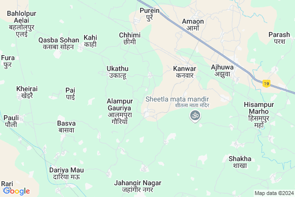
Umra
Umra Map
EDIT Map
Add Your House
 ..
..
Current Corona Virus Infected Patients Count in Fatehpur District
| City Name | District Name | Total Covid cases |
|---|
Locality Name :
Umra
( उम्र )
Block Name : Dhata
District : Fatehpur
State : Uttar Pradesh
Division : Allahabad
Language : Hindi and Urdu
Current Time 04:10 PM
Date: Thursday , Apr 24,2025 (IST)
Time zone: IST (UTC+5:30)
Elevation / Altitude: 108 meters. Above Seal level
Telephone Code / Std Code: 05182
Assembly constituency : Khaga assembly constituency
Assembly MLA : Krishna Paswan
Lok Sabha constituency : Fatehpur parliamentary constituency
Parliament MP : NIRANJAN JYOTI
Serpanch Name :
Pin Code : 212655
Post Office Name : Khaga Town
Alternate Village Name : Umara
Commodities Prices : Ajuha Market / Mandi
Umra Live Weather
Temperature: 43.2 °C
clear sky
Humidity: 2%
Wind : 6.29 mt/sec towards W
StationName : "Kanwar"
observed on 2 Hours Back
Temperature: 43.2 °C
clear sky
Humidity: 2%
Wind : 6.29 mt/sec towards W
StationName : "Kanwar"
observed on 2 Hours Back
Umra Weather Forecast for Next 5 days
25-04-2025
29.8°C to 43.3°C
clear sky
29.8°C to 43.3°C
clear sky
26-04-2025
28.2°C to 44.7°C
clear sky
28.2°C to 44.7°C
clear sky
27-04-2025
30.7°C to 45.4°C
clear sky, broken clouds, scattered clouds, few clouds
30.7°C to 45.4°C
clear sky, broken clouds, scattered clouds, few clouds
28-04-2025
27.3°C to 43.6°C
scattered clouds, clear sky
27.3°C to 43.6°C
scattered clouds, clear sky
29-04-2025
27.2°C to 39.8°C
broken clouds, overcast clouds
27.2°C to 39.8°C
broken clouds, overcast clouds
National Highways Reachable To Umra
Nationa High Way :NH19
Nationa High Way :NH19
Rivers Near Umra
Usra Nadi
Garara Nadi
Usra Nadi
Garara Nadi
About Umra
Correct below Info and add more info about UmraUmra is a Village in Dhata Block in Fatehpur District of Uttar Pradesh State, India. It belongs to Allahabad Division . It is located 56 KM towards East from District head quarters Fatehpur. 13 KM from Karikan Dhata. 154 KM from State capital Lucknow
Umra Pin code is 212655 and postal head office is Khaga Town .
Tendua ( 2 KM ) , Bichhiyawan ( 3 KM ) , Hardaspur Geriya ( 3 KM ) , Ukathu ( 3 KM ) , Kishunpur Chirai ( 4 KM ) are the nearby Villages to Umra. Umra is surrounded by Vijayipur Block towards west , Airayan Block towards North , Kara Block towards East , Sirathu Block towards East .
Lal Gopalganj Nindaura , Fatehpur , Rae Bareli , Chitrakoot are the near by Cities to Umra.
This Place is in the border of the Fatehpur District and Kaushambi District. Kaushambi District Sirathu is East towards this place .
Umra 2011 Census Details
Umra Local Language is Hindi. Umra Village Total population is 1472 and number of houses are 263. Female Population is 47.4%. Village literacy rate is 45.5% and the Female Literacy rate is 16.6%.
Population
| Census Parameter | Census Data |
| Total Population | 1472 |
| Total No of Houses | 263 |
| Female Population % | 47.4 % ( 697) |
| Total Literacy rate % | 45.5 % ( 670) |
| Female Literacy rate | 16.6 % ( 244) |
| Scheduled Tribes Population % | 0.0 % ( 0) |
| Scheduled Caste Population % | 40.1 % ( 591) |
| Working Population % | 49.0 % |
| Child(0 -6) Population by 2011 | 206 |
| Girl Child(0 -6) Population % by 2011 | 49.5 % ( 102) |
Umra Census More Deatils.
Politics in Umra
BJP , BSP , INC are the major political parties in this area.Polling Stations /Booths near Umra
1)P.s. Sarsauli2)P.s. Bhurchuni Room No-2
3)P.s. Umara Room No-1
4)P.s. Tenduwa Room No-1
5)P.s. Akilpur Airana
HOW TO REACH Umra
By Rail
Kanwar Rail Way Station , Athsarai Rail Way Station are the very nearby railway stations to Umra.Colleges near Umra
Excellent International Computer Digree Colege Dhata-fatehpur
Address :
Dic
Address : Dhata
Schools in Umra
J.h.s.umra
Address : umara , dhata , fatehpur , Uttar Pradesh . PIN- 212655 , Post - Khaga Town
Govt Health Centers near Umra
1) Kasba sohan , KASBASOHAN , ,2) Dhata 2 , Dhata 2 , Dhata 2 , Dhata 2
3) Sultanpur ghosh , SULTANPUR GHOSH , ,
Hospitals in Umra,Dhata
Vidya Pathology & X-Ray Center
Ward No. 07; Maulana Azad Nagar; Tanda Mode; Ajhuwa;; Ajhuwa; Uttar Pradesh 212217; India
7.6 KM distance Detail
more ..
Colleges in Umra,Dhata
Rama Devi Shiv Mangal Prasad Mahavidyalaya; Ajuha
Ward No. 1 Bhautar; Nagar Panchyat Ajuha; Uttar Pradesh 212214; India
7.0 KM distance Detail
Mahatma Buddh Mahavidyalaya
300 meters from G.T. Road (Kanpur-Allahabad); Ajuha; Uttar Pradesh 212217; India
7.5 KM distance Detail
more ..
Schools in Umra,Dhata
SHRI DIGVIJAY SINGH INTER COLLEGE
Alampur Gauriya; Uttar Pradesh 212655; India
2.5 KM distance Detail
Sri Jagat Devi Inter College Kishunpur Chirai
Kishunpur Chirai; Uttar Pradesh 212655; India
4.5 KM distance Detail
श्री जगत देवी हाईस्कूल इण्टरमीडिएट कालेज किशुनपुर चिरई
Kishunpur Chirai; Uttar Pradesh 212655; India
5.1 KM distance Detail
Electronic Shops in Umra,Dhata
ASHEESH COMMUNICATION & CSC CENTER
Alampur Gauriya; Uttar Pradesh 212655; India
2.6 KM distance Detail
Local Parks in Umra,Dhata
Railway Park Sirathu
Railway Station Rd; Sirathu; Uttar Pradesh 212217; India
15.8 KM distance Detail
About Umra &
History
How to reach Umra
Tourist Places Near By Umra
Schools in Umra
Colleges in Umra
Temperature & weather of Umra
places in Umra
Umra photos
More Information
How to reach Umra
Tourist Places Near By Umra
Schools in Umra
Colleges in Umra
Temperature & weather of Umra
places in Umra
Umra photos
More Information
Village Talk
Post News or Events about this Village
Near Cities
Lal Gopalganj Nindaura 48 KM near
Fatehpur 51 KM near
Rae Bareli 69 KM near
Chitrakoot 72 KM near
Lal Gopalganj Nindaura 48 KM near
Fatehpur 51 KM near
Rae Bareli 69 KM near
Chitrakoot 72 KM near
Near By Taluks
Dhata 13 KM near
Vijayipur 14 KM near
Airayan 14 KM near
Kara 15 KM near
Dhata 13 KM near
Vijayipur 14 KM near
Airayan 14 KM near
Kara 15 KM near
Near By Air Ports
Bamrauli Airport 68 KM near
Kanpur Airport 125 KM near
Amausi Airport 139 KM near
Khajuraho Airport 179 KM near
Bamrauli Airport 68 KM near
Kanpur Airport 125 KM near
Amausi Airport 139 KM near
Khajuraho Airport 179 KM near
Near By Tourist Places
Kaushambi 46 KM near
Rae Bareli 68 KM near
Allahabad 77 KM near
Shringverpur 81 KM near
Pratapgarh 94 KM near
Kaushambi 46 KM near
Rae Bareli 68 KM near
Allahabad 77 KM near
Shringverpur 81 KM near
Pratapgarh 94 KM near
Near By Districts
Kaushambi 32 KM near
Fatehpur 53 KM near
Chitrakoot 58 KM near
Rae Bareli 68 KM near
Kaushambi 32 KM near
Fatehpur 53 KM near
Chitrakoot 58 KM near
Rae Bareli 68 KM near
Near By RailWay Station
Kanwar Rail Way Station 4.4 KM near
Katoghan Rail Way Station 7.4 KM near
Athsarai Rail Way Station 8.2 KM near
Sirathu Rail Way Station 14 KM near
Khaga Rail Way Station 14 KM near
Kanwar Rail Way Station 4.4 KM near
Katoghan Rail Way Station 7.4 KM near
Athsarai Rail Way Station 8.2 KM near
Sirathu Rail Way Station 14 KM near
Khaga Rail Way Station 14 KM near