| Home | City Bus | Maps | Villages | Cities | Rail | Tourist Places | School | College | Pin Codes | Corona Cases Count |
| Distance Calculator Bus Services IFSC Codes Trace Mobile Number Weather Search Place Trace IP Available Cash ATM/Banks Locate Polling Booth Report an Error contact People |
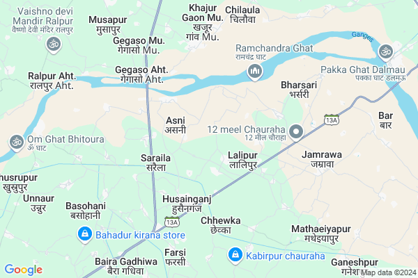
Ojhapur
Ojhapur Map
EDIT Map
Add Your House
 ..
..
Current Corona Virus Infected Patients Count in Fatehpur District
| City Name | District Name | Total Covid cases |
|---|
Locality Name :
Ojhapur
( ओझपुर )
Block Name : Bhitaura
District : Fatehpur
State : Uttar Pradesh
Division : Allahabad
Language : Hindi and Urdu
Current Time 12:37 PM
Date: Monday , Apr 28,2025 (IST)
Time zone: IST (UTC+5:30)
Elevation / Altitude: 116 meters. Above Seal level
Telephone Code / Std Code: 05180
Assembly constituency : Husainganj assembly constituency
Assembly MLA : Usha Maurya
Lok Sabha constituency : Fatehpur parliamentary constituency
Parliament MP : NIRANJAN JYOTI
Serpanch Name :
Pin Code : 212651
Post Office Name : Husainganj (Fatehpur)
Alternate Village Name : Ojha Pur
Commodities Prices : Lalganj Market / Mandi
Ojhapur Live Weather
Temperature: 40.2 °C
scattered clouds
Humidity: 11%
Wind : 0.56 mt/sec towards NW
StationName : "Fatehpur"
observed on 31 Mins Back
Temperature: 40.2 °C
scattered clouds
Humidity: 11%
Wind : 0.56 mt/sec towards NW
StationName : "Fatehpur"
observed on 31 Mins Back
Ojhapur Weather Forecast for Next 5 days
29-04-2025
28.2°C to 40.6°C
scattered clouds, broken clouds
28.2°C to 40.6°C
scattered clouds, broken clouds
30-04-2025
26.1°C to 40.6°C
broken clouds, clear sky
26.1°C to 40.6°C
broken clouds, clear sky
01-05-2025
27.0°C to 40.6°C
clear sky
27.0°C to 40.6°C
clear sky
02-05-2025
27.0°C to 40.8°C
clear sky, scattered clouds, broken clouds, few clouds
27.0°C to 40.8°C
clear sky, scattered clouds, broken clouds, few clouds
03-05-2025
26.3°C to 40.4°C
clear sky, scattered clouds, few clouds, light rain
26.3°C to 40.4°C
clear sky, scattered clouds, few clouds, light rain
Rivers Near Ojhapur
Yamuna :Ямуна :https://1drv.ms/b/s!Ar-WXIFaX7UdgQuO6WpVrTr6YYsQ
Sai
Yamuna :Ямуна :https://1drv.ms/b/s!Ar-WXIFaX7UdgQuO6WpVrTr6YYsQ
Sai
About Ojhapur
Correct below Info and add more info about OjhapurOjhapur is a Village in Bhitaura Block in Fatehpur District of Uttar Pradesh State, India. It belongs to Allahabad Division . It is located 18 KM towards East from District head quarters Fatehpur. 6 KM from Tarapur Bhitaura. 106 KM from State capital Lucknow
Ojhapur Pin code is 212651 and postal head office is Husainganj (Fatehpur).
Lalipur ( 2 KM ) , Gaura Churiyara ( 2 KM ) , Asni ( 2 KM ) , Saraila ( 3 KM ) , Lakhpura ( 3 KM ) are the nearby Villages to Ojhapur. Ojhapur is surrounded by Lalganj Block towards North , Fatehpur Block towards west , Dalmau Block towards East , Sareni Block towards west .
Fatehpur , Rae Bareli , Purwa , Jais are the near by Cities to Ojhapur.
This Place is in the border of the Fatehpur District and Rae Bareli District. Rae Bareli District Sareni is west towards this place .
Ojhapur 2011 Census Details
Ojhapur Local Language is Hindi. Ojhapur Village Total population is 928 and number of houses are 157. Female Population is 45.5%. Village literacy rate is 54.1% and the Female Literacy rate is 20.0%.
Population
| Census Parameter | Census Data |
| Total Population | 928 |
| Total No of Houses | 157 |
| Female Population % | 45.5 % ( 422) |
| Total Literacy rate % | 54.1 % ( 502) |
| Female Literacy rate | 20.0 % ( 186) |
| Scheduled Tribes Population % | 0.0 % ( 0) |
| Scheduled Caste Population % | 54.0 % ( 501) |
| Working Population % | 57.3 % |
| Child(0 -6) Population by 2011 | 114 |
| Girl Child(0 -6) Population % by 2011 | 48.2 % ( 55) |
Ojhapur Census More Deatils.
Politics in Ojhapur
BSP , INC are the major political parties in this area.Polling Stations /Booths near Ojhapur
1)P.s. Matinpur2)I.c. Pure Meetan Majare Jamrawa Room No.1
3)I.c. Pure Meetan Majare Jamrawa Room No.2
4)P.s. Mirjapur
5)P.s. Ambi
HOW TO REACH Ojhapur
By Rail
There is no railway station near to Ojhapur in less than 10 km.Colleges near Ojhapur
Ganga Charan Sadhari Lal Inter College
Address :
Dhata Inter College
Address :
Mahila Mahavidhyalay
Address :
Vb Kb Mahila Mahavidhyalay
Address :
Mishra Institute Of Technology (mit),khaga
Address :
Schools in Ojhapur
P.s.ojha Pur
Address : ojha pur , bhitaura , fatehpur , Uttar Pradesh . PIN- 212654 , Post - Jamraon
Govt Health Centers near Ojhapur
1) New PHC Khajurgawan , Primary Health Centre , Khajurgawan , Junior Viddyalay Khajurgawan2) Chack mughal , , ,
3) Jagatpur-Ganda , , ,
Hospitals in Ojhapur,Bhitaura
Samudayik Swasthya Kendra
Husainganj; District Fatehpur; SH 13A; Uttar Pradesh 212651; India
3.7 KM distance Detail
Hospital ( Samudyik Swasth Kendra )
U.P.; Husainganj; Uttar Pradesh 212651; India
3.7 KM distance Detail
more ..
Petrol Bunks in Ojhapur,Bhitaura
RAJENDRA FILLING STATION
SAIDNAPUR;NH-232A;FATEHPUR; FATEHPUR EAST; Uttar Pradesh 212601; India
3.7 KM distance Detail
HP PETROL PUMP - KALPANA FILLING STATION
HPC Dealers Saidanapur Fatehpur-lalganj Road; Uttar Pradesh 208001; India
5.2 KM distance Detail
more ..
Colleges in Ojhapur,Bhitaura
Babu Chandrika Prasad Mahila Mahavidyalaya
mustafapur ;Husanganj;Fatehpur; fatehpur; Uttar Pradesh 212651; India
3.1 KM distance Detail
Pandit chandrika Prasad Inter College
Saatmeel; SH 13A; Husainganj; Uttar Pradesh 212651; India
3.9 KM distance Detail
HN Bahuguna Inter College
Husaiganj; Fatehpur; SH 13A; Uttar Pradesh 212651; India
4.0 KM distance Detail
Pandit Dev Narayan college of pharmacy
Jagat pur Aadil hussain ganj; Uttar Pradesh; India
5.6 KM distance Detail
more ..
Schools in Ojhapur,Bhitaura
Kanya Pathshala (Prathamik Vidyalaya)
asni road; Husainganj; Uttar Pradesh 212651; India
3.8 KM distance Detail
a p s inter college hussainganj fatehpur
Husainganj; Uttar Pradesh 212651; India
3.9 KM distance Detail
Mother Teresa Public Higher Secondary School
SH 13A; Husainganj; Uttar Pradesh 212651; India
4.1 KM distance Detail
Electronic Shops in Ojhapur,Bhitaura
raju saini flawar dekoret tivaripur husengnj
Husainganj; Uttar Pradesh 212651; India
3.6 KM distance Detail
हिम्मात ईन्जिनियर बॉक्स
Raibareli Road; Hussainganj Chowraha; Fatehpur; Uttar Pradesh 212651; India
3.7 KM distance Detail
Police Stations near Ojhapur,Bhitaura
Police Station Husainganj
Police Station Husainganj; SH 13A; Uttar Pradesh 212651; India
4.1 KM distance Detail
Haswa Thana FathePur Uttar Pradesh
Mohammadpur Nabada; Uttar Pradesh 212645; India
18.7 KM distance Detail
Governement Offices near Ojhapur,Bhitaura
Sub Registrar Office Sadar;Fatehpur
Abu Nagar; Fatehpur; Uttar Pradesh 212601; India
19.1 KM distance Detail
About Ojhapur &
History
How to reach Ojhapur
Tourist Places Near By Ojhapur
Schools in Ojhapur
Colleges in Ojhapur
Temperature & weather of Ojhapur
places in Ojhapur
Ojhapur photos
More Information
How to reach Ojhapur
Tourist Places Near By Ojhapur
Schools in Ojhapur
Colleges in Ojhapur
Temperature & weather of Ojhapur
places in Ojhapur
Ojhapur photos
More Information
Village Talk
Post News or Events about this Village
Near Cities
Fatehpur 19 KM near
Rae Bareli 42 KM near
Purwa 56 KM near
Jais 75 KM near
Fatehpur 19 KM near
Rae Bareli 42 KM near
Purwa 56 KM near
Jais 75 KM near
Near By Taluks
Bhitaura 6 KM near
Lalganj 16 KM near
Dalmau 18 KM near
Fatehpur 19 KM near
Bhitaura 6 KM near
Lalganj 16 KM near
Dalmau 18 KM near
Fatehpur 19 KM near
Near By Air Ports
Kanpur Airport 75 KM near
Amausi Airport 91 KM near
Bamrauli Airport 115 KM near
Khajuraho Airport 189 KM near
Kanpur Airport 75 KM near
Amausi Airport 91 KM near
Bamrauli Airport 115 KM near
Khajuraho Airport 189 KM near
Near By Tourist Places
Rae Bareli 42 KM near
Kanpur 85 KM near
Kaushambi 98 KM near
Lucknow 101 KM near
Bithur 104 KM near
Rae Bareli 42 KM near
Kanpur 85 KM near
Kaushambi 98 KM near
Lucknow 101 KM near
Bithur 104 KM near
Near By Districts
Fatehpur 18 KM near
Rae Bareli 42 KM near
Unnao 81 KM near
Kaushambi 82 KM near
Fatehpur 18 KM near
Rae Bareli 42 KM near
Unnao 81 KM near
Kaushambi 82 KM near
Near By RailWay Station
Fatehpur Rail Way Station 20 KM near
Lachhmanpur Rail Way Station 35 KM near
Fatehpur Rail Way Station 20 KM near
Lachhmanpur Rail Way Station 35 KM near