| Home | City Bus | Maps | Villages | Cities | Rail | Tourist Places | School | College | Pin Codes | Corona Cases Count |
| Distance Calculator Bus Services IFSC Codes Trace Mobile Number Weather Search Place Trace IP Available Cash ATM/Banks Locate Polling Booth Report an Error contact People |
Kodarpur
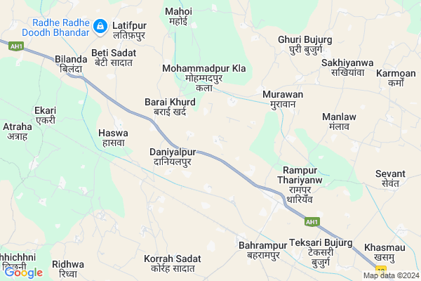
Kodarpur Map
EDIT Map
Add Your House
 ..
..
Current Corona Virus Infected Patients Count in Fatehpur District
| City Name | District Name | Total Covid cases |
|---|
Locality Name :
Kodarpur
( कोदरपुर )
Block Name : Bhitaura
District : Fatehpur
State : Uttar Pradesh
Division : Allahabad
Language : Hindi and Urdu
Current Time 11:28 AM
Date: Monday , Apr 28,2025 (IST)
Time zone: IST (UTC+5:30)
Elevation / Altitude: 116 meters. Above Seal level
Telephone Code / Std Code: 05180
Assembly constituency : Fatehpur assembly constituency
Assembly MLA : Chandra Prakash
Lok Sabha constituency : Fatehpur parliamentary constituency
Parliament MP : NIRANJAN JYOTI
Serpanch Name :
Pin Code : 212645
Post Office Name : Haswa
Commodities Prices : Fatehpur Market / Mandi
Kodarpur Live Weather
Temperature: 36.7 °C
scattered clouds
Humidity: 16%
Wind : 2.6 mt/sec towards SW
StationName : "KhÄ\u0081ga"
observed on 1 Hours Back
Temperature: 36.7 °C
scattered clouds
Humidity: 16%
Wind : 2.6 mt/sec towards SW
StationName : "KhÄ\u0081ga"
observed on 1 Hours Back
Kodarpur Weather Forecast for Next 5 days
29-04-2025
28.2°C to 40.7°C
scattered clouds, broken clouds
28.2°C to 40.7°C
scattered clouds, broken clouds
30-04-2025
26.1°C to 40.7°C
broken clouds, clear sky
26.1°C to 40.7°C
broken clouds, clear sky
01-05-2025
27.0°C to 40.7°C
clear sky
27.0°C to 40.7°C
clear sky
02-05-2025
26.8°C to 40.9°C
clear sky, scattered clouds, broken clouds, few clouds
26.8°C to 40.9°C
clear sky, scattered clouds, broken clouds, few clouds
03-05-2025
26.3°C to 40.4°C
clear sky, scattered clouds, few clouds, light rain
26.3°C to 40.4°C
clear sky, scattered clouds, few clouds, light rain
Edit below overview about Kodarpur
Edit below overview about Kodarpur
OverView of Kodarpur
Right Name KONDARPUR AND POST OFFICE IS HASWA PIN CODE 212645 DISTRICT FATEHPUR STATE UTTAR PRADESHEdit below overview about Kodarpur
Rivers Near Kodarpur
Yamuna :Ямуна :https://1drv.ms/b/s!Ar-WXIFaX7UdgQuO6WpVrTr6YYsQ
Sai
Yamuna :Ямуна :https://1drv.ms/b/s!Ar-WXIFaX7UdgQuO6WpVrTr6YYsQ
Sai
About Kodarpur
Kodarpur is a Village in Bhitaura Block in Fatehpur District of Uttar Pradesh State, India. It belongs to Allahabad Division . It is located 19 KM towards East from District head quarters Fatehpur. 14 KM from Tarapur Bhitaura. 127 KM from State capital Lucknow
Kodarpur Pin code is 212645 and postal head office is Haswa .
Sachaoli ( 2 KM ) , Barai Khurd ( 2 KM ) , Saray Udai ( 3 KM ) , Mohammadpur Kla ( 3 KM ) , Sangaon ( 3 KM ) are the nearby Villages to Kodarpur. Kodarpur is surrounded by Bhitaura Block towards North , Fatehpur Block towards west , Hathgaon Block towards East , Telyani Block towards west .
Fatehpur , Rae Bareli , Purwa , Lal Gopalganj Nindaura are the near by Cities to Kodarpur.
This Place is in the border of the Fatehpur District and Rae Bareli District. Rae Bareli District Sareni is North towards this place .
Kodarpur 2011 Census Details
Kodarpur Local Language is Hindi. Kodarpur Village Total population is 924 and number of houses are 176. Female Population is 49.1%. Village literacy rate is 60.3% and the Female Literacy rate is 23.3%.
Population
| Census Parameter | Census Data |
| Total Population | 924 |
| Total No of Houses | 176 |
| Female Population % | 49.1 % ( 454) |
| Total Literacy rate % | 60.3 % ( 557) |
| Female Literacy rate | 23.3 % ( 215) |
| Scheduled Tribes Population % | 0.0 % ( 0) |
| Scheduled Caste Population % | 26.8 % ( 248) |
| Working Population % | 32.3 % |
| Child(0 -6) Population by 2011 | 122 |
| Girl Child(0 -6) Population % by 2011 | 50.8 % ( 62) |
Kodarpur Census More Deatils.
Politics in Kodarpur
BJP , SP , BSP are the major political parties in this area.Polling Stations /Booths near Kodarpur
1)P.s. Chudhakiyapur2)P.s. Daniyal Pur Room - 1
3)P.s. Ekari Room -2
4)P.s. Sacholi
5)P.s. Kusumbhi
HOW TO REACH Kodarpur
By Rail
Rasulabad Rail Way Station , Faizullapur Rail Way Station are the very nearby railway stations to Kodarpur.Colleges near Kodarpur
Ganga Charan Sadhari Lal Inter College
Address :
Dhata Inter College
Address :
Mahila Mahavidhyalay
Address :
Vb Kb Mahila Mahavidhyalay
Address :
Mishra Institute Of Technology (mit),khaga
Address :
Schools near Kodarpur
J.h.s.pilkhani
Address : pilkhani , bhitaura , fatehpur , Uttar Pradesh . PIN- 212645 , Post - Haswa
J.h.s.rara
Address : rara , bhitaura , fatehpur , Uttar Pradesh . PIN- 212645 , Post - Haswa
J.h.s Bela
Address : bela , bhitaura , fatehpur , Uttar Pradesh . PIN- 212651 , Post - Husainganj (Fatehpur)
J.h.s. Gobardhan Pur
Address : gobardhan pur , bhitaura , fatehpur , Uttar Pradesh . PIN- 212601 , Post - Fatehpur
Govt Health Centers near Kodarpur
1) Bilanda , , ,2) Chack mughal , , ,
3) Aladatpur , , ,
Hospitals in Kodarpur,Bhitaura
Tripathi Nursing Home Asothar Road Thariyav
Fatehpur; Uttar Pradesh 212622; India
3.9 KM distance Detail
Government Ayurvedic Hospital Haswa
khaildar; Haswa; Uttar Pradesh 212645; India
5.2 KM distance Detail
more ..
Petrol Bunks in Kodarpur,Bhitaura
HP PETROL PUMP - LODHI FILLING STATION
Hpcl Dealer Village - Kasimpur Ambapur; Kanpur; Uttar Pradesh 212604; India
3.6 KM distance Detail
Humdard Nagar Sitapur Mod Satyashiv Petrolpump
thariyon; Fatehpur; Uttar Pradesh; India
5.4 KM distance Detail
Pindian Oil Petrol Pump
Kanpur - Allahabad Hwy; Barari; Uttar Pradesh 212645; India
7.0 KM distance Detail
more ..
Colleges in Kodarpur,Bhitaura
Sarla Devi Sriram Girls Degree College
Rampur Thariyanw; Uttar Pradesh 212622; India
4.5 KM distance Detail
Bhanumati Chotelal Inter College
Rampur Thariyanw; Uttar Pradesh 212622; India
5.4 KM distance Detail
Swami Chandra Das Inter College
Haswa Korrah Road; Haswa; Uttar Pradesh 212645; India
5.5 KM distance Detail
more ..
Schools in Kodarpur,Bhitaura
Uchch Prathmic Vidhyalya Daniyalpur
Haswa Korrah Road; Daniyalpur; Uttar Pradesh 212645; India
2.3 KM distance Detail
Model School Daniyalpur
Haswa Korrah Road; Daniyalpur; Uttar Pradesh 212645; India
2.4 KM distance Detail
Electronic Shops in Kodarpur,Bhitaura
#тαяα _вαттєяу _ѕєяνι¢є _иєαя _ρσωєя _нσυѕє _тнαяιуσυи _fαтєнρυя
; Rampur Thariyanw; Uttar Pradesh 212622; India
4.5 KM distance Detail
Super Markets in Kodarpur,Bhitaura
Shyama Marrige Lawn Naveen Market G T Road Thariyaon
Rampur Thariyanw; Uttar Pradesh 212622; India
4.8 KM distance Detail
Local Parks in Kodarpur,Bhitaura
Shree Pitambar Lal Garden
Korrah Sadat Road; Chak Kori Sadad; Uttar Pradesh 212622; India
7.3 KM distance Detail
Police Stations near Kodarpur,Bhitaura
Haswa Thana FathePur Uttar Pradesh
Mohammadpur Nabada; Uttar Pradesh 212645; India
6.2 KM distance Detail
Governement Offices near Kodarpur,Bhitaura
Nagar Palika Parishad
G T Road Near Sadar Hospital; Fatehpur; Uttar Pradesh 212601; India
18.7 KM distance Detail
About Kodarpur &
History
How to reach Kodarpur
Tourist Places Near By Kodarpur
Schools in Kodarpur
Colleges in Kodarpur
Temperature & weather of Kodarpur
places in Kodarpur
Kodarpur photos
More Information
How to reach Kodarpur
Tourist Places Near By Kodarpur
Schools in Kodarpur
Colleges in Kodarpur
Temperature & weather of Kodarpur
places in Kodarpur
Kodarpur photos
More Information
Village Talk
Post News or Events about this Village
Near Cities
Fatehpur 16 KM near
Rae Bareli 55 KM near
Purwa 75 KM near
Lal Gopalganj Nindaura 78 KM near
Fatehpur 16 KM near
Rae Bareli 55 KM near
Purwa 75 KM near
Lal Gopalganj Nindaura 78 KM near
Near By Taluks
Haswa 4 KM near
Bhitaura 13 KM near
Fatehpur 17 KM near
Hathgaon 18 KM near
Haswa 4 KM near
Bhitaura 13 KM near
Fatehpur 17 KM near
Hathgaon 18 KM near
Near By Air Ports
Kanpur Airport 90 KM near
Bamrauli Airport 102 KM near
Amausi Airport 111 KM near
Khajuraho Airport 175 KM near
Kanpur Airport 90 KM near
Bamrauli Airport 102 KM near
Amausi Airport 111 KM near
Khajuraho Airport 175 KM near
Near By Tourist Places
Rae Bareli 54 KM near
Kaushambi 80 KM near
Kanpur 100 KM near
Shringverpur 109 KM near
Allahabad 111 KM near
Rae Bareli 54 KM near
Kaushambi 80 KM near
Kanpur 100 KM near
Shringverpur 109 KM near
Allahabad 111 KM near
Near By Districts
Fatehpur 18 KM near
Rae Bareli 54 KM near
Kaushambi 67 KM near
Chitrakoot 83 KM near
Fatehpur 18 KM near
Rae Bareli 54 KM near
Kaushambi 67 KM near
Chitrakoot 83 KM near
Near By RailWay Station
Rasulabad Rail Way Station 5.8 KM near
Faizullapur Rail Way Station 8.1 KM near
Fatehpur Rail Way Station 18 KM near
Khaga Rail Way Station 20 KM near
Rasulabad Rail Way Station 5.8 KM near
Faizullapur Rail Way Station 8.1 KM near
Fatehpur Rail Way Station 18 KM near
Khaga Rail Way Station 20 KM near